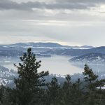
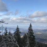
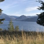
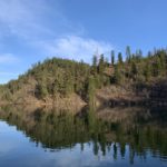
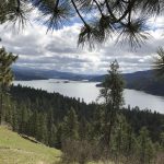
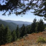
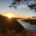
The Coeur d’Alene Mountains are the northwestern-most part of the Bitterroot range of the Rocky Mountains. They extend from Coeur d’Alene eastwards into Montana and are bordered to the north and east by Lake Pend Oreille and the Clark Fork river. To the west they are bound by the Selkirk Mountains and to the south Lake Coeur d’Alene, the South Fork of the Coeur d’Alene river, and the St. Regis river. The mountains are named after the Coeur d’Alene tribe.
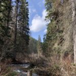
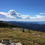
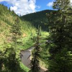
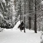
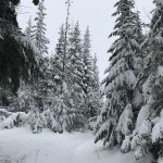
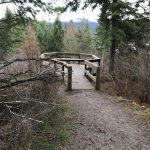
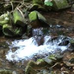
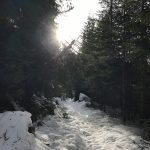
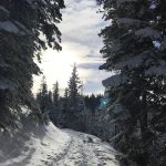
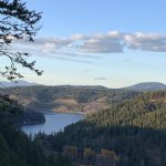
While not as spectacular as the surrounding mountains (particularly the Cabinets and Selkirks), the Coeur d’Alenes nevertheless offer a few scenic hikes in close proximity to Coeur d’Alene. Unfortunately, more than a century of intense logging and mining has led to a very dense network of forest service roads, clearly at the expense of hiking trails. Today’s web of dedicated hiking trails in fact is somewhat disjointed and shriveled.
The Coeur d’Alene Mountains in Idaho are largely unprotected, but the Montana side includes a few roadless areas. Ownership is mostly in public hands, administered by the Forest Service (Idaho Panhandle respectively Lolo National Forest) and the BLM.
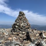
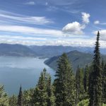
Most of the peaks in the Coeur d’Alene Mountains top out around 6,000 feet.
| Photo | Trail | Rating | Difficulty | Distance | Duration | Elevation Gain | High Point | Low Point | Type | Features | Status | Administration | Fees and Permits | Maps | Open To | Season | Trail# | Resources |
|---|---|---|---|---|---|---|---|---|---|---|---|---|---|---|---|---|---|---|
 | Beauty Bay Overlook | 1.5 / 5 | Easy | 0.6 mi | 0:14 h | 70 ft | 2,682 ft | 2,564 ft | Year-around | |||||||||
 | Bernard Peak | 2.9 / 5 | Moderate | 17.8 mi | 6:03 h | 3,099 ft | 5,145 ft | 2,303 ft | Year-around | 37 | ||||||||
 | Blossom Lakes Loop | 3.2 / 5 | Moderate | 14.0 mi | 4:59 h | 2,652 ft | 6,444 ft | 4,104 ft | July – October | 404 | ||||||||
 | Blue Creek Bay Loop | 2.0 / 5 | Easy | 6.1 mi | 1:49 h | 972 ft | 2,810 ft | 2,105 ft | Year-around | |||||||||
 | Bobtail Ridge | 2.8 / 5 | Moderate | 9.2 mi | 4:15 h | 2,327 ft | 4,785 ft | 2,480 ft | Year-around | 598 | ||||||||
 | Canfield Mountain East Flank | 2.7 / 5 | Moderate | 9.5 mi | 3:20 h | 1,952 ft | 4,137 ft | 2,255 ft | Year-around | 3, 6, 7, 8, D | ||||||||
 | Canfield Mountain North Side | 2.8 / 5 | Moderate | 8.6 mi | 2:35 h | 1,938 ft | 4,151 ft | 2,239 ft | Year-around | |||||||||
 | Canfield Mountain South Flank | 2.8 / 5 | More Difficult | 3.5 mi | 1:22 h | 1,826 ft | 4,099 ft | 2,229 ft | Year-around | |||||||||
 | Chilco Mountains | 3.6 / 5 | Moderate | 11.0 mi | 3:38 h | 2,843 ft | 5,657 ft | 4,164 ft | May – November | 14 | ||||||||
 | Coeur d’Alene River Loop | 3.8 / 5 | Moderate | 25.4 mi | 13:01 h | 3,291 ft | 4,451 ft | 2,756 ft | May – October | |||||||||
 | Cougar Bay Loop | 2.7 / 5 | Moderate | 3.3 mi | 1:59 h | 557 ft | 2,425 ft | 2,063 ft | Year-around | |||||||||
 | Devil Peak | 2.5 / 5 | Moderate | 17.6 mi | 5:50 h | 2,096 ft | 4,630 ft | 2,925 ft | May – October | 22, 56 | ||||||||
 | Eagle Hut Loop | 2.5 / 5 | Moderate | 8.5 mi | 2:57 h | 819 ft | 3,599 ft | 3,004 ft | Winter | |||||||||
 | East Canfield Butte Loop | 2.2 / 5 | Moderate | 8.9 mi | 3:48 h | 1,904 ft | 3,869 ft | 2,276 ft | Year-around | 9, 10, A, D | ||||||||
 | Elk Mountain | 2.8 / 5 | Moderate | 11.9 mi | 4:20 h | 2,339 ft | 4,246 ft | 2,121 ft | Year-around | |||||||||
 | English Point Loop | 2.0 / 5 | Easy | 5.1 mi | 1:29 h | 227 ft | 2,591 ft | 2,467 ft | Year-around | 80 | ||||||||
 | Farragut State Park Loop | 3.0 / 5 | Easy | 13.2 mi | 4:01 h | 593 ft | 2,458 ft | 2,052 ft | Year-around | |||||||||
 | Fernan Lake Natural Area | 2.6 / 5 | Moderate | 3.0 mi | 1:02 h | 559 ft | 2,563 ft | 2,126 ft | Year-around | |||||||||
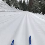 | Fourth of July Groomed XC-Ski Loop | 2.5 / 5 | Easy | 5.5 mi | 1:28 h | 383 ft | 3,290 ft | 2,943 ft | Winter | |||||||||
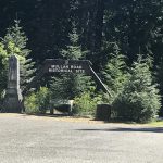 | Fourth of July Pass Mullan Interpretive Loop | 2.1 / 5 | Easy | 0.4 mi | 0:12 h | 54 ft | 3,167 ft | 2,993 ft | Year-around | |||||||||
 | Graham Mountain Loop | 3.7 / 5 | Moderate | 16.9 mi | 6:18 h | 4,034 ft | 5,728 ft | 2,226 ft | May – November | 41, 17, 33 | ||||||||
 | Granite Peak from Tamarack Saddle | 3.3 / 5 | Moderate | 9.2 mi | 3:24 h | 2,197 ft | 6,829 ft | 5,568 ft | May – November | 137 | ||||||||
 | Heyburn State Park North Loop | 3.5 / 5 | Moderate | 18.8 mi | 6:23 h | 2,408 ft | 3,359 ft | 2,101 ft | Year-around | |||||||||
 | Independence Creek to Faset Peak Loop | 3.0 / 5 | More Difficult | 25.4 mi | 8:17 h | 3,069 ft | 5,257 ft | 2,866 ft | May – October | 22, 414, 416 | ||||||||
 | Jeanette’s Jaunt | 2.2 / 5 | Easy | 7.1 mi | 2:41 h | 641 ft | 3,128 ft | 2,783 ft | Winter | |||||||||
 | Killarney Mountain | 2.7 / 5 | Moderate | 7.8 mi | 2:31 h | 1,094 ft | 3,917 ft | 3,124 ft | Year-around | |||||||||
 | Lost Creek – Trout Creek Loop | 3.4 / 5 | More Difficult | 44.0 mi | 19:03 h | 8,270 ft | 6,195 ft | 2,575 ft | June – November | 153, 502, 774, 214, 7, FR-430 | ||||||||
 | Marie Creek Loop | 3.1 / 5 | Moderate | 14.3 mi | 4:56 h | 2,096 ft | 3,696 ft | 2,344 ft | Year-around | 241 | ||||||||
 | Mineral Ridge Loop | 3.4 / 5 | Moderate | 3.7 mi | 1:08 h | 1,015 ft | 3,176 ft | 2,070 ft | Year-around | |||||||||
 | Mount Coeur d’Alene Loop | 2.6 / 5 | Moderate | 18.7 mi | 6:02 h | 4,000 ft | 4,422 ft | 2,110 ft | Year-around | 79, 227, 257, 258 | ||||||||
 | Revett Lake | 3.0 / 5 | Moderate | 6.7 mi | 2:09 h | 976 ft | 5,725 ft | 4,830 ft | June – October | 9 | ||||||||
 | Schafer Peak via Green Monarch | 3.6 / 5 | More Difficult | 9.4 mi | 4:46 h | 2,408 ft | 5,217 ft | 4,539 ft | June – October | 68, 69 | ||||||||
 | Sunset Peak | 3.4 / 5 | Moderate | 16.2 mi | 5:51 h | 3,733 ft | 6,422 ft | 3,324 ft | Year-around | 147, 151 | ||||||||
 | Tubbs Hill Loop | 2.8 / 5 | Easy | 2.2 mi | 0:37 h | 193 ft | 2,352 ft | 2,143 ft | Year-around | |||||||||
 | Upper Independence Creek | 3.1 / 5 | Strenuous | 18.6 mi | 6:41 h | 1,909 ft | 4,846 ft | 3,095 ft | April – November | 3, 22 |