- Seven Devils Mountains
- There are 3 car campgrounds near the trailhead, Windy Saddle, Seven Devil Lake, and a horse camp. Seven Devil Lake is the nicest
- All lakes except Gem Lake have campsites
- We stayed at Bernard Lake, Haas Lake, and Cannon Lake
- My favorite lakes were Sheep Lake, Baldy Lake, and Dog Lake
- The section from Windy Saddle to Sheep Lake gets the most use and is in best condition
- Beyond Baldy Lake, conditions are somewhat worse, but still decent. Expect to climb over an occasional tree
- Some of the spur trails are in dire conditions. There is lots of deadfall on #129 from Echo Lake to He Devil Lake. The Horse Heaven Lake trail is no longer maintained and difficult to find. Expect some deadfall on the Dog Lake route, but otherwise it is in fine shape
The base loop around the Seven Devils is only around 28 miles, but in doing so you’ll miss out on the best the Seven Devils have to offer: stunning mountain lakes, close-ups of 9,000-foot peaks and the sheer 1.5 mile vertical drop to the Snake River. The extended 50-mile loop covered here includes all possible on-trail side trips, but you can just add to the base loop by referring to the “Things to Consider” section below for mileage and elevation gain for each side trip. Whether you do the loop counterclockwise as we did doesn’t matter; we did so to get the harder part (elevation-wise; lots of up-and-down) out of the way first. That is the stretch to Horse Heaven on #124, while the Boise South trail (#101) is relatively level. Depending on the season, water is not easy to come by, especially between Baldy Creek and Cannon Creek (around the south end of the loop) and typically necessitates an uphill trek to a lake. Much of the loop is above 7,000 feet, meaning it could snow anytime of the year. We did the loop in the last week of August, with the days pleasant and sunny (hiking short-sleeved, but needing a pullover when you stop) and the nights cold. Make sure to check the forecast for snow before setting out.
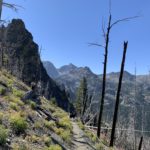
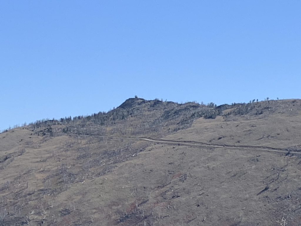
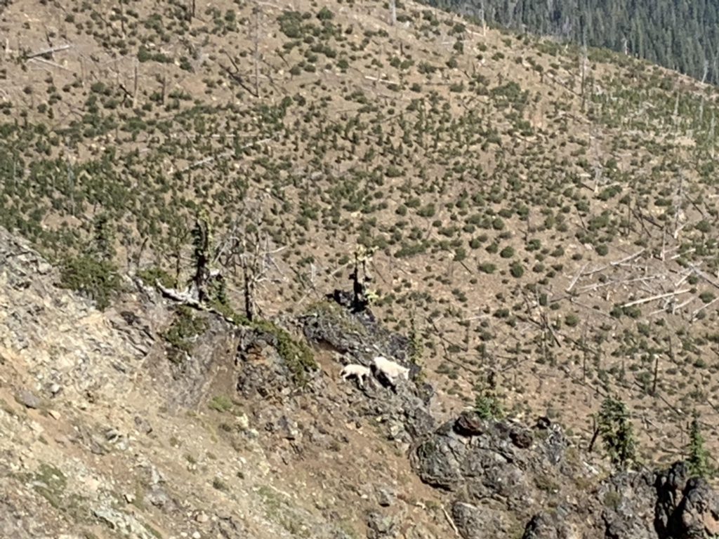
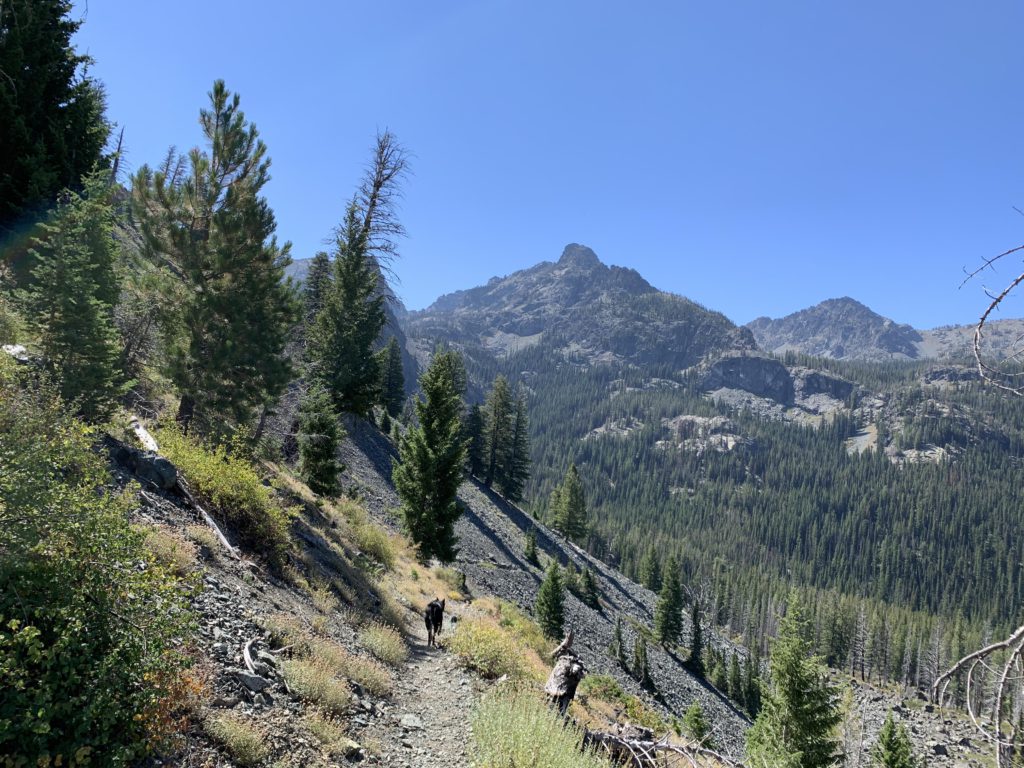
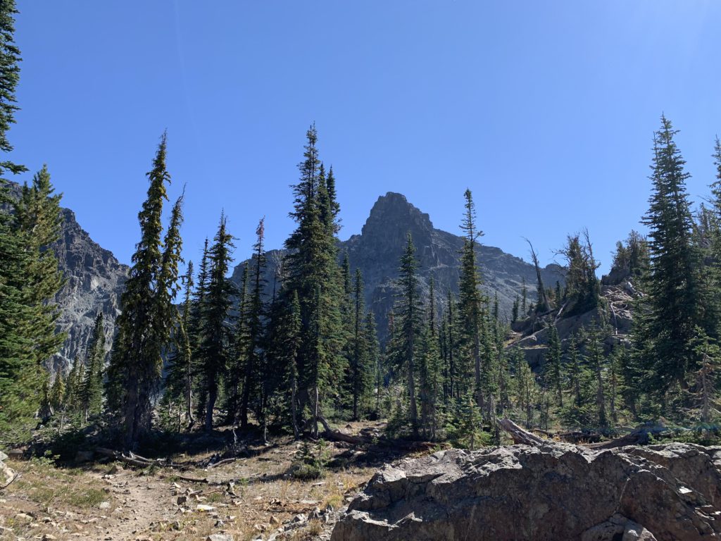
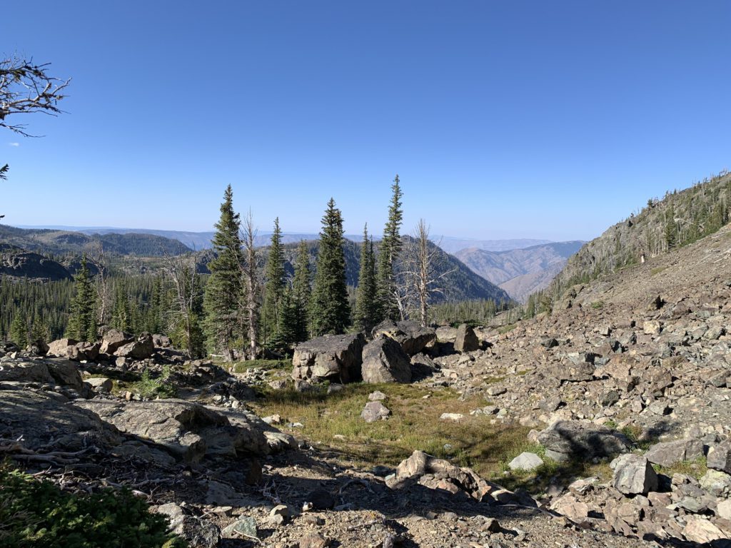
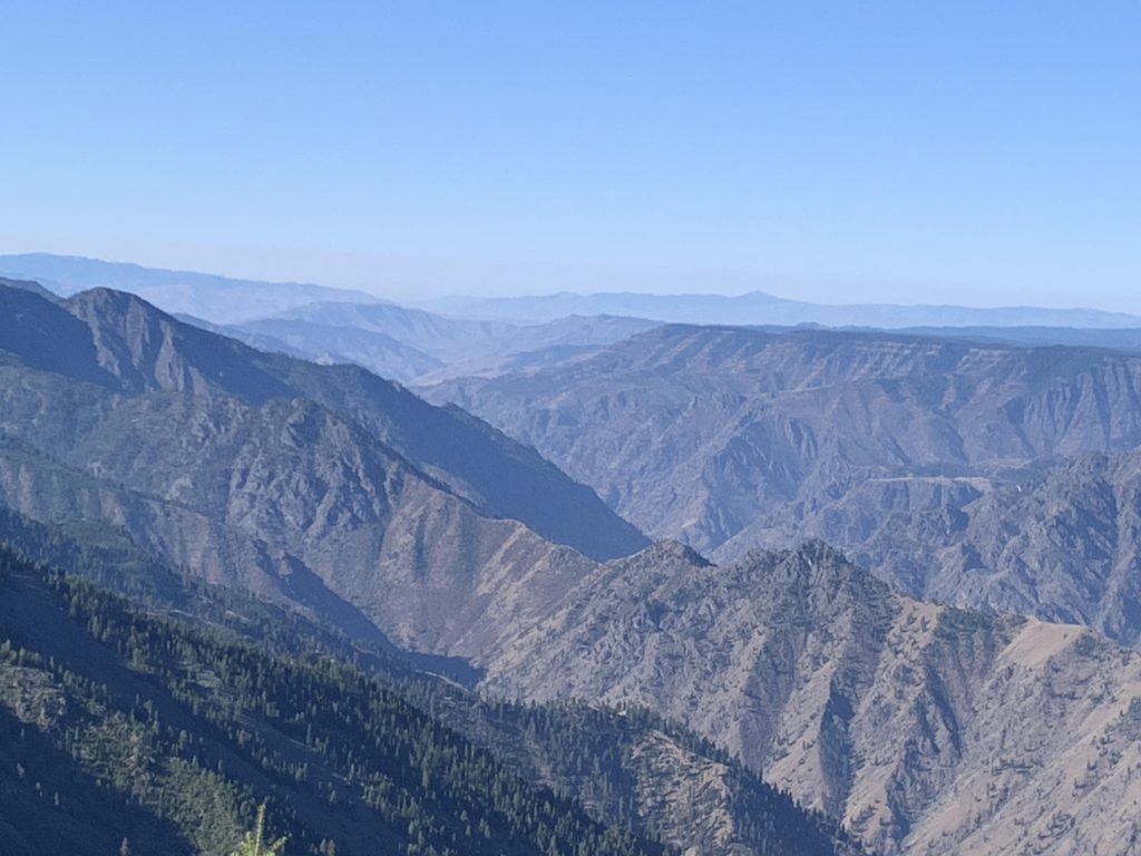
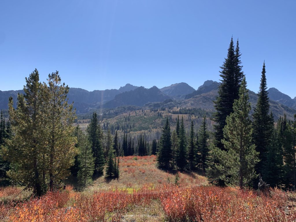
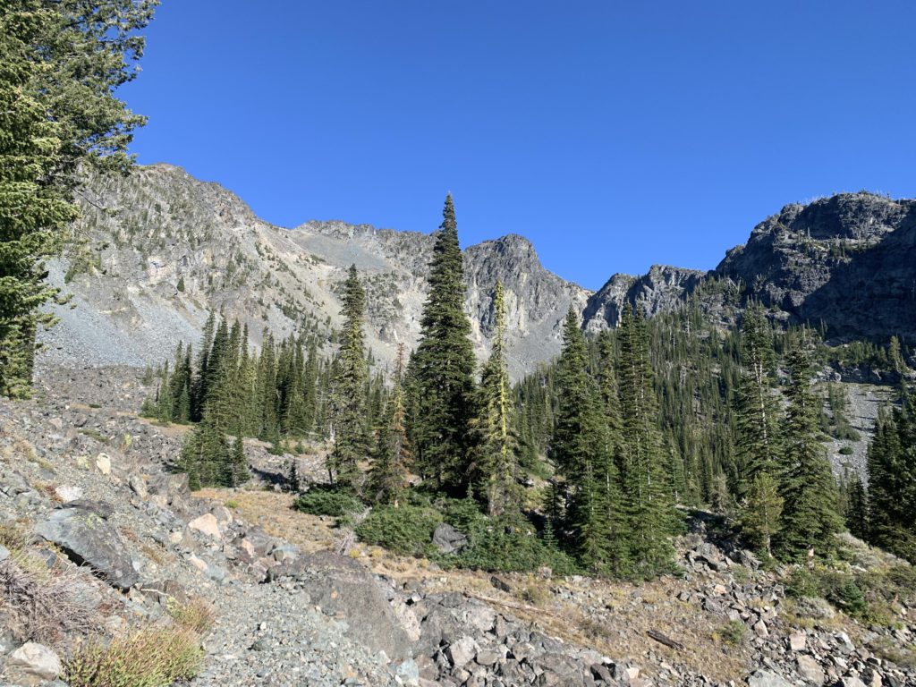
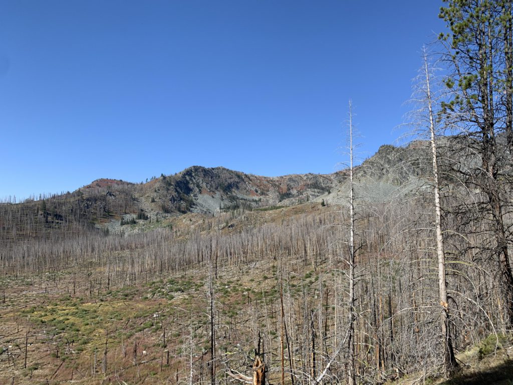
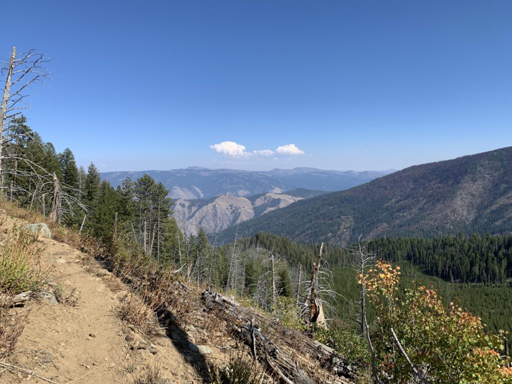
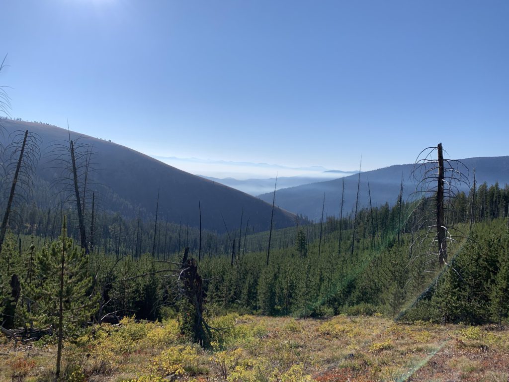
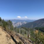
For a counterclockwise tour, the trail drops down the north side of Windy Saddle through an old burn with filtered views into the mostly barren Sheep Creek drainage. Hells Canyon and the rocky Oregon Wallowas are in the distance, with Hat Point standing out. The trail switchbacks several times (you can skip the detour to the stock tank for horses and the turn-off to the Sheep Creek trail into Hells Canyon), then contours beneath massive rock formations to the dry crossing of East Fork Sheep Creek. Up above tower the nameless peaks holding Sheep Lake in place. After the crossing, the trail climbs quite rapidly, switchbacking twice through burned forest that could get hot in the afternoon and curls around the northernmost ridge extending from the Tower of Babel. Views here, at the 2-mile mark, are fantastic, whether you look back to Windy Saddle and trace the straight line of the road to Heaven’s Gate lookout, the massive wall of Dry Diggins Ridge, or, once you turn the corner, He and She Devil high above. This also appears to be a favorite spot for mountain goats; we saw a nanny and a couple of kids.
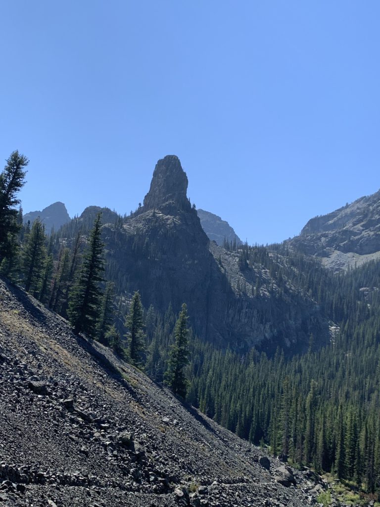
After the trail wraps around the mountain, it starts to decline in a series of switchbacks and heads generally southwest, with He Devil featuring strikingly on the skyline. As you descend further into the West Sheep Creek drainage and cross a broad talus slope smelling intensely of thyme whenever a stray rock stirs the foliage, the focus shifts to the Devil’s Tooth, a prominent spire poking straight up into an intensely blue sky. The moss-covered crossing of West Fork Sheep Creek is at the 4-mile mark, with the forest now fully intact. The creek, outlet to Sheep Lake and several other lakes in the cradle of the Seven Devils, carries water throughout the season. There is also a great campsite right next to the creek and there are plenty of logs ensuring a dry crossing. Shortly past the creek is another, draining Shelf and Basin Lakes; then, the trail ascends in thick timber. The climb is mild, however, as the trail moves deep into a side gully, then pops out of the woods and switchbacks steeply uphill across talus to a junction at the 5.6-mile mark.
The junction is called Iron Phone Junction and is a four-way intersection. Immediately to the right is unsigned trail #140, which extends out onto Dry Diggins Ridge and connects to the Bernard Creek trail #58 at McGaffee Cow Camp. Trail #58 drops down to Hells Canyon. Also on the right, signed “Dry Diggins,” is Bernard Lake trail #57, which leads to the Bernard Lakes and then on to Dry Diggins Lookout. Somewhat to the left, turning south, the signed base loop continues across a plateau. Tree cover is rather light and you can make out the skyline of the Seven Devils’ highest peaks. Only a half-mile later, the trail forks in a clump of woods. The left fork heads into the heart of the Seven Devils (Sheep Lake), while the base loop continues straight toward Hibb’s Cow Camp. It’s about another mile on that trail to the junction with #56, which is the return from Dry Diggins Lookout.
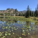
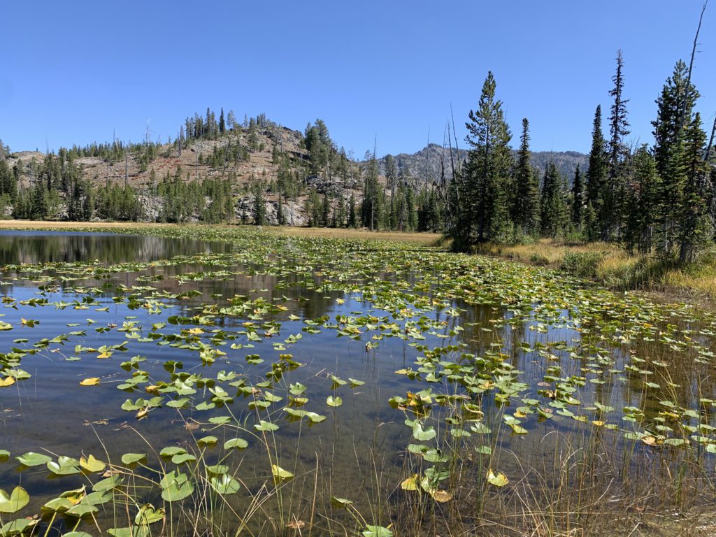
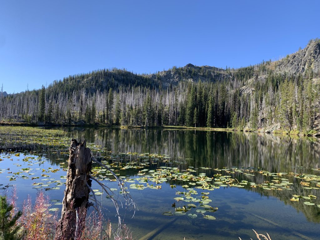
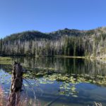
Our first side trip was Sheep Lake. Turning left at the junction, the trail heads due south and quickly passes Lily Pad Lake, a shallow pond in an open and flat area. True to its name, it’s covered with lilies. An ok campsite is located near the lake in an old burn, yet a far better one awaits a bits later, behind a hump that eliminates any lake views, and perhaps the mosquitoes that come with it. The trail then crosses a bog and starts to climb gradually, offering an occasional view into the Sheep Creek drainage. A mile from the junction, the trail passes Basin Lake, which lies a bits away to the right, with campsites on both sides of the outlet; the southern end is better and broader. The lake is ringed with fully intact forest.
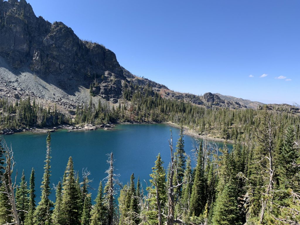
Beyond Basin Lake, the trail continues to climb, gaining another 200 vertical feet in a half mile to a junction with the spur trail to Shelf Lake, down below to your left. All but the eastern end of Shelf Lake consists of forest; on the eastern side a sparsely forested scree slope slides into the lake. There is a huge flat campsite right next to the lake; more sites are sprinkled near the lake’s inlet. Both Basin and Shelf are stocked with rainbow trout on a three-year rotation.
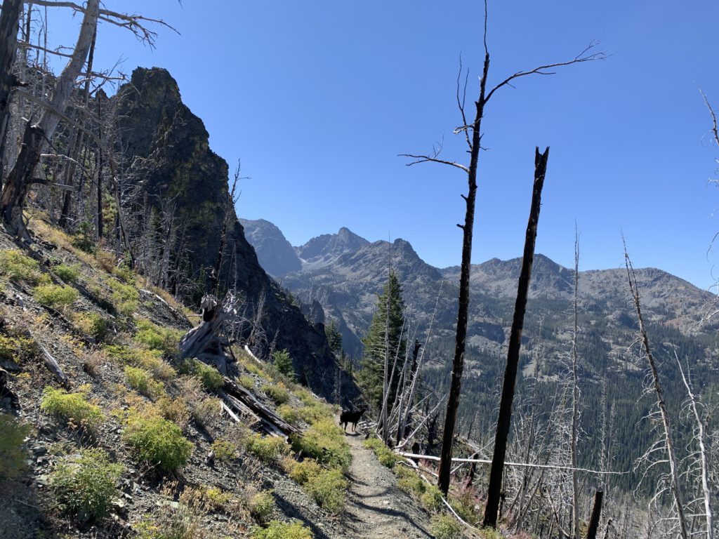
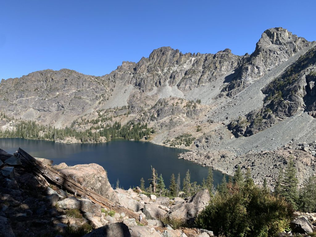
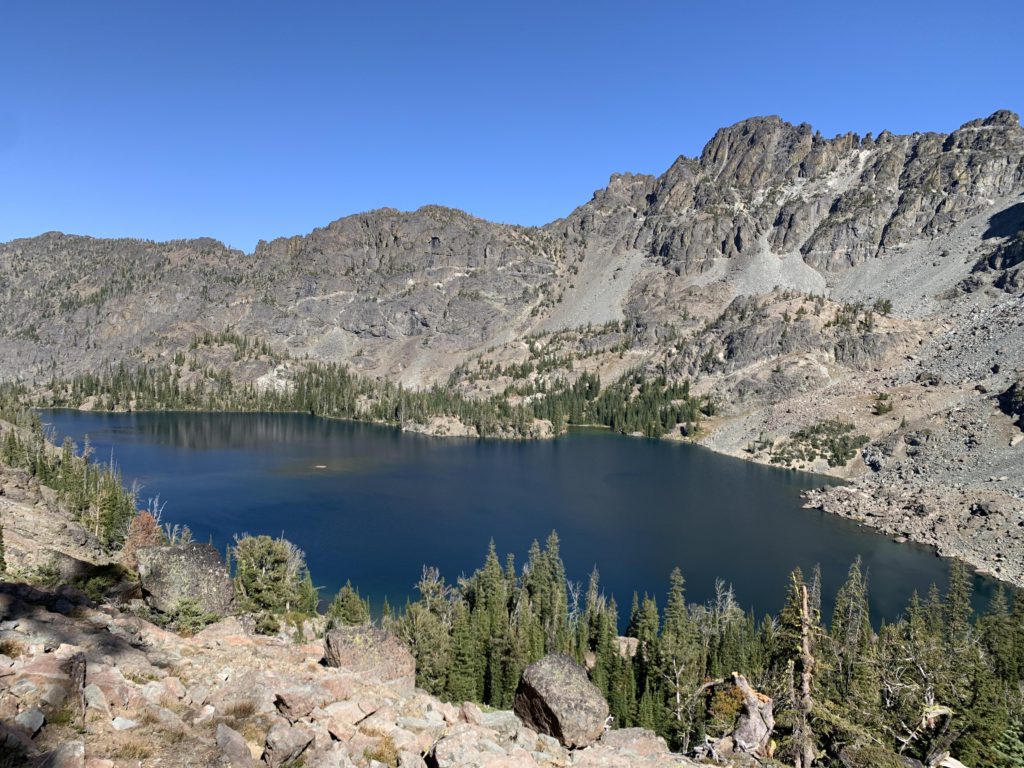
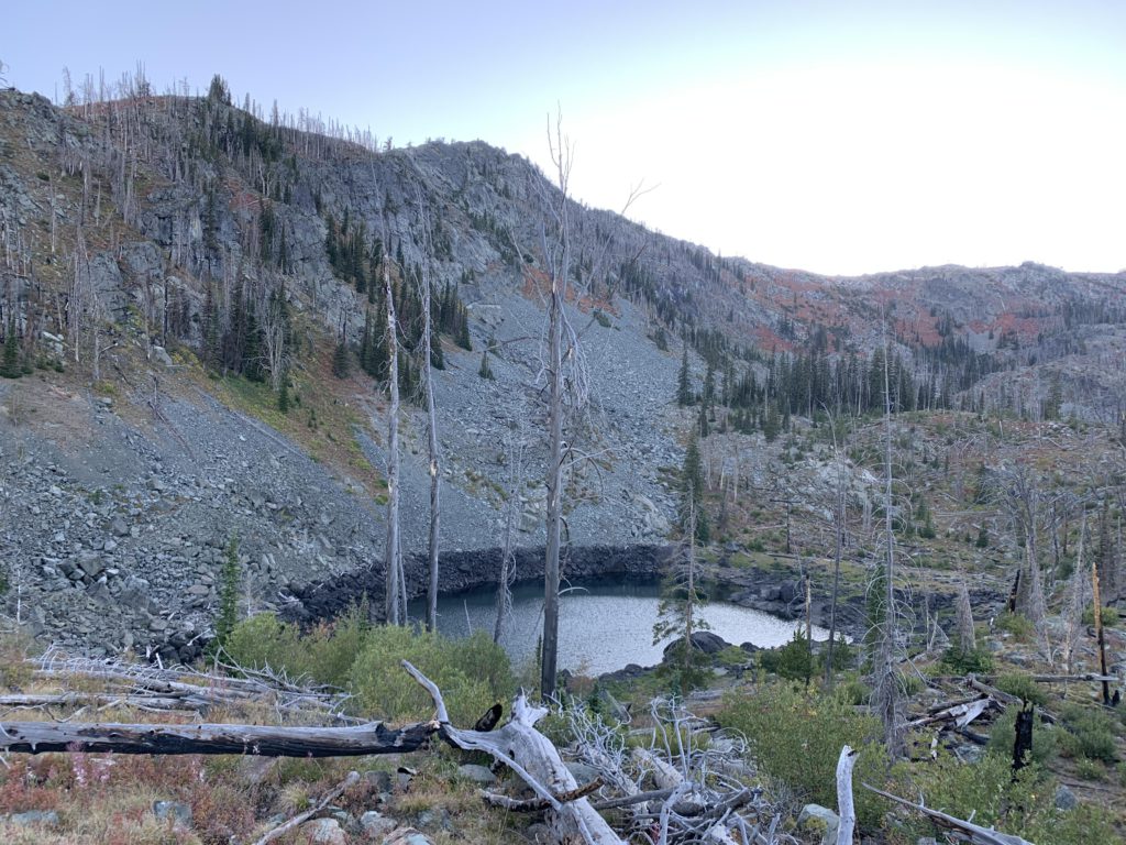
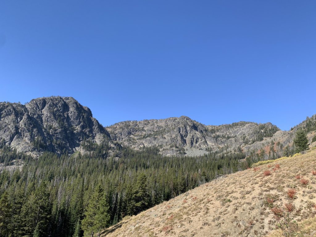
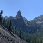
Continuing on for another quarter mile and a bit more elevation gain you get to a creek draining Gem Lake in a rather pretty spot, where the water gurgles from a rock-lined bed and gathers into a tranquil pool. An unofficial side-trail heads straight up behind a tree to the right for perhaps 300 yards to Gem Lake. Gem Lake is a wonderful lake, also stocked with rainbows, but lacks campsites. It makes for a nice resting place nonetheless, with He Devil looming high above its southern end. Past Gem Lake, the trail switchbacks and ascends through light forest eastwards, tracing the outline of a steep cliff wall. When that cliff ends, the trail flattens and curls around, heading southwest to a treed overlook, where, if you step a few dozen yards through the trees, you get a majestic bird’s eye view of Gem Lake. Meanwhile, a steep granite wall separating you from Sheep Lake pops up on the left. Following a comparatively flat section, the trail switchbacks and climbs once more to reach the pass to Sheep Lake a bit over 3 miles from the 124/123 junction. And at that point grand vistas of the Seven Devils’ highest peaks open up, including He Devil (on the right with its distinctive silhouette), She Devil (the massive bulk next to He Devil), Mount Baal (sphinx-like), and the Tower of Babel (at the end of ridge to the left).
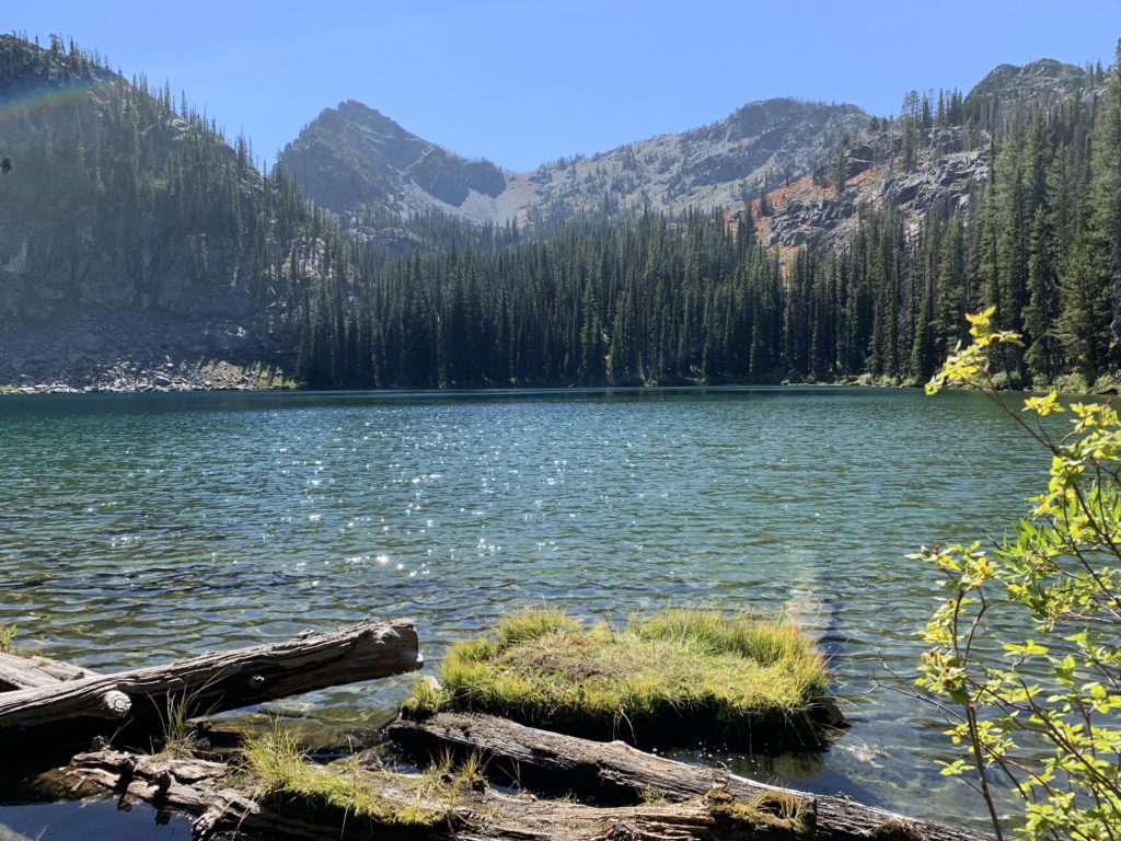
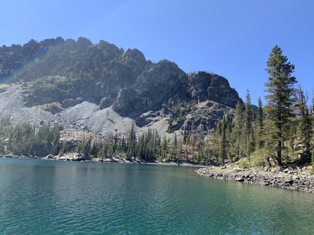
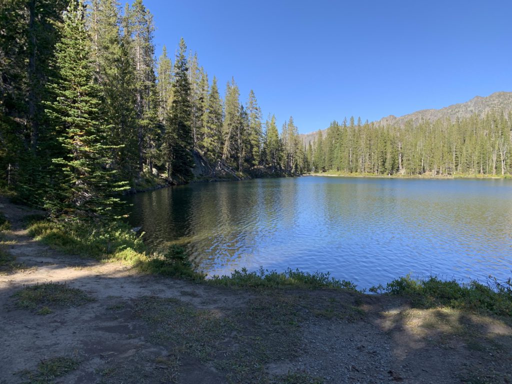
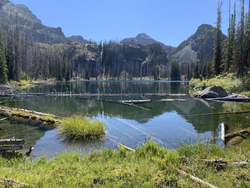
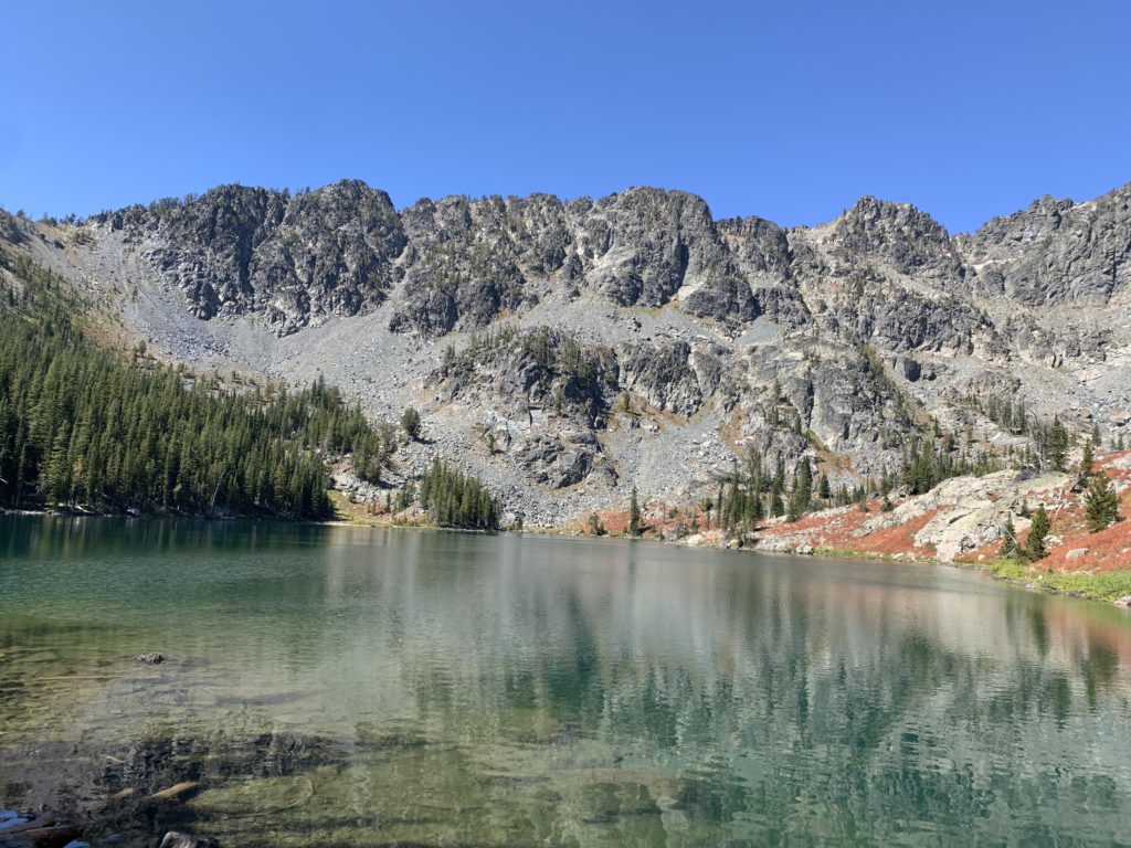
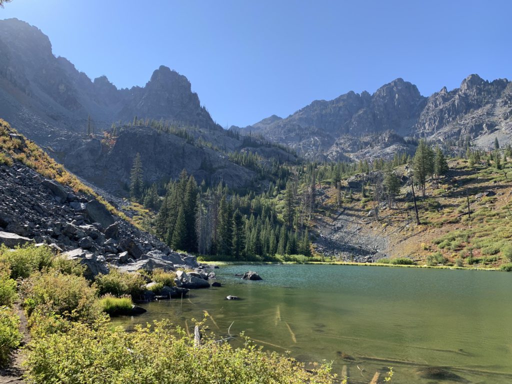
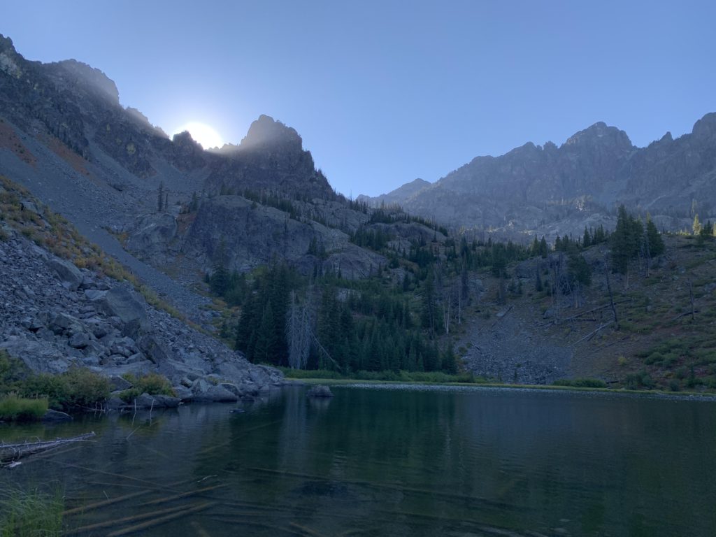
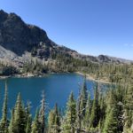
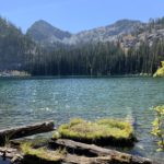
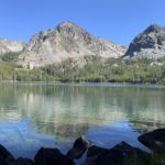
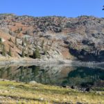
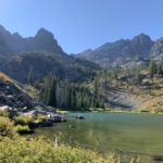
The trail then declines, switchbacking numerous times as it sheds 300 feet over about half a mile to reach Sheep Lake. Views of the peaks and the lake are phenomenal. An obvious, albeit unofficial, trail heads up He Devil from the southernmost switchback. I believe it is not a technical climb, but it doesn’t look canine-compatible, so we passed. However, at ~9,300 feet the views are likely worth every effort. Sheep Lake is the largest lake in the Seven Devils and an absolute beauty, with the greenish blueness of the water contrasting sharply with the bare rock surface that surrounds it. I’d say it’s the most beautiful lake, although Baldy Lake and Dog Lake are close runners up. There are a couple of campsites where the trail meets the lake; none were taken while we were there (weekday), but they clearly received heavy usage. An unofficial trail continues along the lake to its northeastern tip, with more campsite on a peninsula. That trail (“Climber’s Route”) then climbs up to a ridge above Mirror Lake and crosses over to descend to Seven Devil Lake Campground. We have not hiked it; presumably it is steep and narrow and scary. We were surely tempted to set up camp at Sheep Lake, but it was just too early in the day; thus we backtracked to Iron Phone Junction.
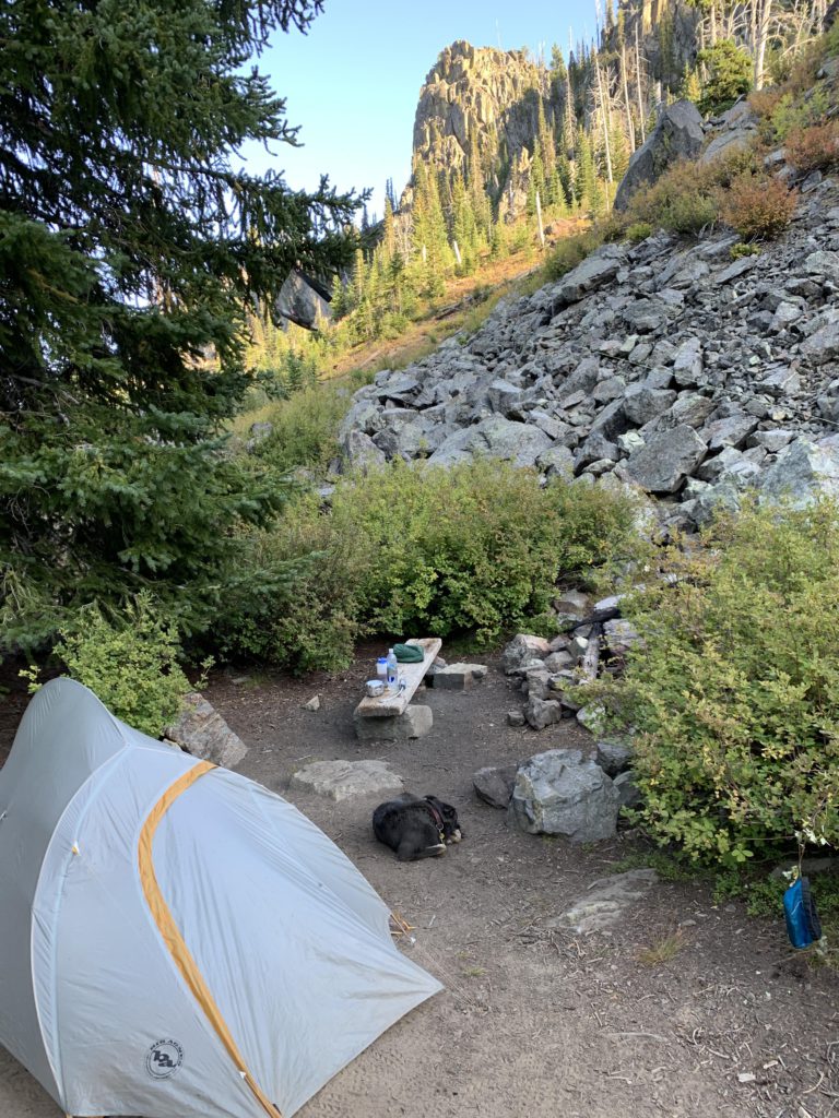
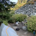
The next side trip was Dry Diggins Lookout, which promises the absolute best views into Hells Canyon. The trail contours along for a short distance and provides a good view of the hills harboring the Bernard Lakes to the northwest, then drops steeply beneath a solid granite wall to the left. Much of the Bernard Creek drainage is burnt, albeit recovering. The trail traverses the drainage, moving along the edge of the burn and eventually crosses a couple of dry brook beds. Then the trail switchbacks uphill through intact forest to the first of the Bernard Lakes, a swampy pond where you’d just expect to spot a moose (we didn’t). Shortly afterwards a spur trail leads to an overlook, while the main trail continues to ascend and reach the lower of the Bernard Lakes less than 2 miles from Iron Phone Junction. It was our destination for the day. There are campsites at either Bernard Lake, with the lower featuring two. The larger one, at the western end of the lake, was a bits away from the lake, so we picked the smaller one, which came with a large boulder next to the lake. It was perfect for cooking and lounging, as Naughty can attest. The only downside was a bleached snag standing right next to the campsite; luckily it stood firm for another night. Parts of the forest around the lake burned at some point, yet numerous trees survived.
The next day we continued towards the lookout, noting traces of frost in the shady areas. It is just a quarter mile to Upper Bernard Lake, which is covered with large patches of water lilies. A nice, albeit smallish, campsite resides at the northwestern end of the lake. Looming high above in the distance is Dry Diggins Lookout. Past Bernard Lake is a smaller pool, nearly completely covered with lilies, and the trail crosses its outlet (Upper Bernard Lake drains northwestwards, not into Lower Bernard Lake). A side trail loops around the lake, so bear kind of right. Soon after, the trail leaves the forest behind and switchbacks uphill. The view of the tree-lined Bernard Creek drainage is great and if you look back you can see Upper Bernard Lake. The signed junction with trail #56, at 7,600 feet, is about 2.5 miles from Iron Phone Junction.
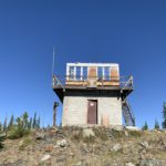
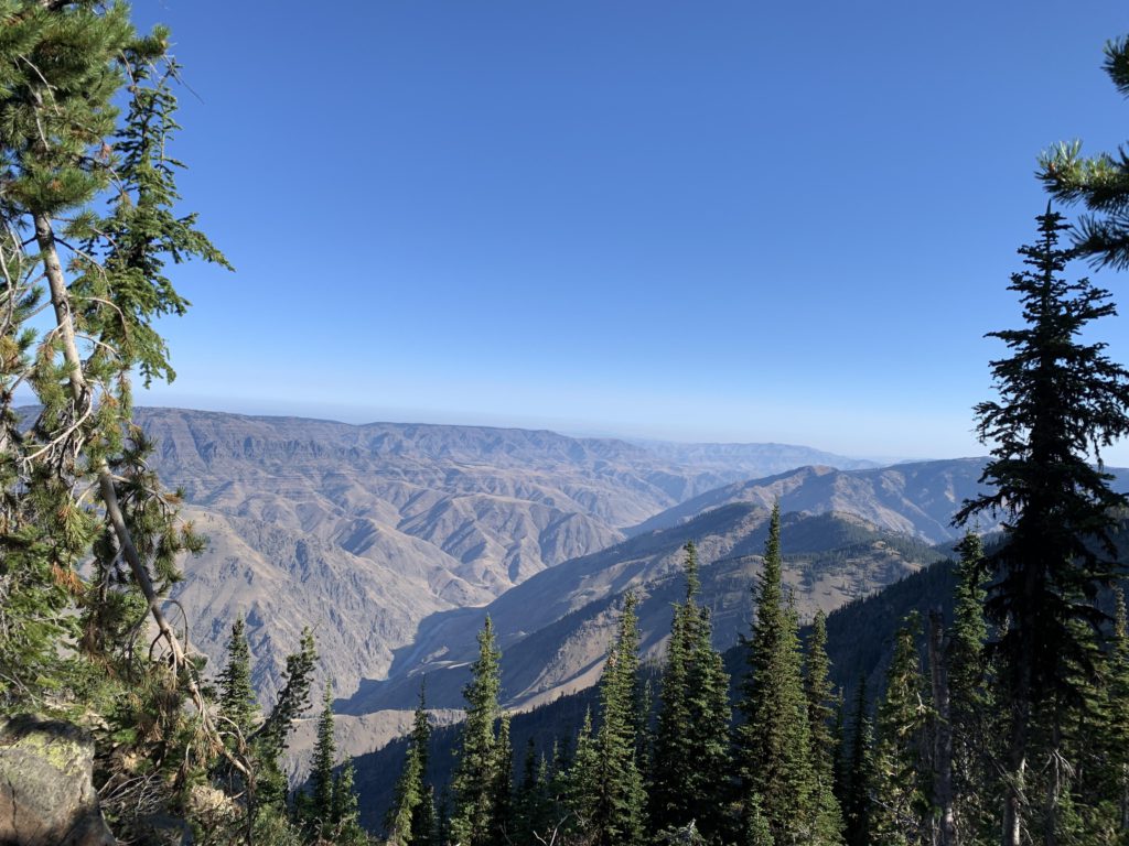
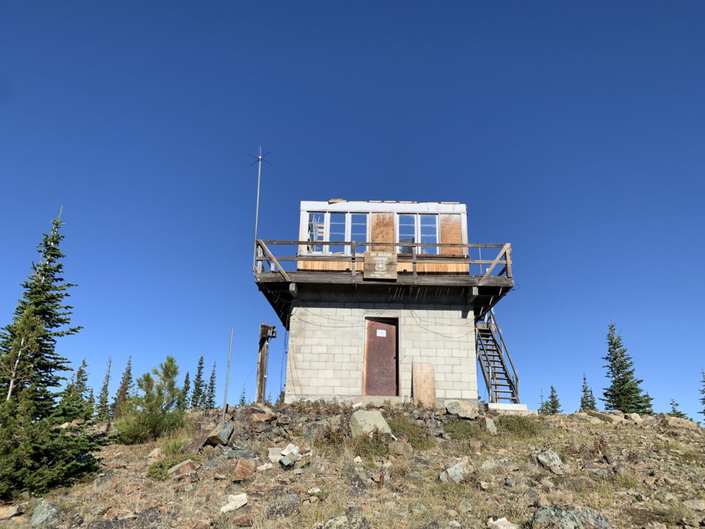
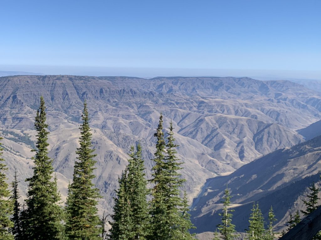
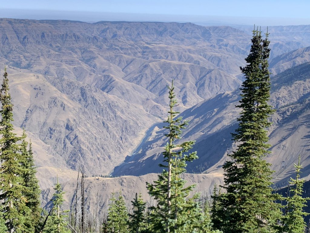
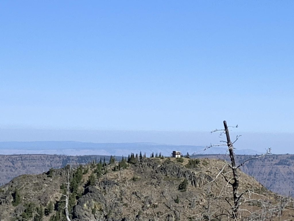
It’s another half mile uphill to the lookout, through open terrain hugging the ridge, with good views of the lookout and a sampling of the breathtaking views the lookout has to offer. Shortly before the lookout you’ll get grand views into Hell’s Canyon. The lookout is gated by two stone sentries, put up by the sheepherders of yesteryear; they are endpoints to the fence once moving up and down these mountains. The lookout, sitting on a concrete-block basement that still holds tools and a rusting bedstead, was recently beheaded: the roof landed a few dozen feet to the side. The inside of the lookout gives the (deceiving) impression of only having been abandoned yesterday. There is a Coleman lantern, a wood stove, a pencil sharpener mounted to a desk, cabinetry, a refrigerator, cooktop, mason jars, pencils, and a can of coffee just waiting for the proprietor to return. But the real treat is not the lookout; it’s the all-around view, particularly the 1.5-mile vertical drop into Hell’s Canyon (the lookout is just below 8,000 feet), with the Snake River winding through the naked hills far below. In the distance is Oregon’s skyline with Hat Point to the far right. Looking East, you can see an expanse of burned and unburned trees, with Upper Bernard Lake in its midst and the Seven Devils in the far distance. East across Hell’s Canyon are the Wallowas and the Eagle Cap.
Then it’s back to the junction with #56 (signed Hibbs Cow Camp), where the trail once again climbs, entering a partially burned forest. Looking back, you can spot the lookout, while the view eastwards brings to light the Bernard Lakes. The trail rises to about 8,000 feet (which is higher than the lookout), then flattens and slowly descends back to the main loop. This is an open area and the view of the Seven Devils is impressive, especially of Devil’s Throne, but you can see as far as the Heaven’s Gate Lookout. Shortly before returning to the Loop, a good trail branches off to the right. It’s not marked on any maps but in good condition. Possibly it’s an alternate route to Hibbs Cow Camp. The entirety of trail #56 is just 1.5 miles.
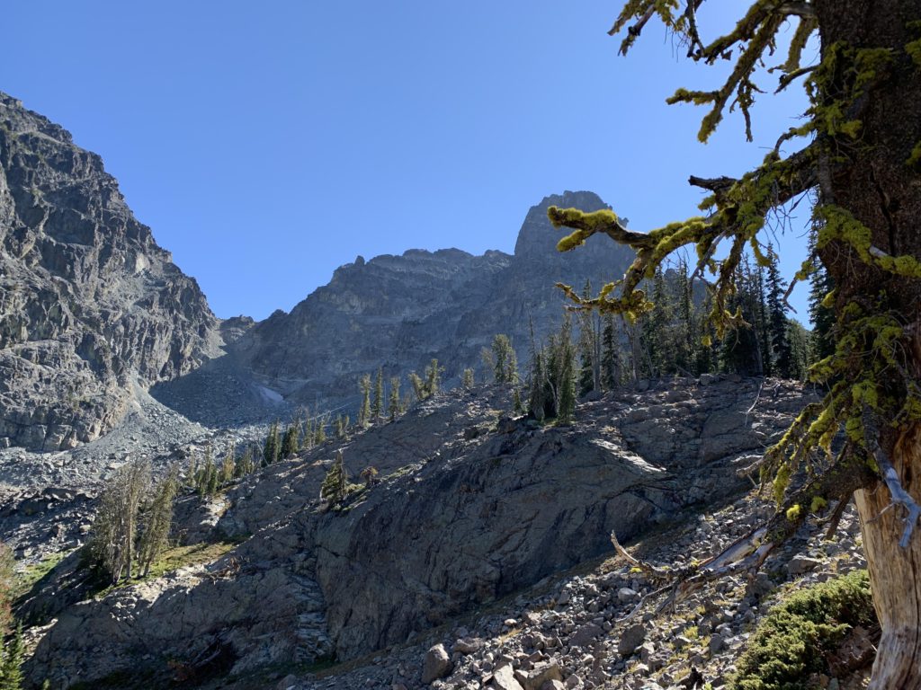
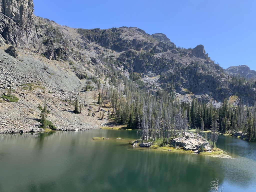
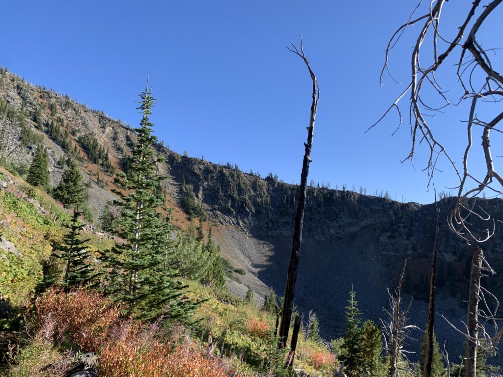
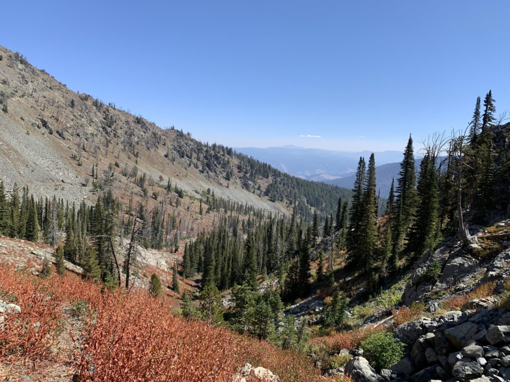
The junction with the main loop is signed; you want to head southwest, towards Hibbs Cow Camp, an area that burned in 2015. However, you’ll enter intact forest as the trail declines towards the Hibbs Cow Camp junction in about a half mile. Presumably, there are camp sites at Hibbs Cow Camp, but we didn’t check it out. A short while later, following a further drop in elevation, is the crossing of Little Granite Creek, which is a reliable source of water and even features a small campsite. Then the trail contours along, high above Hells Canyon, weaving in and out of partial burns, mountain meadows, and evergreen forest, with the skyline dominated by the Devil’s Throne and the Twin Imps. About 2 miles after rejoining the main loop from Dry Diggins, and 800 vertical feet lower, is the signed junction to Echo Lake and He Devil Lake, both worthy sidetrips. It’s only about three-quarters of a mile to Echo Lake and 400 vertical feet, which is accomplished via six switchbacks. Alas, the area burnt at some point and you will have no shade whatsoever. The benefit of that are views across Hell’s Canyon into Oregon. Echo Lake offers an excellent campsite, apparently well used, on its eastern shore. A cross-country trek to Quad Lake is possible; we did some exploring along Echo’s northern shore but ran into heavy brush. The Southern end might be a better bet, but it is also brushy. Past Echo, the trail starts to climb and conditions deteriorate quickly, with the trail covered densely with deadfall. Another seven switchbacks and several hundred feet of elevation gain gets you to He Devil Lake, which is preceded by a small pond. Campsites are less ideal at this lake, but it is particularly picturesque, featuring a small wooded (burnt) island in the shadow of Mount Belial. Although the lake is at the foot of He Devil, that peak remains hidden. If you came for the fishing, expect rainbow trout.
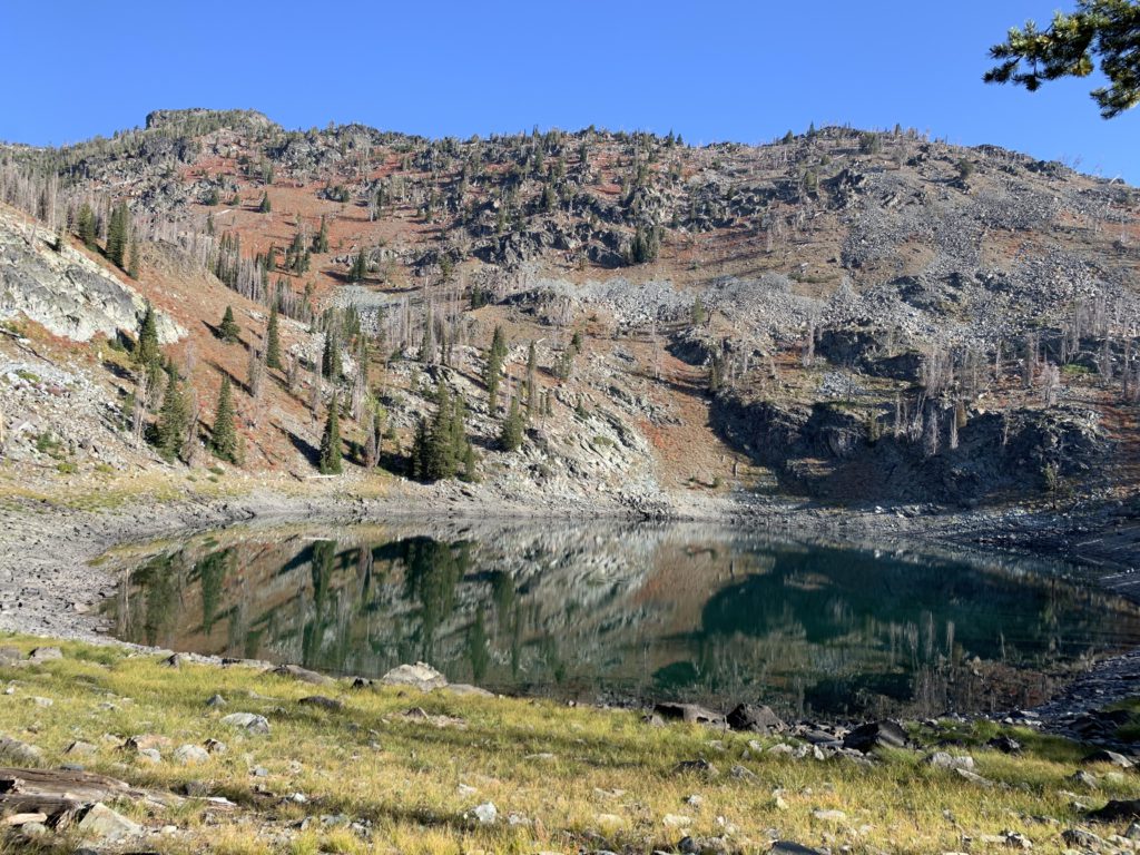
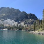
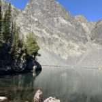
After retracing your steps to the main loop, continue south through burnt and regrowing forest (lots of mountain ash), steadily losing elevation down to about 6,400 feet, which is the low point of the loop at the Baldy Creek crossing (5 miles from Dry Diggins junction) . There are frequent good views into Oregon, and a cell signal. Baldy Creek is the last reliable on-trail source of water until you get to Dog Creek. It also offers a small campsite. Past the creek, the trail climbs quite steeply (also brushy), to return to about 7,000 feet at the junction to Baldy Lake, which is easy to miss. Taking the Baldy Lake spur, you turn the corner and head southeast, with the Devil’s Throne featuring prominently on the horizon. The ascent is relatively gradual, through talus and burnt patches, and spread over nearly a mile. The lake is spectacular, with the Devil’s Throne and Twin Imps looming high above it and a great campsite right on the lake next to the outlet (there are several, actually). We’d have loved to camp there, but it was just too early in the day; thus, back to the main loop.
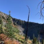
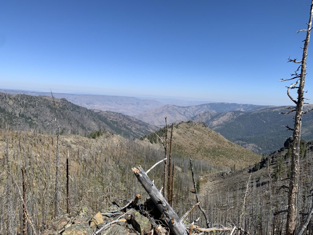
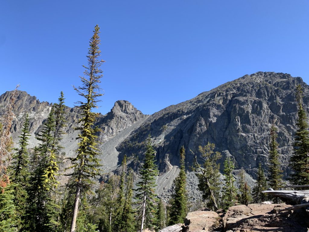
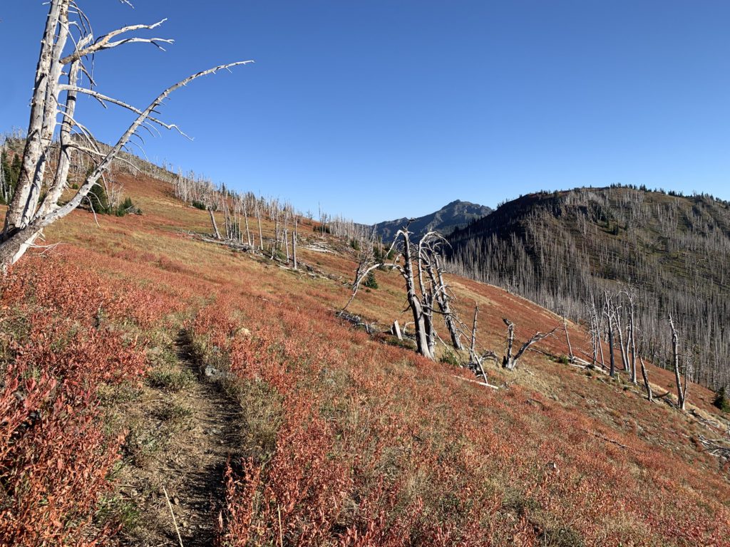
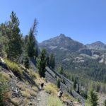
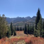
Continuing on the loop, the trail largely contours along, rising ever so slightly, and somewhat lulls you to sleep with its patches of burnt forest, mountain meadows–red with dried up fireweed–and broad views across Hell’s Canyon. The next point of interest is Devil’s Farm, a boulder and talus covered cauldron up on your left. This area is rather open, so you’ll have excellent views far into Oregon and the Wallowas. Continuing on, the trail ascends a smaller talus-covered cauldron, up a flank of Pyramid Mountain, to just over 8,000 feet with breathtaking views, whether it’s into Oregon or Horse Heaven Cabin up ahead. Then follows a relatively gradual descent through mountain meadows down to the Horse Heaven Cabin junction. About halfway down that stretch is a spring perhaps a hundred yards above the trail, in a stand of dead trees, but it was dry. The Horse Heaven Cabin trail switchbacks steeply uphill to the right, while the main loop descends to the left through burnt forest and across talus. There is also a trail going down into Hell’s Canyon (#114), but it wasn’t signed and may be discontinued. It’s about 14 miles from the Dry Diggins junction to the Horse Heaven Cabin junction.
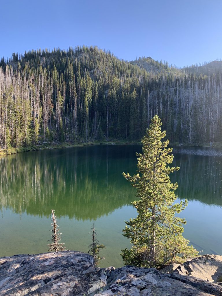
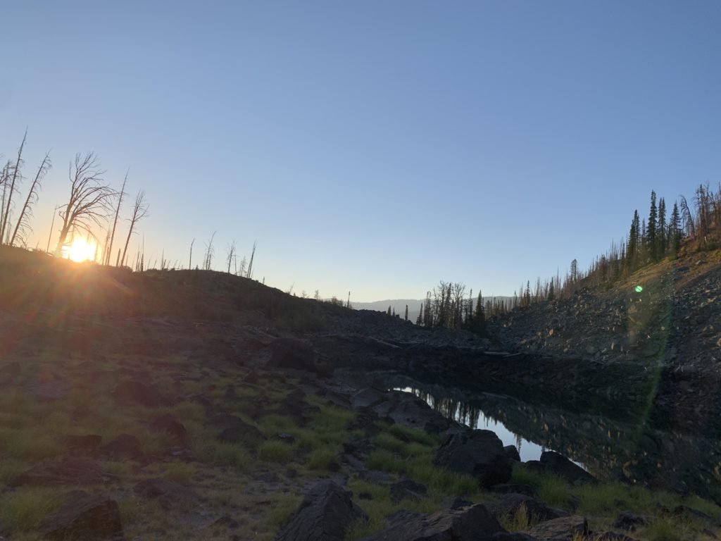
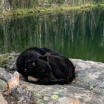
Diving into the Rapid River drainage (Mill Creek, actually), the trail quickly loses elevation and offers broad views across the burnt forest to the east and south. Switchbacking twice across talus, the trail than levels off and rides a ridge eastwards, alternating through burnt forest and alpine meadows. Eventually, the trail curls around and heads northeast towards Haas Lake. Our plan was to spend the night at Horse Heaven Creek, where we hoped to find water and a flat camp spot. However, the creek draining Haas Lake was entirely dry and we feared to find a repeat at Horse Heaven Creek. Since it was late in the day, the ascent to Horse Heaven Lake was out of question; hence, we chose the short cross-country hike uphill to Haas Lake. It is less than a quarter mile up a boulder-strewn incline. Haas Lake is an interesting location, being mostly devoid of forestation. The small lake, lined with black rocks, appears out of place, moonscape-like. Flat areas are sparse and strewn with rocks and boulders. On the western edge of the lake is a grassy patch of level ground where you can pitch a tent next to a firepit from which weeds are sprouting. The chance of you have it to yourself likely approaches 100%.
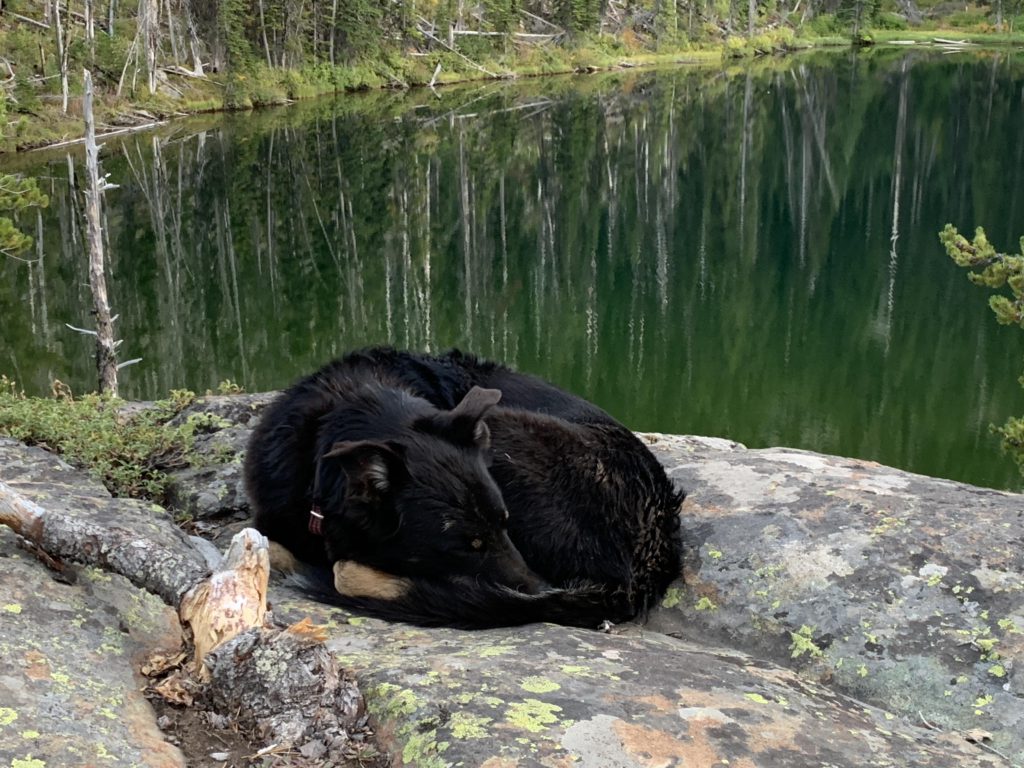
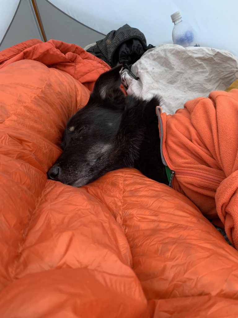
The approaching night seemed colder and because there had been traces of frost in the morning, Naughty was wrapped in PJs that night (one of my thermal shirts), besides sleeping on top of her Thermarest pad that keeps the ground cold at bay. In the morning, she always anxiously wants to get out of the tent and investigate, and this time was no exception. Only, as I was packing up sleeping bag and mat she came back shaking and tried to get back into the tent. The sun was already out and we found her a nice spot where she could rest and soak up the sun. Since our plan was to hike out that day and I packed 5 days of dog food (4 days of man food–I don’t get very hungry when backpacking), she also received an extra ration of food and then we were on our way, with Naughty exploring left and right and far ahead as she usually does. For the return to the main trail we picked a more easterly route down a ravine and were back on the Boise South Trail in no time.
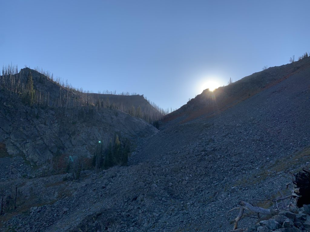
The traverse to Horse Heaven Creek leads through burnt forest. There once was signage indicating the discontinued Horse Heaven Lake route, but that is now just ashes. The creek was dry and there are no campsites, only dead snags threatening to fall at a moment’s notice. The actual spot where the trail is supposed to be is relatively easy to make out, near the dry creek bed where the loop trail angles away, but there is no trace of a path, lots of hip-high fireweed and plenty of blowdown. It’s a bushwhack. You want to aim for the saddle south of the lake and avoid the steep rocks to the east. About halfway up you should be able to find traces of the old trail. If you follow our GPX tracks, the westerly one is the correct route, which we discovered on the way back. Look for switchbacks; game trails don’t switchback. There’s a good campsite slightly above Horse Heaven Lake, in a stand of trees. The lake has a shallow approach, surrounded by rocks and grass, with most trees burnt. It’s a nice place, but I liked Slide Rock Lake better. To get there, head back up the trail as you’d come in, then continue the climb up a similar trajectory. There’s not much of a trail, just continue up a kind of ravine through a copse of pines west of Horse Heaven Lake. Eventually the terrain levels and you come upon another lake. Or should, according to the map. It was totally dry and we walked right through it, finding an old deer carcass and bear scat. Bear scat generally was sparse in the Seven Devils, perhaps because so much of the forest is burnt. In “Home below Hell’s Canyon,” Grace Jordan describes frequent encounters with bears, but that was almost a century ago.
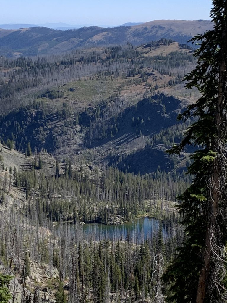
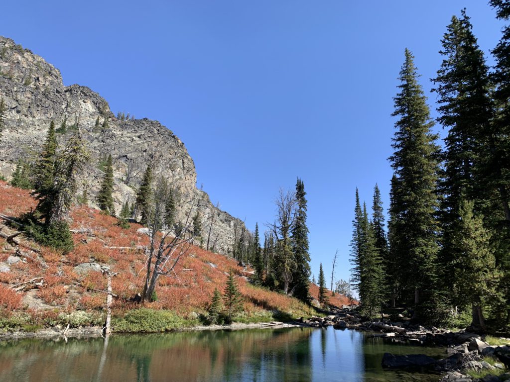
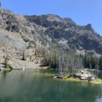
On the far side of the pond is a bit of intact forest, past which the terrain steepens again on approach to Slide Rock Lake. The lake is the quintessential alpine lake, nestled up against the sheer granite slopes of Pyramid Mountain and the Twin Imps. Scree covers the lower flanks and gives the appearance of “sliding” into the lake. A hawk and a golden eagle trolled the water, the latter riding the current high and disappearing across the crest of the Imps. The ascent to Slide Rock is about 2 miles and 800 vertical feet from the main loop. There is a small, little-used campsite near the outlet.
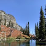
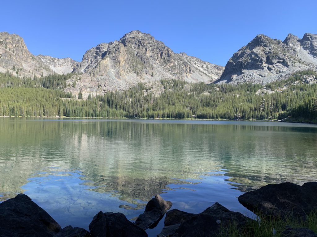
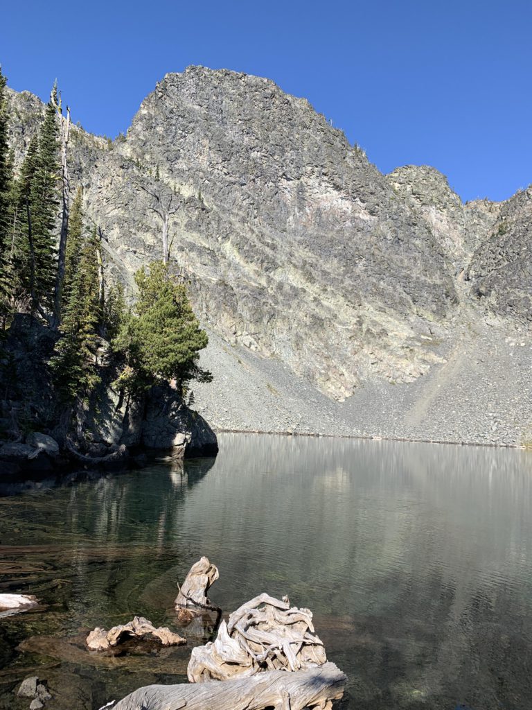
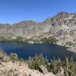
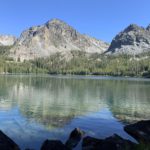
Back on the main loop, the going is far easier, with the trail in good condition and relatively level. The view gets a bit old, though. There’s only that many dead snags you can bear to look at. Most of the terrain along the Boise South trail burned at some point or another and the trail just weaves in and out of various stages of reforestation. A bit over 4 miles into the Boise South Trail is the first reliable on-trail water source, Dog Creek, which also comes with a large campsite and the option to steeply ascend 1,000 vertical feet to Dog Lake, which is highly recommended. There are no switchbacks and it just gets steeper as you go along. It does get a fair bit of equine traffic and unfortunately there is a bit of blowdown. The route deviates slightly compared to the old USGS maps, but pretty much stays on the north side of Dog Creek, after crossing it at the Boise South junction. You recross just before reaching the lake. Some of the forest higher up is intact and there are huge patches of fireweed. A campsite awaits near the outlet and more are likely sprinkled around the lake; there’s lots of shoreline. As we approached the shore, the eagle we had spotted on Slide Rock Lake lifted off a tree right in front of us. What a sight! Dog Lake was one of my favorites, deep blue-green water cupped by the steep granite walls of the Twin Imps. The forest ringing the lake is fully intact.
Once again back on the Boise South trail, Naughty, who’d enjoyed Dog Lake immensely, wasn’t doing so well anymore. No more scampering ahead into the now mature forest or looking for squirrels. Instead, she dropped behind and I had to wait for her several times. Not like her at all, despite her age (she was 9 at the time); she has never been the one slowing us down. Hanson Creek, about 6 miles along the Boise South trail, was dry but featured a campsite. The trail is easy and in good condition, but Naughty’s situation did not improve. At some point we took a 15-minute break by the side of the trail to let her rest. This turned out to be a terrible idea: when we continued she was all stiff and had a hard time walking! Even though it was early in the day, we decided to stay the night at Lower Cannon Lake and hike out the next day.
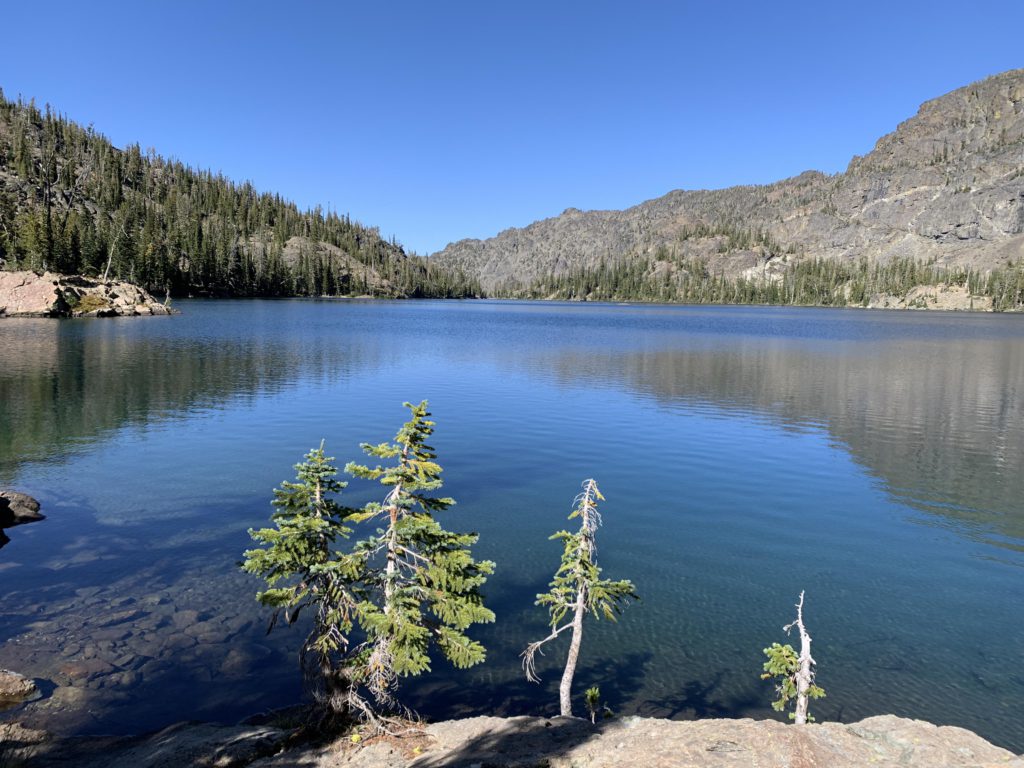
The junction to the Cannon Lakes is signed and Cannon Creek is a reliable source of water. The uphill section to Lower Cannon Lake is less than a mile and only 300 feet of elevation gain, starting out with a series of switchbacks. It is also only 4 miles from Windy Saddle, making it a popular destination. As you hike up, you’re treated to nice views into the heart of the Seven Devils: Goblin, Ogre, Tower of Babel. Halfway up, the trail crosses the creek, then climbs a bit to a junction with a cairn. The trail going off to the right is the unofficial trail to Upper Cannon Lake. We went left, which brought us to the Lower Cannon Lake, a magnificent lake tucked beneath the Goblin’s chin. Campsites are on the south side of the lake, of which we snagged the smaller one near the lake. Naughty sought a sunny spot in the dirt, where she plunked herself down and kept an eye on the gophers and pikas playing in the rocks nearby. It was still early and we had several hours of daylight to burn. A short run to Upper Cannon Lake looked enticing to man but not dog. But we had fun at the lake anyway. That night Naughty got another layer, a fleece pullover.
Naughty was in better spirits the next day, and we only had a short distance left. Back on the loop, there’s less then 4 miles, half of it contouring along with several creeks to cross (easy) in the Bridge Creek drainage. Then the trail switchbacks uphill, crisscrossing alpine meadows and zipping in and out of forest. The trail leaves the wilderness, then passes the Seven Devils Guard Station with its buildings and, a bit later, corral. Prominently, to the southwest, is the basin home to Seven Devils Lake and Campground beneath a bulging rock outcropping. Then the trail exits the forest (literally through a gate) and switchbacks up a mountain meadow back to the Windy Saddle parking lot.
I’m happy to report that Naughty fully recovered. We did another 50-mile hike a few days later at lower elevations, but also in one fewer day, and she had no problems whatsoever. Perhaps it was the cold, perhaps she ate something that didn’t agree with her, or just plain exhaustion. We spent all three nights above 7,000 feet on the Seven Devils Loop, which is far higher than where we normally camp.
The stats by day are: Day 1 to Bernard Lakes 15.2 miles and 3,300 feet of elevation; Day 2 to Haas Lake 17 miles and 3,400 feet of elevation; Day 3 to Lower Cannon Lake 14.3 miles and 2,000 feet of elevation; Day 4 back to trailhead 4 miles and 1,300 feet of elevation. We did not see anyone until we got to Cannon Lake, but came across two taken campsites, Basin Lake and He Devil Lake. Another party camped at Cannon Lake, and yet another at Upper Cannon Lake, so that area is indeed popular.
Alternate Routes
- Several trails connect to Hells Canyon: Sheep Creek trail #53, Bernard Creek trail #58 from Dry Diggins Ridge, and Hibbs Cow Camp / Granite Creek trail #112. There is also trail #114, Two Creek, but there was no signage, so it may be discontinued
- Several trails connect to Rapid River: Silver trail #134, Frank Wurl trail #61, and #62 near Dog Creek
- Trail #214 connects to Emerald Lake and Black Lake via Horse Heaven Cabin
- Dry Diggins Ridge trail #140 starts at the Iron Phone Junction. It’s not signed and may be discontinued, but the trail is very much discernible. It extends out 2 miles, then connects to Bernard Creek trail #58
- From Seven Devil Lake Campground, a “Climber’s Route” leads across Goat Pass, a ridge above Mirror Lake, and drops down to Sheep Lake. It is steep and narrow and unmaintained
- Heaven’s Gate Lookout is only a mile from Windy Saddle. You can hike to the lookout from there or take the Boise North trail
Things to Consider
- The base loop (#124, #101) around the Seven Devils is only about 28 miles, but you’d miss out on all the interesting stuff: the lakes and the view into Hells Canyon. Here follow all side trips from the base loop:
- Sheep Lake (#123) is 6.8 miles roundtrip from loop trail #124, and 900 feet of elevation gain. Trail conditions are good
- Dry Diggins Lookout adds less than 4 miles to the loop and 700 feet of elevation gain. Conditions are quite good
- Echo Lake and He Devil Lake is 2.8 miles roundtrip with 600 feet of elevation gain. Trail conditions to Echo Lake are good, but there is an immense amount of deadfall on the He Devil Lake stretch. You can also bushwhack to Triangle and Quad Lake (or even Purgatory Lake), but that is exceedingly brushy
- Baldy Lake is 1.8 miles roundtrip with 300 feet of elevation gain. Trail conditions are good
- Horse Heaven and Slide Rock Lakes is 4 miles roundtrip with 800 feet of elevation gain. There is no trail for the first couple hundred yards and the signage burned in a forest fire; afterwards the trail is rather faint, but blowdown is not too awful
- Dog Lake is 2.4 miles roundtrip and 1000 feet of elevation gain. Trail conditions are decent with some deadfall. It gets heavy equine use. Steep
- Lower Cannon Lake is 1.5 miles roundtrip with 300 feet of elevation gain. The trail is in good condition. A faint trail, marked with a cairn, continues to Upper Cannon Lake
- For the most part, you’ll have a cell signal on trail 124. It is especially good on Dry Diggins Lookout. There’s no signal on the Boise South Trail
Not so great