- Bitterroot Mountains
- Campground at trailhead (pit toilet)
- Junction 110/101
- Shortly ahead of the 121/101 junction
- A mile or so past the 121/101 junction (in the woods)
- Junction 114/101
- Siamese Lake
- You could probably make camp near any of the many Straight Creek crossings, but there were no obvious sites
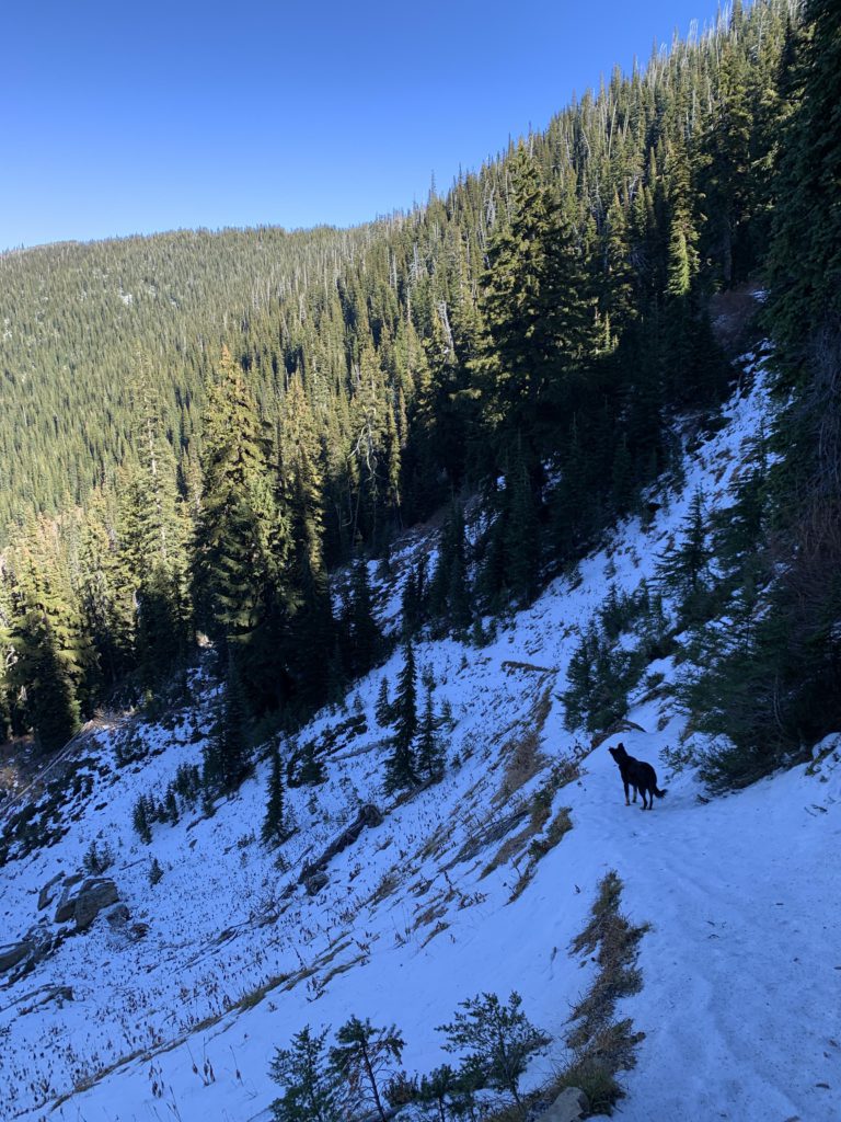
- Good. Expect a fair bit of deadfall along the upper section of trail 101 as well as the stretch to the lake on 114. There was almost no deadfall on trail 99
- The burnt bridge across West Fork Fish Creek has been replaced
- Straight Creek is crossed eight times, with logs making the upper 2 or 3 fordings easier. North Fork Fish Creek also needs to be forded (probably not a good idea in spring or early summer)
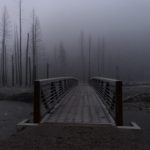
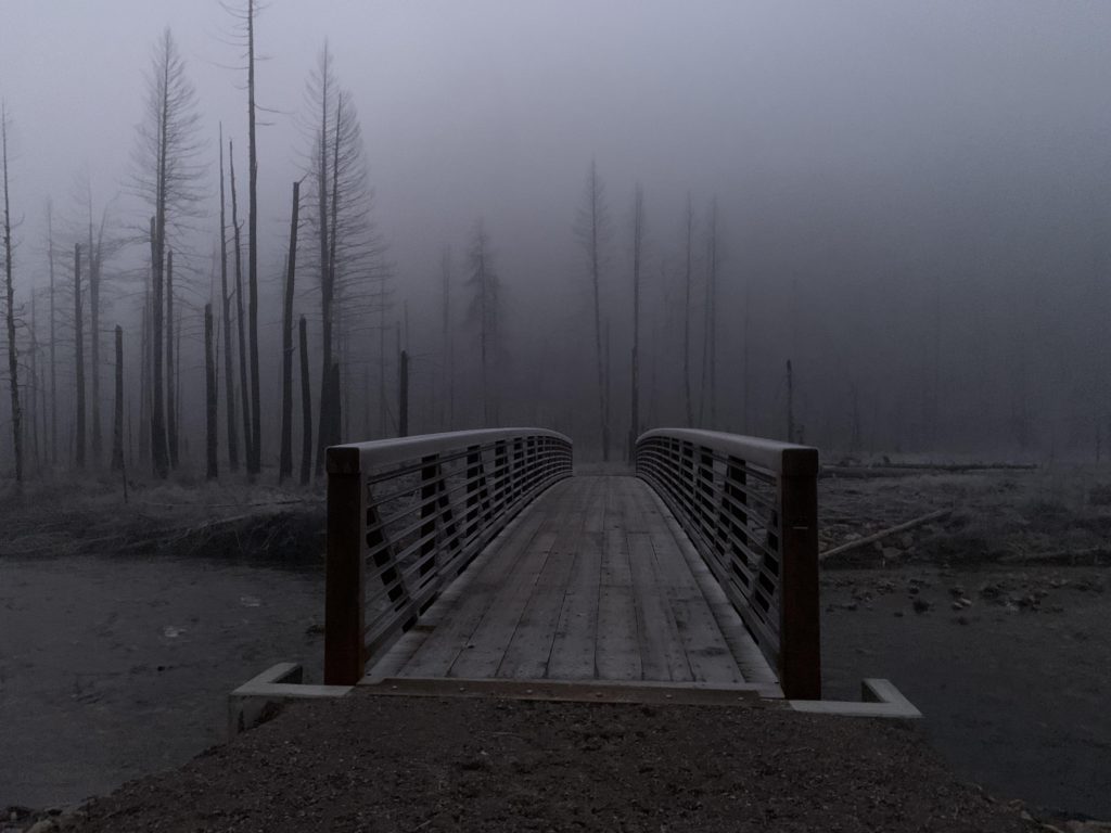
This hike can be problematic late or early in the year, as it involves numerous creek fordings and a high probability of snow at the high point, Chilcoot Pass. Having hiked the Great Burn last year, we knew what to expect at the very start of the loop: a rather frigid fording of West Fork Fish Creek with its swinging bridge burnt in the 2015 fire. What surprise, then, as we pulled up to the trailhead at dawn, to see a rather sturdy specimen crossing the creek! It reinforced our decision for a clockwise tour, since all other creek crossing are on Straight Creek. If snow became an issue, we would just turn back, but hopefully at least make it to Siamese Lake. As it turned out, these fears were unwarranted.
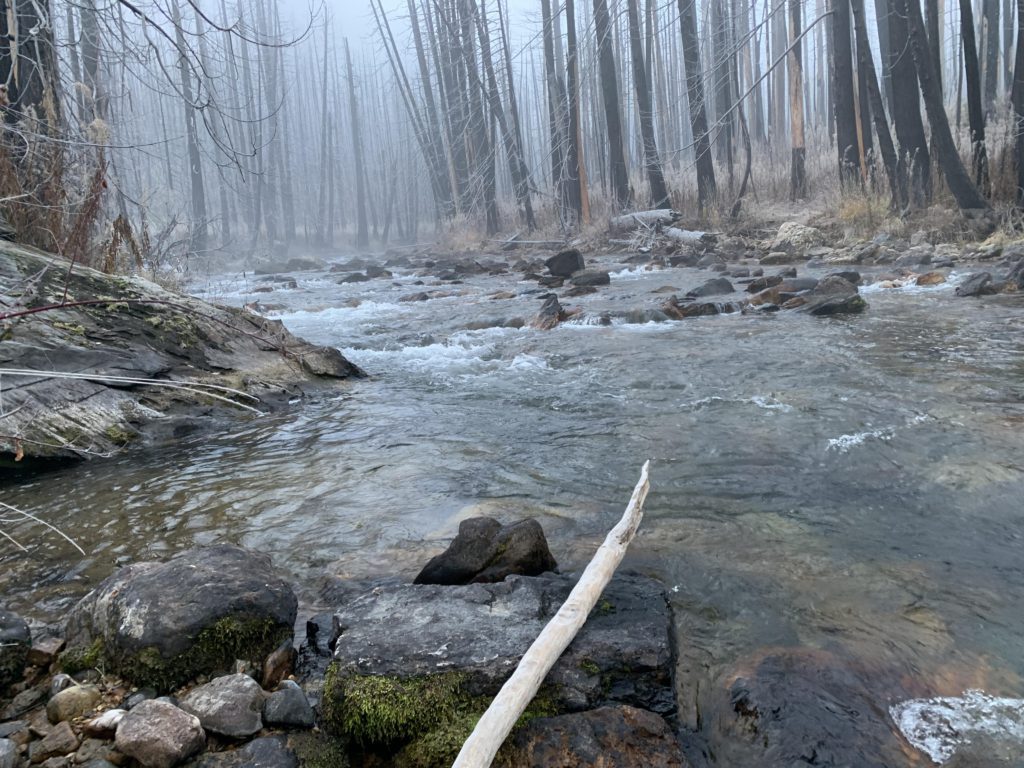
Daylight hours are few in late October and thus we hoped (and realized) good time along the burned stretch on West Fork Fish Creek. The ascent is de minimis, the trail frozen hard and in good condition, and the creek bottom hung heavily with fog. The forest is recovering, with many lodgepole pine saplings already hip-high or taller. After about three miles the burn retreats and the trail gets shaded by cedars. About 4 miles in, the trail crosses West Fork Fish Creek on a sturdy bridge, with a campsite and perfect swimming hole awaiting on the other side.
The trail parallels West Fork Fish Creek and soon comes to a junction with Indian Ridge Trail #104, though the sign is camouflaged by an emerging sapling and the trail somewhat overgrown. Soon after is the junction with Cedar Peak trail #510. It is 4.5 miles to Chilcoot Pass on that route, according to the signage; the trail promises lots of deadfall and, judging by the map, switchback galore. Continuing on 101 instead, past a spacious campsite, the trail forks near the 6-mile mark, with trail #121 heading downhill to a fording of the creek, followed by a steep uphill on the far side towards Mud Lake (this appears to be a frequently used trail).
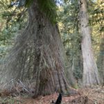
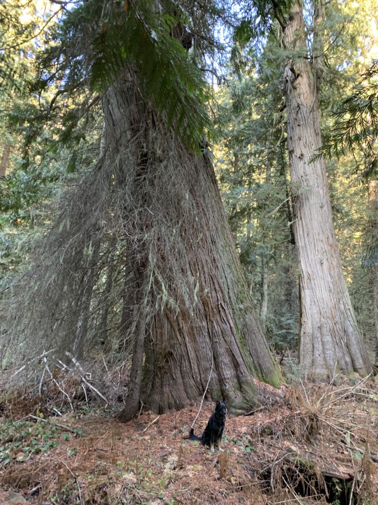
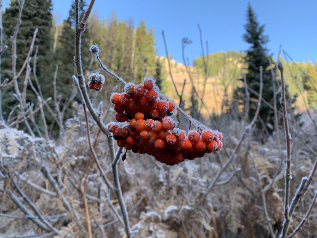
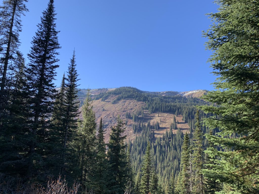
Heading uphill on 101 instead, the trail steepens, but not terribly so, and remains well shaded by a beautiful cedar canopy, pierced in a few spots by avalanche chutes thick with slide alder and elderberries that undoubtedly make for a brushy summer hike. Now, with all foliage gone, the chutes offer pleasant views of frost-tipped treed hillsides. The cedars won’t retreat until you’re above 4,500 feet, with a most spectacular old-growth grove near that level. It is in fact striking how lush and green the forest is. Expect some flooding when you cross the creek that drains Siamese Lake.
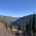
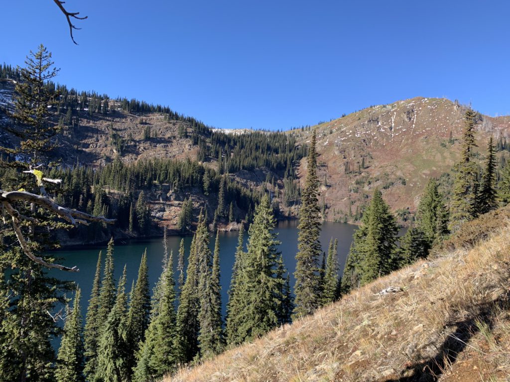
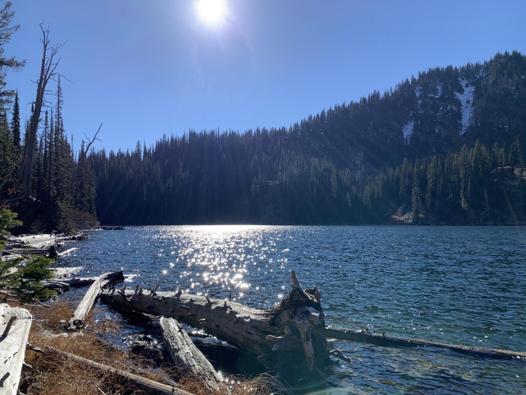
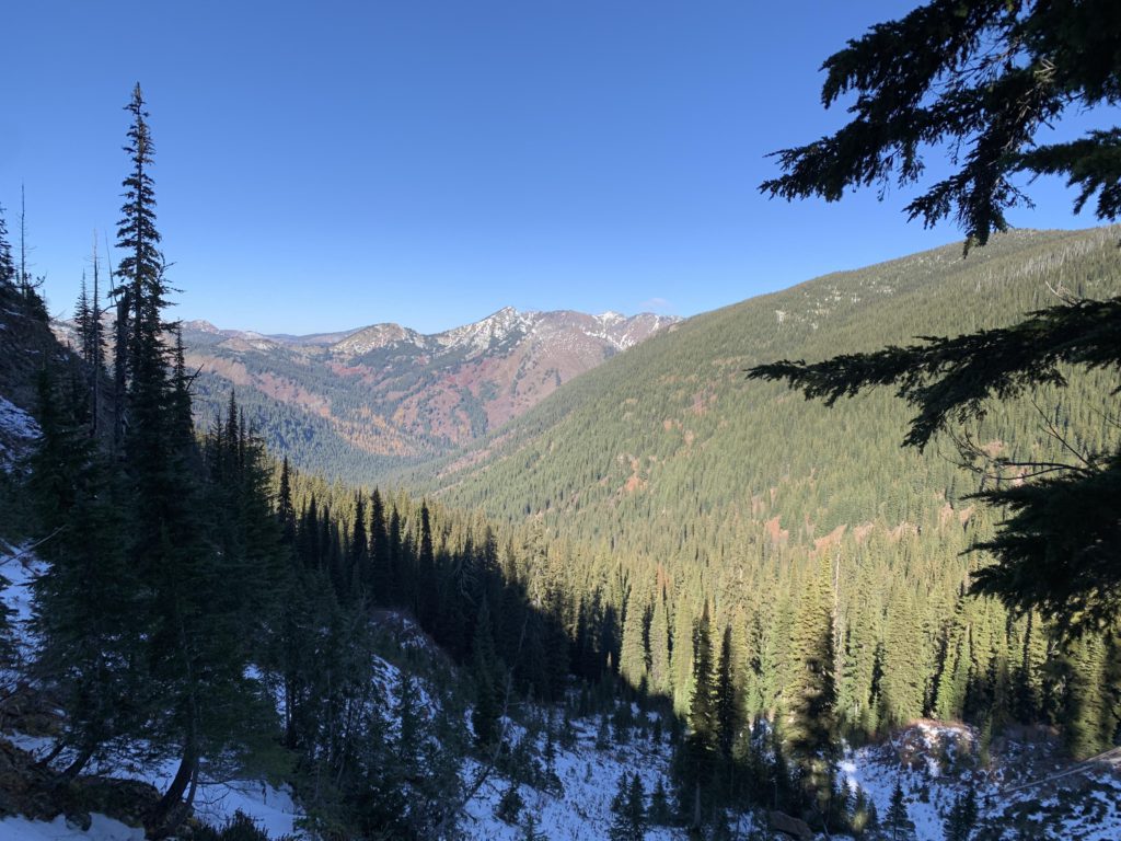
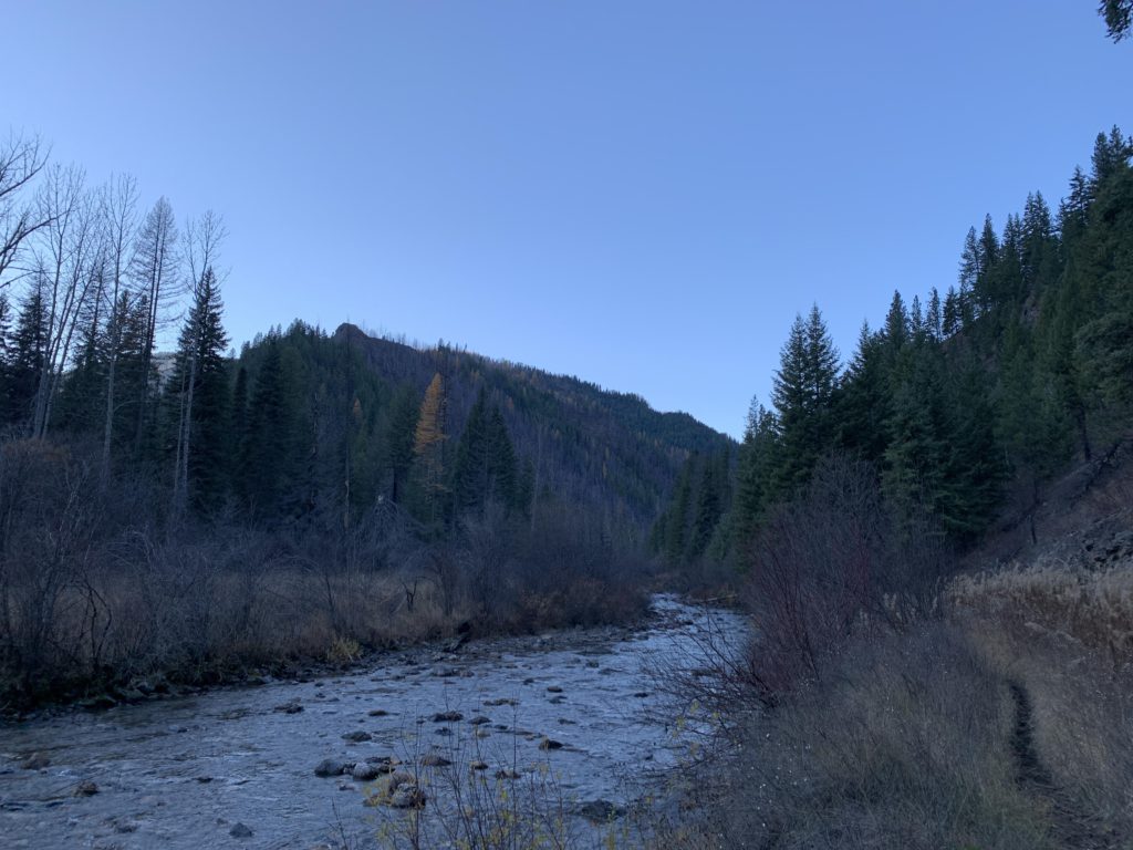
Near the 12-mile mark is the junction with trail 114. Trail 101 (left) continues up to Stateline and Fish Lake, while 114 (right) moves into a marshy area called Foley Basin where we spotted a mule deer clamoring down a steep treeless hillside. The trail then switchbacks, turning north-northeast and re-enters the forest, all the while climbing. For the next two miles the trail contours towards Siamese Lake, but nonetheless you should expect substantial ups and downs along this stretch. The trees recede somewhat and you’ll be treated to grand views of the West Fork Fish Creek drainage and its fall display of golden-dressed larches (the morning fog dissipated quickly). Just ahead of Siamese Lake we came across the first few patches of snow. The trail approaches the lake from the south side, traversing a small a hump and dropping down to join the lake at its outlet where a small campsite awaits.
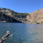
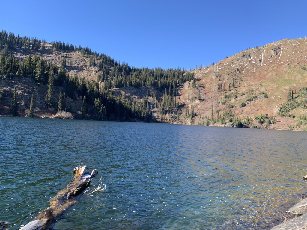
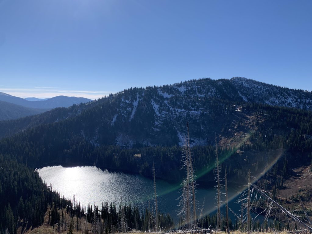
The lake, stocked with cutthroat trout, is picturesque and all we could wish for in an alpine lake, including a solid headwall rising upwards towards Stateline. Across the lake, to the northwest, is the inlet, cascading down a rockface from upper Siamese Lake. To the north is a steep grassy hillside, a result of the Great Burn, no doubt, and a haven for elk. It is possible to climb to the upper lake, although that is perhaps an arduous bushwhack. Far easier is the good path leading down from the Stateline trail (see separate report). There was no snow at the lake, but it was cold; thus, we didn’t linger long.
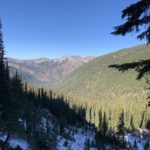
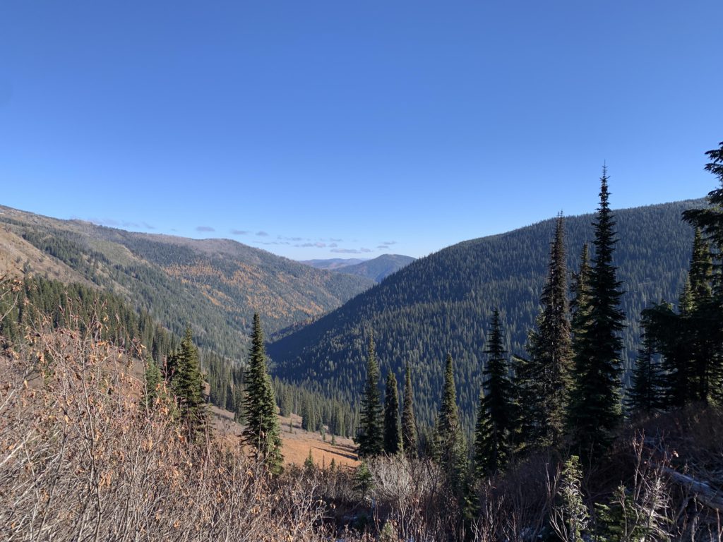
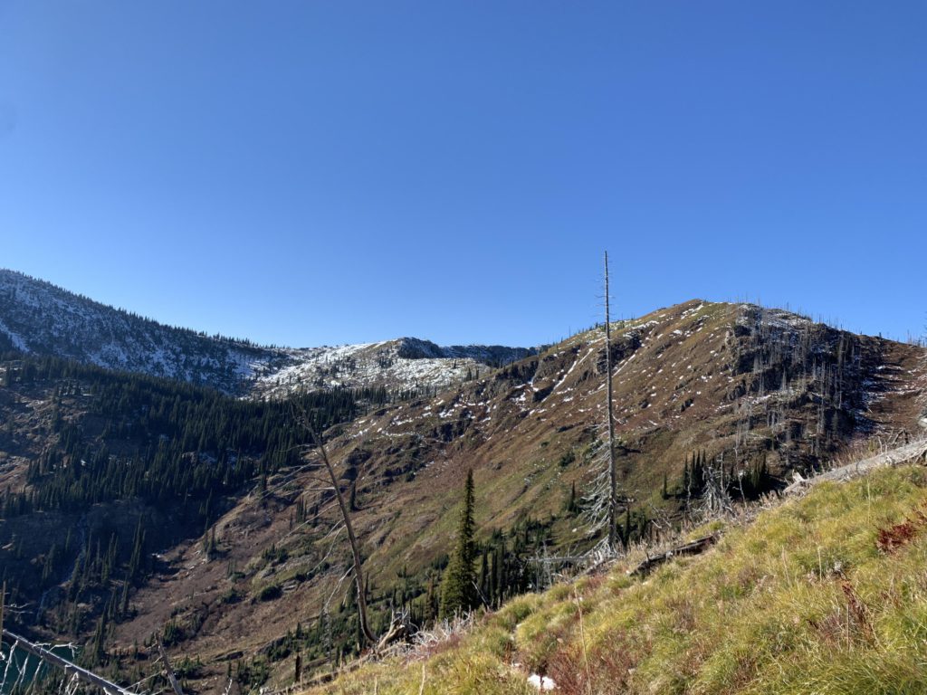
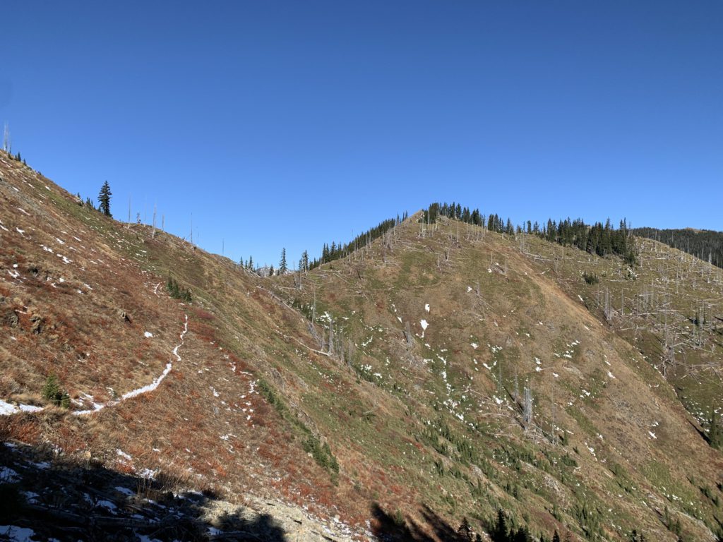
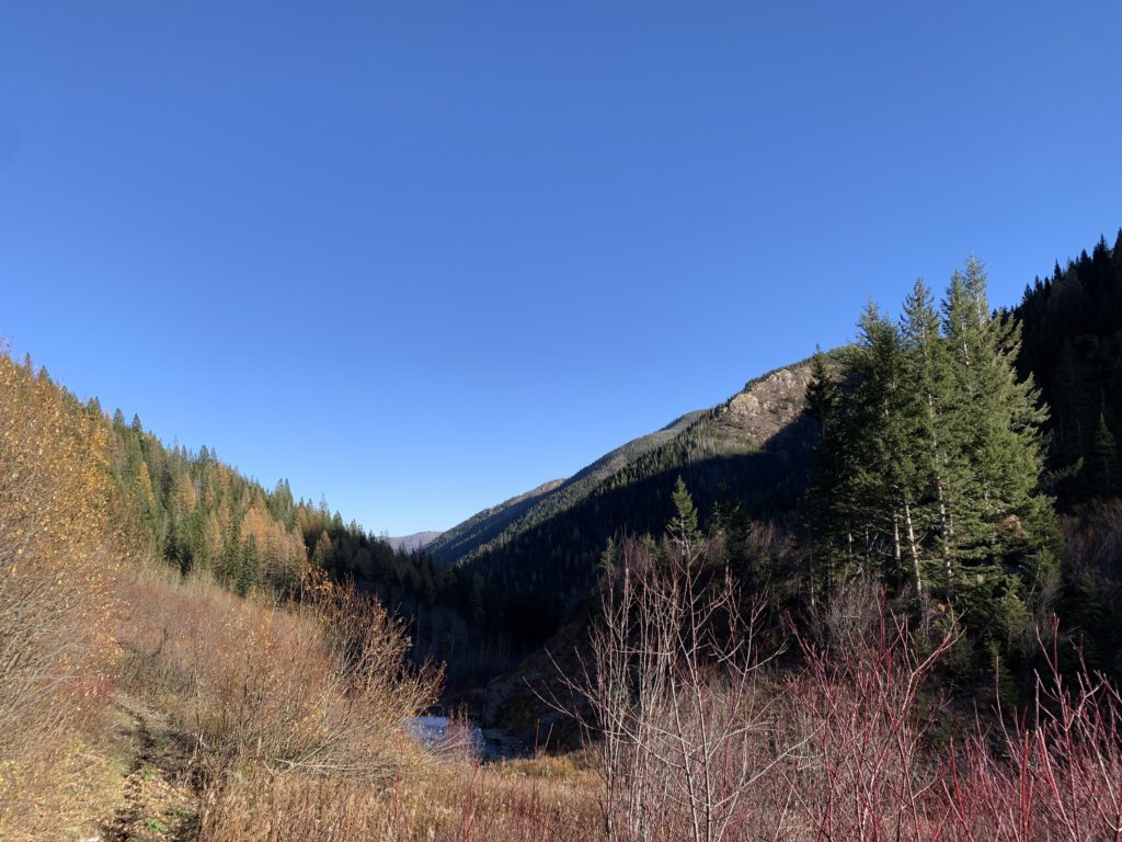
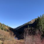
From the lake the trail switchbacks steeply uphill across open meadows with excellent views across the West Fork Fish Creek drainage, the lake, and the Stateline ridge. The upper lake remains hidden, though it’s easy to make out the basin wherein it lies. The trail does not scale the ridge entirely, instead contouring along once you reach 6,700 feet all the way to Chilcoot Pass, about 15 miles from the trailhead. The trail forks, with #510 heading back down to W Fork Fish Creek via Cedar Peak, while our trail drops down to the north into the Straight Creek drainage (#99). The dropoff here is fairly steep and exposed, with Crater Peak looming prominently in the distance. The trail was filled in with packed, frozen snow, making the traverse tricky. MicroSpikes came in handy, even though they were only needed for a couple hundred yards. The snow then receded, with the trail descending uneventfully through spruce forest and paralleling an unnamed creek. Just before you get to Straight Creek, the opposing hillside comes into view, nearly bare, with only shrubbery gaining a tentative foothold. The Great Burn impacted this basin far more severely than the West Fork Fish Creek drainage. Judging by the vegetation, the climate is also far harsher here, with only a small sprinkling of cedars, while spruce and fir prevail.
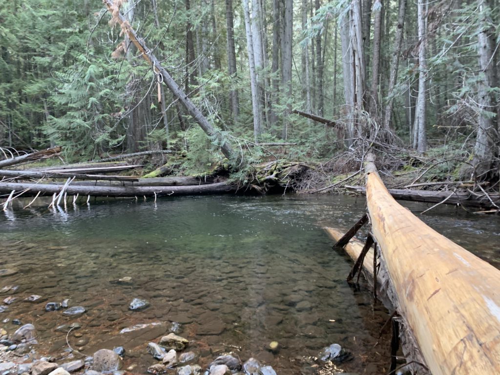
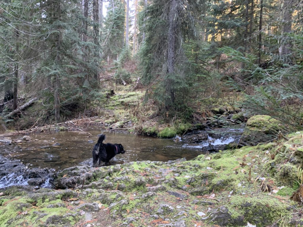
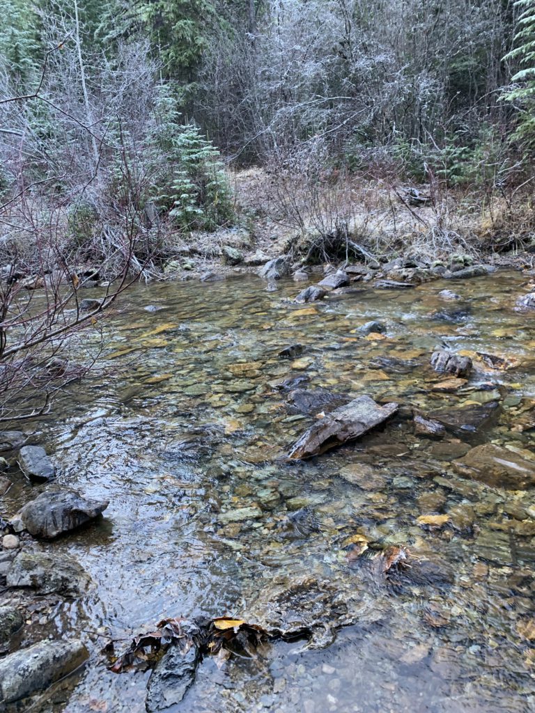
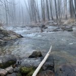
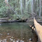
Immediately upon meeting up with Straight Creek, that creek needs to be crossed, which this late in the season was easily accomplished via a handy log. Get used to more crossings; there are 8 in total. The trail continues through the forest, climbing at times, then descends to the creek for another crossing, also by log. Another crossing follows at the 19-mile mark, this time without a handy log, but a short bushwhack fixes that as there are numerous logs across the creek. Once on the north side of the creek, the forest recedes somewhat and you get frequent views up the steep and brushy flanks of Crater Peak.
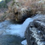
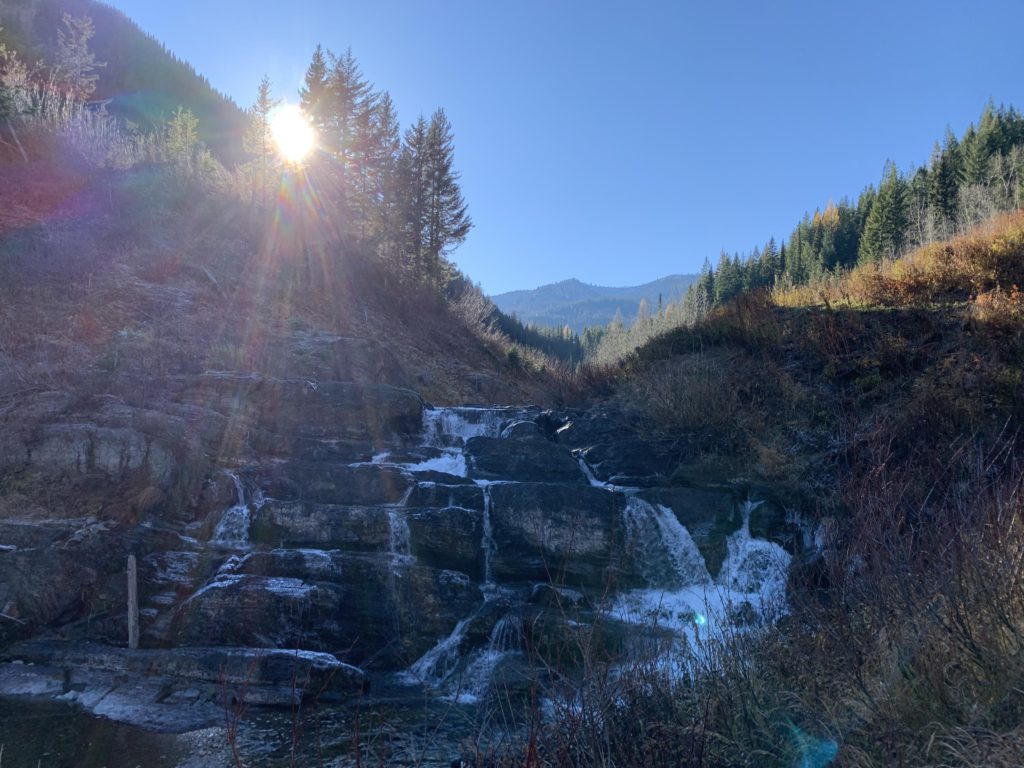
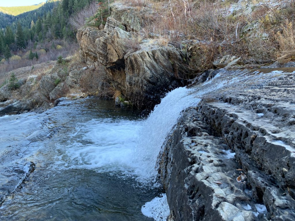
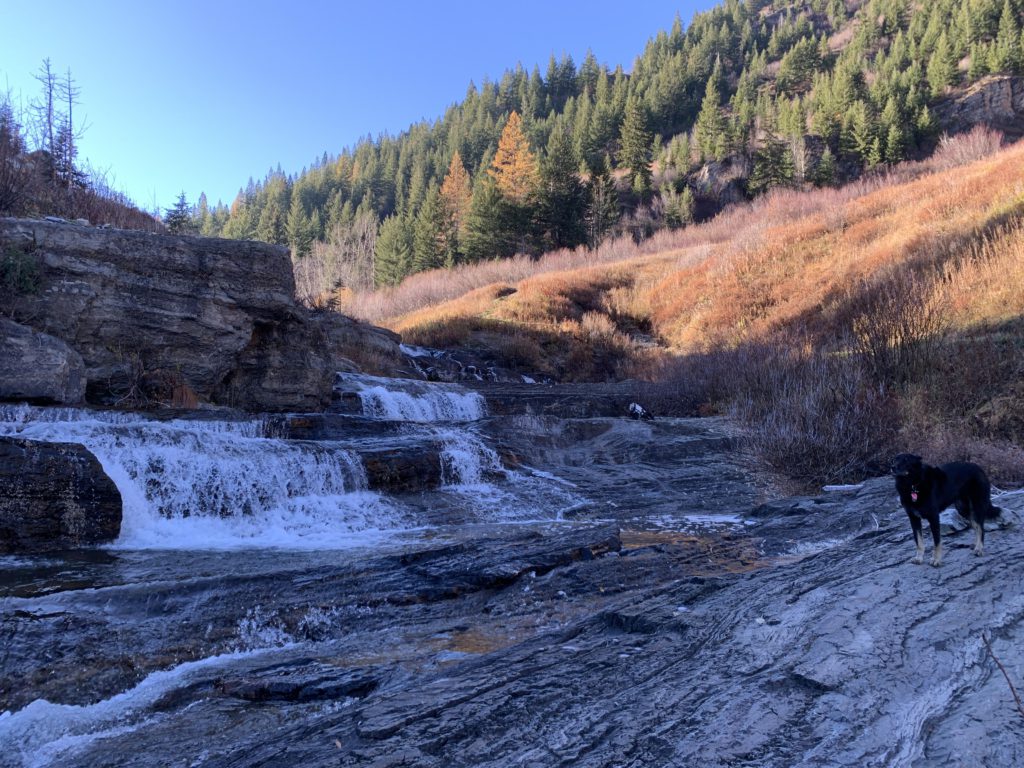
The highlight of the hike, Siamese Lake aside, surprises near the 20-mile mark: a series of cascades in Straight Creek, with the water sliding over smooth granite from one pool to the next. Quite spectacular and worth a bit of lingering.
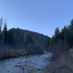
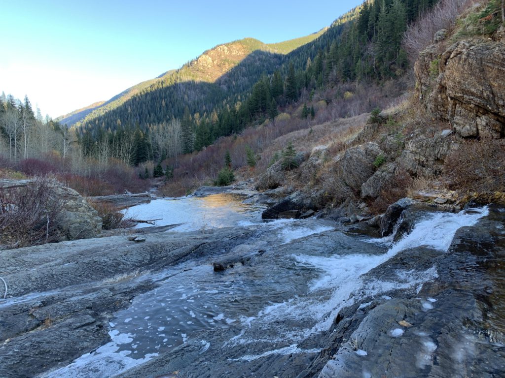
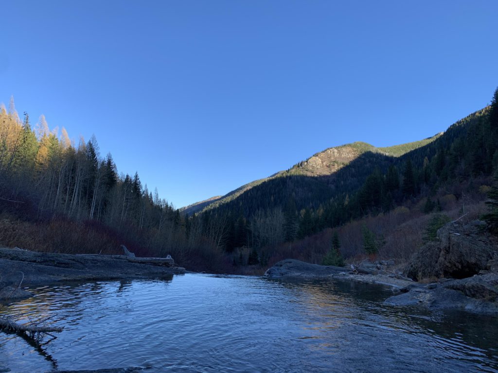
Waterfalls are frequent as the trail parallels Straight Creek, but usually seen from above and filtered by trees. Views of the ravaged sides of Crater Peak are also frequent, yet the return to the trailhead is relatively uneventful, albeit punctured by frequent creek crossings. There are no bridges and log options are fewer and fewer; plus, as it was getting later in the day (the low fall sun left the valley in deep and freezing shadow after 4pm), the logs were slick and frozen. From crossing #4 (about 21 miles in) man and dog simply marched right through the frigid water (the level is low in October; it is likely torrid during snowmelt). Crossing #5 comes shortly afterwards; you’re nearly at North Fork Fish Creek for crossing #6, and #7 follows at the confluence. In fact, only a few steps afterwards you will ford North Fork Fish Creek. Then it’s just a mile or so back to the trailhead, with the level trail paralleling the creek. And yes, we made it back before dark.
Alternate Routes
- Trails 110, 104, 121, 101, and 103 connect to Stateline trail 738 for alternate loops
- Trail #510 connects Chilcoot Pass with #101 near the crossing of W Fork Fish Creek
- A game trail continues to Upper Siamese Lake
Things to Consider
Not so great