- Bitterroot Mountains
- Kelly Creek and Cayuse Creek confluence
- A number of fishermen’s campsites along Kelly Creek
- Outfitter’s camp at Bear Creek/Kelly Creek junction
- Outfitter’s camp at Kelly Creek junction with South Fork
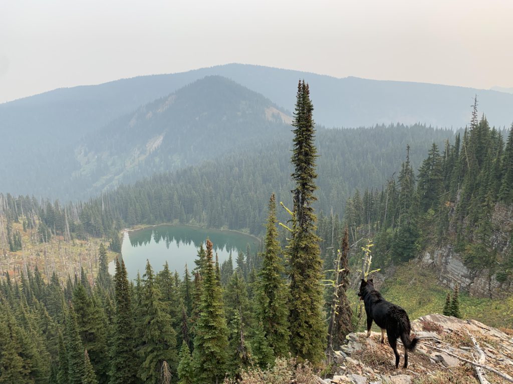
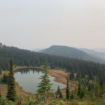
- Kid Lake
- Mud Lake
- Unnamed tarn ahead of Fish Lake
- Dry camp on Bruin Hill or Little Moose Ridge is a possibility
- There is a pit toilet at the trailhead
- Kelly Creek was in good condition all the way to Kid Lake
- There are sections of washed out tread on the Stateline trail, and some deadfall
- Lots of deadfall on the Bruin Hill trail
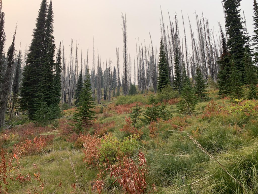
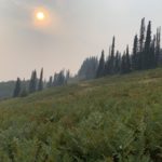
- The trail is easily lost in the old burns and elk meadows on Bruin Hill and Little Moose Ridge
- Trail 490 down to Bear Creek/Kelly Creek is fairly good with some deadfall; lots of sand on the trail
I admit that the Seven-Devil Loop nearly brought me to my knees, but surely I didn’t need 5 full days of bed rest?!? Believe me, I was more than ready when the Scribe suggested a three-day tour if only we could find a wildfire-smoke-free zone. He settled on either the Shedroof Divide or Kelly Creek, leaving the final decision to the smoke counters. On the morning of our departure, said Smoke Counters decided that Missoula, MT had marginally less smoke than Ione, WA and thus we trekked east. Having slept for most of the past five days, I made good use of the three-hour drive by catching a few more z’s.
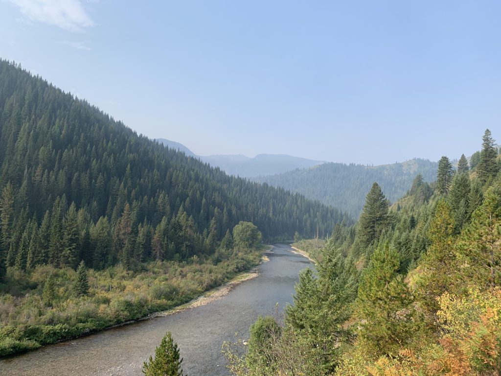
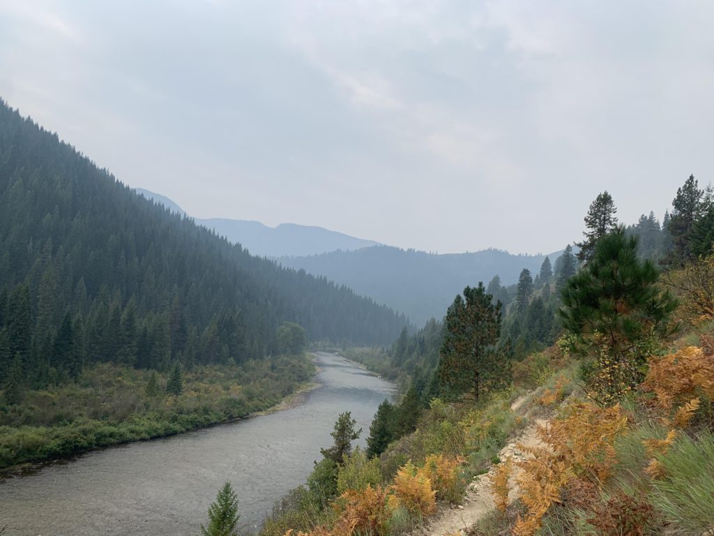
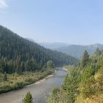
The start of the loop at the former Kelly Creek Workcenter gives you a couple of options, one to the left of the pit toilet and the other, steeper, to the right; they converge a short way in. Trail #567 is a dusty singletrack that gets quite heavy use as the creek is popular with anglers fly-fishing for world-famous west-slope cutthroat trout (catch-and-release only, no bait, barbless hooks required) and horsemen bound for the hunting camps further upstream. The going is easy, as the trail is mostly flat and parallels Kelly Creek, providing good views upstream and up the treeless expanse of Little Moose Ridge. The hillside on the far side of the creek, leading up to Toboggan Ridge, is heavily treed. The trail mostly runs slightly above the creek. There are numerous tributaries (easy to cross) along the first eight miles, however, providing ready access to water, and spur trails drop down to Kelly Creek. Just shy of 1.5 miles in, shortly past the Pileup Creek crossing, is the junction with Little Moose Ridge trail #760, where clearly most hikers, ourselves included, stay on #567.
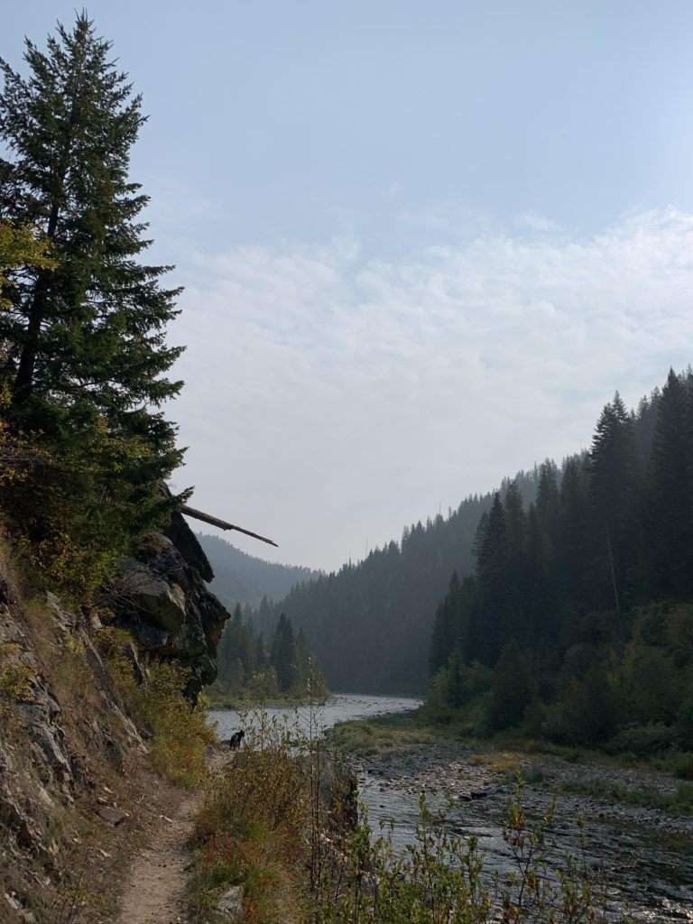
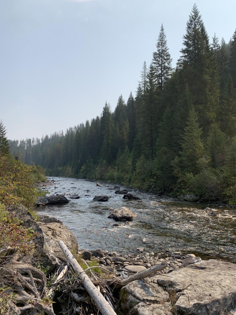
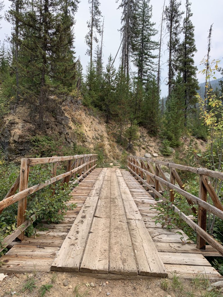
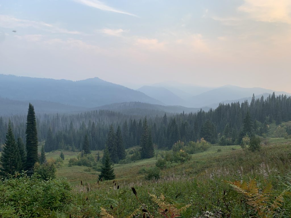
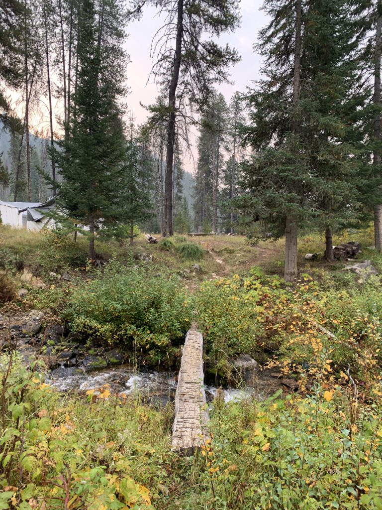
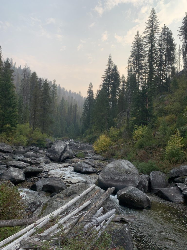
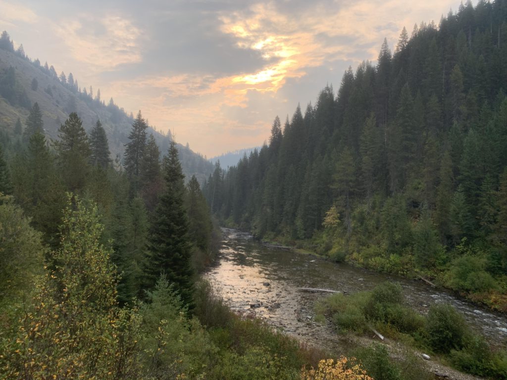
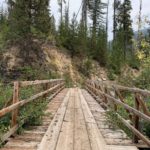
Four miles into the hike, a side trail leads down to the Cayuse and Kelly Creek junction, featuring a pretty campsite that is definitely worth the detour. The old USGS map shows trails crossing Kelly Creek and follow Cayuse Creek respectively climb to Toboggan Hill, but there was no signage, meaning the trails are likely no longer maintained. From the confluence, the spur trail moves back into the woods, past a secondary campsite, and shortly rejoins the main trail. It again contours slightly above Kelly Creek, which is now a fair bit smaller and boulder-lined. The trail frequently approaches the creek and there are several small campsites right near the creek. The stretch to Bear Creek features a sizable boulder field, with some the size of small houses. The last couple of miles ahead of Bear Creek lead through a burn, with Kelly’s Thumb visible in the distance through the snags. Much of the topography, including the creek, is named after John Kelly, who mined the area in the 1800s. His bodily and family members feature especially prominently in place names. Just ahead of Bear Creek, the trail splits, with the left fork crossing Bear Creek via a handy foot bridge, while the right branch diverts towards Kelly Creek and a fording of Bear Creek for horses. There is a large outfitters’ camp at Bear Creek, 8 miles from the trailhead, including several straight-sided tents and paddocks for horses. No one was there, but come hunting season that will likely change.
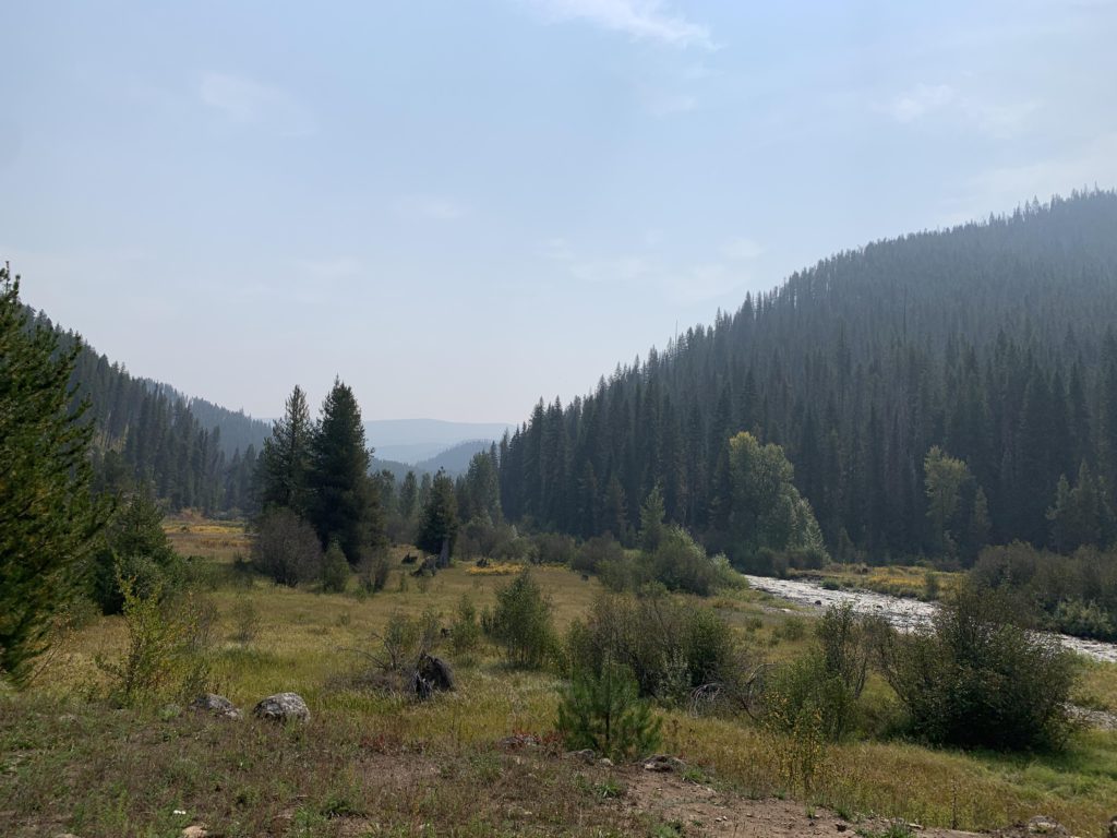
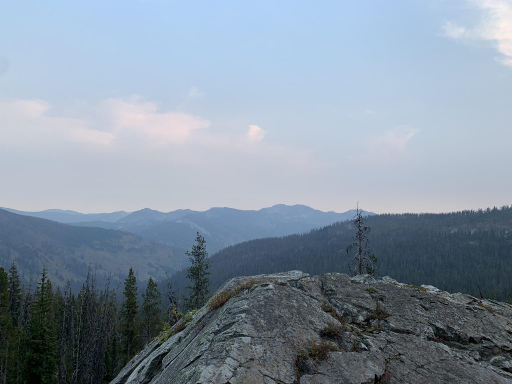
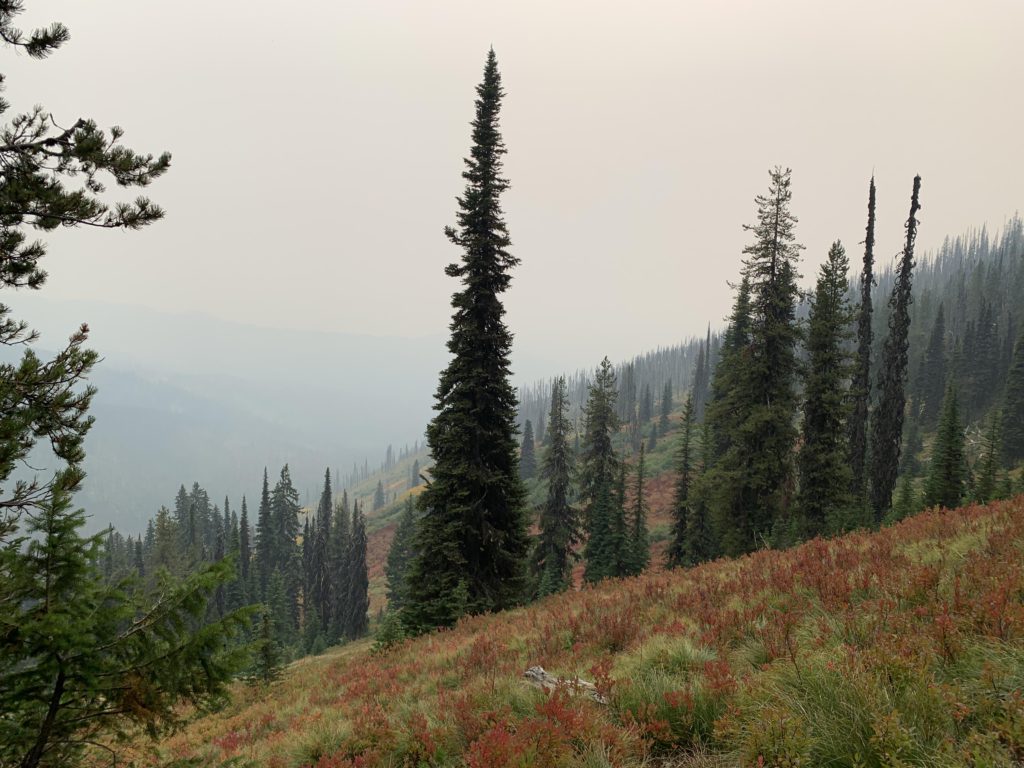
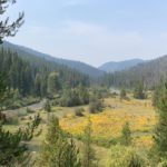
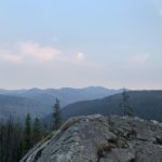
From the camp (a pit toilet!) you have nice views across the flood plain of Kelly Creek, favored by whitetails and mule deer (there is a salt lick). Signage informs that trail #760 (Little Moose Ridge) is 6 miles away, trail #738 (Stateline, via Bruin Hill) 14 miles, and the Hanson Meadows junction 2 miles. The indicated mileage is quite accurate. Staying on #567, the trail climbs steadily and the view of the fall-colored flood plain just gets better. About 9.5 miles from the trailhead, a not-to-be-missed bare rock outcropping offers sweeping views across Hanson Meadows, far below, and the steep mountains in the distance where Kelly Creek originates. The trail then drops for a half mile or so to the junction with trail #565, which declines further across Hanson Meadows towards Kelly Creek and eventually crosses it to ascend a ridge paralleling Rapid Creek to Toboggan Ridge. Instead, stay on #565 through open forest for another mile, enjoying frequent views of Hanson Meadows below and Kelly’s Sister and Kelly’s Finger on the horizon. Then, Deer Creek trail (#513) descends to the right and also climbs up to Toboggan Ridge. Staying on #567, you will shortly hit on the remains of Hanson Ridge trail #428. While easy to discern, there is no evidence whatsoever of a trail at the other end on Bruin Hill. Hanson Meadows, as you may have guessed, is not named after Kelly; it’s a misspelling of the Hansen brothers of five, who prospected in the area in the early 1900s. The rumor that the youngest brother, referred to simply as “kid”, eloped with Kelly’s sister is pure fiction. Though it was slim pickings in nearby Moose City (nothing remains of it) in those days, she was well past her prime by the time the brothers arrived. Instead, the boy settled on imprinting his nickname onto the lake lying upstream of the sister. But more of that in a bit.
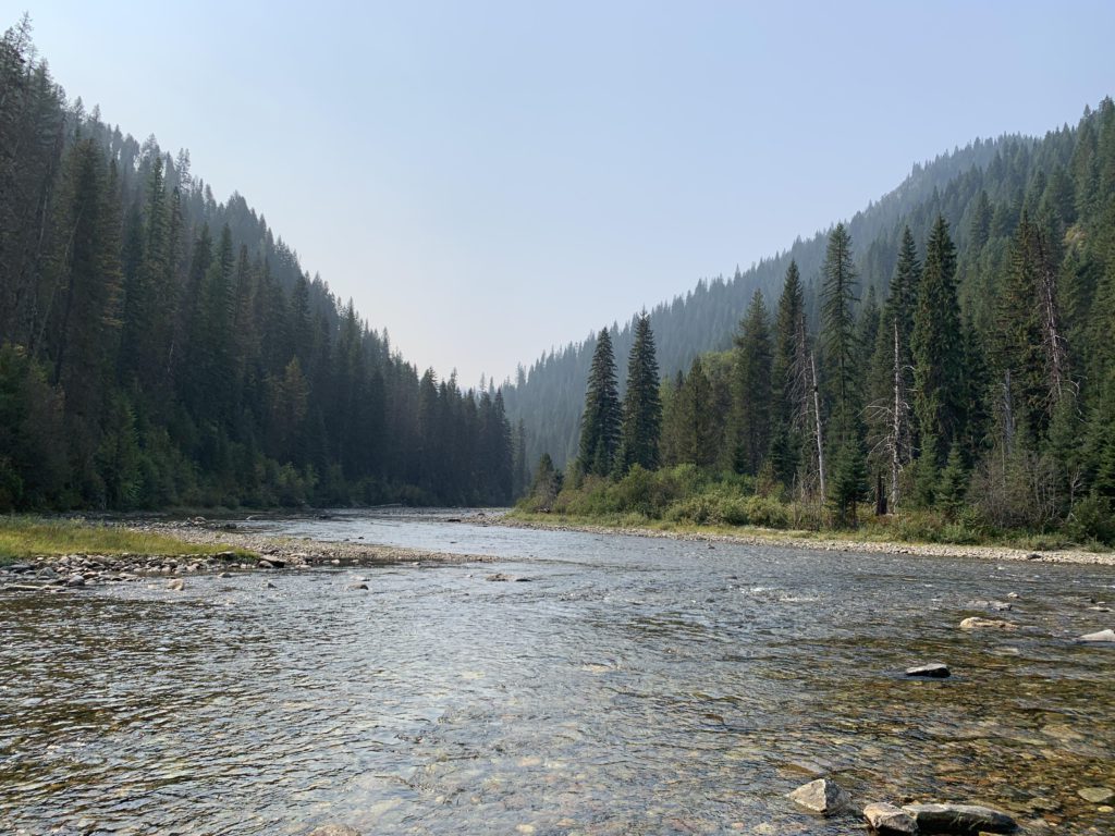
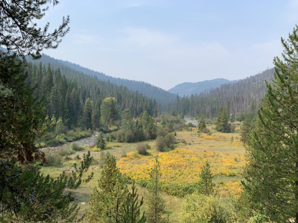
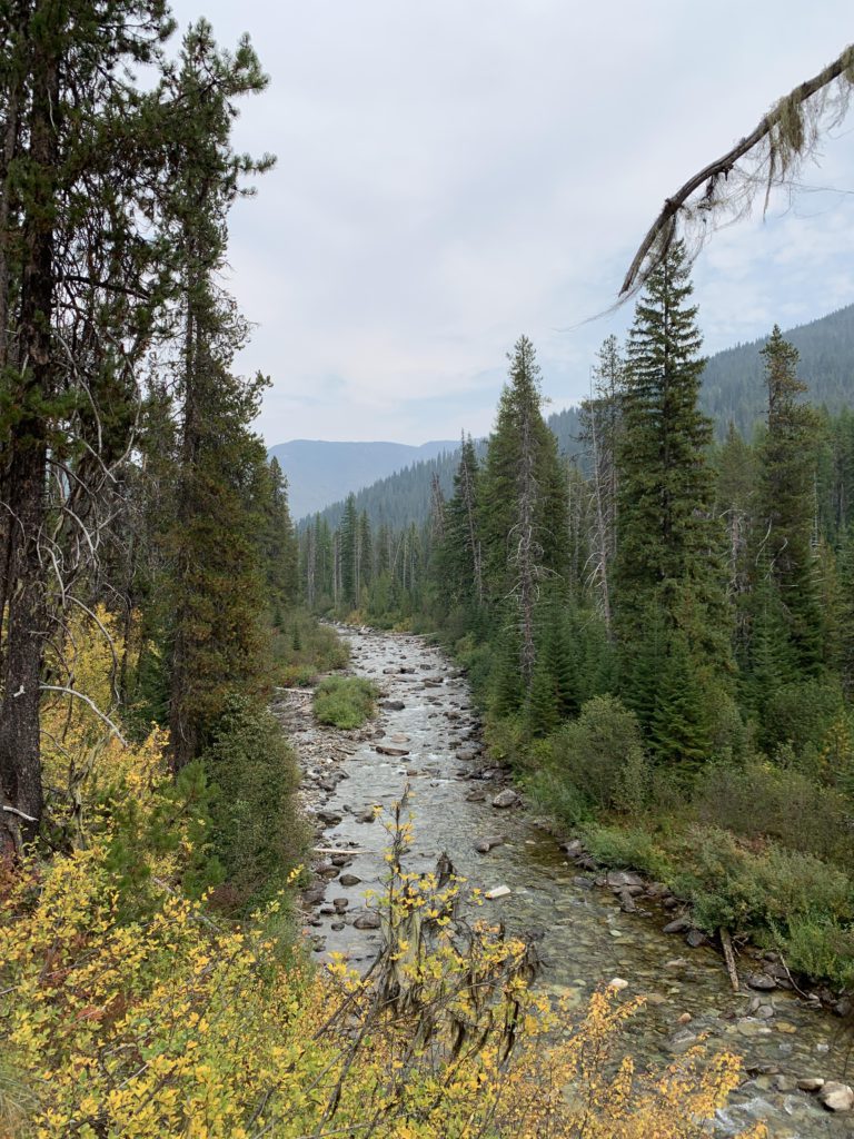
Around the 14-mile mark, at Kelly’s Sister’s overgrown granite foot, the trail crosses the North Fork Kelly Creek on an exceedingly sturdy wooden bridge and less than a half-mile later breaks away from an extensive outfitters camp in a broad meadow and trail #506, which follows the South Fork. There is no signage for #506, however, so it may be discontinued. There is signage for #738, our destination for the day: 7 more miles, and the steepest ones. At that point, the trail is fairly flat, though, as it skirts a small knob and heads due north to quickly sidle up to the North Fork. Somewhat past the 16-mile mark is the fording of the Middle Fork Kelly Creek, a relatively simple affair this late in the season, but it did require some wading.
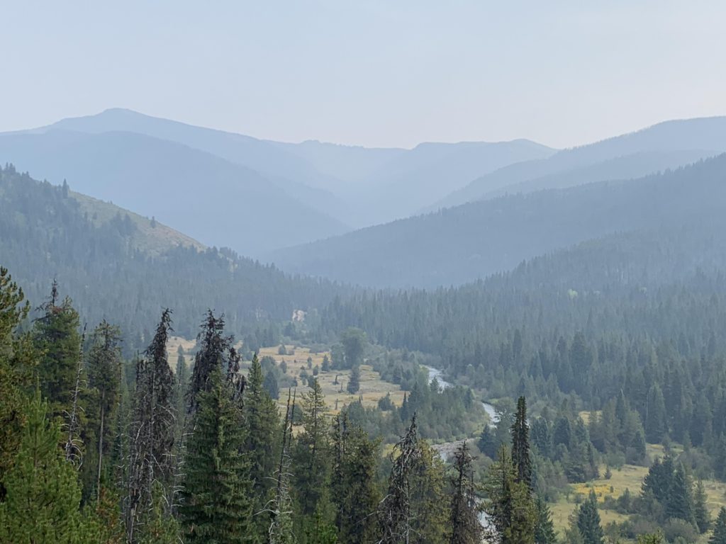
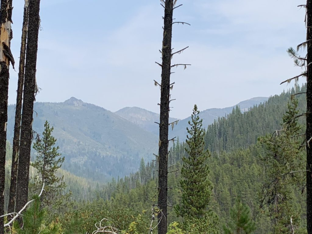
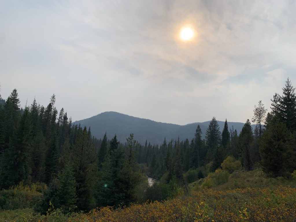
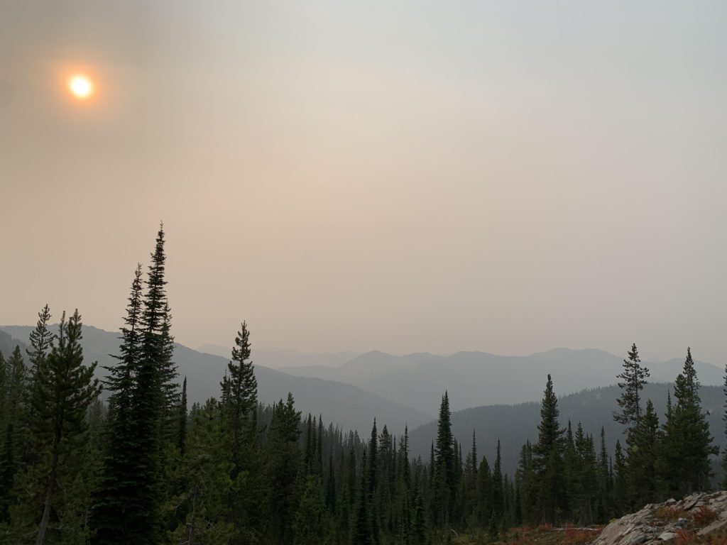
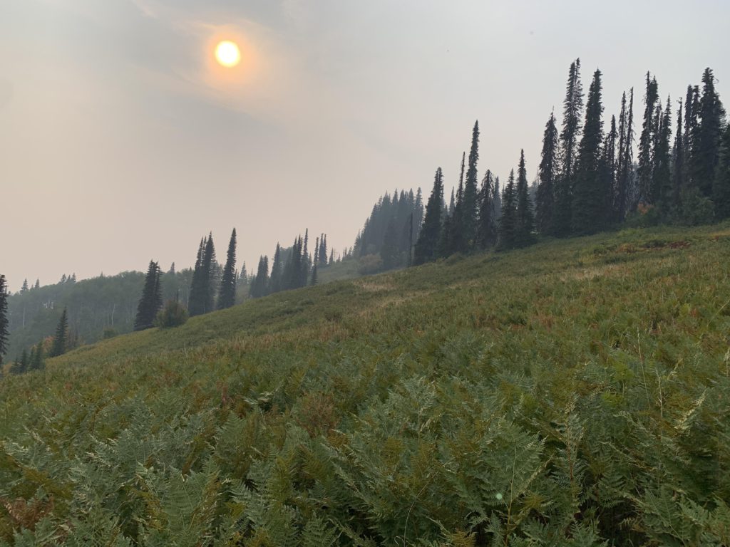
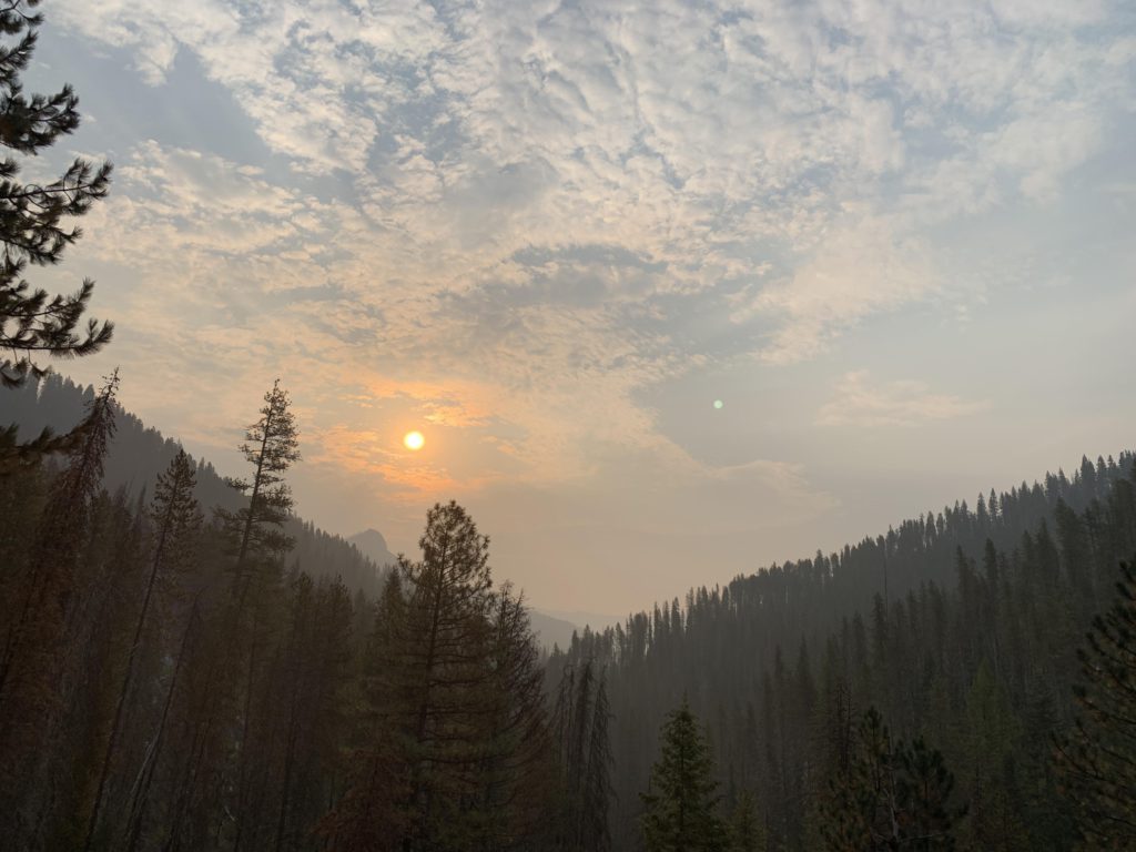
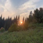
For the next three miles, the trail follows the Middle Fork, staying on its north side the entire time. There are decent views towards the mouth of the Middle Fork, with Kelly’s Sister looming beyond, as well as views up into the high mountains of the Kelly headwaters and Shale Mountain in particular. At the 19-mile mark, the trail moves into the Kid Lake Creek canyon, with no evidence left of trail #503, which once followed the Middle Fork all the way to the stateline. The ascent steepens and the vista changes: in the distance are the mountains marking the border between Idaho and Montana, while the forest retreats in favor of shrubbery wearing the most beautiful fall patchwork coloring. Views just get better the higher up the trail climbs, which it does, from just under 5,000 feet at the Middle Fork to 6,300 at Kid Lake. The view to the west was especially striking, with the sun softly sliding towards Admiral Peak.
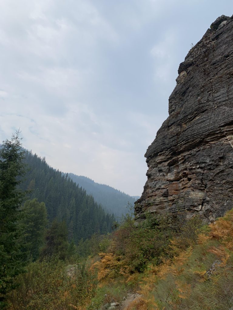
Plan A, according to the Scribe, was to find a decent campsite in the headwaters of Kelly Creek so that we would neither exceed 20 miles in a single day nor hike into the night. With the steepest ascent yet ahead, the Scribe’s worries became more vocal, which I muted by running far ahead of him. This, of course, brought forth that dreaded whistle! To top it off, the Scribe’s GPS kept crashing, which he fixed once and for all by rebooting his phone and telling me, in a frantic voice, that daylight was dwindling. Anyway, he got it working, and we followed the sweeping switchbacks up and up, eventually finding an enormous rock outcropping that offered breathtaking views across the entire Kid Lake Creek canyon. What a treat, and we did not know if then, but the next day the valley would be obscured by a layer of wildfire smoke.
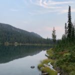
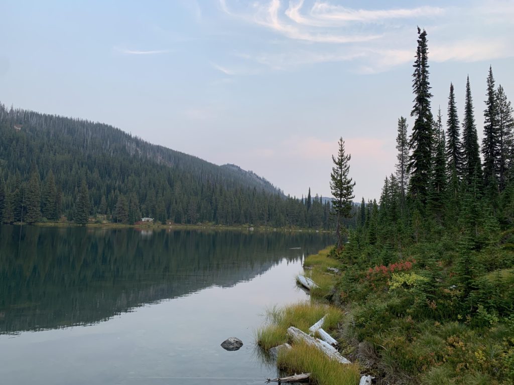
We arrived at Kid Lake with an hour of daylight left and chose to hike along the western shore in pursuit of a campsite. Walking to the end of the lake, we found but a tiny campsite with barely enough room for a tent, but didn’t want to waste more time in search of something better. The Scribe prepared dinner, set up the tent, and hung our food and with all those chores accomplished, darkness and quiet settled on the little lake named after the Hansen youngster.
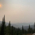
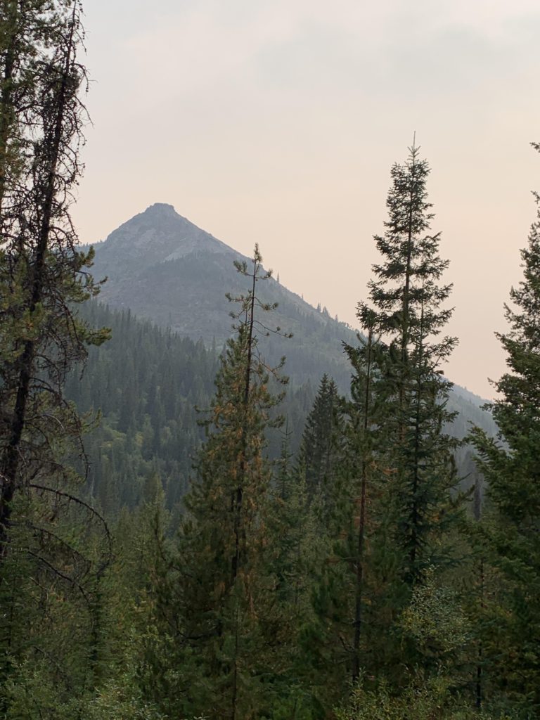
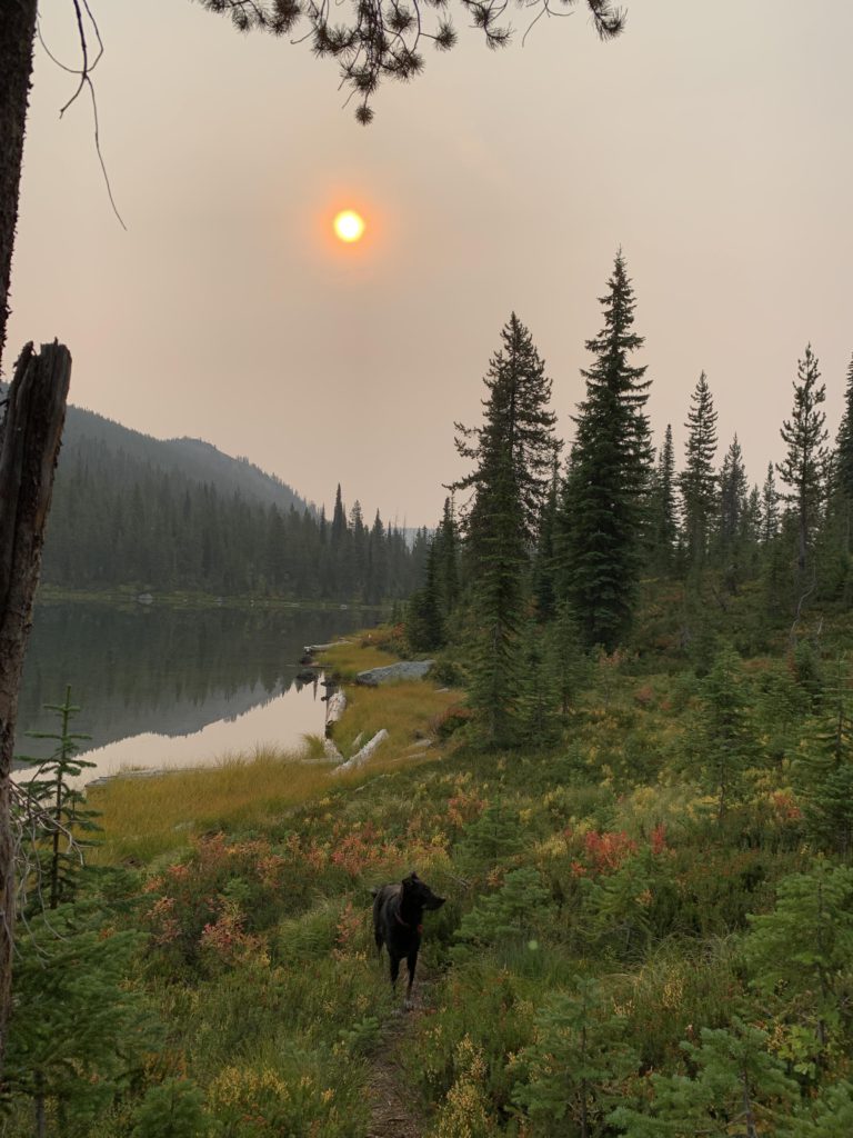
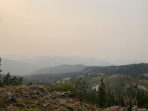
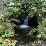
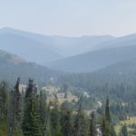
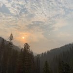
Day 2 started out with minor problems. Firstly, the Scribe had downloaded our route onto his phone, but the reboot on Day 1 made the download disappear. For the 8-mile stretch to Fish Lake this was not an issue as we’d hiked that before, but we knew the route to Bruin Hill and Little Moose Ridge was rerouted compared to the old USGS maps. Secondly, overnight a brownish wildfire-smoke haze had drifted in and obscured our views in most directions. We broke camp and headed back to the main trail, cutting uphill through the woods and stumbling on an expansive campsite overlooking the lake, apparently heavily used by horsemen. The trail climbs to the stateline, at first in a forest of subalpine fir inhabited by innumerable grouse, then the trees give way to a granite plateau. Having traversed this before, we knew views were superb, but the wildfire haze limited visibility. Once you gain the stateline, with excellent views of Admiral Peak ahead, the trail drops down the other side and is once again heavily treed. The Cedar Log Lakes lie to the east, far below, but remain hidden. We cut through the underbrush in a couple of places to catch a glance and were successful the second time. Nonetheless, the view was very much filtered by heavy timber. If you’re interested in a close-up, there is a trail from Mud Lake to the lower Cedar Log Lake.
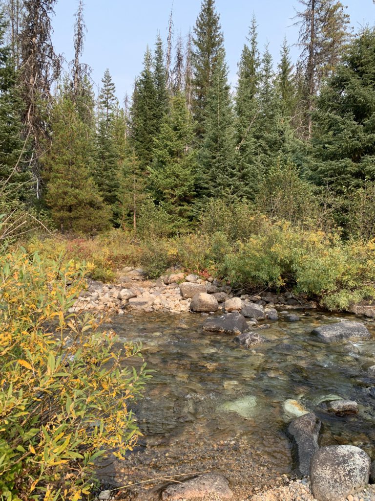
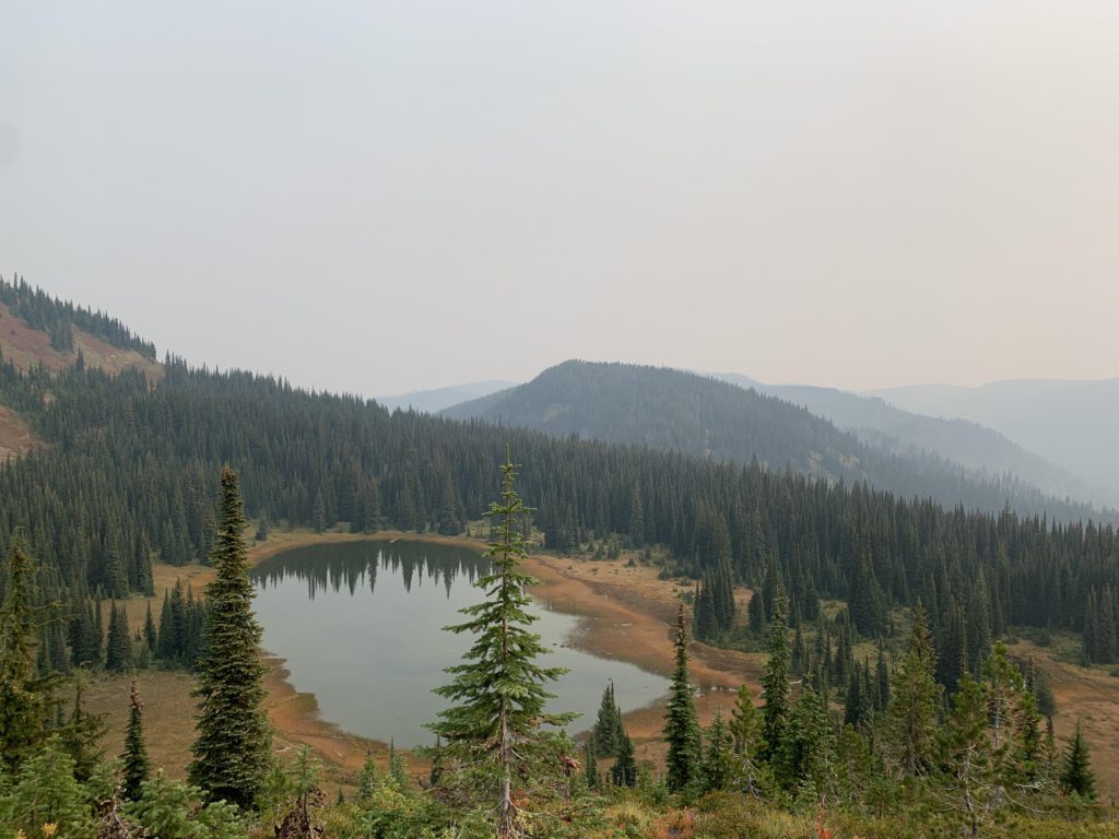
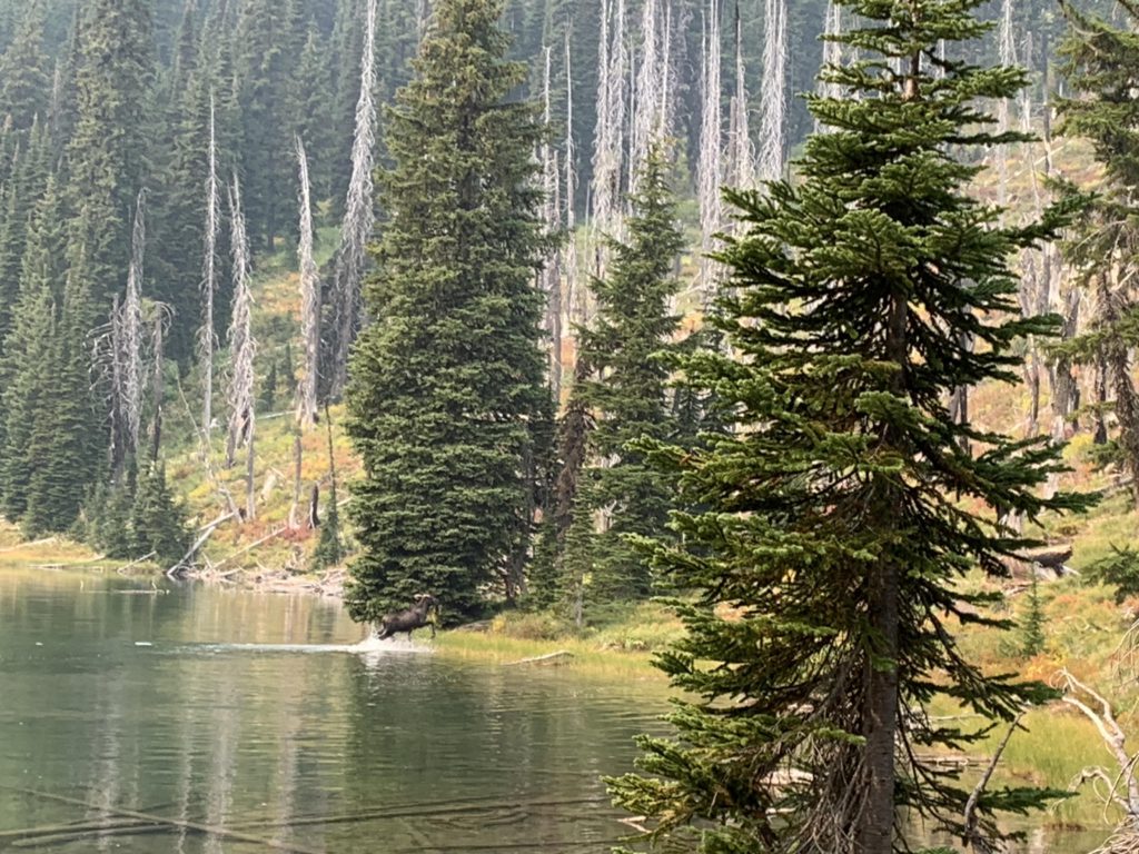
Mud Lake is a shallow lake, but much prettier than its name implies. The trail bypasses the lake proper, yet it’s worth a visit (if you stay overnight, the best site is at the far end). The trail, moving mostly through heather and subalpine fir, then climbs again as it ascends towards Admiral Peak and gives you a bird’s-eye view of Mud Lake. Just shy of the peak, the trail shifts to Admiral’s western face and traverses that with grand (albeit smoky) views into the Kelly Creek drainages, particularly the North Fork. Of trail #493 (N Fork Kelly Creek) you will find no evidence and the path once again traverses the southern face of a smaller hump, then drops down steeply on the north side to an unnamed tarn where we surprised a moose in her morning bath ritual. Figuring wrongly that this would be our last reliable source of water before returning to Kelly Creek, we filled all our bottles. The trail then ascends through an old burn to the ridgeline and a nice overlook with views of Admiral Peak and the tarn. There is some evidence left of trail #428, the old routing of Bruin Hill, but it is littered with deadwood. Make sure to stay on #738 a bit longer, descending a fair bit to a junction only a mile or so from Fish Lake (~30-mile mark). Here, a sign indicates that Bruin Hill is 4.5 miles and Kelly Creek 14; the trail is #490, which in the old USGS maps is the Bear Creek trail.
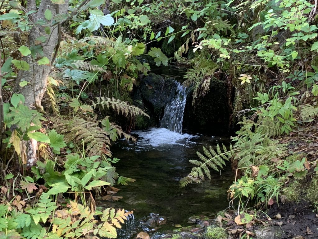
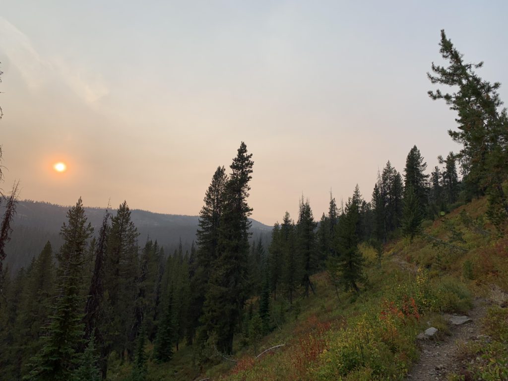
The trail actually does not go to the top of Bruin Hill, so we’re not sure what the mileage refers to; it is substantially further to Bruin Hill. Perhaps it is the mileage to the saddle below Bruin Hill. Anyway, the trail is obvious and easy to follow with filtered views of Wapito Point and Pollock Ridge. However, expect a fair bit of deadfall, which just keeps getting worse. In the headwaters of Moose Creek, we came upon a seasonal brook which had a nice flow of water, even this late in the season. What a pleasant surprise! Up ahead, the fuzzy shape of Bruin Hill pushed out of the smoke. True to its name, we came upon blackbear enjoying a crop of mountain ash berries. I embarked in a barkfest to make sure the Scribe couldn’t take a picture. What was I supposed to do?
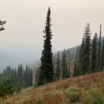
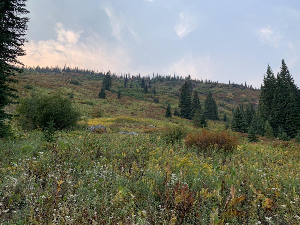
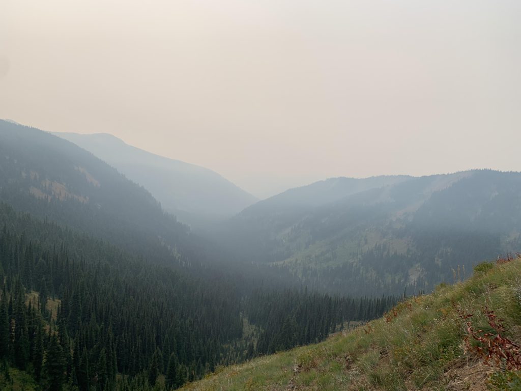
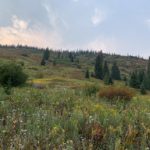
Nearly the entire time, trail #490 declined quite steadily to a saddle below Bruin Hill, at 5,600 feet. Then the trail ascends Bruin Hill’s eastern flank, with no evidence left of the old Hanson or Bear Creek trails. In fact, trail conditions on Bruin Hill are rather difficult because of numerous old burns that obliterated the tread. In the high-mountain meadows just below Bruin’s peak, about 5.5 miles from the Fish Lake junction, the trail starts to descend, following the general direction, but not exact placement of the Little Moose Ridge Trail #760. Views into Kelly Creek would be stunning, but we saw nothing, with the smoke as thick as ever. Assuming we were on #760, and seeing no alternative, we followed this route. On Little Moose Ridge, the forest was largely intact, but soon retreated and gave way to vast elk meadows covered waist-high with ferns, dried-up fireweed and coneflowers. There is no way to distinguish between one of the many paths elk had plowed through the shrubbery from the official trail. From a close-by stand of trees issued a challenging bugle. I was ready to take on the challenge, but the Scribe insisted we move on and that I was no match for an elk. Respectfully, I beg to differ.
We were lucky, making it to the 38-mile mark without getting lost. There, we found another seep of water. While busy filtering water, we completely missed the fact that this was actually the new junction of trails 490 and 760 (can’t recall any signage). The trail then drops down the southern face of a small hump (presumably, trail 760 goes around the norther side) and enters another elk meadow. On the far side of the meadow, in a stand of trees, we found no evidence of the trail. Thinking we were on #760, which runs further up, we reentered the meadow and made for the forest on Little Moose Ridge. Getting there was easily, but the forest was littered with deadfall. There was no sign of a trail and climbing just a couple hundred feet into the woods took immense effort that was incompatible with our plummeting energy levels and the disappearing daylight. With our planned route erased from the GPS, it was time for plan B: Cairn Carto paper map. The Scribe dug it out of his pack and realized that the Bear Creek trail had been rerouted. According to the map, the outfitter’s camp on Bear Creek was only 3 miles away, while Little Moose Ridge extended out another 7-plus miles and required a tiring bushwhack to get to. Thus, we decided to go for Bear Creek.
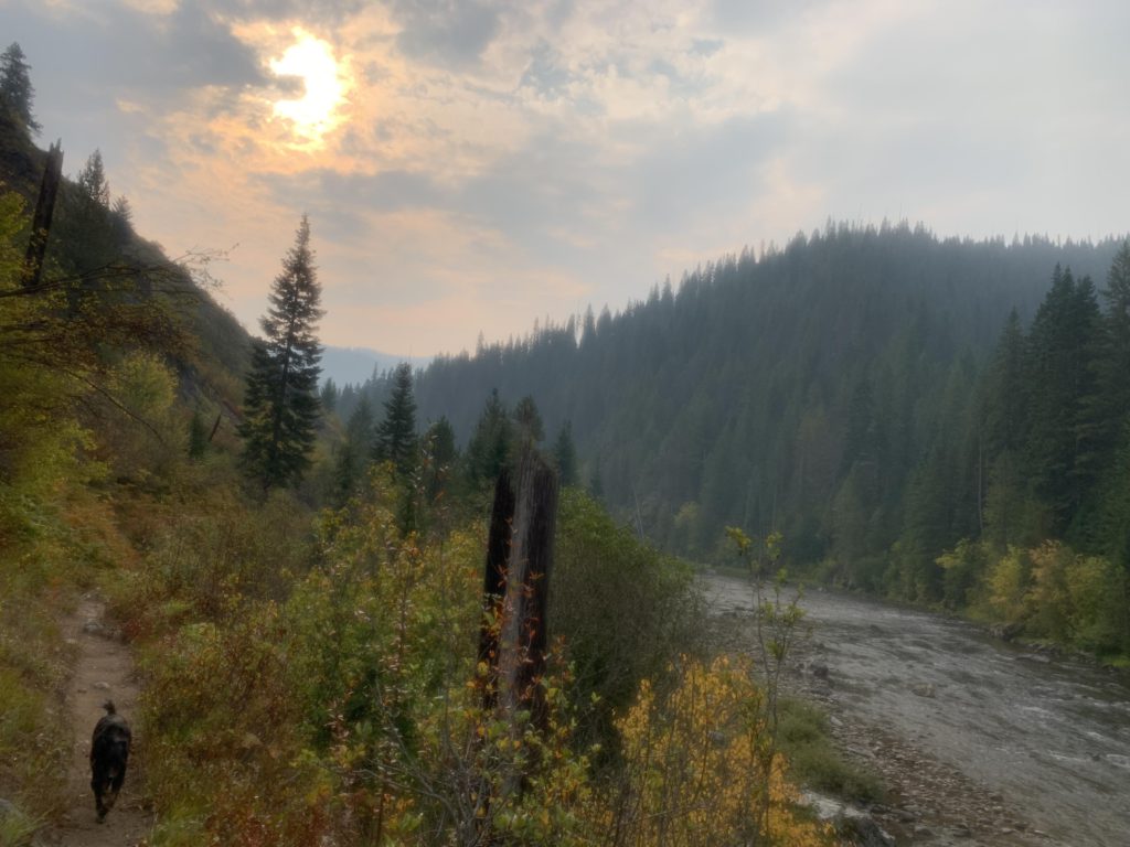
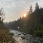
There were two problems with that approach: One, Cairn Carto’s distance was wrong; it’s nearly twice as long. Two, we still didn’t know where the official trail was, having lost it in the elk meadows. Thus, the Scribe decided to bushwhack along the eastern side of Bear Creek, which was not much overgrown, until we met up with the official trail. A nasty crossing of Bear Creek aside (steep and thick with undergrowth), this luckily worked out. The trail descends quickly and the elk meadows get fewer and fewer. Eventually, the trail crosses the creek and moves away from it, but continues to decline. Other than being very sandy, the trail was in good condition. The sand worked its way into the Scribe’s shoes and gave him blisters in unexpected places. As for myself, I’m not very keen on sand either, or gravel for that matter, and fixed the situation via frequent detours into the undergrowth of the largely burnt forest. At roughly the 42-mile mark the trail once again approaches Bear Creek, so named because miners in the good old days hunted bears there in spring, which may be the reason we didn’t see any, bears or miners, for that matter. For another two miles, the trail follows the creek quite closely, though you may not always see it.
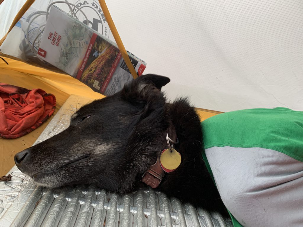
It was dark by the time we got to the outfitters camp at the foot of Kelly’s Thumb. Hurriedly, the Scribe set up camp. He figured there wouldn’t be any bears in a hunting camp and didn’t hang our food. I got my twice-daily ration of food, while the Scribe disappeared into his sleeping bag, munching on an energy bar: We had managed to exceed his daily limit for a second time in as many days. By the light of the mtnGLO string lights, the Scribe retraced our steps on the map, while I announced the presence of perpetrators with a low wuff. The Scribe obligingly clambered out of bag and tent and shone his flashlight into the Kelly Creek floodplain where it was reflected in the questioning eyes of a mule deer herd. He told me to go to sleep, but the deer evidently found our illumination troubling and kept coughing noisily.
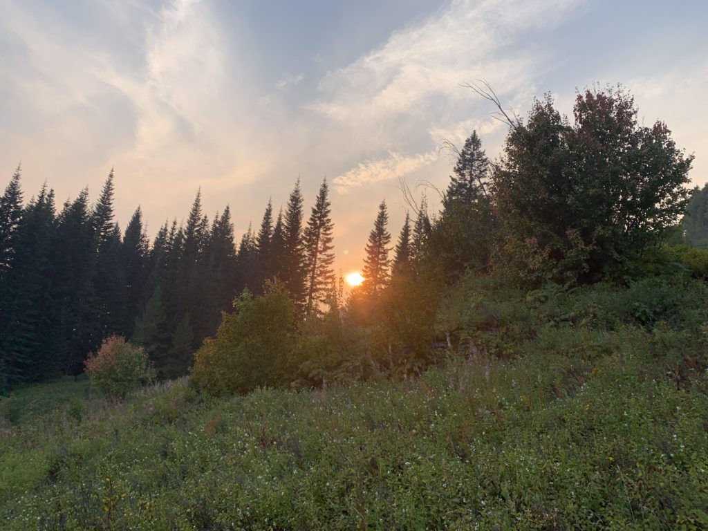
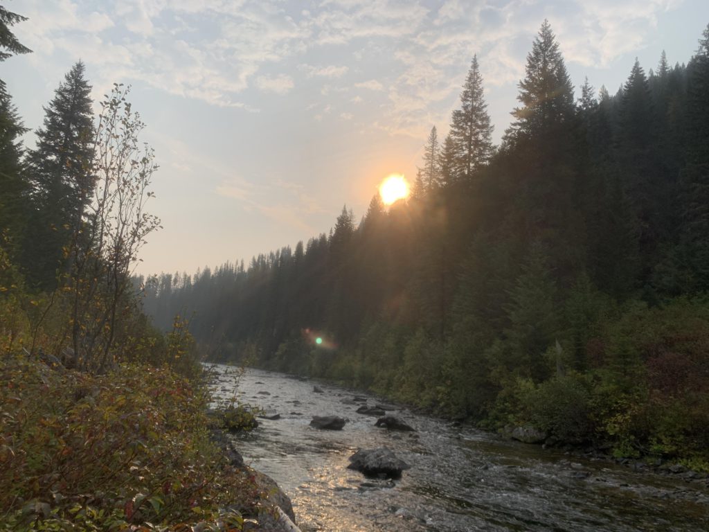
It rained steadily that night. With everything soaked, the Scribe figured that his shoes (not waterproof) would be next. He declared that there would be no distractions and we’d hike straight out. To keep weight at a minimum, he packed just half a liter of water as water was easy to find along this stretch. And indeed we made excellent time, arriving at the car well before 10 AM, shoes soaking, although the Scribe’s yells (“No Distractions!!!”) followed me into the brush on numerous occasions. I know how to tune that out 🙂
Alternate Routes
- Trails 532 (Cayuse Creek), 565 (past Hanson Meadows), and 513 (Deer Creek) connect to Toboggan Ridge, although #532 may be discontinued as there was no signage. Trail #555 also appears to be discontinued (no signage at Cayuse Creek) or at least rerouted (there was signage at Bear Creek for “Grasser Creek”, which may lead to Toboggan Ridge)
- The Hanson Ridge (428), North Fork Kelly Creek (493), and Middle Fork Kelly Creek (503) trails appear to be discontinued
- #506 extends along the South Fork Kelly Creek
- From the Stateline you can connect to Schley Mountain (738/110), Upper Cedar Log Lake (116), Indian Ridge (104), Middle Fork Indian Creek (121), and Fish Lake (738)
- An alternative descent from Bruin Hill is Little Moose Ridge (760)
Things to Consider
Not so great