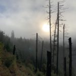
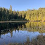
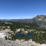
The Cabinet Mountains stretch from Bonners Ferry in Idaho almost all the way to Missoula in Montana. To the north they are bordered by the Purcell Mountains. Lake Pend Oreille and the Kootenai river separate the Cabinets from the Selkirks to the West, and in the south the dividing line is the Clark Fork river. Eastwards, the Cabinets extend to Flathead Lake and River. The mountains were christened by French explorers, who likened the rock formations to cabinets.
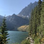
The Cabinets are distinctly higher than the Coeur d’Alene Mountains to the south, with the tallest peak, Snowshoe Peak, at 8,738 feet. That peak harbors the last remaining glacier in the Cabinets, Blackwell Glacier.
The majority of the Cabinet Mountains is in public hands, administered by the Forest Service (Idaho Panhandle, Lolo and Kootenai National Forest). The area in Idaho is largely unprotected, while the Montana side boasts the Cabinet Mountain Wilderness, protecting the highest peaks. The wilderness, created in 1964, consists of 94,000 acres, which is only about 5% of the Cabinets’ total expanse (an additional wilderness near Scotchman peak has been proposed).
| Photo | Trail | Rating | Difficulty | Distance | Duration | Elevation Gain | High Point | Low Point | Type | Features | Status | Administration | Fees and Permits | Maps | Open To | Season | Trail# | Resources |
|---|---|---|---|---|---|---|---|---|---|---|---|---|---|---|---|---|---|---|
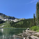
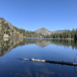
 | Big Spar Lake | 2.6 / 5 | Moderate | 6.8 mi | 2:28 h | 828 ft | 3,551 ft | 3,238 ft | Year-around | 143A | ||||||||
 | Bramlet Lake | 3.2 / 5 | Moderate | 6.8 mi | 2:19 h | 1,838 ft | 5,637 ft | 3,900 ft | June – November | 658 | ||||||||
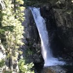 | Char Falls | 2.6 / 5 | Easy | 1.2 mi | 0:25 h | 98 ft | 4,194 ft | 4,051 ft | Best during snowmelt | |||||||||
 | Engle Peak | 4.1 / 5 | More Difficult | 13.4 mi | 5:37 h | 5,366 ft | 7,563 ft | 2,738 ft | June to October. All that ascent would be killer in showshoes… | 926, 932 | ||||||||
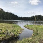
 | Flower Point and Flower Lake | 2.1 / 5 | Moderate | 2.3 mi | 0:59 h | 483 ft | 4,284 ft | 3,718 ft | Year-around | 16 | ||||||||
 | Gem Lake | 3.9 / 5 | More Difficult | 3.2 mi | 1:23 h | 1,149 ft | 5,790 ft | 4,536 ft | May-November | 554 | ||||||||
 | Goat Mountain | 3.5 / 5 | More Difficult | 8.0 mi | 4:28 h | 4,191 ft | 6,381 ft | 2,325 ft | Year-around | 135 | ||||||||
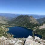
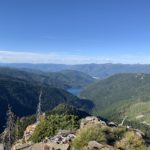
 | Granite Lake | 4.4 / 5 | Moderate | 13.3 mi | 5:10 h | 1,814 ft | 4,692 ft | 3,082 ft | June – October | 136 | ||||||||
 | Horseshoe Pond | 4.3 / 5 | Strenuous | 3.0 mi | 2:06 h | 895 ft | 6,038 ft | 5,236 ft | July – October | |||||||||
 | Lake Darling – Pend Oreille Divide Loop | 3.8 / 5 | Moderate | 8.0 mi | 3:18 h | 1,810 ft | 6,424 ft | 4,605 ft | June – November | 52, 67, 161 | ||||||||
 | Lake Estelle to Gem Lake Connector | 3.9 / 5 | Strenuous | 2.6 mi | 2:07 h | 1,142 ft | 6,417 ft | 5,723 ft | July – October | |||||||||
 | Leigh Lake | 3.6 / 5 | More Difficult | 3.2 mi | 1:35 h | 1,133 ft | 5,207 ft | 4,035 ft | June – October | 132 | ||||||||
 | Little Spar Lake | 3.4 / 5 | Moderate | 7.4 mi | 3:30 h | 1,800 ft | 5,263 ft | 3,430 ft | July – October | 143 | ||||||||
 | Parmenter and Flower Creek Loop | 4.6 / 5 | Moderate | 28.1 mi | 11:14 h | 5,975 ft | 7,548 ft | 2,345 ft | Late June – October | 140, 360, 137, 15 | ||||||||
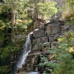 | Ross Creek Cascades | 3.1 / 5 | Moderate | 8.1 mi | 3:25 h | 1,463 ft | 4,274 ft | 2,888 ft | April – November | 142, 321 | ||||||||
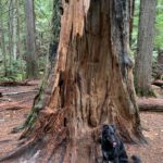 | Ross Creek Cedars Loop | 2.6 / 5 | Easy | 1.1 mi | 0:27 h | 202 ft | 2,969 ft | 2,815 ft | Year-around, but the access road is closed for skiing during the winter months (December onward) | 142, 405 | ||||||||
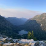
 | Sky Lakes and Hanging Valley Loop | 4.3 / 5 | Strenuous | 13.6 mi | 6:28 h | 3,717 ft | 7,141 ft | 3,637 ft | July – October | 135, 137 | ||||||||
 | Spar Peak | 3.8 / 5 | More Difficult | 6.3 mi | 3:08 h | 2,807 ft | 6,584 ft | 3,699 ft | July – October | 324 | ||||||||
 | Taylor Peak and Minor Lake Loop | 4.3 / 5 | Moderate | 33.9 mi | 13:06 h | 7,623 ft | 7,193 ft | 2,501 ft | Late June to October | 320, 360, 139, 317 | ||||||||
 | Three Lakes Loop (Blacktail Lake, Moose Lake, Lake Estelle) | 3.6 / 5 | Moderate | 14.6 mi | 5:39 h | 2,729 ft | 6,543 ft | 4,900 ft | June – October | 24, 36, 213, 237 |