Leigh Lake

The hike to Leigh Lake is short but steep and leads right into the heart of the Cabinet Mountain Wilderness to a lake huddling beneath the near-vertical cliffs of Snowshoe Peak, the highest mountain in the Cabinets. The dramatic setting and the short hike ensure that you will have plenty of company: It’s the most popular hike in the Wilderness.
Location
  • Cabinet Mountains
Rating
3.6 out of 5
Difficulty
More Difficult (steep)
Distance
3.2 miles
Duration
1:35 hours moving time (Hiking)
Elevation Gain
1,133 feet
High Point
5,207 feet (Leigh Lake)
Low Point
4,035 feet (Trailhead)
Features
  • Lake
  • Rock Formation
  • Waterfall
  • Outing Type
  • Daytrip
  • Trail Type
  • Out-and-back
  • Trailbed
    Packed dirt, gravel, granite
    Trail#
    132
    Water
  • Leigh Lake and the Leigh Creek
  • Camping
    • Not allowed within 300 feet of the shoreline
    Conditions
    • Good, but the trail is steep and in the rocky areas near the top it is easily lost
    Administration
  • Kootenai National Forest
  • Status
  • Wilderness Area
  • Maps
    USGS
  • Snowshoe Peak
  • Fees & Permits
  • None required
  • ()
    Open To
  • Hikers
  • Dogs
  • ()
    Directions
  • From US-2, at the 40-mile marker (8 miles south of Libby), take FR-278 (Bear Creek Road) west for 3 miles. Turn right onto FR-867 (Cherry Creek Road) and follow that for 4.5 miles. Turn onto FR-4786 (Leigh Creek Road) and follow this single-lane gravel road uphill for a bit over a mile. Contrary to other reports, it is actually in good condition.
  • Season
    June – October
    Date
    October 4, 2020

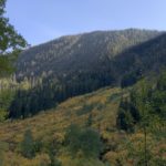
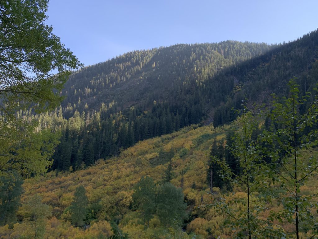
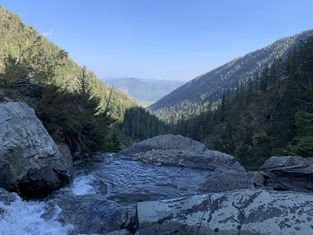
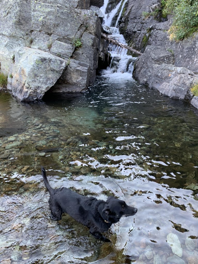
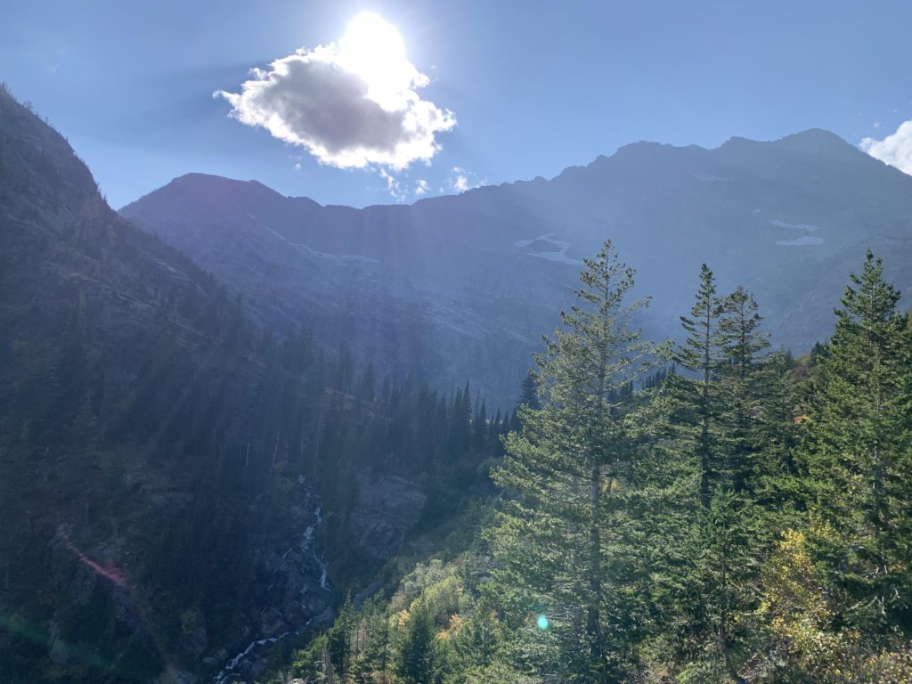
    Albeit short, this trail does have some bite, as you are gaining about 1,000 feet in just over a mile. In fact, the trail does not fool around and immediately starts the climb in a well-shaded forest. Views of the Leigh Creek valley open up just before entering the Wilderness, with the bushes ablaze in orange and red fall colors and the sight accompanied by the roar of the Leigh Creek waterfall. Steadily climbing, the falls are reached in just under a mile. It is the first source of water. Looking back, this location also offers a great view down the Leigh Creek valley.

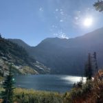
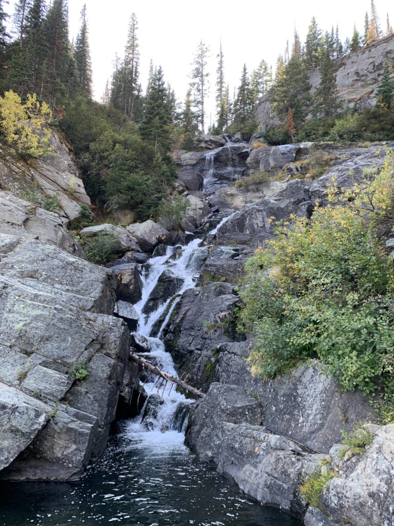
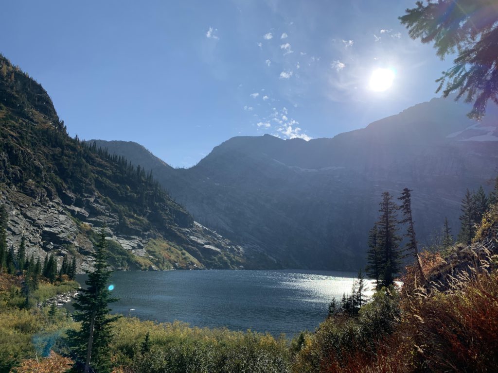
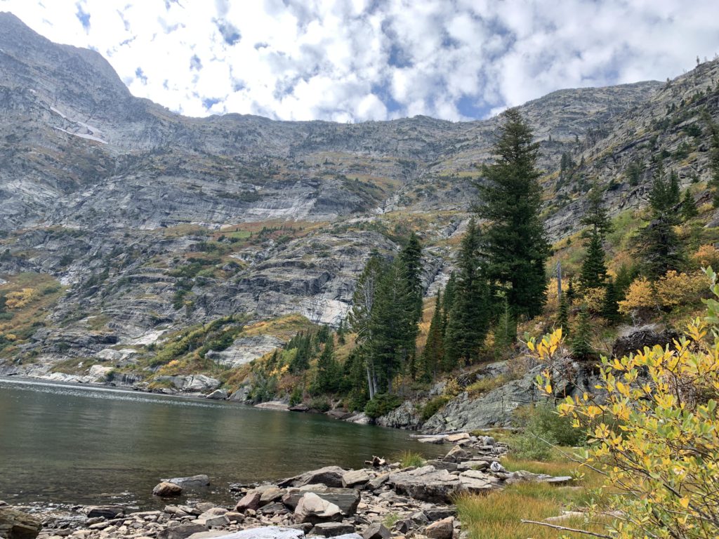
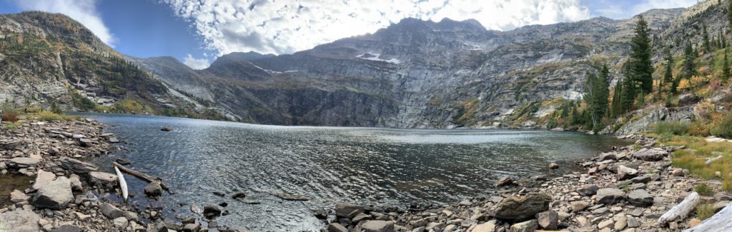
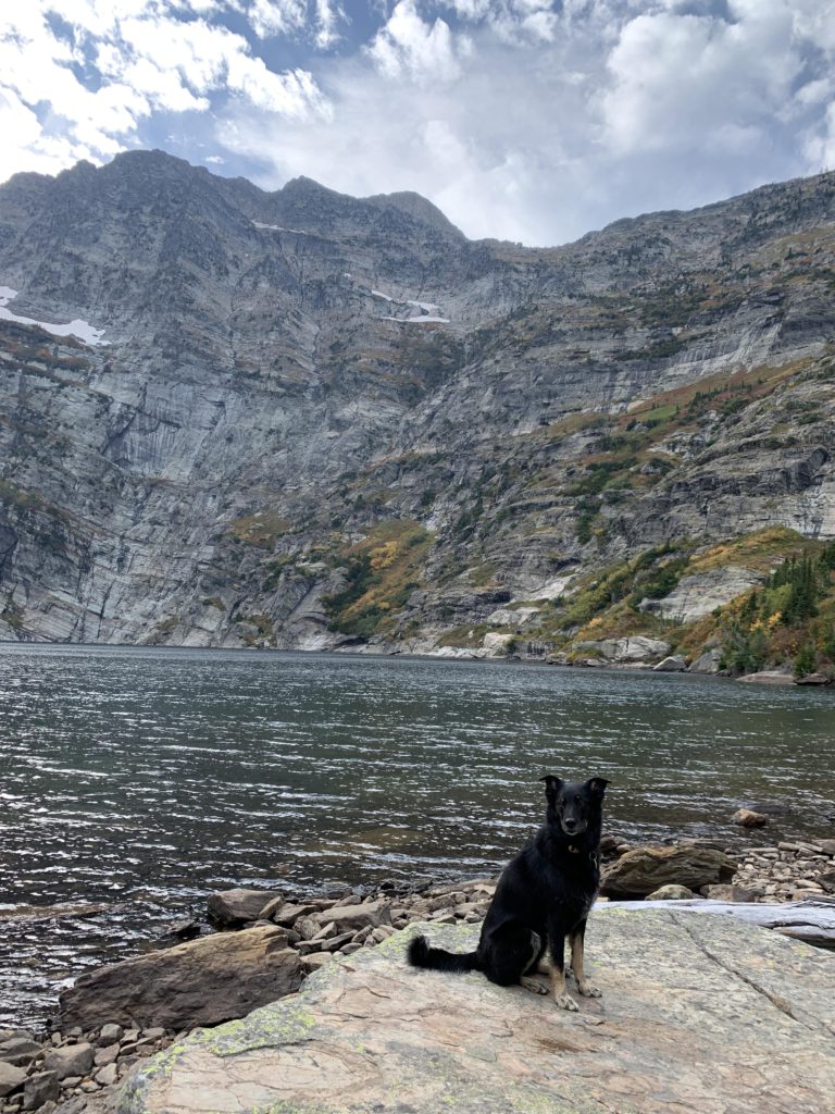
    Past the falls the trail is rocky and confusing. The main trail appears to climb steeply up, while many side trails wind hither and tither. Up and west is generally the direction you want to go. Once you are on the level of the lake, the last bit of trail easily contours along. The lake is almost completely ringed with near-vertical granite, the sheer cliffside of Snowshoe Peak being the most dominant. The northeast side of the lake likely is the best starting point for an off-trail excursion to Snowshoe Peak, or just the ridge between Snowshoe and Bockman, which promises views onto the Cabinet’s only glacier–Blackwell Glacier–, while the unnamed peak to the south likely puts you in the the best position for a birds-eye photo of the lake.

    Alternate Routes

    • The best approach to Snowshoe Peak is likely via the saddle between Bockman and Snowshoe Peak. Bushwhacking there is minimal, but it looks pretty steep.

    Things to Consider

      Not so great

        Improvised picnic table at the trailhead
        Fall colors paint the Leigh Creek valley
        Infinity pool waterfall
        Leigh Creek waterfall
        Naughty enjoying the waterfall
        Near the lip of the lake with Snowshoe Peak looming above
        Leigh Lake
        Leigh Lake and the view of the saddle between Snowshoe and Bockman
        Panorama shot of the lake
        Naughty and the vertical cliff of Snowshoe Peak in the background
        View towards the outlet
        Outlet