This short trail outside Leavenworth, WA, follows an old pipeline that in the early 1900s carried water from the Tumwater dam through a tunnel and alongside the Wenatchee River through the Tumwater Canyon to a powerhouse near today’s trailhead. The electricity generated there was needed to power a Great Northern Railway train through a Cascade Mountains tunnel (couldn’t use coal-powered trains because the smoke was deadly inside the tunnel).
| Location | Elsewhere |
| Rating | 2.6 out of 5 |
| Difficulty | Easy (entrance to tunnel is a scramble) |
| Distance | 2.8 miles |
| Duration | 1:18 hours moving time (hiking) |
| Elevation Gain | 193 feet |
| High Point | 1,459 feet (Tunnel) |
| Low Point | 1,253 feet (Trailhead) |
| Trail Type | Out-and-back |
| Trailbed | Packed dirt |
| Trail# | 706 |
| Water | Wenatchee River |
| Status | National Register of Historic Places |
| Administration | Wenatchee National Forest |
| Conditions | Excellent |
| Permits | None required |
| Camping | Not available |
| Maps | USGS Leavenworth |
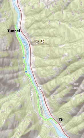
| Trailhead | From Leavenworth (Icicle Road), head west on US-2 for about 1.7 miles. The trailhead will be on your left, a gravel road leading down to the river (it is not signed). There is parking for a dozen cars and a pit toilet at the trailhead.
Google Directions (47.587183, -120.707433) |
| Season | Year-around |
| Squirrel Density | Naughty was not invited along, but would have loved it! |
| Features | Riverwalk, Structure |
| Distance From |
|
| Resources | |
| Date | September 17, 2017 |
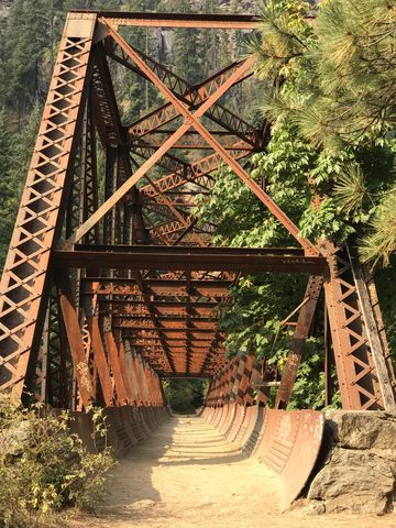
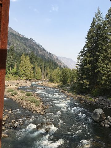
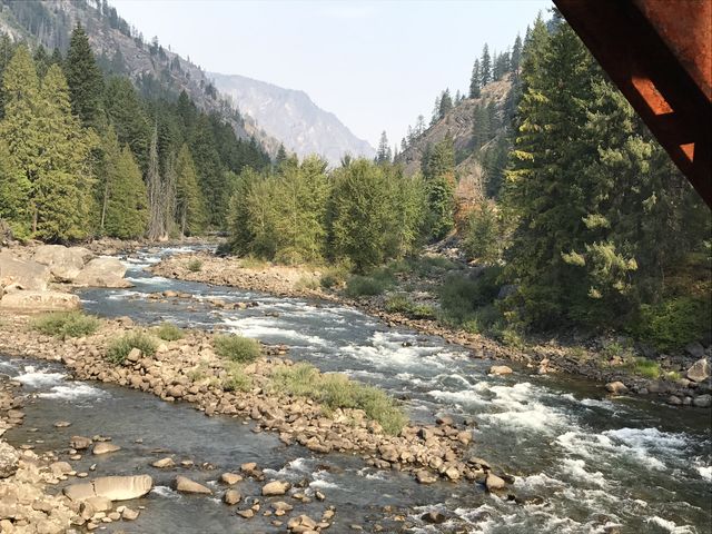
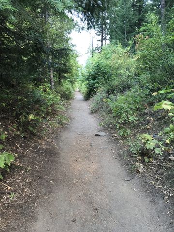
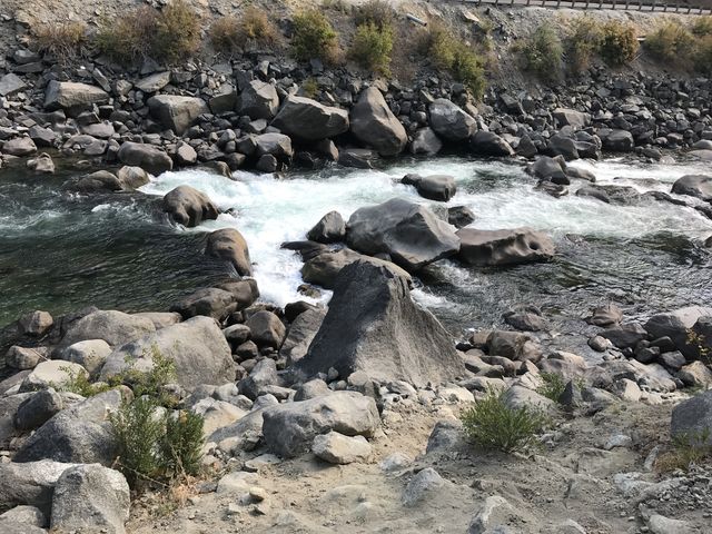
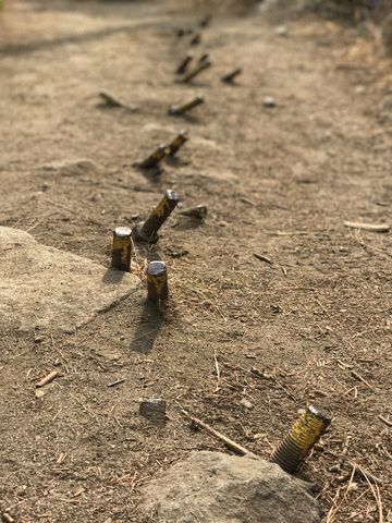
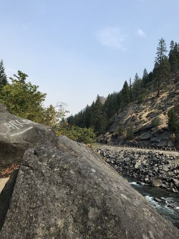
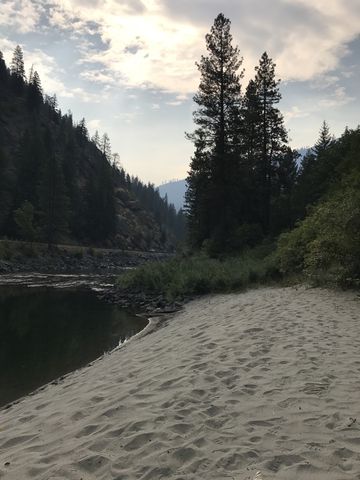
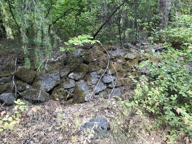
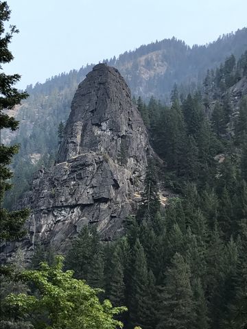
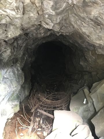
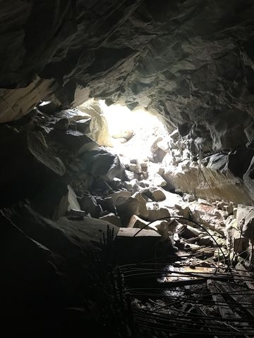
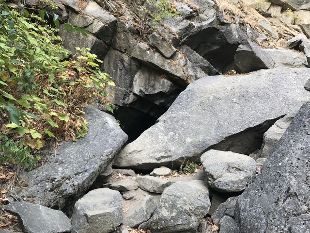
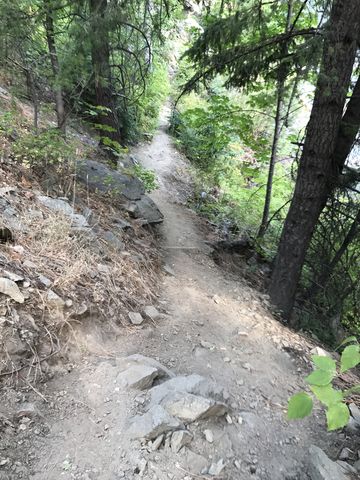
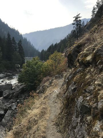
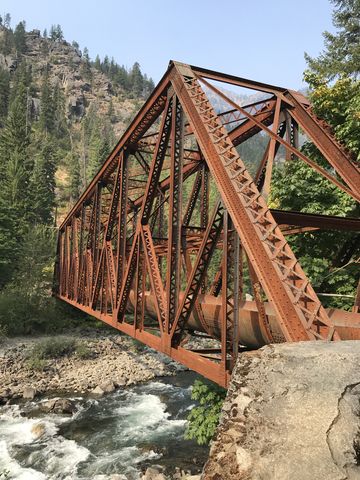 The trail starts out on the east side of the Wenatchee River, but almost immediately crosses the river using the old steel pipeline bridge, which provides good views up- and down-river. The trail then parallels the river through a mixed coniferous and deciduous forest for a bit over a mile, using the bed of the old pipeline for much of the way. Along the way you’ll come across signs of beaver activity, picturesque sandy beaches, shoals of salmon resting on the downstream side of boulders, popular Castle Rock–studded with climbers–on the far side of the river, and evidence of the old pipeline itself (spikes and rock walls). The trail ends at a tunnel obscured by a rock slide.
A narrower single-track continues on northwards, but soon deteriorates to little more than a game trail.
Enjoy this hike? Let us know in the comments below!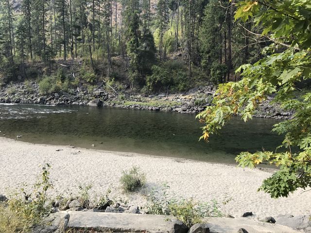
© 2016 – 2017 NaughtyHiker. All rights reserved. No duplication without permission.
Pretty scenery. That should be popular with history buffs.
Yes, and exploring the tunnel could be fun too. It’s probably no more than half a mile long
Pretty scenery. That should be popular with history buffs.
Yes, and exploring the tunnel could be fun too. It’s probably no more than half a mile long