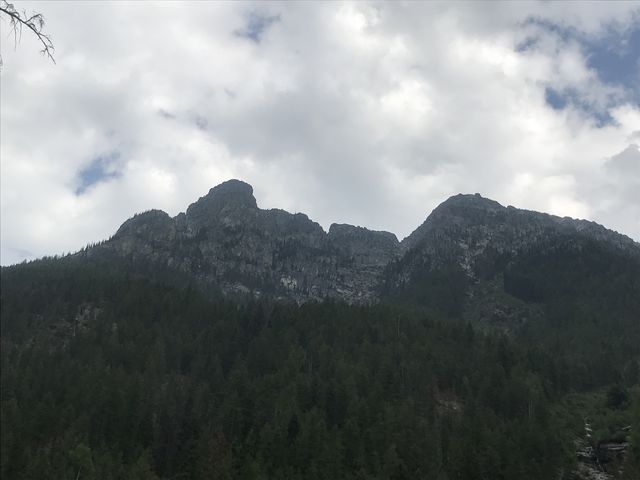
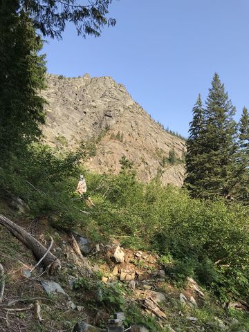
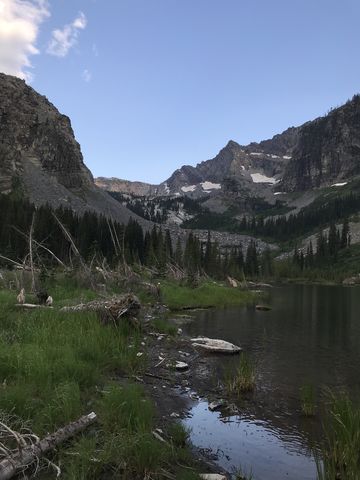
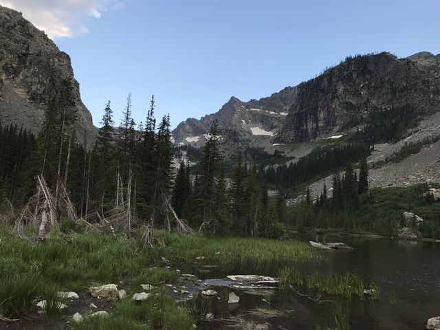
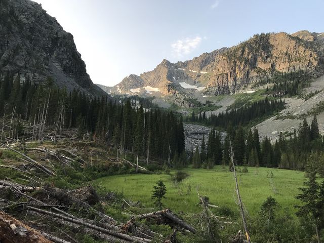
Little Ibex Lake sits amidst a dramatic surrounding of tall peaks near the highest points of the Cabinets, with excellent views of Snowshoe Peak, the highest point. The lake is fed by permanent snow fields, remnants of what once was Ibex Glacier. Be prepared for a difficult slug uphill, though, as the steep trail is littered with blowdown, and ferocious hoards of mosquitoes await anyone or anything with an ounce of blood.
| Location | Cabinet Mountains |
| Rating | 3.8 out of 5 |
| Difficulty | Strenuous (steep, fordings, deadfall) |
| Distance | 12.9 miles |
| Duration | 5:53 hours moving time (hiking) |
| Elevation Gain | 2,701 feet |
| High Point | 5,238 feet (Little Ibex Lake) |
| Low Point | 2,432 feet (Trailhead) |
| Trail Type | Out-and-back |
| Trailbed | Packed dirt, loose rocks |
| Trail# | 978, 980 |
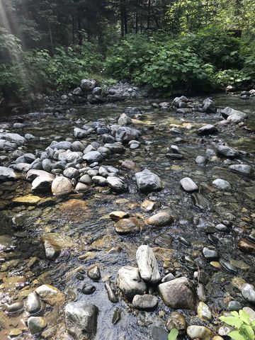
| Water | Middle Fork Bull River and its tributaries; Little Ibex Lake |
| Status | Wilderness Area |
| Administration | Kootenai National Forest |
| Conditions | Trail 978 is in excellent condition and has recently been maintained. Trail 980 is no longer maintained and is littered with deadfall. There are fresh blazes, however (look for notches in deadfall, three-stack cairns, and blazes on trees) |
| Permits | None required |
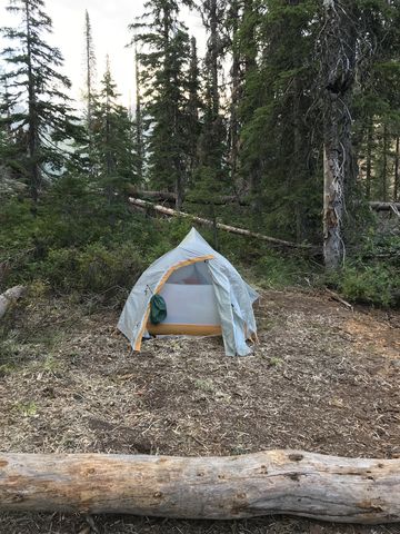
| Camping | There is a nice spot on a ledge above the meadow and lake |
| Maps | USGS Ibex Peak |
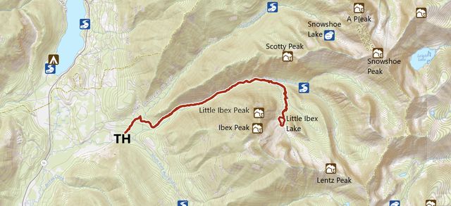
| Trailhead | From MT-56, turn east onto FR-410 (South Fork Bull River Road) at the 16-mile marker. FR-410 is a gravel road. Follow it for a bit over a mile, then turn right onto the South Fork Bull River Road. This is signed as going to the South and Middle Fork and the road is called Pine Ridge Road. Continue for three-quarters of a mile. There is a small parking lot for 4-5 cars just after a bridge crossing. The trail starts on the opposite side of the road. It is not signed; the trailhead kiosk is a few hundred yards up the trail. Google Directions (48.195553, -115.819266) |
| Season | July – October |
| Squirrel Density | Who cares for squirrels in bear country? |
| Features | Lake, Grove, Meadow |
| Distance From |
|
| Resources | |
| Nearby Hikes | |
| Date | July 27, 2018 |
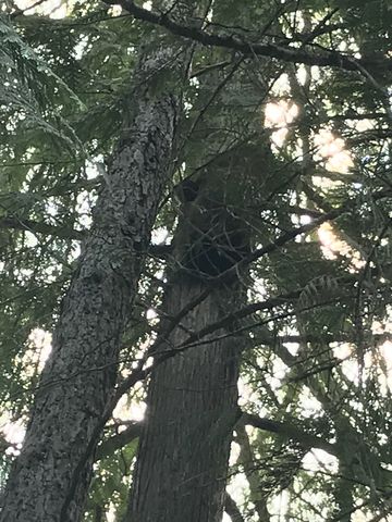
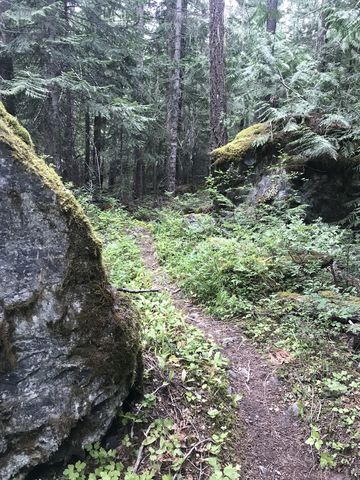
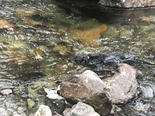
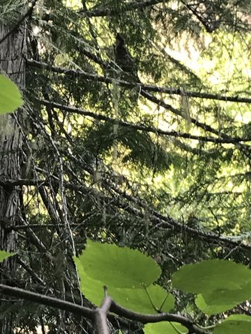
 This trail starts out benign enough, a singletrack on a soft forest floor, with the cedars drowning out almost all light. Trail signage is a few hundred yards into the hike and just shy of the 1-mile mark the trail splits, with the Middle Fork trail heading right and the North Fork trail (to Snowshoe Lake) going left. Swing a right and soon after the path uses an old logging road (make sure not to miss the singletrack turn-off on the return trip!). Next is the crossing of the North Fork, which was a straightforward rock-hop, but a few logs also assist if needed. The trail then continues relatively flat through a verdant cedar forest along the Middle Fork valley, but the creek cannot be heard or seen for the first 2 miles. In pursuit of other pastimes (swimming is one of her favorites), Naughty flushed a blackbear out of the undergrowth. It really was more cinnamon than black, but easily three or four times her size. She decided not to give chase, and the bear decided to seek solace in a giant cedar, which it climbed in such a flash that neither bear spray nor camera could be deployed. Anyway, we took a quick photo (it didn’t turn out), while the bear maintained her belief that she was more scared than we were, and hightailed it.
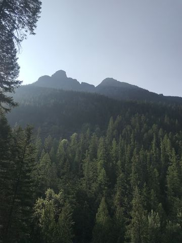
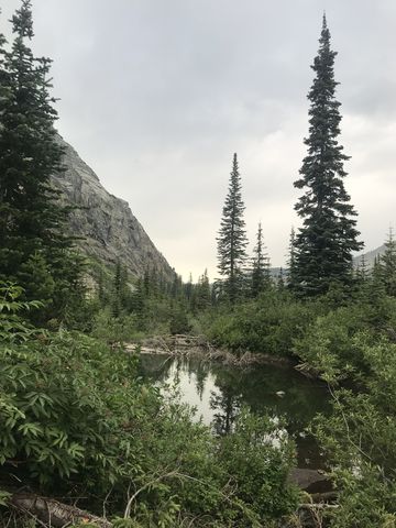
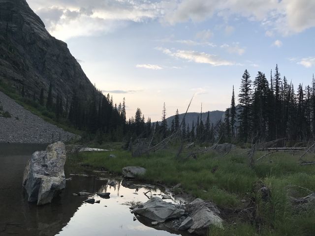
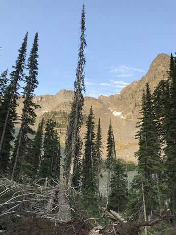
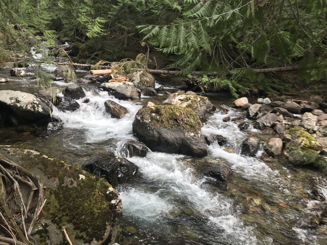 Around the 2-mile mark the trail approaches the creek and then the incline picks up a bit. On the bright side, though, a cool breeze lifts off the creek and replaces the humid air so prevalent while hiking through the cedar forest, which felt almost like a rainforest. The trail continues to gain ground, with the forest retreating enough to offer views of the sheer cliff walls of Scotty Peak and the tips of Ibex Peak and Little Ibex Peak high up in the sky.
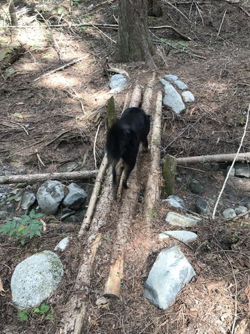
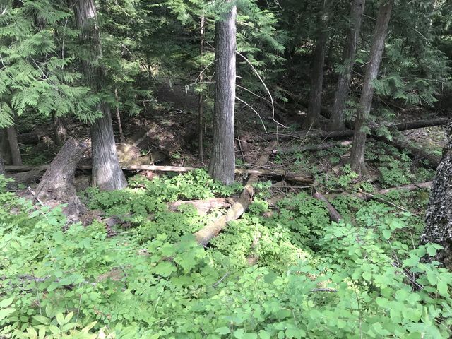
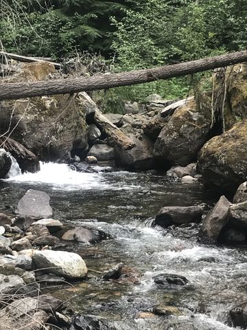
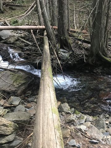
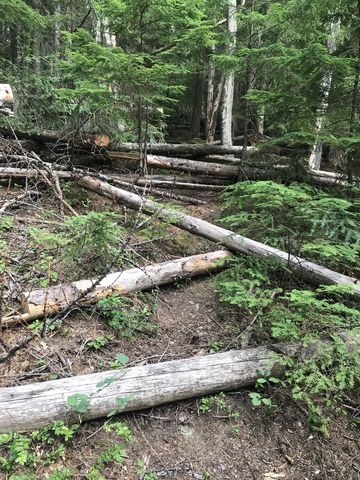
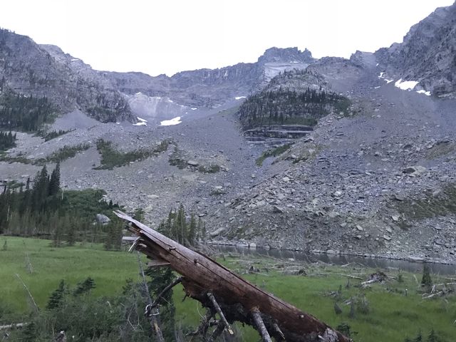
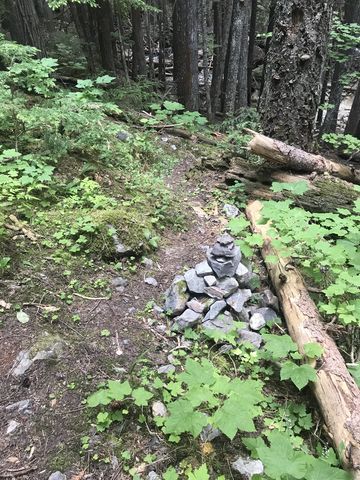 Watch out for a cairn around the 4.5-mile mark, which indicates the fork of “trail” #980 to Little Ibex Lake. This old trail is still visible, leading down to the creek, which it crosses by means of 2 logs, the first one for the Middle Fork and the other for the creek coming down from Little Ibex Lake. The water wasn’t awfully strong and Naughty chose to wade through the creek instead. Then the slug uphill starts. The next 2 miles are fairly steep. Expect few, if any switchbacks. Do expect lots of deadfall. Expect a little more and you still won’t be disappointed. The trail is difficult to make out in places, but thankfully someone had bothered to refresh the faint blazes of the original trail (I believe it’s been unmaintained for a couple of decades by now), added three-stack cairns here and there and cut notches into the downed logs. Nonetheless, I strongly recommend you download the GPS tracks (see Resources, above); I’m pretty sure that they are reflective of the correct route. One exception is a large clearing beneath the lip of Little Ibex Lake. This clearing appears to be the result of a slide, with a tremendous jumble of logs and lots of brush, making it nearly impossible to find anything resembling a trail. The short of it is that you need to ascend the left side of this clearing and pick up the trail again about halfway up (there is a small cairn). It then leads into the forest and climbs steeply to the top.
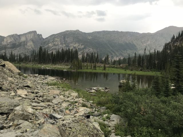 The lake is not the most spectacular in the Cabinets, but the views are. The lake’s’ cirque is evenly split between a splendid meadow and the water, but the meadow is probably a marsh during snowmelt. The campsite sits on a ledge above the meadow amidst a huge mess of fallen logs. It’s possible to hike around the lake; on the eastern side the meadow offers the easiest route (it’s marshy and brushy along the southern end) and on the western side talus pushes into the lake. There are no fish in the lake, but it clearly inhabits the largest frog population of any lake. It’s relatively shallow, yet the swimming was still good and the water cold.
The worst part? The mosquitoes. Absolutely ferocious!
Enjoy this hike? Let us know in the comments below!
Alternate Routes
- Trail #978 continues for about 2 miles past the Little Ibex Lake fork, but eventually just peters out. I would rate the difficulty of this trail as Moderate, with some uphill hiking
Things to Consider
- There are year-around snow fields above the south end of the lake, remnants of what used to be Ibex Glacier
- The view from the west side (feature photo) includes the highest peak in the Cabinet Mountains, Snowshoe Peak
- The low-lying parts of the trail through the cedar forest may turn into a marsh during snowmelt and the fordings will probably be difficult or impossible
- Be on the lookout for mountain goats and muledeer (we saw a couple of muledeer)
© 2016 – 2018 NaughtyHiker. All rights reserved. No duplication without permission.
The mosquitoes sound ridiculous!
They almost claimed 2 casualties