There really is only one downside to the Stevens Lakes trail, the result of all its upside: the trailhead is easily accessible, right off I-90, it’s a short hike in well-shaded woods, there are lots of camping opportunities, and two cooling and picturesque lakes await you, nestled up high below Stevens Peak. The downside? Everyone goes there on a sunny day, so expect heavy foot traffic!
| Location | Bitterroot Mountains |
| Rating | 3.4 out of 5 |
| Difficulty | Moderate |
| Distance | 6.1 miles |
| Duration | 3:25 hours moving time (hiking) |
| Elevation Gain | 1,845 feet |
| High Point | 5,760 feet (Upper Stevens Lake) |
| Low Point | 3,949 feet (Trailhead) |
| Trail Type | Out-and-back |
| Trailbed | Packed dirt, talus |
| Water | The lakes and Willow Creek |
| Status | Unprotected |
| Administration | Coeur d’Alene National Forest |
| Conditions | Very good. The trail along Lower Stevens is narrow and there are many exposed roots. |
| Permits | None required |
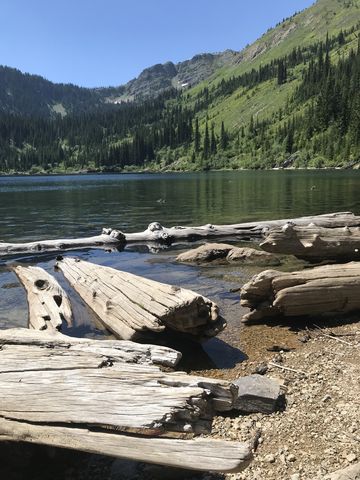
| Camping | There are great campsites at each of the lakes as well as in the woods halfway between the trailhead and Lower Stevens Lake. |
| Maps | USGS Mullan |
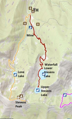
| Trailhead | Take exit #69 (Mullan East) on I-90 and head north. At the stopsign take a right towards Shoshone Park. You will pass the Lucky Friday Mine on the left and after about a mile come to a Y; take a right. The road surface becomes more and more riddled with potholes. Eventually the road will cross the freeway and turn into a one-lane road. After the freeway crossing the road turns to dirt. In about a mile the road emerges onto a parking lot where a number of roads converge. This is the trailhead for Stevens Lake (left side of creek), Lone Lake (right side of creek) and the Northern Pacific rail-to-trail leading up to Lookout pass. A picnic area and restrooms complete the offerings. Google Directions (47.454353, -115.765952) |
| Season | Year-around |
| Squirrel Density | Lots! |
| Features | Lake, Waterfall |
| Distance From |
|
| Resources | |
| Nearby Hikes | |
| Date | July 21, 2018 |
 Although we’ve already reported on the Stevens Lakes area in an earlier report, we thought it appropriate to follow up with a second post since the first one had incomplete GPS mappings, showed the lakes in white clothing, and included a steep off-trail piece. This time we did a group hike to Upper Stevens Lake, and did so at the peak of summer.
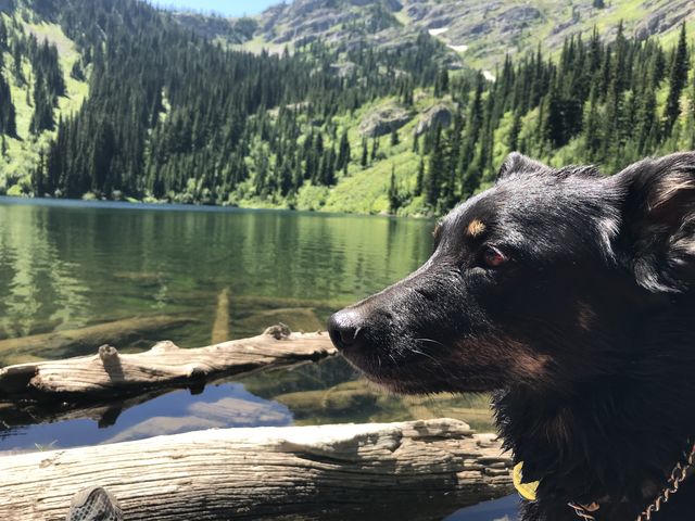
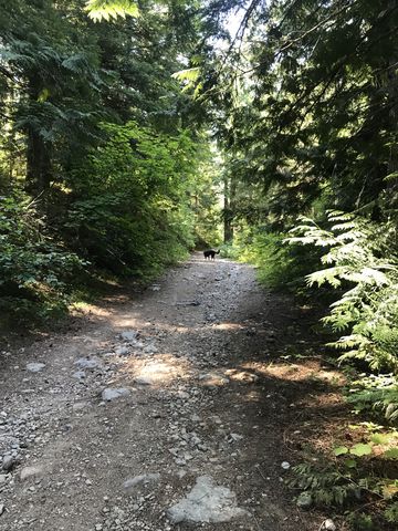
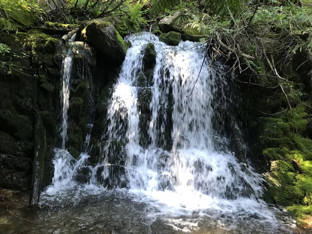
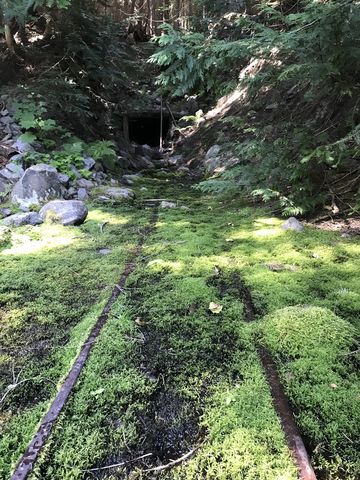
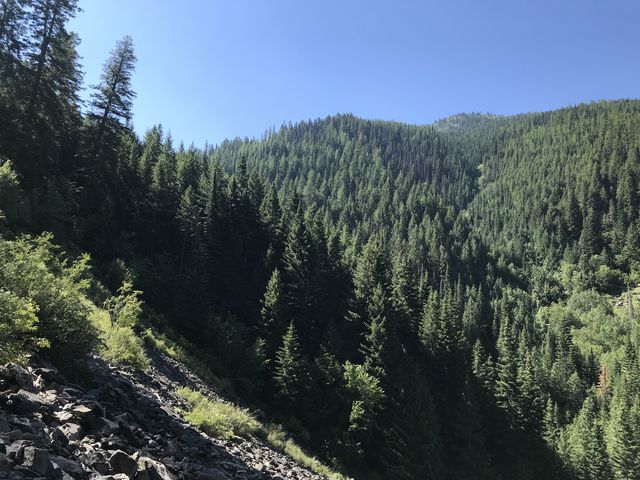
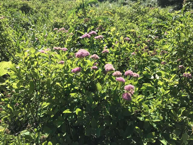
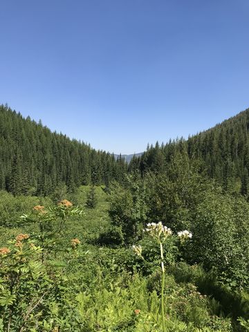
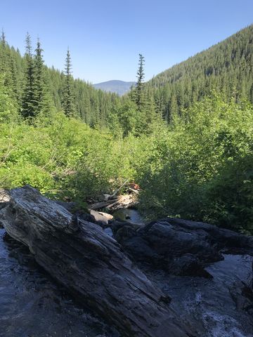
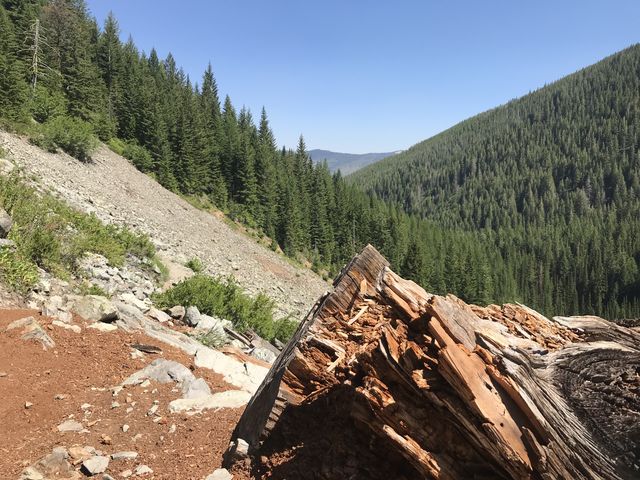
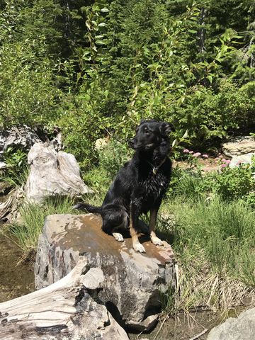
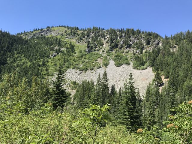 The trail starts out on an old mining road, which immediately begins the climb. It does so in an interesting mix of fir and cedar and is well shaded, with the thunder (or whisper, depending on season) of Willow Creek to your right and visibly here and there through the trees. The trail moves higher, following the creek’s east fork, which, not even a half mile into the hike, shows off with a pretty waterfall. Shortly afterwards an rock-hop across the creek brings you to the location of an old mining shaft, with the tailings spread out to the right, making a decent campsite, and the mine entrance to the left (follow the old moss-overgrown rail tracks). The mining road continues for a bit further, but soon is left behind in favor of a proper singletrack. This path continues to ascend the hillside, opening up select mountain views in the process. Slightly past the one-mile marker, the trail levels off near a couple of campsites in the woods. Soon after, the forest recedes and you get much better views in a brushy bowl painted with spirea. The trail crosses the bowl, crosses Willow Creek, which again shows off with a waterfall, then crosses and recrosses a talus slope. Listen and watch for pika!
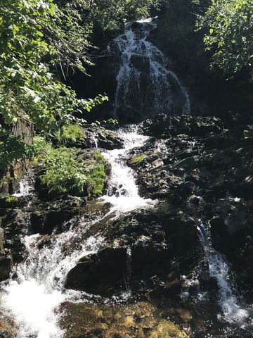
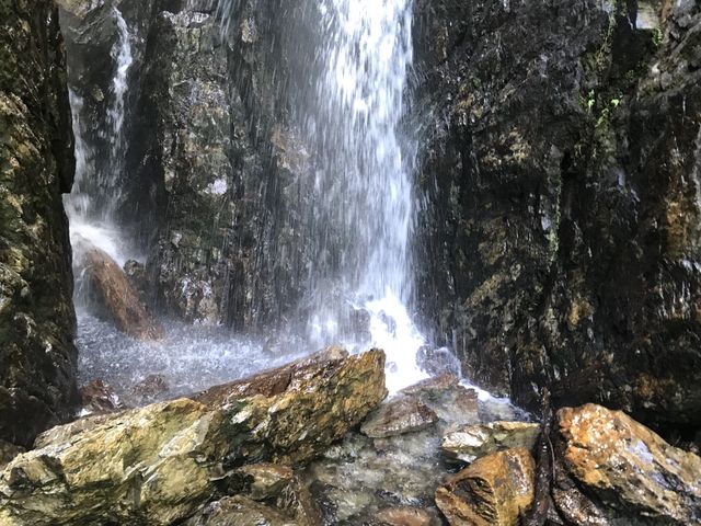
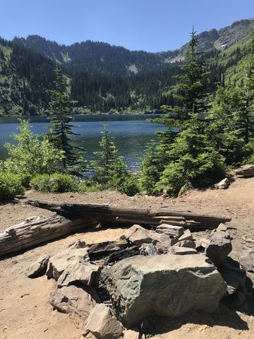
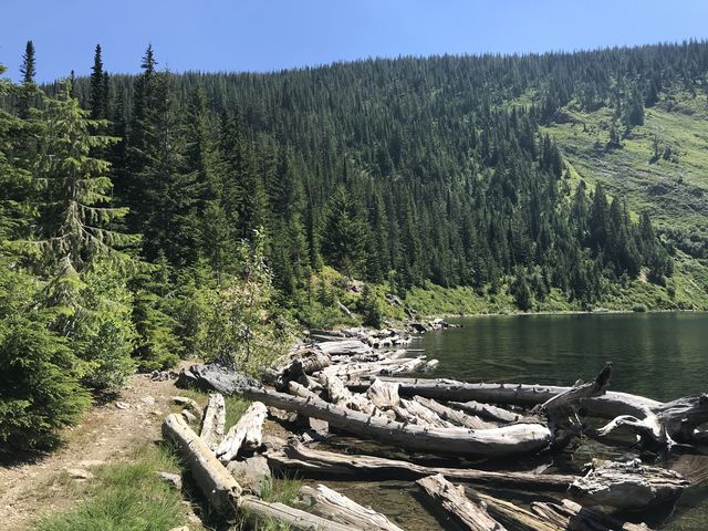
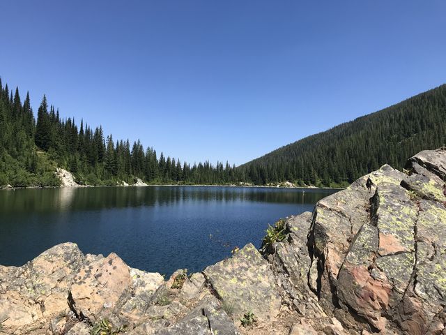
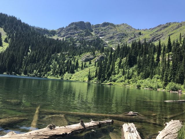
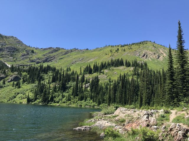
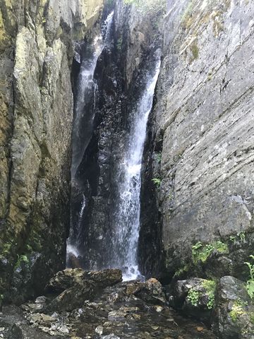 Afterwards, the trail enters the woods once again and switchbacks uphill. From one of the switchbacks you can spot the largest waterfall in Willow Creek, and a precarious path leads to the bottom of it, in case you want to take a shower (not even Naughty wanted to do that). Then, it’s a couple more switchbacks and you are at Lower Stevens Lake, with fine views of Stevens Peak, which still shows remnants of snow in July.
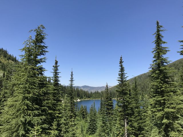
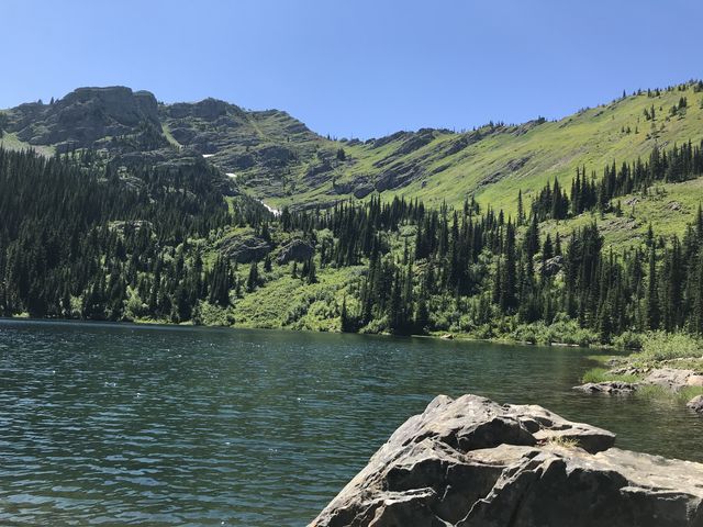 The trail to Upper Stevens Lake meanders along the western shore of the lower lake and gets a bit confusing towards the end. Stay near the lakeshore, even as side trails branch off; you should get to a small granite-ringed peninsula, then continue along the shore a bit longer and the trail will take off into the woods, climb higher, and shortly reach Upper Stevens Lake. It’s about a half mile from the north end of Lower Stevens Lake to Upper Stevens Lake.
Enjoy this hike? Let us know in the comments below!
Alternate Routes
- A scramble to the saddle below Stevens Peak opens up routes to the St. Regis Lakes or Lone Lake
© 2016 – 2018 NaughtyHiker. All rights reserved. No duplication without permission.
Very pretty lakes!