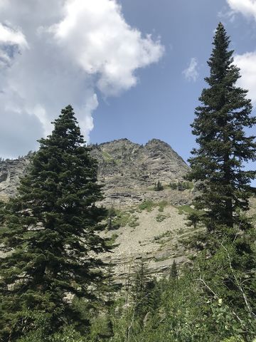
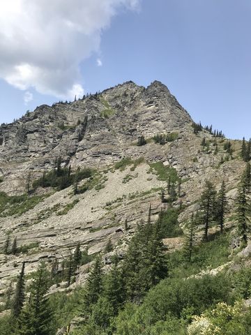
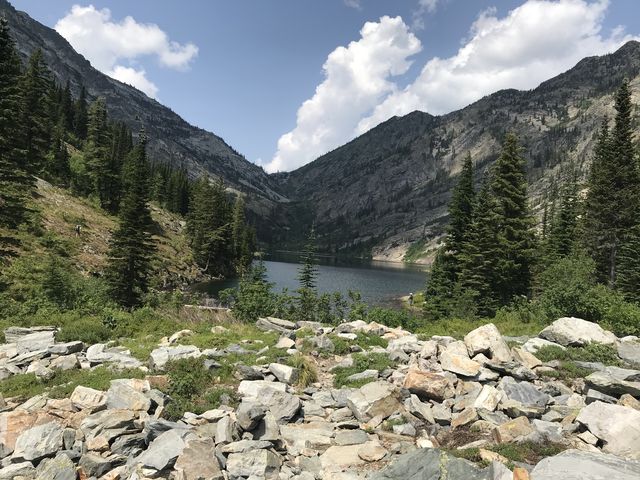
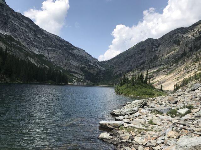
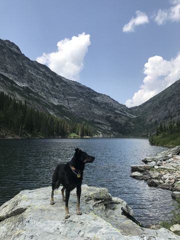
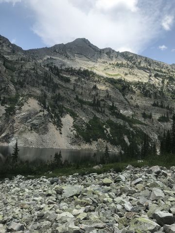
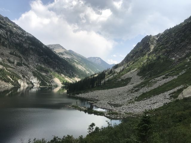
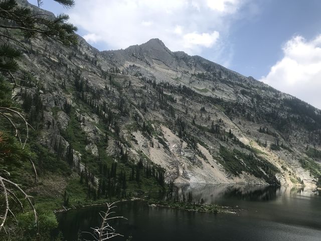
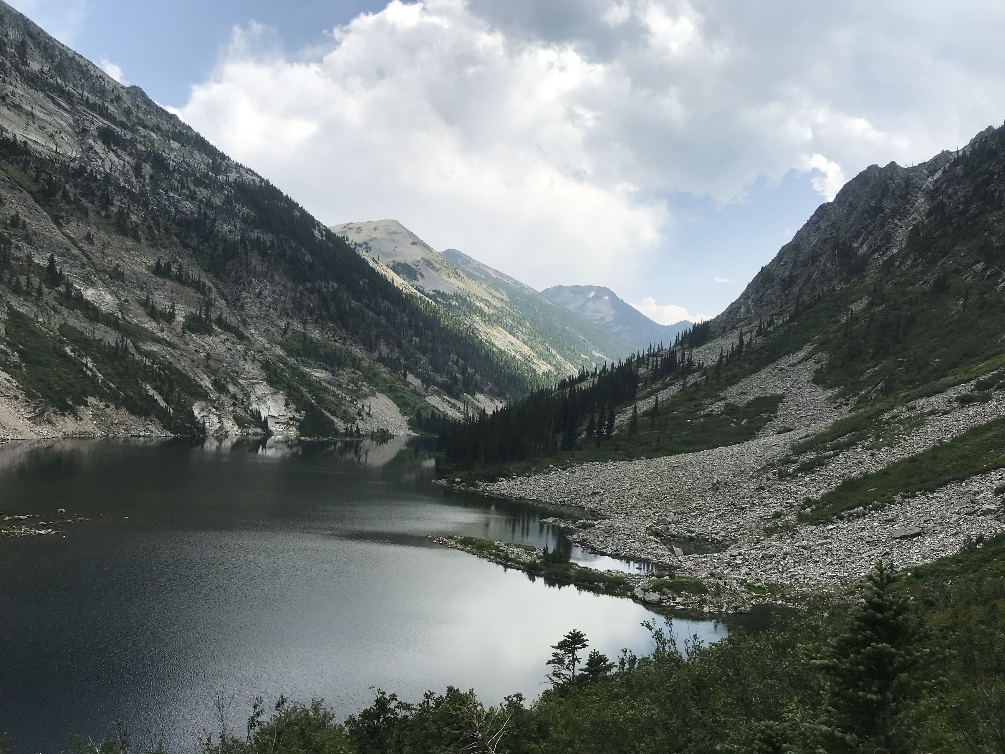
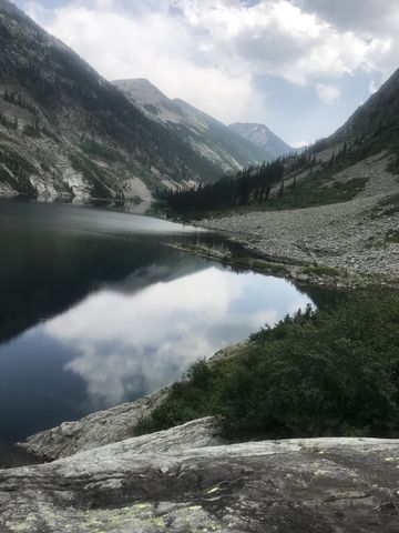
Rock Lake is a pleasant hike to a phenomenal lake in the midst of the Cabinet Wilderness. Steep talus slopes frame the lake on both sides, with the sheer granite face of Ojibway Peak looming high above. The water is much warmer than you’d expect, and the utter lack of mosquitoes turns this high alpine valley into a piece of paradise. Plus, inspect a thunderous waterfall and old mining equipment along the way.
| Location | Cabinet Mountains |
| Rating | 4.0 out of 5 |
| Difficulty | Moderate (some uphill hiking) |
| Distance | 11.4 miles |
| Duration | 4:21 hours moving time (hiking) |
| Elevation Gain | 1,974 feet |
| High Point | 5,063 feet (Rock Lake) |
| Low Point | 3,074 feet (Trailhead) |
| Trail Type | Out-and-back |
| Trailbed | Packed dirt, loose rocks, old mining road |
| Trail# | 935 |
| Water | Rock Lake and frequent access to Rock Creek |
| Status | Wilderness Area |
| Administration | Kootenai National Forest |
| Conditions | Very good |
| Permits | None required |
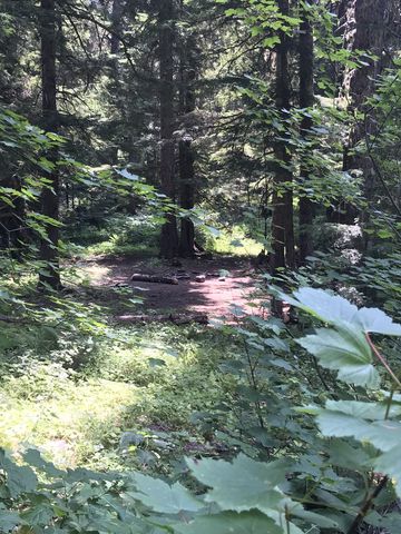
| Camping | A few sites at the south end of the lake and 2 along the trail near the cabins |
| Maps | USGS Elephant Peak |
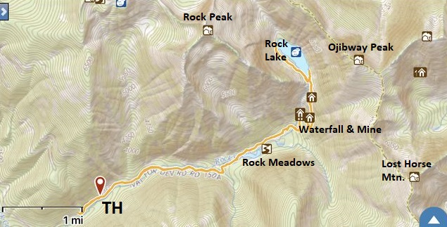
| Trailhead | From MT-200, 2 miles east of Noxon, turn onto NF-150 (Rock Creek Road; gravel) at the 17-mile marker. Continue for a quarter mile, then bear right and proceed underneath the power lines. Continue for 5 miles (at the fork along the way bear left, which means going straight). The road deteriorates quickly and becomes pothole-riddled and it really won’t get any better. After the 5 miles, turn right onto NF-150A (signed Rock Lake), which is a single-lane dirt road. The trailhead is about a mile up the road. Due to deteriorating road conditions, we parked half a mile from the trailhead. It is possible to make it in a car all the way to the trailhead. A Prius was parked there when we hiked. Just depends how much you like your shock absorbers…. Google Directions (48.035225, -115.689393) |
| Season | June – October |
| Squirrel Density | Lots and lots! |
| Features | Lake, Waterfall, Structure, Meadow |
| Distance From |
|
| Resources | |
| Nearby Hikes | |
| Date | July 28, 2018 |
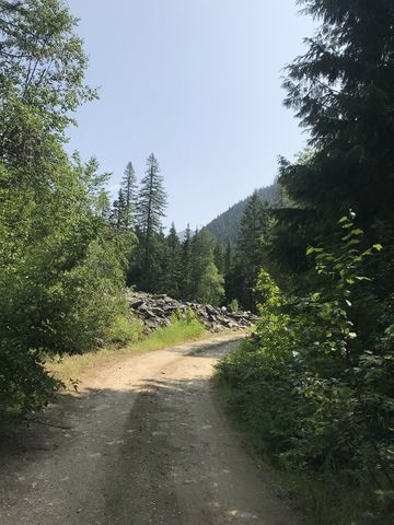
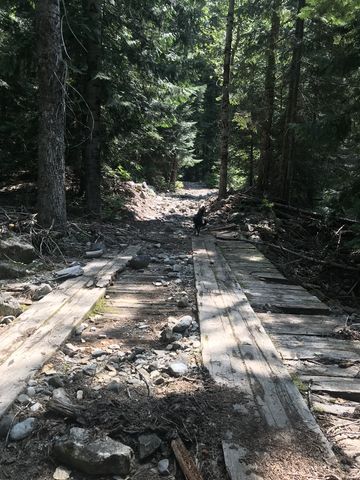
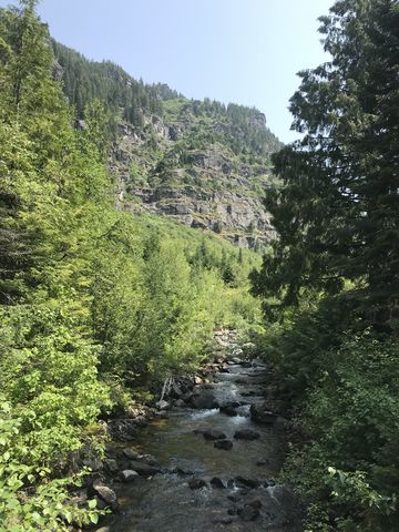
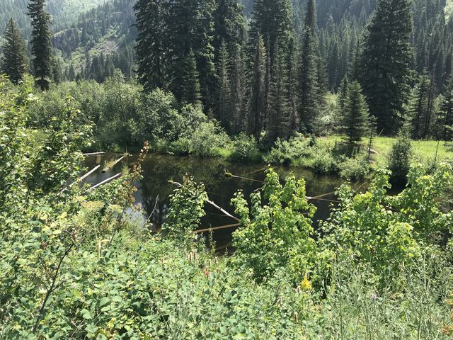
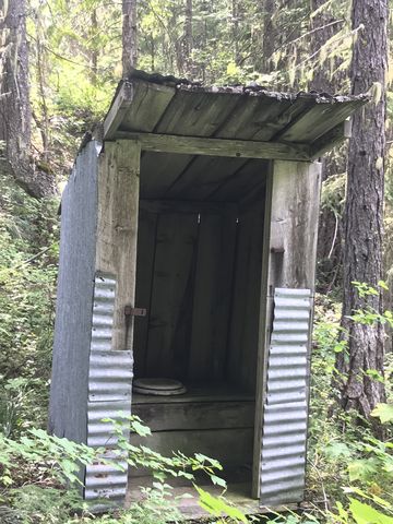
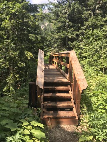
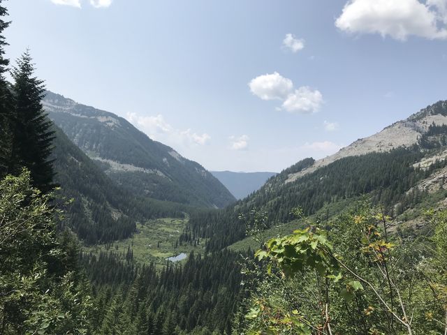
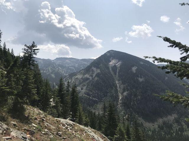
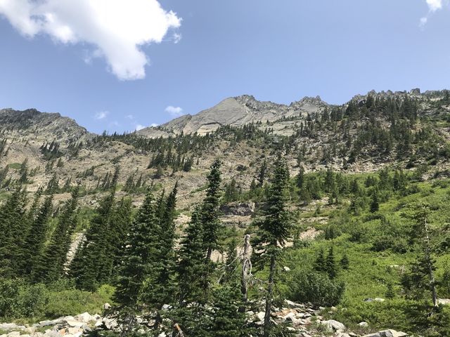
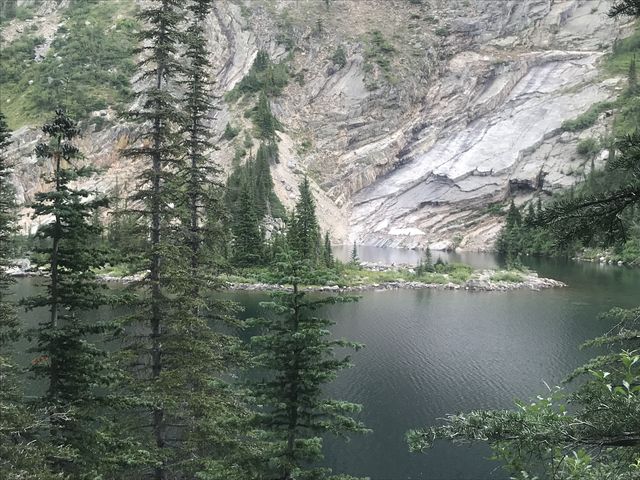
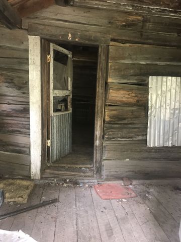 The Rock Lake trail starts out nicely shaded, continuing on the same former mining road that led to the trailhead, only it’s closed to vehicular traffic. The old twintrack continues for nearly 3 miles to the Heidelberg mine and waterfall. Along the way you frequently cross Rock Creek or one of its tributaries, and the forest opens up every so often and presents views of the granite face of Rock Peak. Near the 2-mile mark you hit upon Rock Meadows, a great open area, brushy and dotted with ponds and marshy tufts, and meandering Rock Creek. It once served as a beaver farm. The Meadows are quite extensive and feature an old cabin at either end, both dilapidated and decaying. The lower one is more interesting, as it happens to be a log cabin uglified with steel sheeting, while the upper is an ugly frame construction uglified further with steel sheeting.
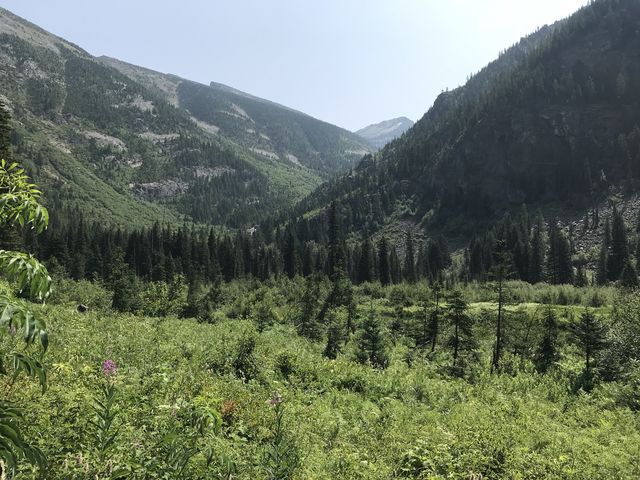
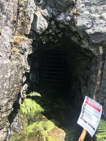
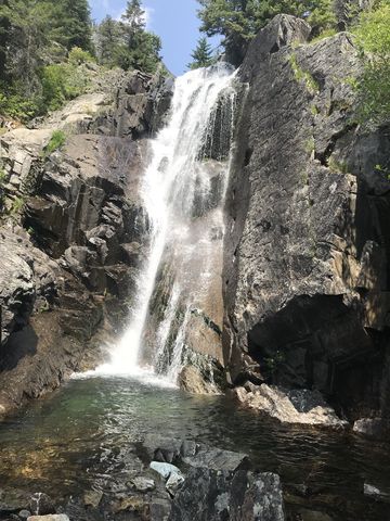
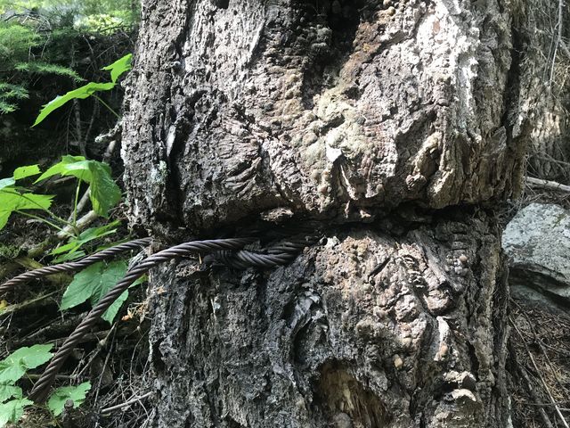
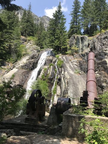 About three miles in is the old Heidelberg mine, whose shaft is barred. There is also some rusting old mining equipment and a water pipeline, but the prettiest part is the waterfall tumbling down from the granite shelf above. Then, after backing up a couple dozen paces, the trail turns into a proper singletrack and switchbacks uphill rather steeply, with splendid views of Lost Horse Mountain at first and later the Rock Creek canyon and Rock Meadows as you climb higher. It’s about 4 miles from the trailhead to the lake. The lake is exceedingly popular and on our visit numerous parties hiked and camped along the lake, including a group of horsemen.
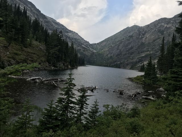
The trail continues along the western shore of the lake, albeit somewhat overgrown, to the north end of the lake and yet keeps going on from there, evidently heading up to St. Paul Pass (we didn’t go any further and the trail is probably not maintained). The route along the lake is about a mile long.
Enjoy this hike? Let us know in the comments below!
Alternate Routes
- Continue along the path on the lake’s western shore across St. Paul Pass to St. Paul Lake
© 2016 – 2018 NaughtyHiker. All rights reserved. No duplication without permission.
It is a beautiful lake! I visited there in 2013.
Might just be the nicest lake in the Cabinets (but I haven’t seen Leigh and Wanless yet…)