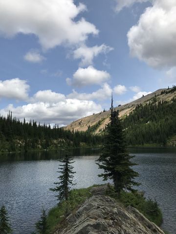
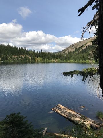
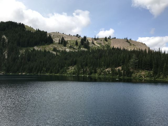
The Crystal Lake loop in the St. Joe Mountains is rather pretty and surprisingly popular given the rather tediously long drive up Rochat Divide. The trout-filled lake, gorgeous camp spots, and huckleberry-carpeted hillsides make it certainly a worthwhile endeavour, topped off with sweeping views from Pearson Peak across the Coeur d’Alene Mountains and the Palouse.
| Location | St. Joe Mountains |
| Rating | 3.6 out of 5 |
| Difficulty | Moderate (some uphill and off-trail hiking) |
| Distance | 4.2 miles |
| Duration | 2:05 hours moving time (hiking) |
| Elevation Gain | 1,067 feet |
| High Point | 6,125 feet (Pearson Peak) |
| Low Point | 5,104 feet |
| Trail Type | Loop |
| Trailbed | Packed dirt, loose rocks, off-trail |
| Water | Crystal Lake and a small trickle halfway to the lake |
| Status | Proposed Wilderness |
| Administration | BLM |
| Conditions | Good for the portion with a trail, but beware of rocks and exposed roots; the off-trail portion is comparatively good |
| Permits | None required |
| Camping | At the trailhead (Sheep Camp) and at Crystal Lake |
| Maps | USGS Crystal Lake |
| Trailhead | From I-90, take exit #40 (Cataldo), and head south on Latour Creek Road. After about 7 or 8 miles the road turns to gravel. Eventually the road morphs into Rochat Road (FR-613), but you simply go straight (the left fork crosses the creek and heads up Latour Peak, which is a different hike). It’s just shy of 20 miles from the freeway to the trailhead at Sheep Camp, and the road gets worse as it winds higher, being a mere dirt road once you arrive at the trailhead. Google Directions (47.388212, -116.401681) |
| Season | June – October |
| Squirrel Density | Phenomenal! |
| Features | Mountaintop, Lake, Meadow |
| Distance From |
|
| Resources | |
| Nearby Hikes | |
| Date | August 12, 2018 |
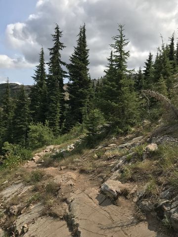
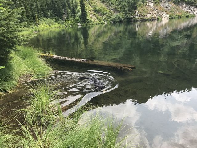
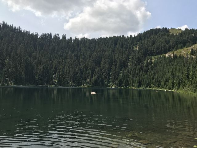
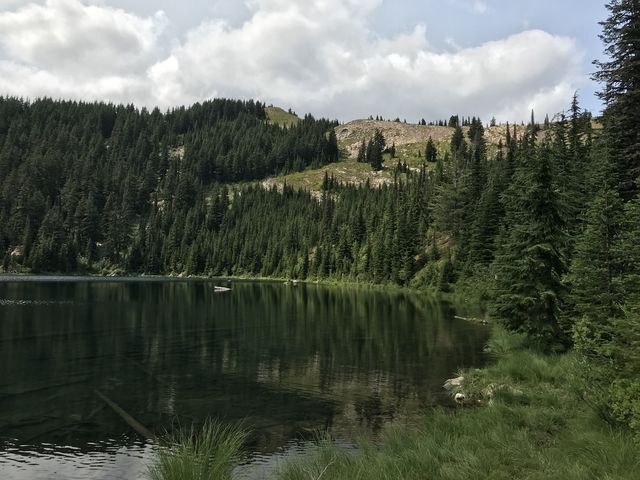
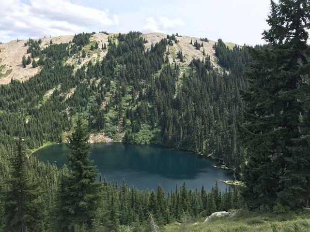
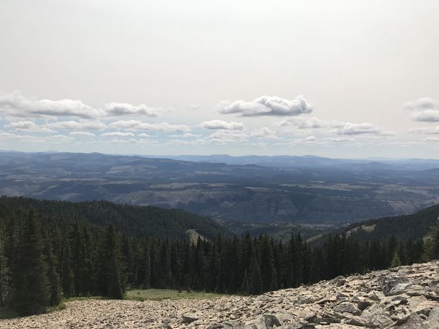
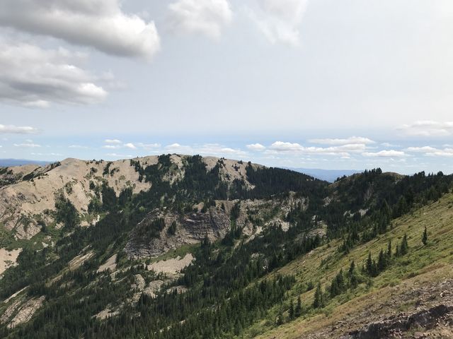
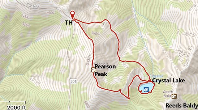
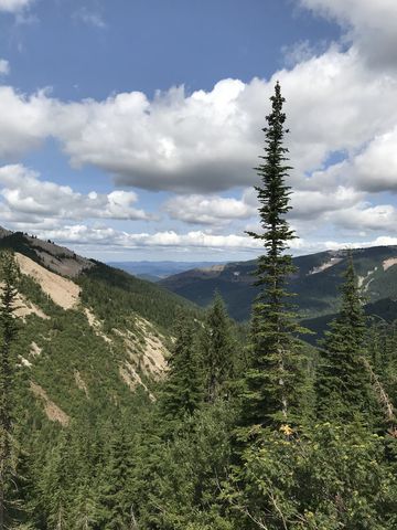 The trail starts on the northeast side of FR-613, dropping slightly and contouring along the northeastern flank of Pearson Peak. At first the trail is rather open with good views to the mouth of Latour Creek and the surrounding mountains, including Latour Peak, then its gets rockier, crossing a few talus slopes, and finally fir takes over on approach to the lake. It’s about 1.5 miles to the lake. There are a few choice campsites right where the trail meets the lake, but perhaps the best one is on the far side, where a minute peninsula slides into the lake beneath the steep forested nose of Reeds Baldy. The easier way to it is around the western end of the lake, which features a decent angler trail. It’s possible to circumvent the lake (about 3/4 mile), but the eastern end is steep and brushy.
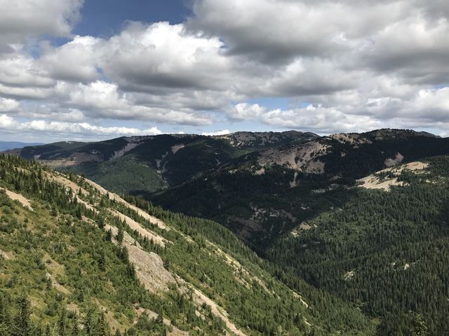
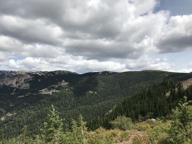
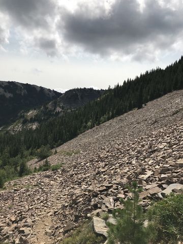
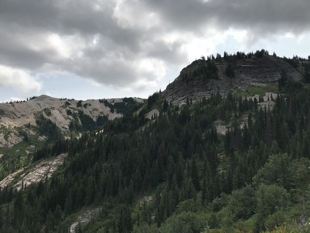
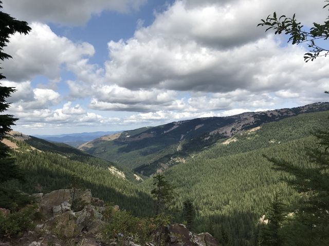
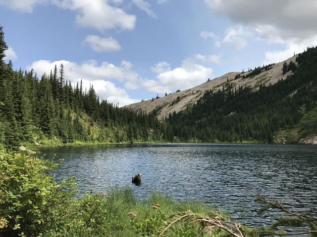
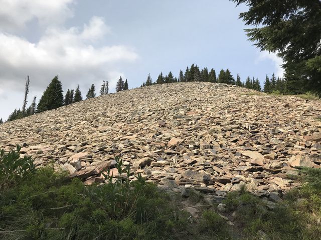
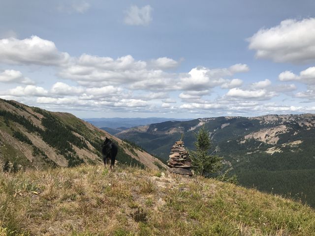
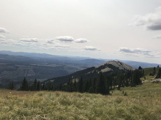
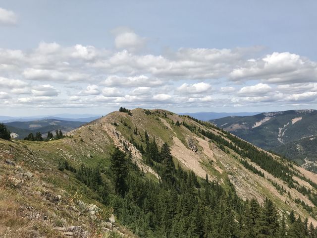
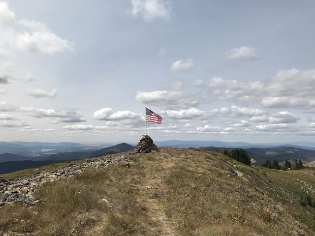
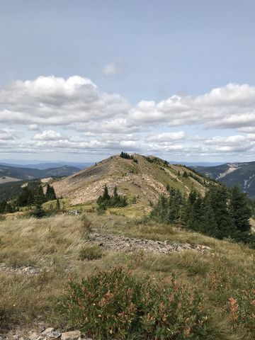
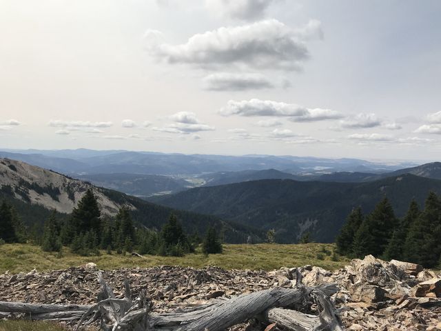
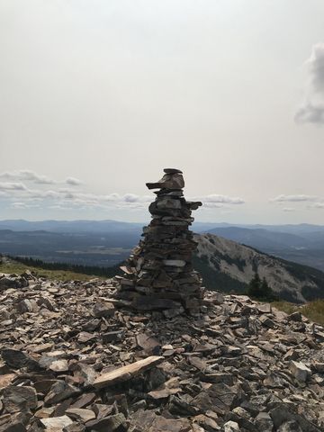
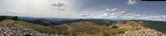
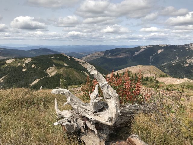
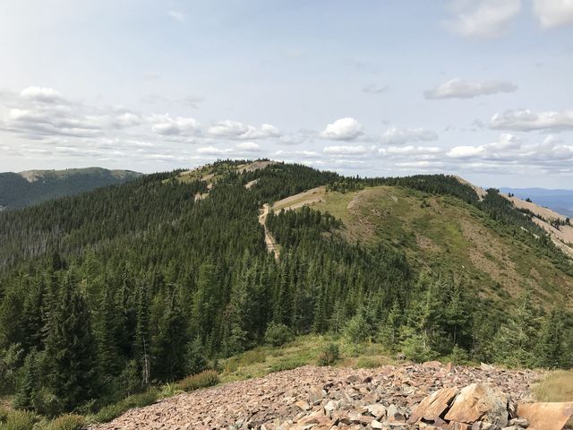
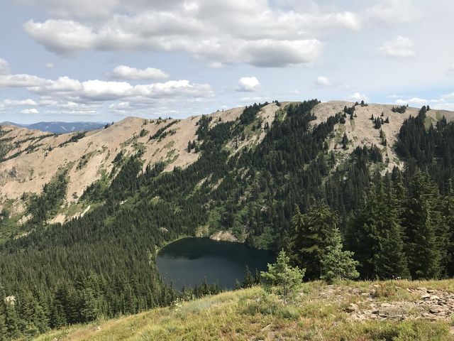 Either head back the way you came, or, to get a bird’s eye view of the lake, steeply climb the headwall of the lake towards a saddle between Pearson Peak and Reeds Baldy. At the saddle you can either continue on the trail, which shortly meets up with FR-613, where you head north back to the car, or, for better views, hike off-trail up the rocky ridge towards Pearson Peak. After scaling the first knob, peek over the edge to the east at the lake as you won’t be able to see it anymore later. The route then follows animal tracks, sticking close to the spine of the ridge as it climbs higher up treeless Pearson Peak. The views here are phenomenal, starting with antenna-studded St. Joe Baldy, beyond it the Clearwater Mountains to the south, then the St. Joe River Valley and Palouse to the west, and the Coeur d’Alene Mountains to the north. There is a rock cairn at the top of Pearson Peak, and afterwards it’s downhill towards Rochat Peak, crossing plenty of shifting talus. Shortly before returning to the trailhead, alpine fir blocks the way and the animal tracks get a bit confusing. It might take some brute force…
Enjoy this hike? Let us know in the comments below!

© 2016 – 2018 NaughtyHiker. All rights reserved. No duplication without permission.