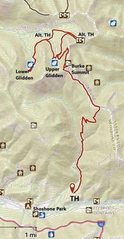
Nestled in the forest near the Idaho-Montana state line, the Glidden Lakes are as popular with campers–if not more so–as Blossom and Revett further north. The hike follows the Idaho State Centennial trail for much of the way and tosses in excellent views into Montana and Idaho and the Lookout Pass ski area.
| Location | Coeur d’Alene Mountains |
| Rating | 3.4 out of 5 |
| Difficulty | More Difficult (steep ascent to stateline) |
| Distance | 17.1 miles |
| Duration | 6:15 hours moving time (hiking) |
| Elevation Gain | 3,759 feet |
| High Point | 6,616 feet (Burke Summit) |
| Low Point | 3,787 feet (Trailhead) |
| Trail Type | Lollipop |
| Trailbed | Packed dirt; forest road |
| Trail# | 7, 133, 135 |
| Water | The lakes and an occasional brook; virtually none on the stateline trail |
| Status | Unprotected |
| Administration | Coeur d’Alene National Forest |
| Conditions | Good. A fair bit of blowdown in the first part of the stateline trail |
| Permits | None required |
| Camping | At either lake |
| Maps | USGS Lookout Pass, Thompson Pass |
| Trailhead | Take exit #69 (Mullan East) on I-90 and head north. At the stopsign take a right towards Shoshone Park. You will pass the Lucky Friday Mine on the left and after about a mile come to a Y; take a left onto Larson Road and continue to Shoshone Park, about 2.5 miles. This is probably the best place to park. Alternatively, continue to the Hale fish hatchery and take a left onto the gravel road just ahead of the buildings. Continue for maybe 500 feet to an intersection; go straight and the road will markedly deteriorate as it moves uphill. The trailhead is at an elbow, about a mile uphill. There is parking for perhaps a couple of cars. Google Directions (47.472976, -115.708592) |
| Season | June – October |
| Squirrel Density | Lots of them! And ground squirrels too! |
| Features | Mountaintop, Lake, Grove |
| Distance From |
|
| Resources | |
| Nearby Hikes | |
| Date | June 24, 2018 |
Before you set out on this trek, be aware that there are much easier ways to get to the Glidden Lakes. In fact, you can simply drive up the Canyon Creek Road, through Burke, and take a forest service spur road right to the shores of Lower Glidden Lake. From that spur, an old twintrack leads a half mile uphill to Upper Glidden Lake. An even easier route to Upper Glidden Lake starts at Cooper Pass and contours levelly along the northern flank of Burke Summit for a mile.
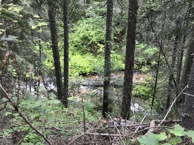
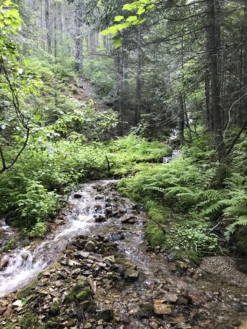
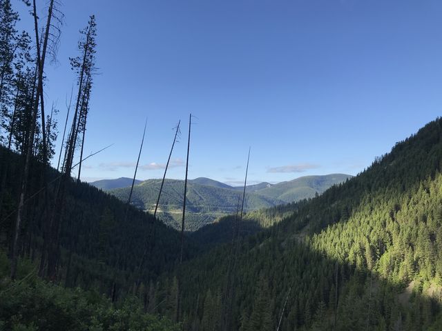
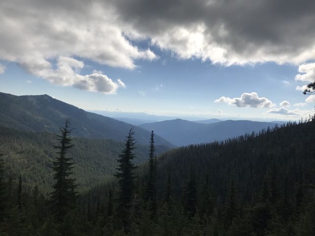
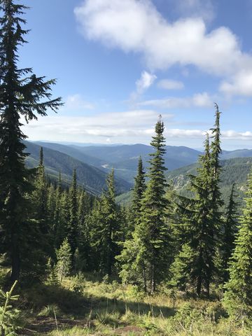
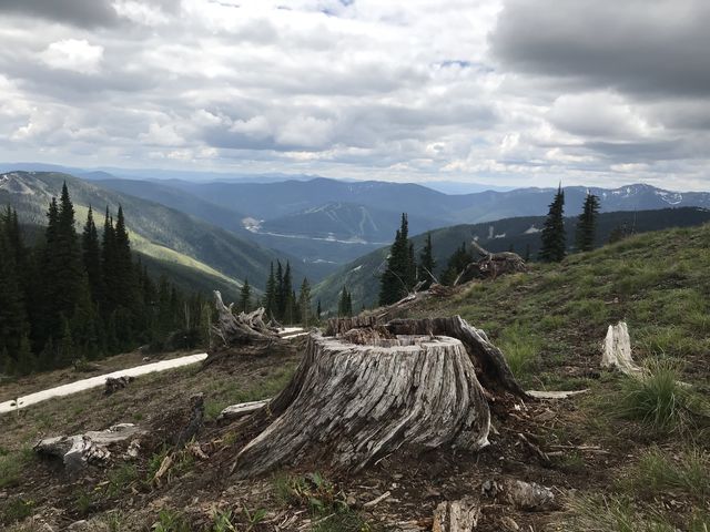
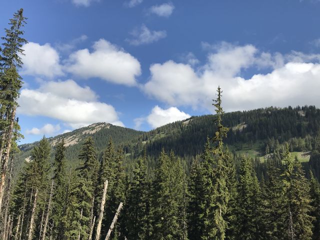
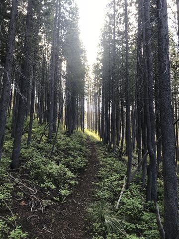 But what’s the fun in that, right? Hence our start outside Mullan on trail #133, which is also part of the Canada-to-Nevada Idaho State Centennial Trail (the stretch to Cooper Pass). Initially, this trail is an old logging road, wider than a twintrack, that heads in the same direction as the Little North Fork of the South Fork of the Coeur d’Alene River. It does so quite levelly in a thick and lush cedar forest. A mile in, the trail forks and you want to take the uphill one, which shortly comes to an end. A singletrack continues on, crossing a creek which is likely the last water source before reaching Upper Glidden Lake. For the next 2 miles, the trail climbs steeply (particularly the first mile) to the state line. In the process, the forest recedes somewhat, either due to burns or logging or both (the stumps were sawed off and blackened), which creates great views southwards to Lookout Mountain, the ski runs, and I-90 bisecting the lower half. The trail reenters forest in the upper mile, but the trees are young and provide only limited shade.
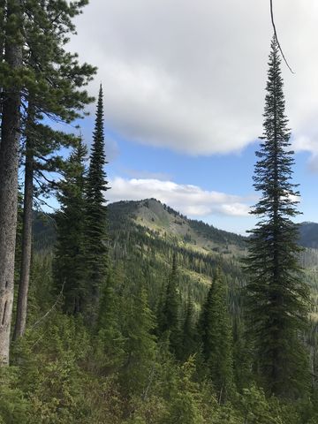
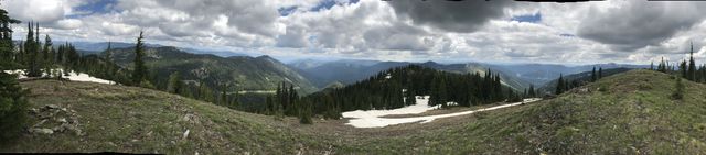
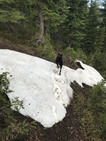 On the ridge above, the trail meets the Stateline Trail (#7). Bear left and the singletrack continues on the ridge for a while, then drops into Montana, then the ridge again, then into Idaho. Selectively, there are good views into the Summit Creek drainage on the Montana side and bare-topped Burke Summit up ahead. There was a fair bit of blowdown on this section, but it got better the further we went, also crossing a few remaining snow patches here and there.
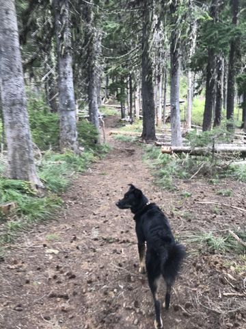
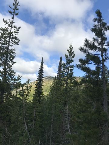
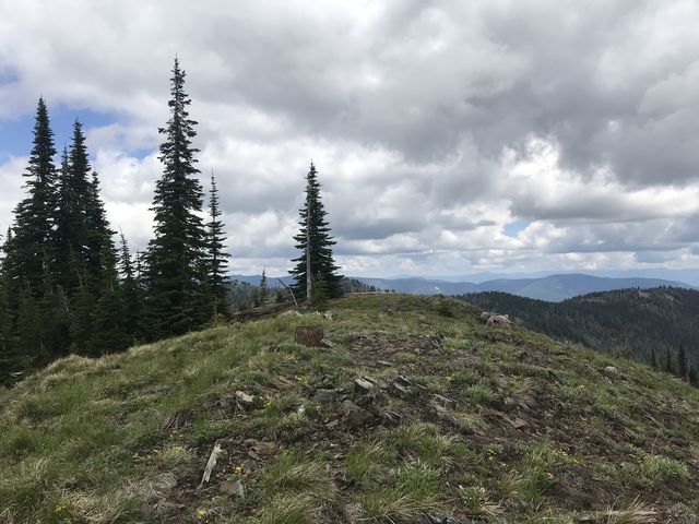
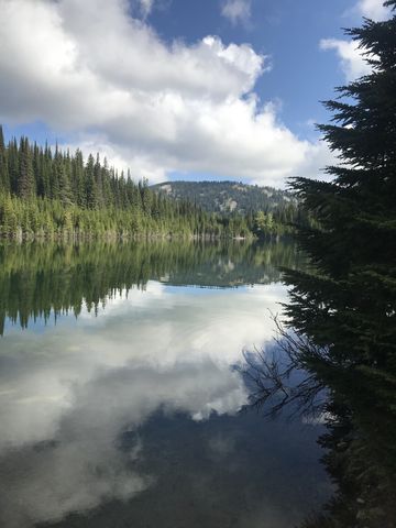
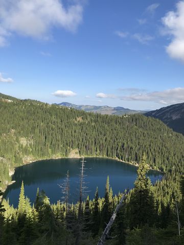 Near the 4.5-mile mark the trail shifts northwards and leaves the ridge as it rides up to the unnamed peak that provides the headwall for Upper Glidden Lake. After a short climb, the lake comes into view in a near-perfect cirque in the woods below (be sure to take pictures, the views of the lake really don’t get better). The trail continues north, high above the lake along the western flank of Burke Summit. If you intend to climb the peak, this is a good spot as it is relatively treeless and rich in ground squirrel, if that’s to your liking. Near the top is a small grove of trees in which, unbeknownst to us, a family of muledeer had settled. Naughty being Naughty made sure they scattered to the four winds. The peak is pretty much bare with excellent views south and west, but trees block Upper Glidden Lake.
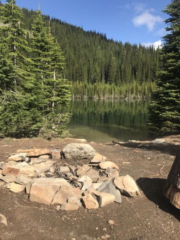
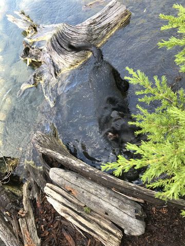
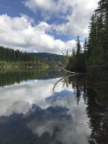
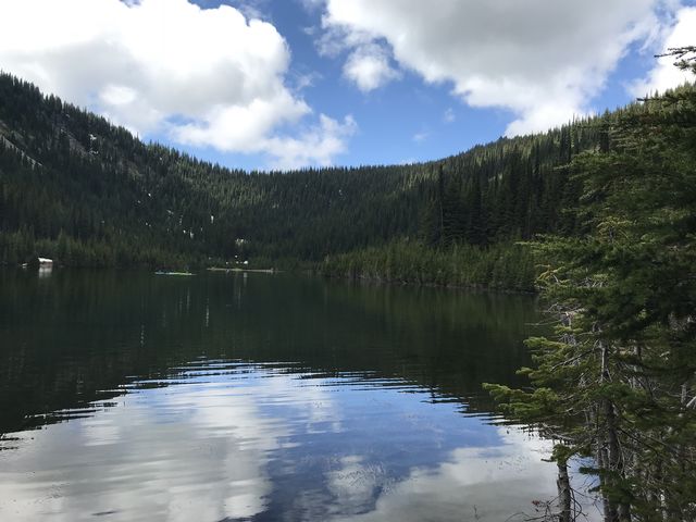
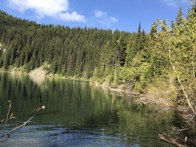 Continuing, the trail then declines through dense forest and at an elbow in a switchback a short spur trail leads to the lake at the six-mile mark. The lake is rather pretty and invites for a swim (Naughty heeded the call) and offers numerous excellent campsites. The descent to Lower Glidden starts on the far side of Upper Glidden’s outlet, using an old logging road that spills out onto a forest service road after about half a mile.
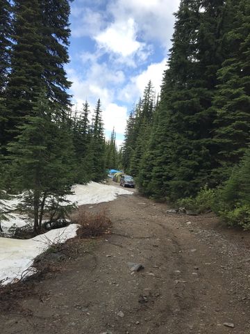
 Follow the forecast service road uphill for another mile to the lake and along its eastern shore to its head. Numerous car-campers occupied the lake, setting up their tents right on the road since it is very shady and the road defended its territory with 2-foot snow berms. Naughty dipped into Lower Glidden Lake, too, but we decided we preferred the upper lake in its pretty bowl. Incidentally, the two lakes aren’t connected (ie Upper Glidden doesn’t drain into Lower Glidden).
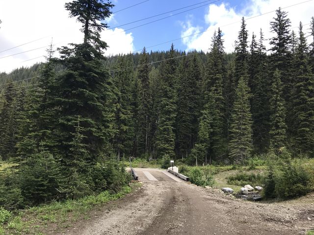
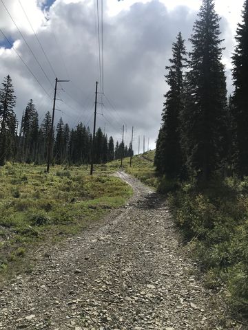 Then it’s back on the forest service road, but to turn this into a lollipop loop we followed the road past the Upper Glidden spur trail to a set of power lines shown on the map, with the intent of hiking beneath the power lines. The advantage of power lines is that they are usually kept clear of brush and there is no blowdown. We were in luck, indeed, with the area cleared and on top of that there was a gravel road beneath the lines. But as we climbed, we found out what the disadvantage of power lines is: they head into the distance in a straight line, no matter what the terrain does, and in our case it was steeply uphill!
 Anyway, we made it to Cooper Pass at the 10-mile mark and there found a singletrack signed #135, that led us back to Upper Glidden Lake. If you’re looking for a shortcut to trail #135, bushwhack for perhaps 20 or 30 yards uphill once you’re about two-thirds up the power line trail. That’s roughly at the point the power line trail levels off. You should meet #135 quickly.
Enjoy this hike? Let us know in the comments below!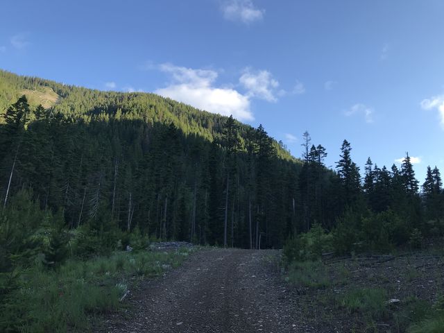
Alternate Routes
- To shorten the hike, you could drive to Lower Glidden or Cooper Pass and hike from there
© 2016 – 2018 NaughtyHiker. All rights reserved. No duplication without permission.
Thanks for the writeup there isn’t much online in regards to these two lakes.
Glad you liked it! Particularly the upper lake is very scenic