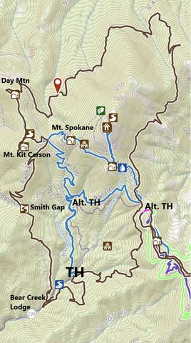
Exceedingly popular with mountain bikers, the Mount Spokane Loop covers most ground within the state park without actually ascending Mount Spokane. From the park’s entrance, the trail climbs to a saddle southeast of Mount Spokane, criss-crosses the ski runs and chairlifts, then drops down the north side only to ascend anew for fantastic views from Day Mountain. A quick visit to Mount Kit Carson, a steep decline in dense forest above Burping Brook, and a short excursion to the south of Deadman Creek round out the hike.
| Location | Selkirk Mountains |
| Rating | 3.2 out of 5 |
| Difficulty | More Difficult (a few steep sections on trail #140) |
| Distance | 21.4 miles |
| Duration | 6:23 hours moving time (hiking) |
| Elevation Gain | 3,919 feet |
| High Point | 5,277 feet (Mount Kit Carson) |
| Low Point | 3,032 feet (Bear Creek Lodge) |
| Trail Type | Loop |
| Trailbed | Packed dirt; old forest roads |
| Trail# | 120, 121, 122, 130, 131, 132, 140, 160 |
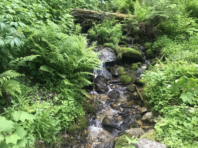
| Water | There are numerous tributaries early in the year, but later Blanchard Creek and Deadman Creek may be the only water sources |
| Status | State Park |
| Administration | Washington Parks and Recreation |
| Conditions | Excellent. The entire loop is well suited for mountain biking. |
| Permits | Discover Pass required |
| Camping | Bald Knob Campground |
| Maps | USGS Mount Spokane |
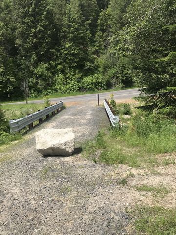
| Trailhead | Take I-90 exit #287 and head north on Argonne Road for 8.5 miles (Argonne will turn into Bruce Road). At the roundabout turn right onto WA-206 Mount Spokane Park Drive and follow it to the trailhead (it is a few hundred yards into the park; there is parking on the left and right, with a pit toilet on the left). Alternatively, take the I-90 Sullivan exit and head north via Sullivan, Wellesley, Progress and Forker to WA-206.
Google Directions (47.88816, -117.125296) |
| Season | Year-around |
| Squirrel Density | Dogs must be leashed |
| Features | Mountaintop, Grove, Meadow |
| Distance From |
|
| Resources | |
| Nearby Hikes | |
| Date | June 17, 2018 |
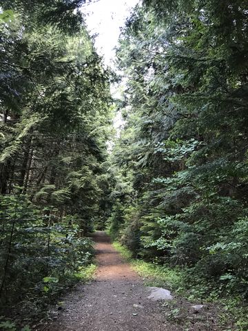
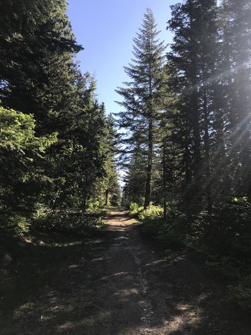
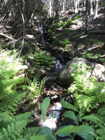
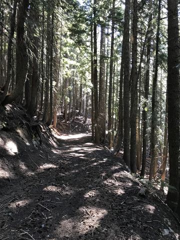
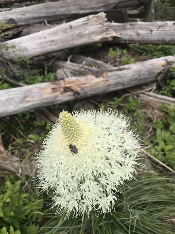
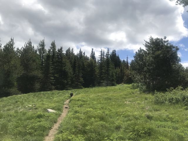
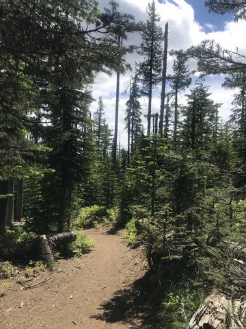
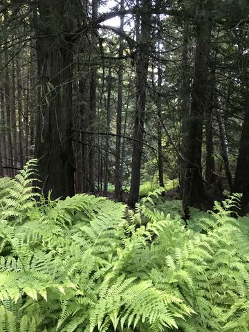 For a counterclockwise circumference of Mount Spokane, start on the south side of the road. A couple of trails converge here and you could take either; the easiest one is labeled 121, an old fire road (the other is #122, and if you take that swing a left onto the singletrack a few dozen yards uphill). Trail 121 moves pleasantly uphill, following a tributary of Deadman Creek. A hairpin turn soon shifts the ascent westwards to an intersection with a singletrack near the half-mile mark. Taking the singletrack to the right brings you back to the trailhead, so swing a left (eastwards) onto trail #120. The singletrack contours along the mountain, crossing small brooks here and there on convenient wooden bridges. Views are limited along this stretch, but pretty flowers, including beargrass and extensive patches of ferns reward the eye. The trail continues up and along the hillside, using old fire roads here and there only to leave them behind shortly and morphing into a singletrack again. The trail eventually shifts northwards and steadily ascends the western flank of Linder Ridge.
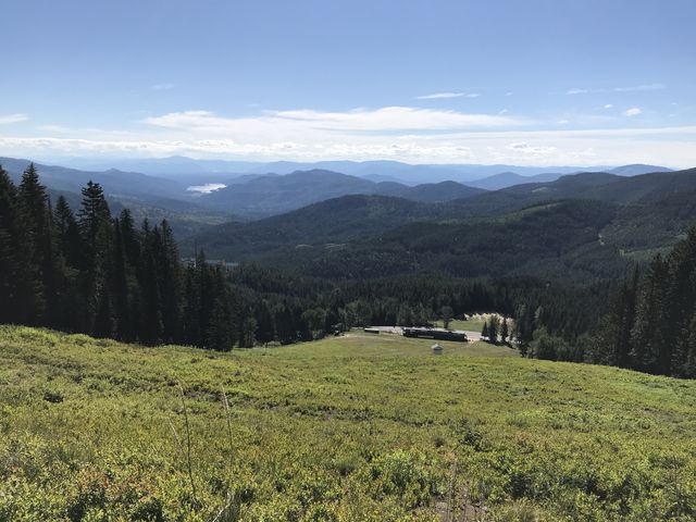
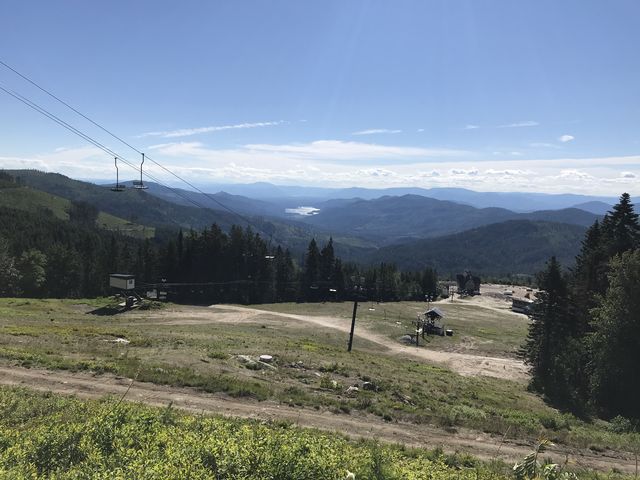
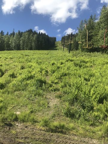
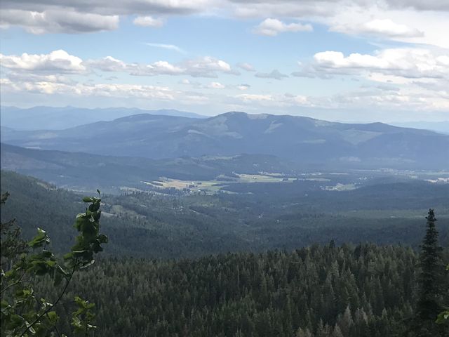
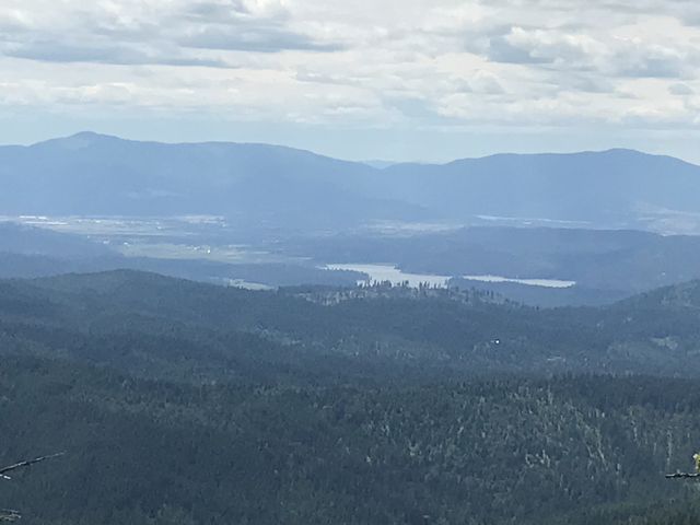
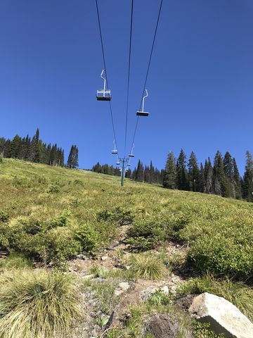 After 2 miles of ascent, the trail spills out onto the Snowmobile parking lot at about 4600 feet. Here you’ll cross the Mount Spokane Road towards the trail kiosk to the right of the Summit Road. A trail (#131) leads uphill for a short distance, past equipment buildings, and ends at a fire road in an elbow of the Summit Road. Follow the fire road northeastwards, ignoring trail #131 veering off to the left and heading uphill to the summit (this fork is signed). Continuing along the wide fire road (it merges with another road after a bit, just continue straight), you’ll soon be treated to views into Idaho, and these get even better as you pass beneath the chairlifts and cross the ski runs. After you cross chairlift #1, follow the Roulon Run downhill (at the fork bear right) until you get to a clearing with several chairlifts. Pass underneath lift #2 and aim for #5 (that is the really short lift). Pass underneath #5 and follow the road as it bends and heads for the beginning of chairlift #5. Soon you will see chairlift #3 below to your left. Near the gabled building, take a left and follow chairlift #3, eventually passing beneath it and following the flattish road (not the one that curls around and drops downhill). You’ll cross Brickel Creek (or a tributary thereof) and the trail becomes #130, an old fire road. This road continues through the woods to a saddle (around 4500 feet) and the intersection with trail #150 at the 6-mile mark. Ignore #150 and drop down the far side to an intersection at the 8-mile mark. Alas, the marker post is lying on the ground and points nowhere. A green arrow on a tree points right. Take a left!
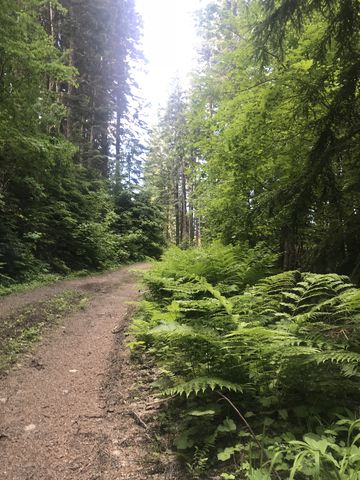
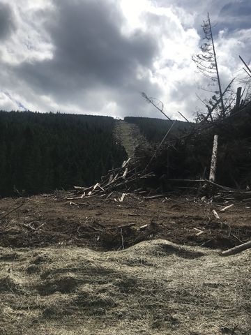
 A bit later there is additional signage, very large, pointing to chairlift #4. Take the spur road if you want to see the chairlift, but there isn’t much there to look at. Instead, continue on trail #130, which is still a wide old fire road that steadily ascends the north side of Mount Spokane to meet up with the Kit Carson Loop Road at the 12-mile mark. Along that stretch you’ll come across the clearcuts where the new ski run and chairlift will be put in. On a brighter note, you might encounter a moose and calf, as we did, wandering up the road and eventually disappearing into the woods.
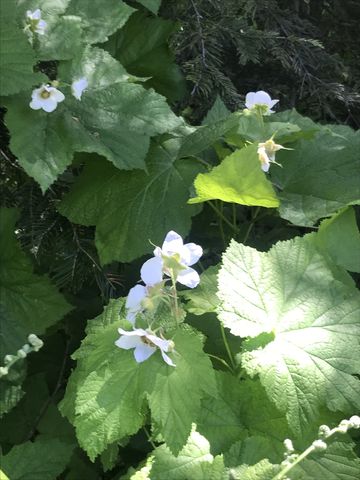
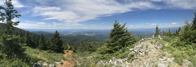
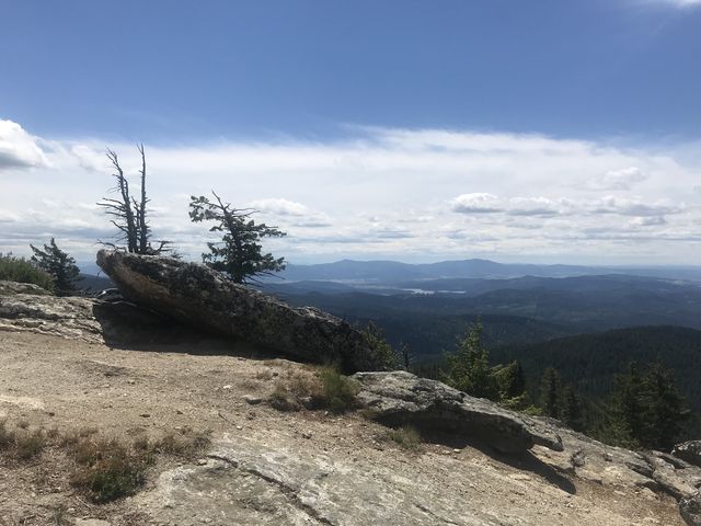
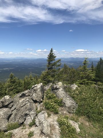 After crossing the Kit Carson Loop Road, you’ll be treated to nice views on the singletrack that ascends for perhaps a mile through thin forest carpeted with lots of beargrass and huckleberries to Day Mountain. A broad green meadow to the west of the peak (5000 feet) offers the best views. Following the meadows across the mountain and to the saddle between Day Mountain and Mount Kit Carson is an absolute pleasure! In that saddle, take trail #160 that shifts southwest and soon climbs (at the fork bear right) to the granite knob that is Kit Carson. The views are spectacular.
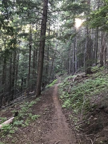
 Backtrack to the fork and take the other prong, which leads downhill to a saddle between Kit Carson and Mount Spokane, merging with trail #130 along the way. A number of trails converge here, including the Kit Carson Loop Road, and a port-a-potty provides relief (this is around the 13-mile mark). Take trail #140 to the right (south side, it is signed; the trail on the other side heads up to Mount Spokane). For a while the path contours softly along the mountain, then switchbacks and descends in earnest. Watch out for mountain bikes along as they go pretty fast in this stretch. Near the 17-mile mark you will reach the Smith Gap, where several trails meet. Amenities include a warming hut and pit toilets. Trail #140 continues on the far southeastern end of the Gap, veering off to the right on an old fire road. Just as you’re wondering how you’d ever get off the mountain at the slightest of incline in that road, a singletrack plunges steeply into a dark cedar forest. Beware, in fact, as there are some very steep sections along this stretch. Trail #140 comes to an end just past the 18-mile mark at a point where it leaves the park. A gravel road picks up there and drops down to the Bear Creek Lodge on the Mount Spokane Road.
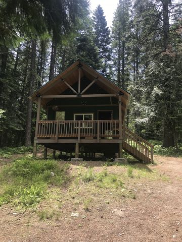
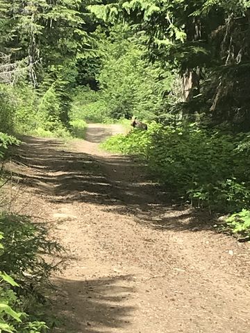
 At the lodge you have choices to make. The easiest way is to hike back on the Mount Spokane Road a quarter mile to the car. The most tempting choice might be to stop at the lodge for a drink. Instead, we chose the scenic route, which meant crossing the road and at the lower end of the Bear Creek parking lot crossing Deadman Creek on a footbridge. Immediately after that crossing, take a left and follow the fire road uphill and into the woods (signed “shortest route to trail #120”). It’s a pleasant walk through the woods, with the thunder (or whisper, depending on season) of Deadman Creek in your ears. At the 20-mile mark, the trail switchbacks and meets up with trail 120A (or some such–whatever the long way is called). Continue uphill, which at this point is nearly level, to the fork with trail #122. Take that downhill to the trailhead.
Enjoy this hike? Let us know in the comments below!
Alternate Routes
- You could shorten the loop by parking at either the snowshoe lot (at the elbow halfway up) or the snowmobile lot (in the saddle below Mt Spokane). Use trail #100 to connect to the rest of the loop
- Take a look at the trails The Friends of Mount Spokane State Park suggest. A few great suggestions!
© 2016 – 2018 NaughtyHiker. All rights reserved. No duplication without permission.
Thank you for sharing your adventure. Just read your post and now I am excited to try this on Summer. Can’t wait.
Thank you again! Always love your trip reports and especially love seeing Naughty enjoying herself….
Glad you like. There sure are lots of pretty places out there!