The hallmark of the Mallard-Larkins are steep pinnacles, dozens of sub-alpine lakes, a flora ranging from rainforest-like ancient cedars to subalpine fir, and world-famous herds of mountain goats and elk. Couple that with unequaled solitude and tranquility and you have the makings for a superb backpacking trip through some of Idaho’s finest woods.
| Location | Bitterroot Mountains |
| Rating | 4.8 out of 5 |
| Difficulty | Strenuous (steep, fordings, challenging trail) |
| Distance | 83.0 miles |
| Duration | 35:51 hours moving time (hiking) |
| Elevation Gain | 18,000 feet |
| High Point | 6,854 feet (Snow Peak) |
| Low Point | 2,300 feet (Little North Fork Clearwater River) |
| Trail Type | Lollipop |
| Trailbed | Packed dirt, talus, gravel, forest roads |
| Trail# | 263, 106/106A, 99, 100, 55, 50, 108, 93/93A, 65, 7, 111, 11, 110, 479, 25 |
| Water | Rivers and lakes are available throughout. Copper Ridge is dry. |
| Status | Proposed Wilderness |
| Administration | St. Joe National Forest, Idaho State |
| Conditions | From good to poor. The best trails were #11 and #55. See text below for details. |
| Permits | None required |
| Camping | Canyon & Buck Creek, Bathtub Mountain, Snow Peak Pond, Little North Fork Clearwater & Canyon Creek, Mud Lake, Larkins Lake, Crag Lake, ahead of Heart Pass, Heart Lake, Northbound Lake, Mallard Lake, Fawn Lake, Skyland Lake, Table Camp |
| Maps | USGS Red Ives Peak, Bathtub Mountain, Montana Peak, Mallard Peak, Buzzard Roost, Pole Mountain |
| Trailhead | The trailhead is at the Red Ives Ranger Station, about 1.5 hours from St. Regis, MT. Follow Little Joe Road (#282) and Gold Creek Road (#388) to the St. Joe River Road (FH 50). The Montana side is a well-graded gravel road, the Idaho side is blacktop; total length about 30 miles. When you hit the St. Joe river turn left onto FH 50/St Joe River Road. This is a one-lane (mostly) paved road. Continue to the Red Ives Range Station, about 8 miles.
Google Directions (47.05639, -115.352645) |
| Season | July – September |
| Squirrel Density | They’re everywhere! |
| Features | Mountaintop, Lake, Waterfall, Riverwalk, Structure, Grove, Meadow |
| Distance From |
|
| Resources | |
| Nearby Hikes | |
| Date | August 27, 2018 |
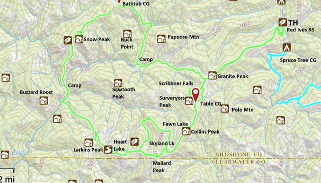
 I’ve been craving to hike the Mallard-Larkins region ever since the Scribe broached the subject last year. Unfortunately, our attempt then was thwarted by forest fires, but this year looked promising. The Scribe spent a year strategizing about a lengthy 5-day, 100-mile loop, which, as you can see by the mileage above, didn’t come to fruition. He blames trail conditions and excessive elevation gain. I blame his lack of endurance. And his lack of planning. He figured on 12k or 13k of cumulative elevation gain, and that turned into 18k for the 83 miles we did hike. I can’t read maps, so don’t look at me. I just go where he goes, no matter how idiotic. Anyway, what he came up with was a sweeping loop from the St. Joe River to Snow Peak, succeeded by a return via the Mallard-Larkins crest, with several smaller loops and excursions attached to the main loop, providing the ability to add on or skip mileage as he saw fit. Of these planned add-ons, we did just Scribner Falls and Skyland Lake; options we passed on included Hero Lake, Black Mountain, and Pole Mountain/My Ruby Creek. For GPS navigation, he used the USGS “National Map” in the GaiaGPS app, which fairly accurately show the loop with two exceptions. The first exception was the ascent to Copper Ridge, where the first mile now follows a new route on an old logging road and the second was the descent from Snow Peak to the Little North Fork Clearwater, which was not shown at all.
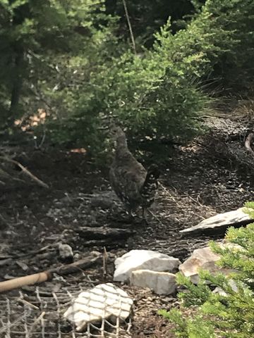
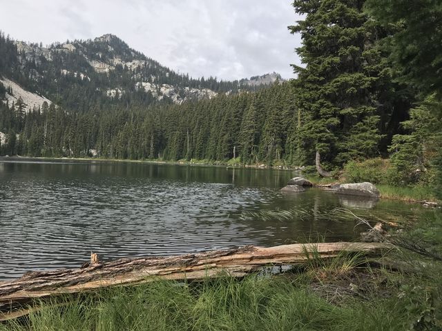
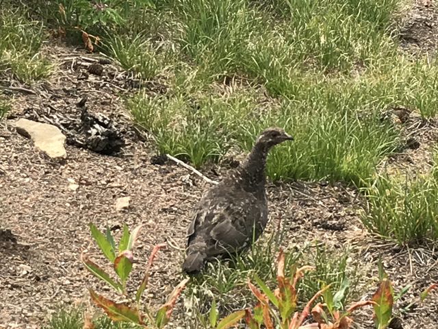
 The Mallard Larkins Pioneer Area and the Snow Peak Wildlife Management Area are squeezed in between the St. Joe River, near its headwaters, and the Clearwater River. The Snow Peak area encompasses some 32,000 acres, shared between the state of Idaho and the Forest Service, as it originally consisted of a typical railroad-grant patchwork of ownership (the state bought its share from Plum Creek Timber in 1989). To the south, the Mallard-Larkins Pioneer Area adds another 30,500 acres. This region of steep granite pinnacles, varied rainforest-like flora, and dozens of alpine lakes is a haven for wildlife, particularly elk, mule deer, and mountain goats, as well as predators, such as wolves, black bears, and cougars, while its waters are full of trout, salmon, and frogs and the air teeming with birds, including eagles, woodpeckers and grouse. Notably, though, we did not spot any mallards at all, not even at Mallard Lake. The entire Roadless Area encompasses 260,000 acres and has been a candidate for wilderness status for decades, to no avail.
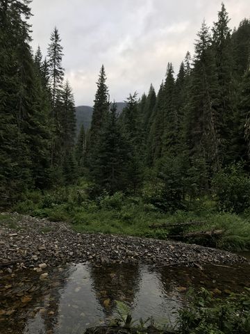
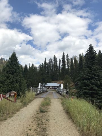
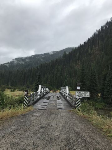 With that preamble, let’s skip to that fateful and rainy Monday morning in August that had as parking the car at the Red Ives Ranger Station, following 3 hours of tedious (the Scribe claims–I slept) driving. The Scribe stopped inside to entrust the particulars of our excursion with the rangers, leaving my rather agitated self in the car (the imminence of a long hike usually renders me quite agitated; it just can’t be helped). After a lengthy eternity he returned and we commenced our journey, at first crossing the St. Joe River on a convenient bridge just as the rain let up. The objective of Day 1, per the Scribe’s grand plan, was to hike the Copper Ridge trail (#263), do a small detour to Scribner Falls and back (#106, 106A), then drop down to Buck Creek via the Upper Canyon Creek trail (#99). If you keep track of stats, that is 19 miles, with 3,500 feet of cumulative elevation gain, and it took us 7:40 hours (moving time).
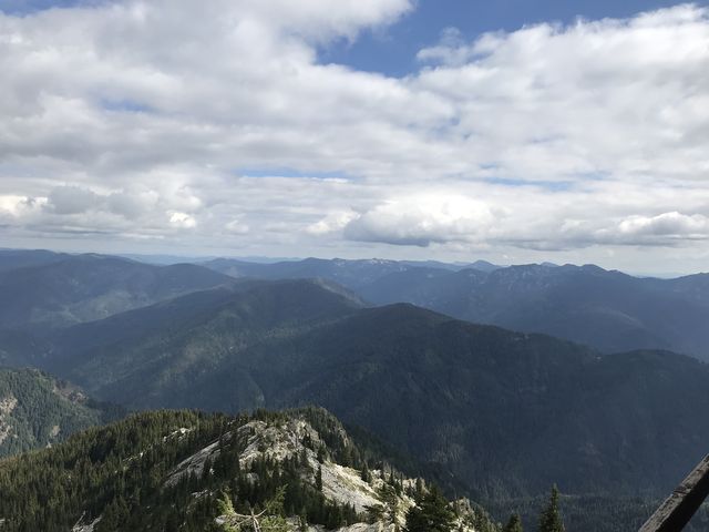
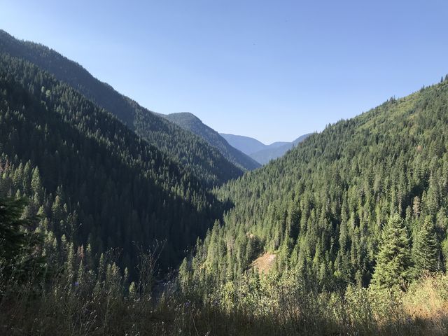
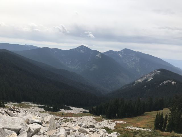
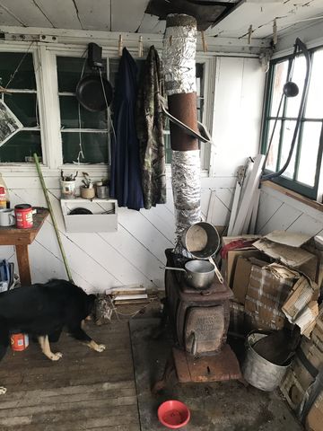
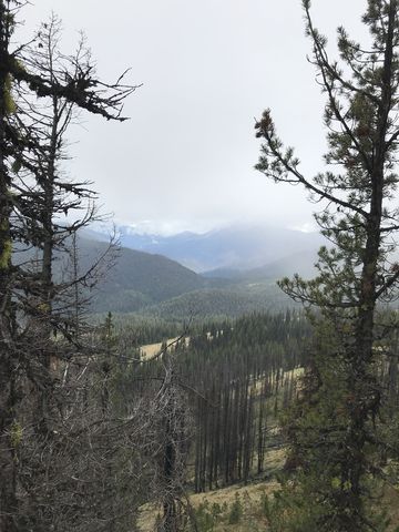
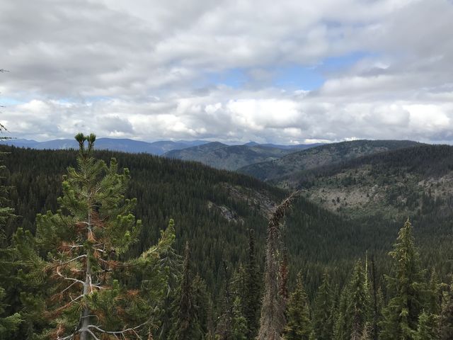
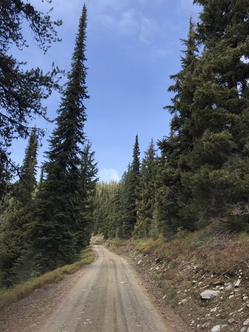
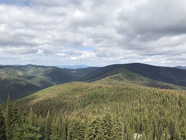
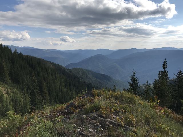
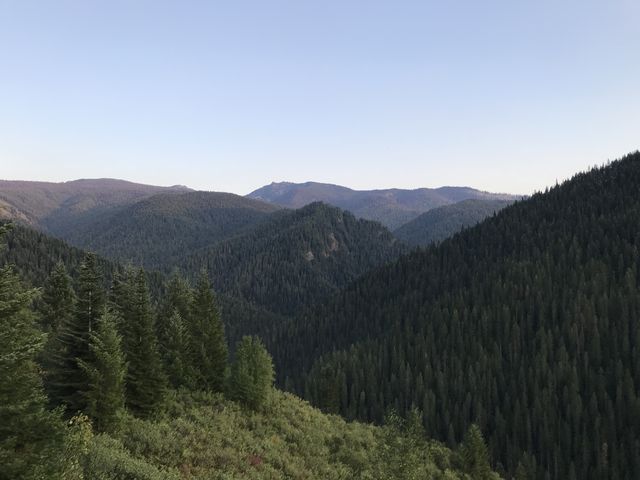
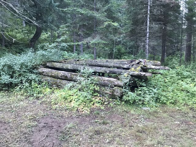
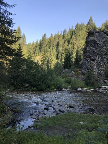
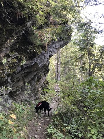
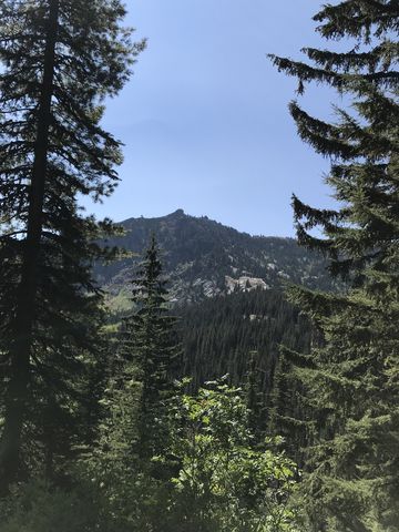
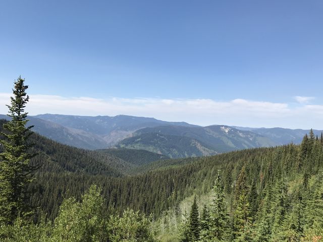
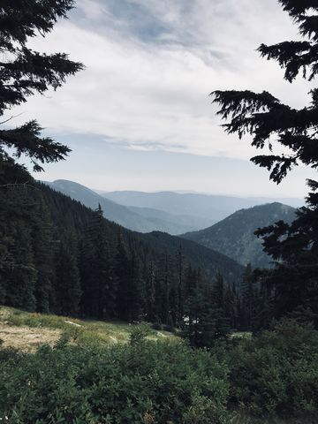
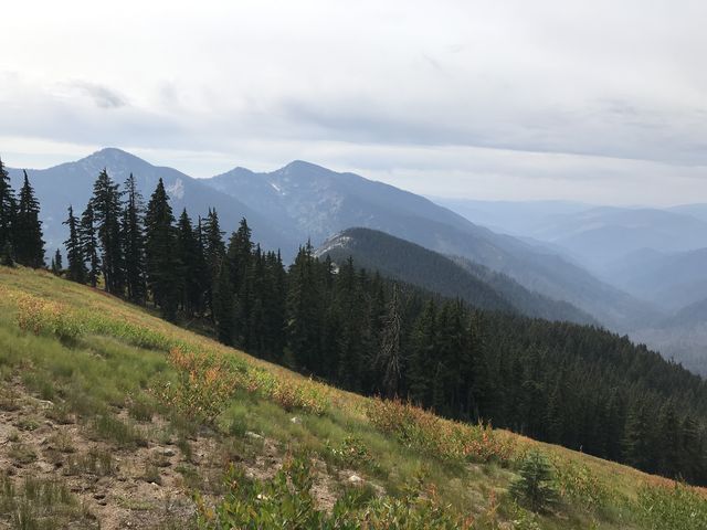
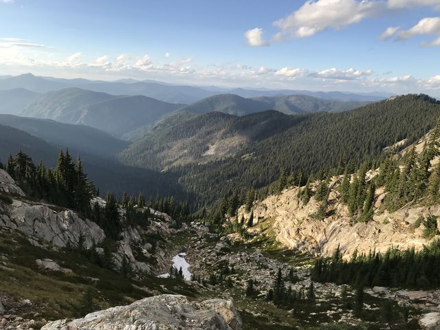
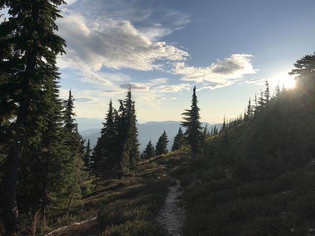
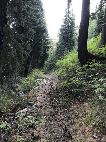
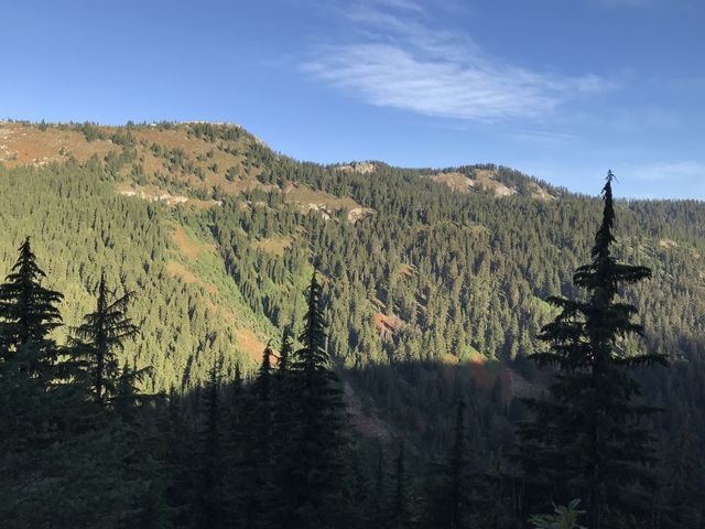
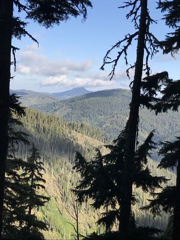
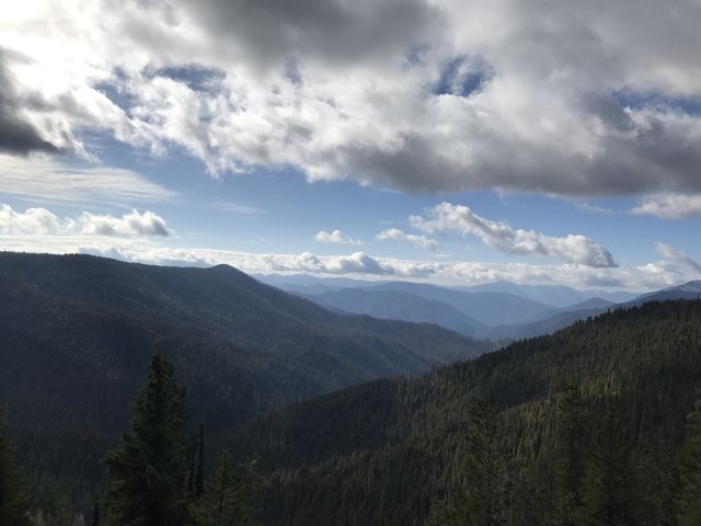
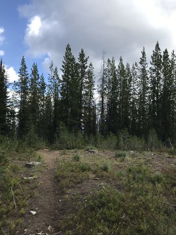
 On the far side of the bridge, the Scribe chose the no longer maintained trail depicted on his map. This meant turning right and following a very faded path zig-zagging up the steep hillside to Copper Ridge. The still dripping shrubbery pushed hard into the trail from both sides and rendered the Scribe’s shoes, socks and pants soaking wet within minutes. It rendered me wet, too, but I tend to shake things off, quite literally. To make matters worse, we quickly lost whatever remnants of a trail there were, but thankfully the undergrowth was comparatively light and we climbed the ridge head on. At the ridgetop we rediscovered the faded trail, now littered with deadfall, as ridgetops tend to bear the brunt of the wind. And it was deadfall of the most difficult kind, not simple logs to step over, but entire trees, branches and all. The going was tough until we came to a forlorn structure in the woods, about a mile into the hike. It was made of metal, not gingerbread, and there was no sign of a witch. There was, however, a wide twintrack next to it, and that twintrack is the new routing of trail #263 (to play it smart, after crossing the St. Joe, you continue on the twintrack through the forest service’s equestrian facilities and uphill for perhaps 2 miles; the shortcut simply is not worth the bushwhack). Riding Copper Ridge, the twintrack soon morphs into a well-traveled and recently-maintained singletrack that climbs steadily uphill. Ahead of Copper Point, it departs from the ridge and contours along the Point a bit, but regains the ridge shortly after. The trail is mostly hemmed in by trees, supplemented with a few neat spots where you can view the St. Joe River far below. The entire length of the Copper Ridge is around 8 miles or so, and it passes the foundation of an old lookout tower on Club Point and offers splendid views from Granite Peak at 6400 ft. Those views include Pole Mountain and in the distance the Mallard-Larkins crest. Then it’s a quick downhill run on the other side of Granite Peak, where the trail is easily lost, but you’ll see FR-201 below, so you know where to aim.
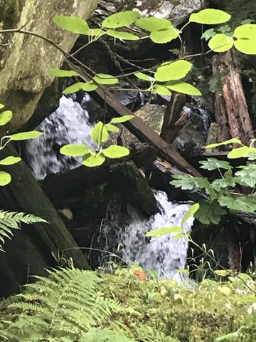
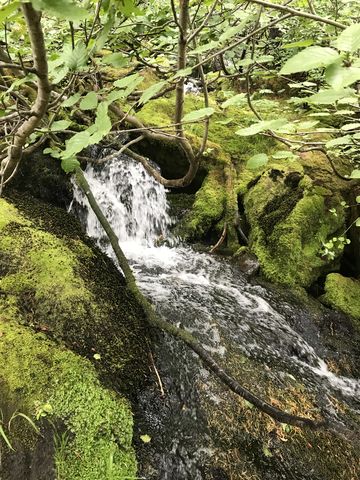 FR-201 runs north and west, with a spur leading southeast to trail #54 along Timber Creek. Follow FR-201 west for about a quarter mile to the trailhead of Upper Canyon Creek (#99). The Scribe decided to pursue a little side trip to Scribner Falls (#106), and thus we stayed on FR-201 for another mile to a fork, where we turned right into what appears to be a car-camping site. Scribner Falls trail #106 takes off to the left (signed) of this clearing and was in good condition. Shaded by a fir canopy and lined with huckleberry bushes, it skirts the Canyon Creek headwaters, contouring more or less flattish along Surveyors Peak for a tad over a mile. About halfway along, Scribner Falls comes into view, cascading down a barren rock wall on the opposite hillside, and in the distance we spotted majestic sheer cliff sides of Snow Peak. Trail #106A branches off to the right and drops gradually lower. The trailbed is somewhat faded in places, and there is a fair bit of downfall, but it was recently blazed. However, the trail simply disappears once you reach the brook (Scribner Creek?) in less than half a mile and it’s a bushwhack to follow it to the rock cliff. We didn’t actually see the falls from this spot due to the steep dropoff and contended ourselves with panoramic hillside views of, mostly, trees.
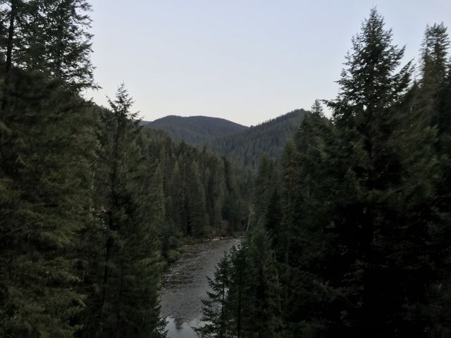
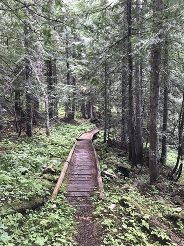
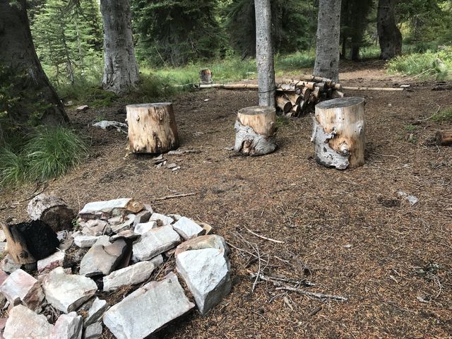
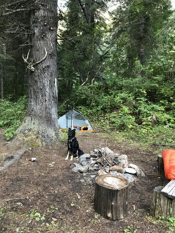
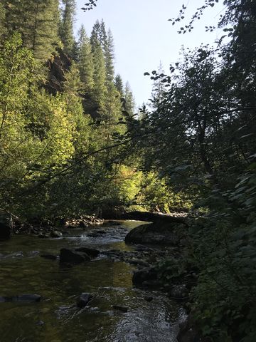
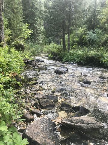 Retrace your steps to the Upper Canyon Creek trailhead, and then it’s downhill for about 6 miles on a pretty good trail. Views are limited, but higher up you’ll catch a glimpse of Snow Peak once or twice. It’s a relatively moist section, and frequent equestrian use took its toll, but there is buckling boardwalk to help out when it gets boggy. Not quite halfway down is a campsite, evidently very popular with horsemen. The camp is to the right near (above) Canyon Creek, while the trail turns left. Quickly afterwards you meet up with Canyon Creek, which the trail then diligently follows to the confluence with Buck Creek. This stretch is lush and pretty and verdant, all at the same time, and many times to such an excess that you won’t see the trail hidden beneath shoulder-high ferns. Also, be prepared for about a dozen creek crossings. With shoes still soaking wet, the Scribe didn’t care one bit. I never care about such things; in fact, I relish a thorough soaking. About 19 miles from Red Ives is the junction with the Buck Creek trail #100 (signed). In a couple hundred feet, to the right, it led us to a decent campsite next to the creek. Not much in use, it nonetheless came with a makeshift table and an easy bearhang. We set up camp quickly, ate, fell asleep to the hooting of owls and woke, shortly past 5 am, to the bugling of elk.
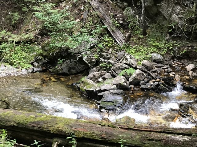
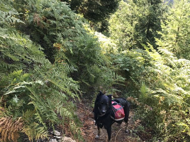
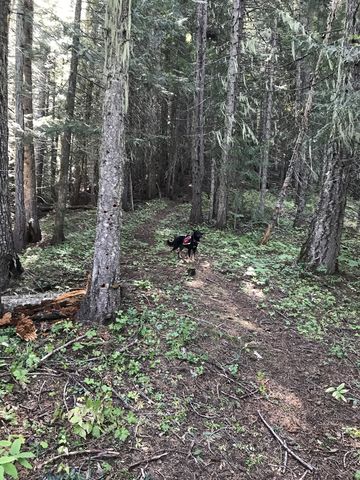
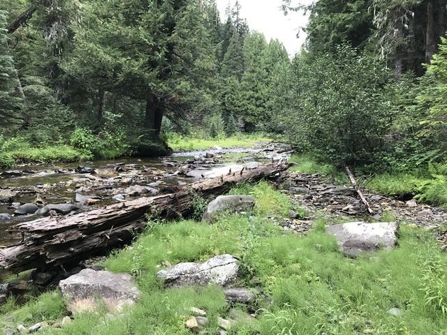 A lot hinged on Day 2, the Scribe explained. He promised we’d make good mileage, easily 25 miles, or more, as the Buck Creek trail is comparatively level, the overall elevation gain for the day modest, and much of the last bit of trail downhill to the Little North Fork of the Clearwater. So much for strategizing. It turned out to be the worst day in terms of overall effort, with mileage merely equivalent to Day 1. The complete stats are 19 miles, 4k of elevation gain, 8:40 hours moving time. Although it hadn’t rained since the start of the hike, and stayed dry throughout, the location next to Buck Creek was less than ideal, with the air humid, the ground soaked, and the trees still dripping. With consternation the Scribe realized in the morning that the tent was as wet as can be and condensation had seeped into his sleeping bag. Shoes and socks were also still moist, which, as he soon found out, was the least of his worries. The morning was chilly, causing us to get moving quickly and taking bets on who would snarf down the cold breakfast the quickest. It wasn’t a fair contest; I always wins. Then the Scribe packed up tent and sleeping bag, wet as it was, and we started out on the Buck Creek trail. The trail soon became a confusing network of game trails, muddy and slick in many places, and littered with downfall. Plus, it seemed our chosen path crossed and recrossed the creek ad nauseam. That said, the creek was gorgeous, bordered as it was by stately Western red cedar, but the trail, or the lack thereof, kept us constantly engaged. More than once the Scribe doubted my trail scouting skills. But he was hard to please. A carefully sawed out section I discovered was quickly dismissed, said sawing being more like gnawing performed by beavers. Well, yes, but the delicious smells! Why wouldn’t I want to pursue that? Even if it led nowhere? The most frustrating sections were the creek crossings, though, with the trail oftentimes commencing further upstream, hidden from view. And smelling a trail in a watercourse is simply not my forte. The hillsides on both sides of Buck Creek are steep and overgrown, making bushwhacking tedious at best. The optimal route, whenever we got stuck, was to stay in the creek. It wasn’t terribly deep and wet shoes can’t get any wetter. Luckily, the trail eventually lifts off the valley floor and climbs a low ridge of Papoose Mountain to join up with the Papoose Mountain trail (not signed). Then it drops back down to Buck Creek and the creek crossings start all over again. It’s probably around 4 miles to the convergence of Buck Creek and Papoose Creek, a location thick with underbrush. Look for bits of boardwalk, but your best bet is following the trail on the USGS National map. The junction with the Papoose Creek trail is signed, but trail and sign are entirely enshrouded in shrubbery.
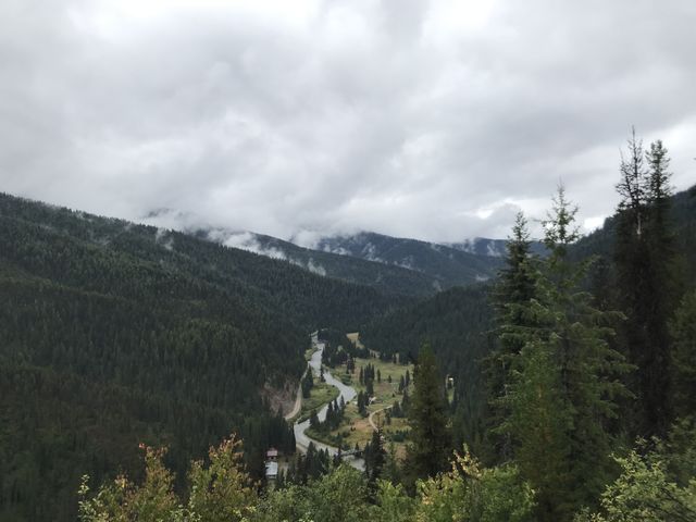
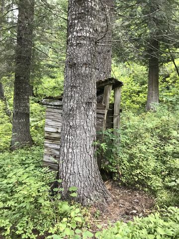
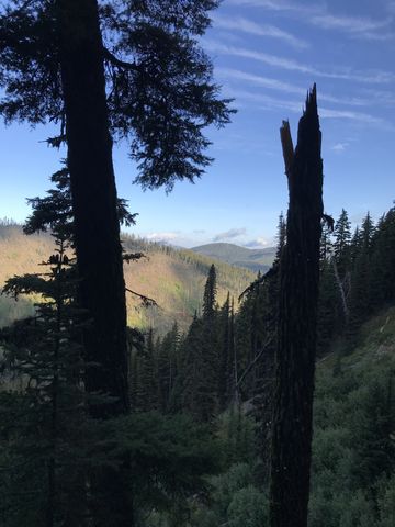
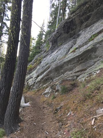
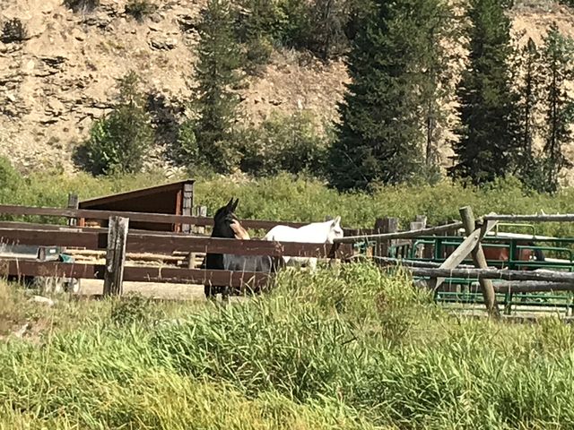
 The trail gets better as it climbs a ridge of Bathtub Mountain, switchbacking up 1000 vertical feet, past remains of giant trees that likely succumbed in the 1910 Great Burn. Then the trail rides the ridge’s spine upwards to FR-201, while offering sneak peeks at the surrounding mountains. The going gets really easy once you’re on FR-201, a dirt/gravel road heading west to Bathtub Camp in less than a mile. The section offers frequent mountain views, especially of Lightning Ridge. Bathtub Camp is geared to equestrian guests, but no one was there while we stopped to refill water. There’s a pit toilet at the camp and an old skid road drops lower next to it. Follow that and then the well-worn singletrack that leads to a shallow puddle of water. While the water filtered, the Scribe commenced the drying process of shoes and socks. Luckily, they would stay dry for the rest of the trip.
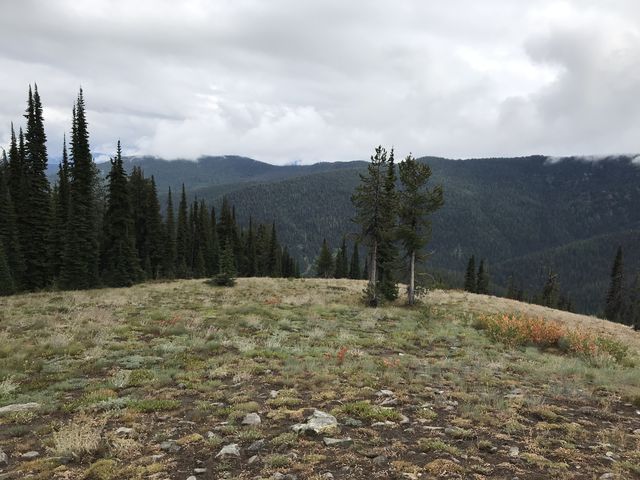
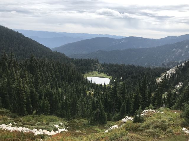
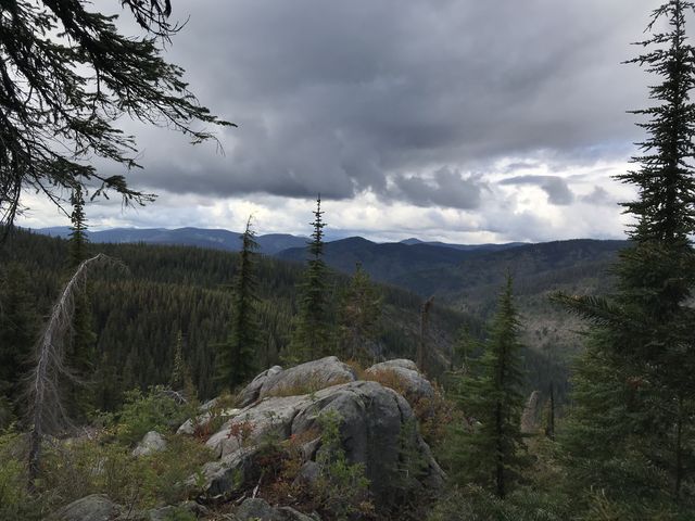
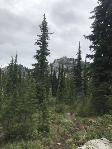
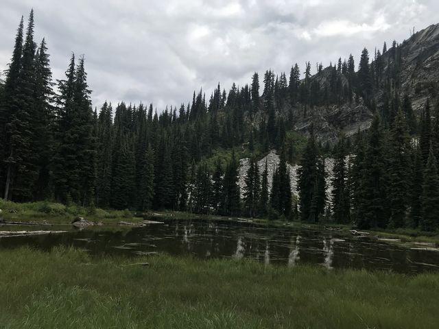
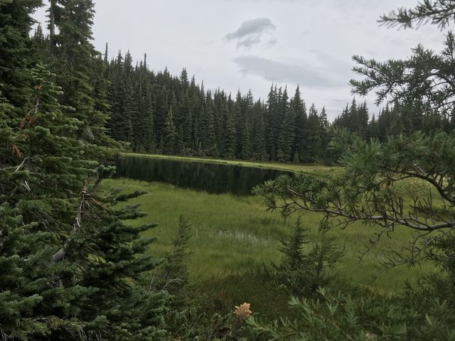
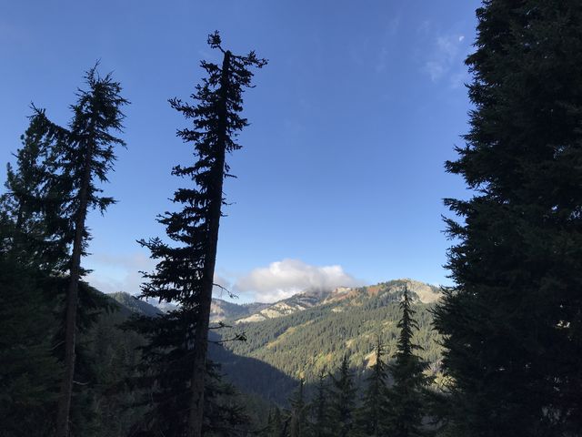
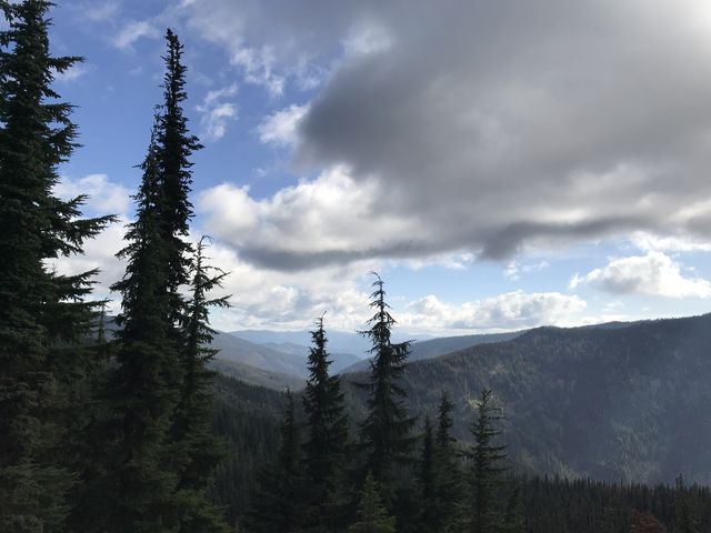
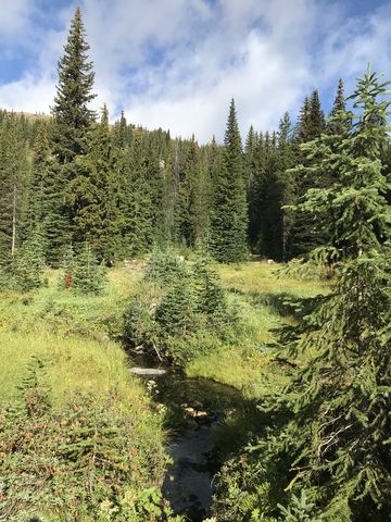
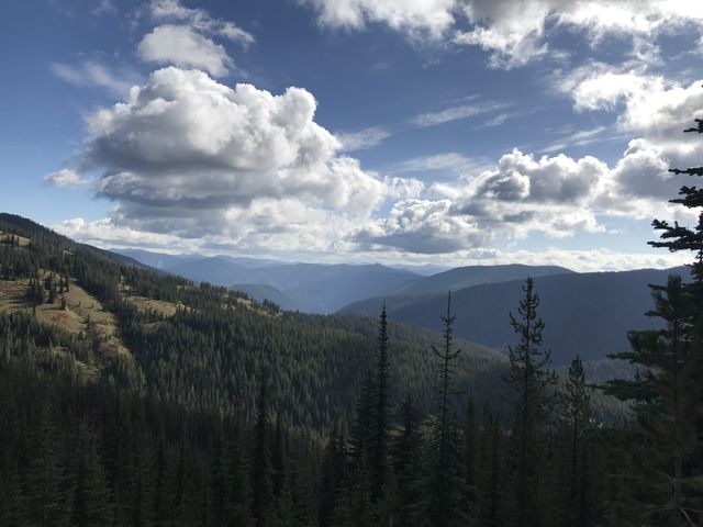
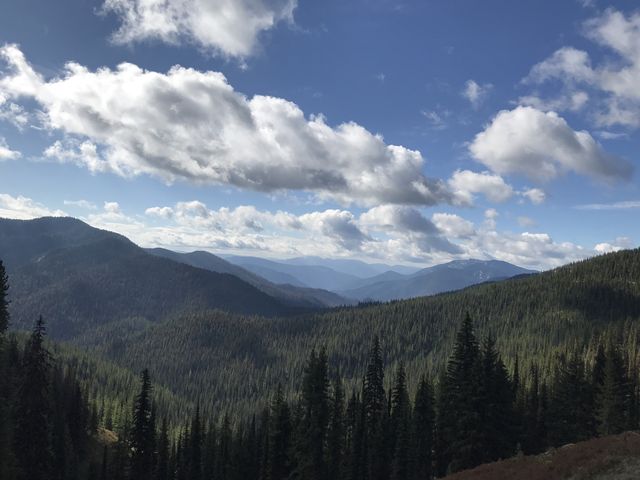
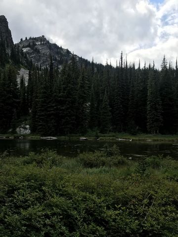 West of the campground, trail #55 (Snow Peak, signed) switchbacks uphill, quickly gaining 500 vertical feet. About a mile in is the signed junction to Lightning Ridge; bear right. The trail is in great condition, a rather wide singletrack, and we made good time. About 2 miles from Bathtub Camp, arrows pointing left (downhill) are carved into the trees. This didn’t correspond to the trail on the map and the Scribe was loath to take a downhill trail when we were supposed to go up. For once, I concurred. Thus, we stuck to the ridge trail, which remained in good condition and continued riding the ridge. The intersection with the Spotted Louise trail we missed altogether (we weren’t going to take it anyway), the only notable sign (if we were even looking in the right spot) being a narrow faded path riddled with deadfall. Shortly afterwards we came upon a small campsite surrounded by woods (it is dry). Continuing along the ridge, the trees finally recede and magnificent views of Snow Peak open up. Just ahead of the final ascent to Snow Peak, a less-used but still obvious trail veers off to the left to an exceedingly nice campsite in a broad meadow, which is likely a shallow pool earlier in the year. Continuing across the meadow and into the woods for another quarter-mile brought us to Snow Peak Pond and another, perhaps even nicer, campsite. This is the last source of water ahead of the Snow Peak climb and really before hitting the Little North Fork Clearwater. The views of the peak are excellent, and if you’re patient enough you might see the local mountain goat gang clambering near the peak. We didn’t.
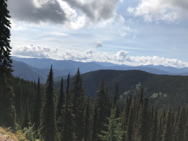
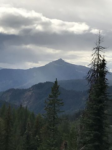
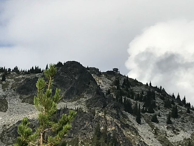
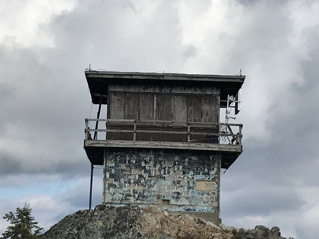 Retrace your steps to the main trail and continue the climb. The peak is less than a mile away, but a steep mile it is, gaining easily 700 feet. At the top you’ll find a defunct lookout tower and astonishing views. There’s even a cell signal, if you dare stepping onto the tower’s derelict catwalk.
 On that last bit of ascent to the lookout tower is a fork in the trail. It’s unsigned and not marked on the USGS National Map, but the older USGS 2016 map shows a hiking trail making its way down to the Spotted Louis trail by means of Spotted Louis Point. Rather than backtrack to the overgrown Spotted Louis intersection with #55, the Scribe chose to take this shortcut, in the hopes of meeting the Spotted Louis trail halfway down and following that to the confluence of Spotted Louis Creek and Little North Fork Clearwater, then continue along the LNF Clearwater to its confluence with Canyon Creek where we’d stay for the night. To make the decision even easier, the trail was in great condition and we made good time.
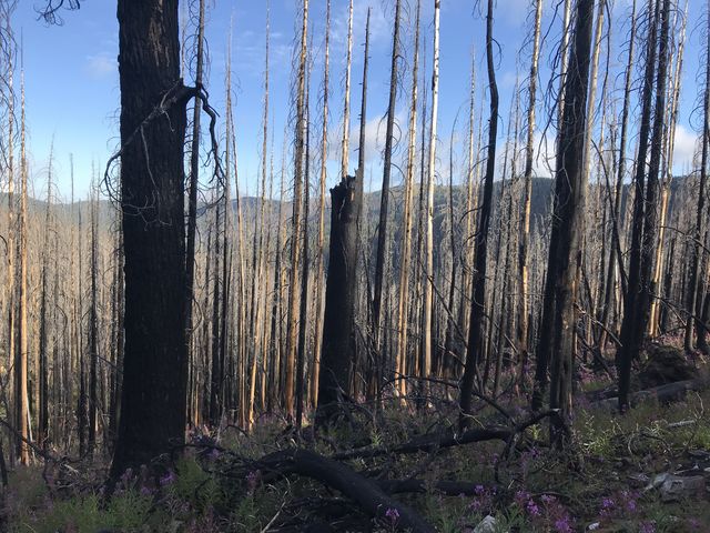
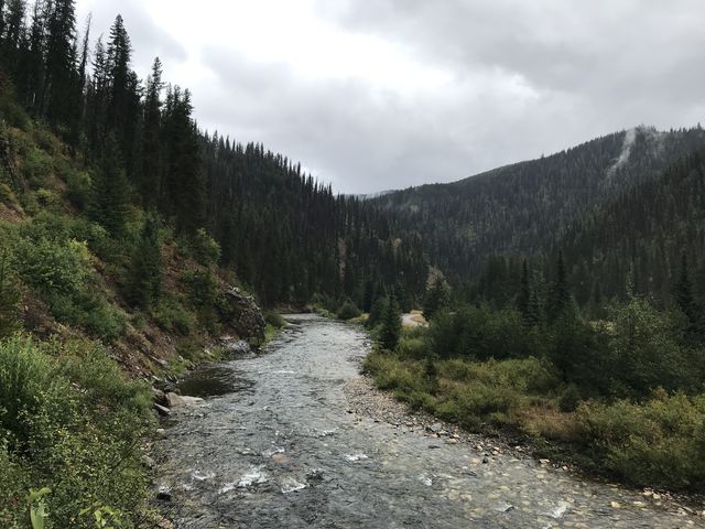
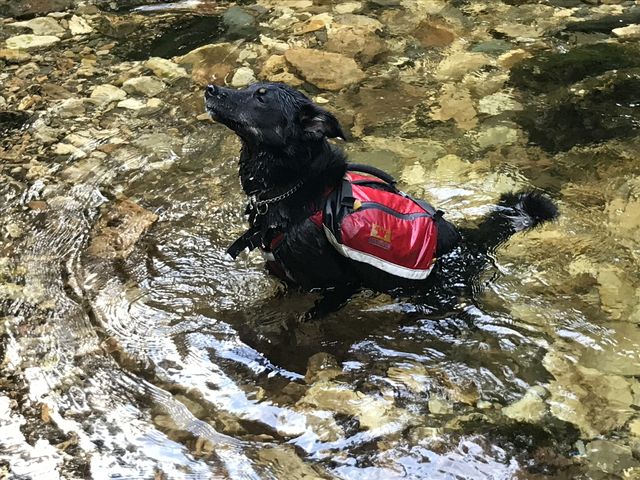
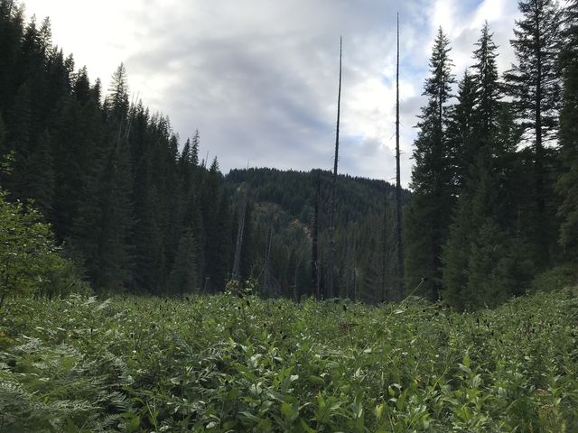
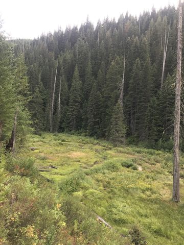
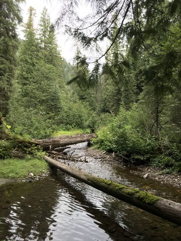
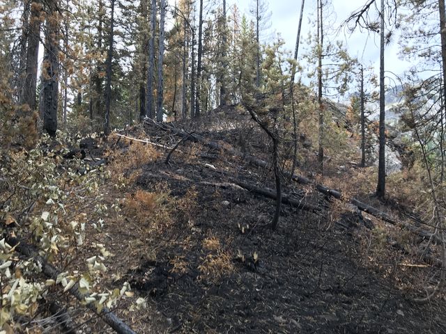 The problem? The trail didn’t lead to Spotted Louise Point. If it did, we entirely missed the intersection. Instead, the trail contoured along Snow Peak high above Culdesac Creek, eventually gaining a ridge and following what is shown on USGS 2016 as trail #55 heading down to the LNF Clearwater confluence with Canyon Creek. For awhile it stayed on the ridge, then strayed into the Triple Creek drainage where signs of an active burn abounded and we had to cross a blackened section, still smoldering and smoking and slick from the rains that had put the fire out on Monday. Through thick forest the trail then dropped further into the Canyon Creek drainage and lost itself in a vast meadow of tall swaying grasses. At the south end of the meadow was an old (hunting?) camp, littered with a number of live traps and fence posts. I discovered a trace of a trail at the west end of the meadow, north of the camp, and we followed that back up to the ridge. The quality of the trail quickly deteriorated, however, while the forest around us grew thicker and more overgrown. Hindsight says there is no trail from this point to the LNF Clearwater. Your best bet is to ride the spine of the ridge, using whatever game trails are available. Alas, the ridge splits at one point and we ended up on the wrong (western) fork. Bushwhacking through impenetrably dense forest, on a steep hillside inhabited, judging by the scat, only by black bears, was arduous to say the least. The distance was only around 200 or 300 yards, but took well over an hour of exhaustive crawling. We never recovered the trail, not even on the eastern ridge. Instead we simply rode the spine of the ridge lower, making use of game trails, which came and went. The last bit was a dense jungle of ferns, out of which we suddenly tumbled onto the LNF Clearwater trail #50. What relief! Plus, the confluence with Canyon Creek was only just around the corner. After crossing it (the Scribe wisely removed his shoes), we stumbled into an excellent campsite, again complete with bearhang and makeshift table and a backwoods privy. It’s the little things that get the Scribe excited; I myself am not too picky when it comes to where and when I leave my mark. The Scribe set up camp quickly while the sky darkened. We ate in darkness, then hit the sack, and were immediately asleep.
 The Scribe’s ambitious schedule cut us an insufficient break on Day 3. His plan had us climbing from 2300-foot LNF Clearwater to 6600-foot Heart Pass, with mileage limited to the 16-18 mile range. After halfway ascending Larkins Peak, we were supposed to detour to Hero Lake, bushwhack to Gnat Point, then bushwhack some more to Gnat Ridge and onwards to Mud Lake. For the night we had our pick of any of a half-dozen lakes along the Mallard-Larkins crest. That was the plan, anyway. Reality was that the prior day’s bushwhacking had exhausted the Scribe’s appetite for any such activity, plus, we didn’t hit the trail until 9 am. Thus, Hero Lake got the boot right from the get-go.
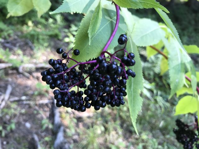
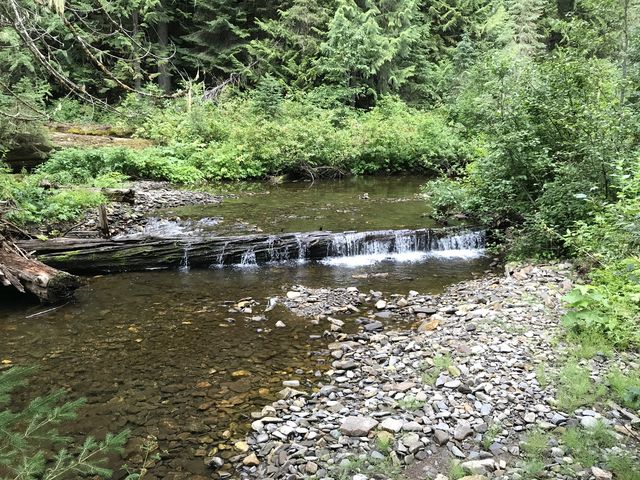
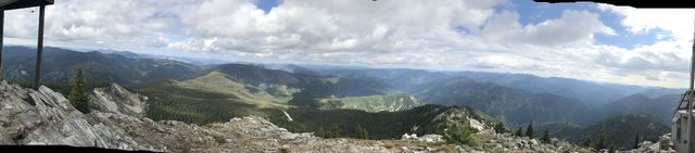
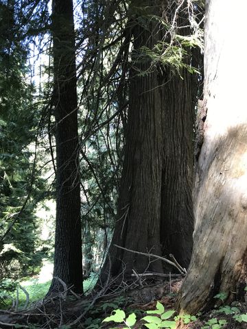
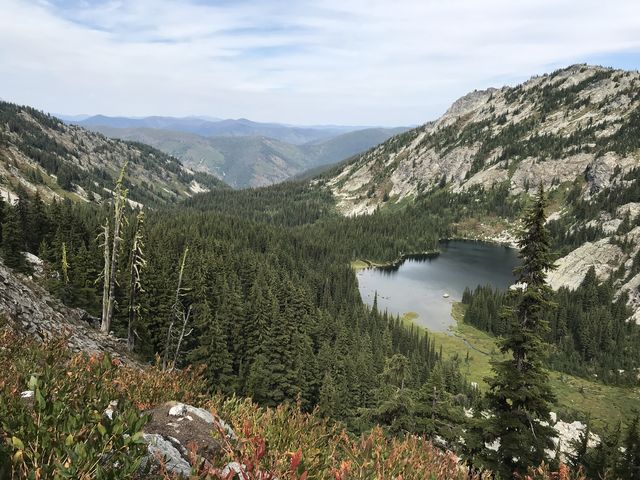
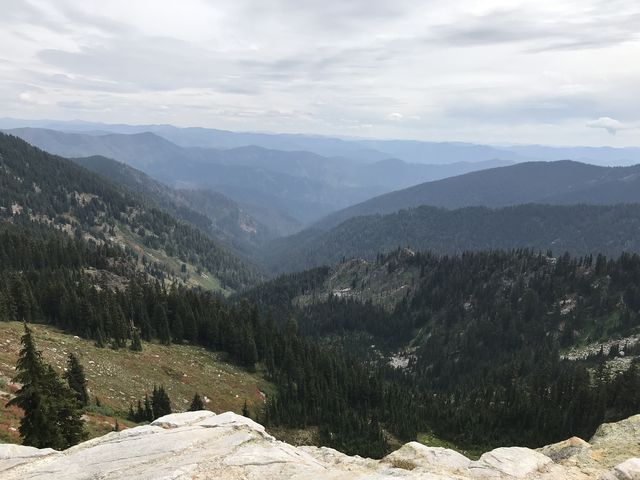
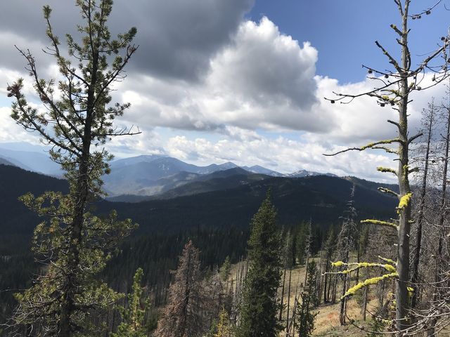
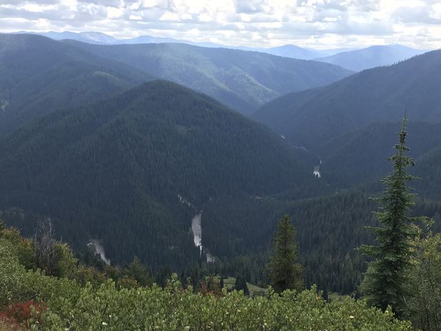
 Leaving the campsite and decaying trapper’s cabin behind, trail #50 parallels the LNF Clearwater, hugging the eastern hillside, and almost immediately meets up with the Surveyor’s Ridge trail, which heads steeply uphill. Continue on trail #50 instead, a trail that promises to be excellent due to comparatively heavy usage. Nonetheless, we encountered a fair number of logs to climb over. In addition, you’ll be fording Sawtooth Creek, which was the deepest creek on this loop, not quite knee-deep, a fording the Scribe performed barefooted. About a mile from Canyon Creek, you arrive at the intersection with the Larkins Creek trail, well camouflaged beneath profusely-growing ferns. This is also a good spot to take photos, as you have pretty views into the LNF Clearwater drainage as well as up the Larkins Creek drainage. We swung a left and disappeared into the ferns along the southwestern face of Mulligan’s Hump, steadily gaining altitude and just as steadily fighting the brush leaning heavily into the path. The trail approaches Larkins Creek at a waterfall, which is audible but not visible, then parallels the creek for a while, only to veers away again and switchbacking steeply uphill through sun-blocking forest. Shortly ahead of the Hero Lake fork is a magnificent ancient grove of cedars that survived the 1910 burn. The Hero Lake junction is rather confusing, though, with an outfitter’s trail in excellent condition branching off to the right (and leading nowhere in particular) and the Hero Lake trail a rather faded footpath to the left. To continue on #108, go straight, which is slightly left and uphill. There are several signs pointing out Hero Lake and Larkins Creek, with the first one correct and the second one pointing into oblivion for Larkins Creek (just follow the trail uphill). The incline lessens and the trees retreat, giving way to small wildflower-rich meadows and formidable views of Larkins Peak and the North Fork Clearwater drainage. Soon the fork to Mud Lake and Larkins Lake appears, the post signing the former lying on the ground about a dozen steps uphill of the Larkins Lake junction. Both lakes are well worth a visit and feature campsites. Mud Lake is prettier (stocked with rainbows) and Larkins has the better campsite. The Mud Lake spur is only a few hundred yards long, while the Larkins Lake trail stretches out for a bit over a quarter-mile to a bowl nestled beneath Larkins Peak. Continuing straight, the Larkins Creek trail continues ever higher, lined with delicious huckleberry bushes and offering grand views of Larkins Peak and Lake. Nearing the top, the trail intersects with #240 a few times (#240 heads over to Larkins Peak, Smith Ridge, and FR-700). Continue on, and still climbing slightly, the trail bypasses a not-to-be-missed ridgetop with fantastic views across Crag Lake and Crag Peak. The view was in fact so breathtaking that the Scribe cancelled our 100-mile target right there and then (we weren’t going to make it anyway) and ended up spending half an hour resting, taking in the view, and watching a mountain goat and kid traversing the talus slope beneath us and finding a safe resting place on a narrow ledge on Crag Peak’s western face. Heart Lake, the Scribe then announced to anyone who was listening (no one did), would be the destination for the day.
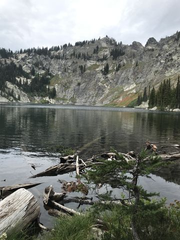
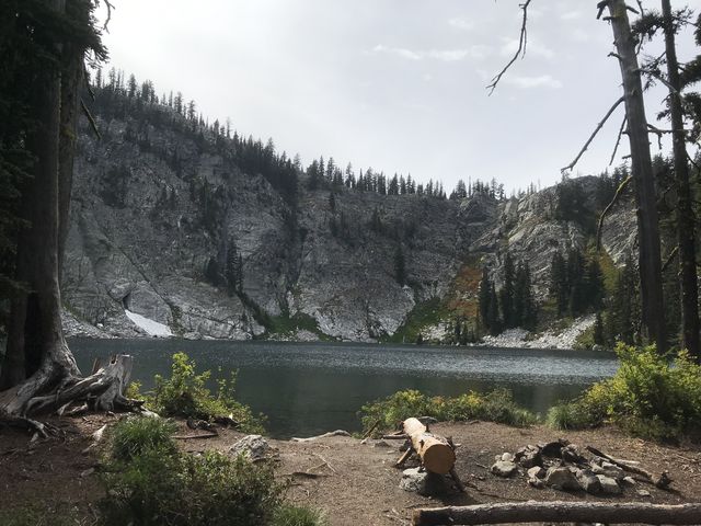
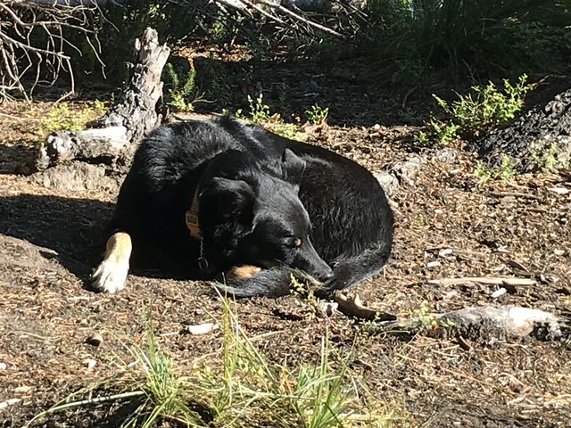
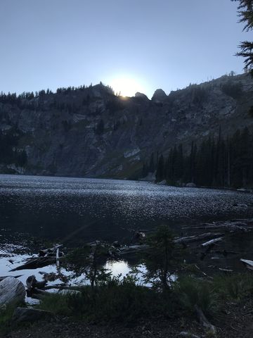
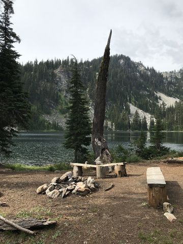
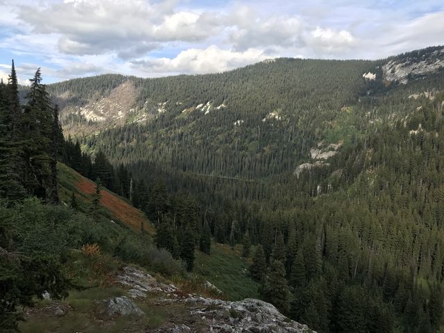
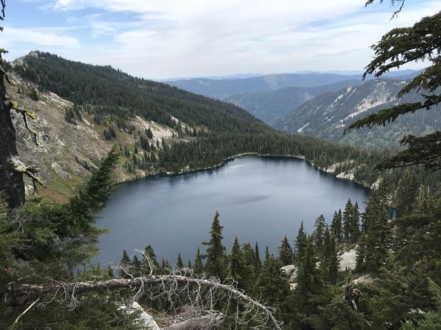 Continuing on, the trail, now called Heart Pass #65 and in good condition, contoured around Crag Peak to a decent campsite with excellent views to the south. It came with a small trickle of water, but we passed and ascended towards Heart Pass. From this location you’re treated to a first glimpse of Heart Lake (stocked with rainbows), the largest body of water in the Mallard-Larkins. The trail drops down steadily, crossing the northern face of Heart Peak, which is mostly talus, and the views of the lake and its bowl just get better. The final junction to the lake is unsigned but hard to miss (trail #7), descending to the eastern end of the lake, near its outlet. There’s a good campsite right there, but an even better one, and rather spacious with its own private beach, awaits a bit further on. Exhausted, we called it a day, even though it was only shortly past 4 pm. The Scribe set up camp, which seemed to take forever. But I didn’t care. I found a nice and sunny spot in the dirt near the lake, dug a shallow pit and curled up in a doughnut. The squirrels could wait. Rest was needed first. The stats for Day 3? 10.5 miles, 5k elevation gain, 5:40 hours moving time. Nothing to write home about, but the nearest post office was too far away anyway….
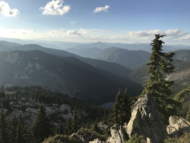
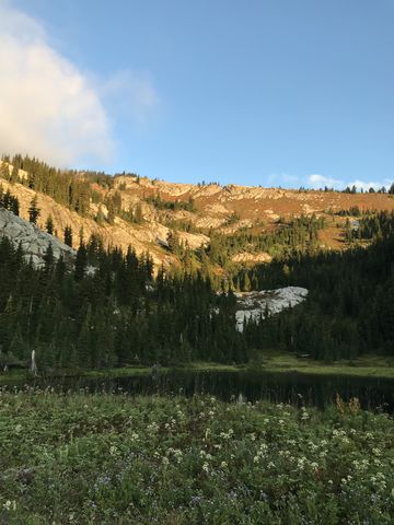
 With camp duties complete, we spent the remainder of the day at the beach mostly doing nothing while sleeping bag and tent and shoes dried in the hot sun. Towards evening we explored a small rise east of camp, which rewarded us with phenomenal views of Mallard Peak (the tiny speck atop is the lookout tower) and Northbound Lake. Then it was back to the lake where we spied on a lone mountain goat at the far end of the lake and marveled at the perennial patches of snow on Heart Peak’s northern face.
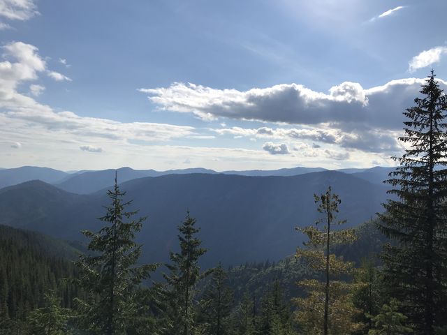
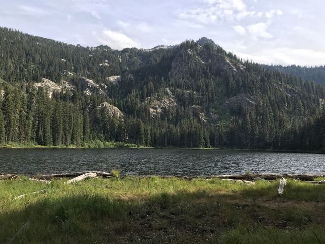
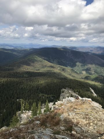
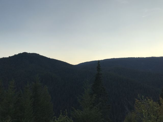
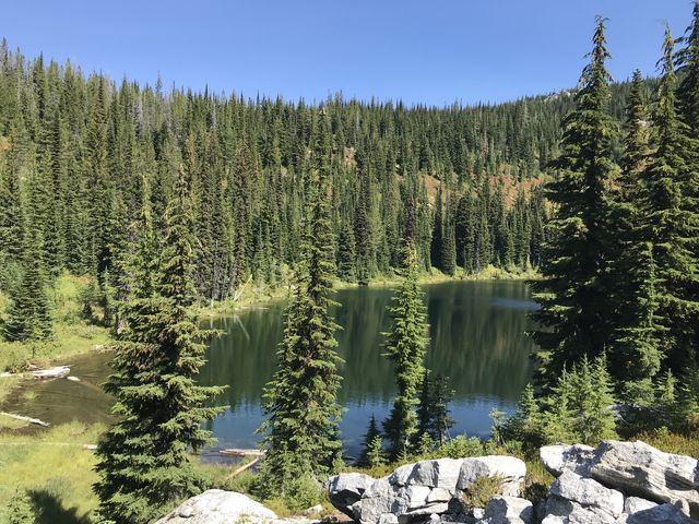
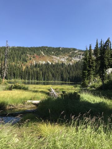
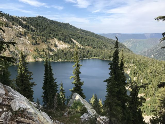
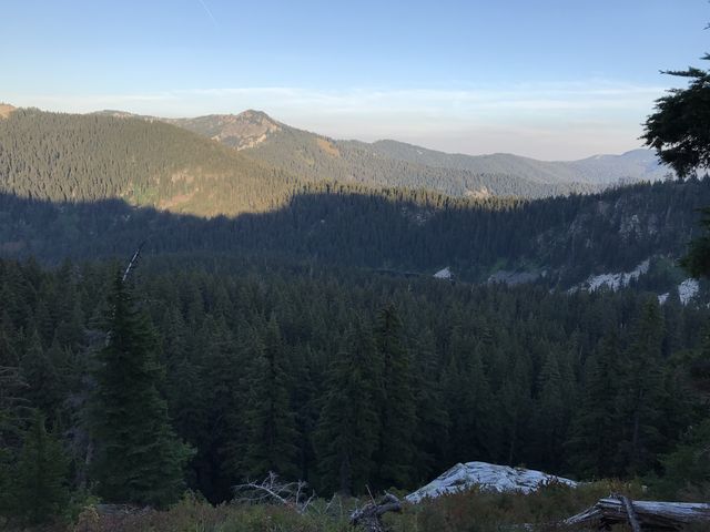
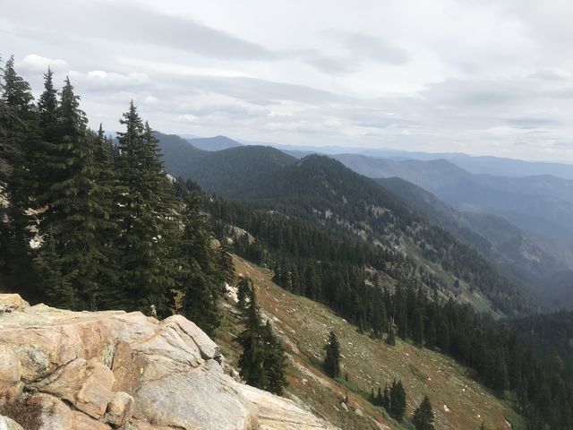
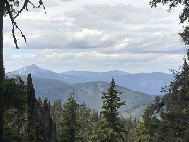
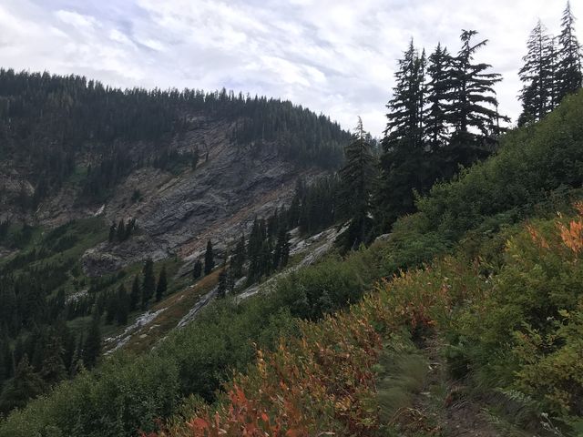
 Well rested, we started Day 4 early, at first backtracking to the junction with #65, then following that trail eastbound. Not far along we hit upon a campsite in a green glen, bordered by talus, beneath Heart Peak, high above Northbound Lake, and complete with a small trickle of water. We continued on, soon re-gaining the ridge and then the fork to Northbound Lake #111. This trail, in excellent condition, switchbacks downhill for less than a mile to a pretty lake stocked with cutthroats and ringed with great campsites. After filtering water, we backtracked uphill and continued on trail #65 for another mile to the junction with Martin Creek trail #479. Trail #65 then contours along the southern side of Mallard Peak, with the forest retreating and giving way to steep sub-alpine meadows and talus slopes. The views are fantastic to the south towards Black Mountain, the tallest peak in the Mallard-Larkins. The traverse comes to an end at a four-way junction beneath Mallard Peak, about 4 miles from Heart Lake. Left and up is trail #599 to the Mallard Peak lookout, right is trail #399 to Nub Peak and Black Peak and straight is the route back to Red Ives via Collins Peak. Views from this spot are spectacular, particularly into the Heather Creek drainage. Leaving Mallard Peak for later, we pushed forward (ie, straight) on what is now called Mallard Peak trail #11, steadily losing elevation as it drops through view-packed open country downhill, past the Fawn Lake turn-off, to Mallard Lake in roughly a mile. Along the way we met the only other hikers on this trip, a fisherman headed for Heart Lake and a couple of bow-hunters also intent on reaching Heart Lake.
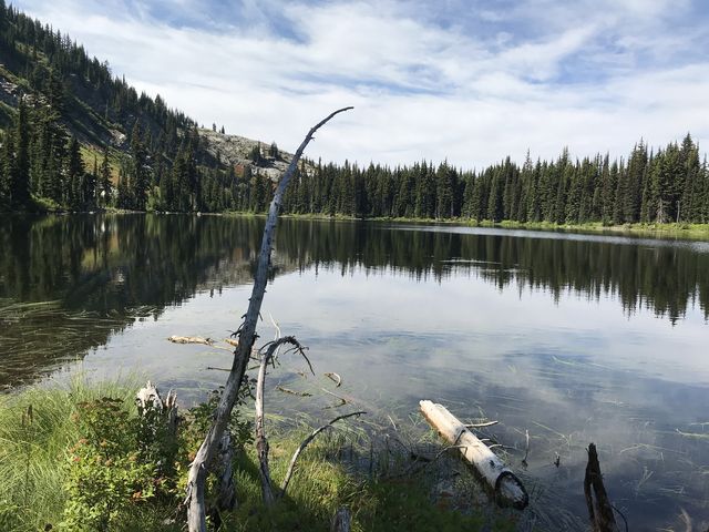
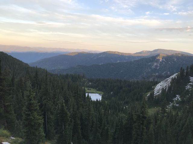
 Unlike Heart and Northbound, shallow Mallard Lake isn’t surrounded by sheer cliff walls; rather, it’s a pretty pond in a meadowy and marshy basin, making it prone to bug infestations. The lake is a bit off-trail, less than a quarter-mile, with the junction signed. We set up camp at the south end of the lake, with the campsite slightly in the woods and away from the water. The Scribe hung our food and heavy equipment out of reach of bears and with pleasure I noted that my pack also was going to be left behind. I had developed some chafing at one elbow and am not particularly eager to wear a pack anyway–who is? With a lightened load we set off once again, backtracking uphill a short distance to the junction with Fawn Lake trail #110. Trail #110 was in good shape and merely contoured along Mallard Peak for 2 miles through fairly dense forest with views of the Collins Ridge. Invigorated by the lack of baggage, I took exploration a bit more serious and that led me to a mule deer intent on playing catch. I complied, until the Scribe’s whistle started to sound dull in my ears. Knowing that he gets his undies in a knot when I don’t show up instantly, I gave up on the deer and rejoined the irritated Scribe on approach to Fawn Lake.
 If you like the stereotypical alpine lake, cradled by vertical granite walls and surrounded by lush-green coniferous forest, you’ll absolutely love Fawn Lake’s deep sparkling waters, teeming with cutthroat trout. The are several campsites, and the water is refreshing, too! Beyond the lake, trail #110 is labeled primitive, which meant frequently climbing across fallen trees as the path ascended to the ridgetop. Overall, the trail isn’t too bad, though until you get to Martin Peak at the lower end of the ridge. There, the thickly overgrown trail (“hard” shrubbery–the type that doesn’t yield when you step on it) switbacks steeply lower. This meant mountain ash, elder, alder, among others that entirely obscured the trail and made the downhill hike quite torturous (if you’re thinking about doing this part with horses you might want to reconsider). At the bottom, the trail suddenly spills out onto Northbound trail #111 at an unsigned and easy-to-miss junction. Swing a left and follow #111, in good condition, for too short a distance to a fork, the right being #111 and the left #479, Martin Creek. Take the left, which was actually in decent shape, having seen its share of equine usage. You’ll have to climb over the occasional tree and deal with some muddiness, though.
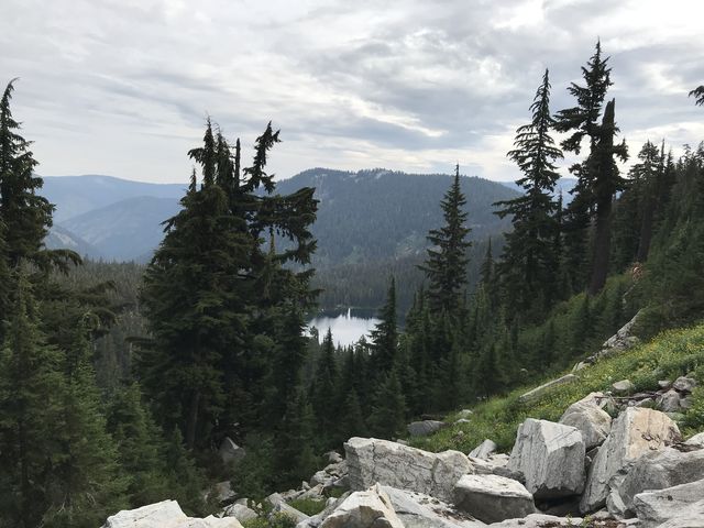
 The turnoff to Skyland Lake is not as depicted on the National Map; rather, it’s closer to the lake and neatly signed. The spur trail is not even a quarter mile long, the lake is stunning and comes with a large and nice campsite that obviously gets a fair bit of use. Though the lake huddles beneath Mallard Peak, you can’t see that pinnacle or the lookout atop. After filtering water–we made do with just a one-liter bottle on this excursion, we backtracked to the Martin Creek trail and continued uphill. Soon enough this trail, too, was marked primitive and the uphill hike turned into a tedious search for anything resembling a trail. On the bright side, the trail is marked accurately on the National Map. On the downside, the trail is completely swallowed by soft shrubbery–luckily the kind that yields and doesn’t bounce back when stepped on. For an additional challenge, the trail switchbacks uphill on a boggy hillside, making dry feet wishful thinking. You’ll pretty much have to constantly check your coordinates versus the GPS as there is simply no telling where the trail is going next. On a normal day, we use about 60-70% of an iPhone charge for GPS navigation and photos (in airplane and battery-saving mode) and on this day we used over 90%. The climb is mostly in overgrown meadows, studded with plenty of fireweed, on a narrow tread with little forest and talus. Good views of Skyland Lake, though. Equine users should note that the trail is closed to horses going downhill but appears to be open going uphill.
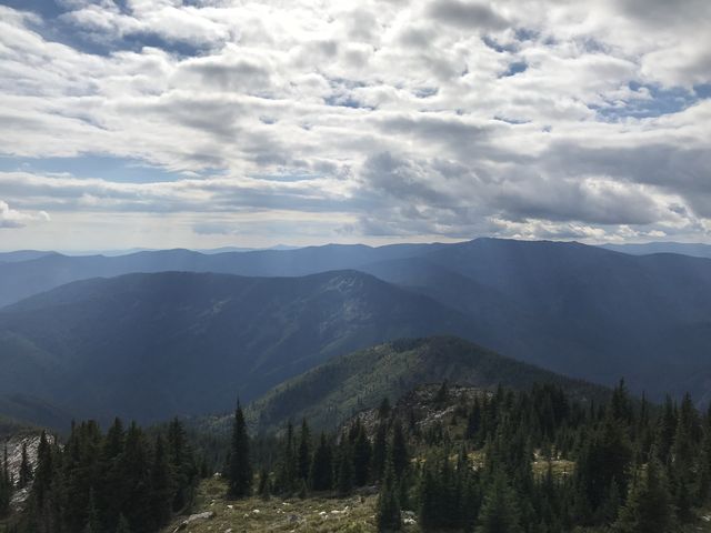
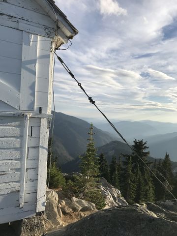
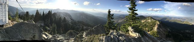
 Once you gain the ridge, the last bit being easy and unobscured switchbacks, you are back on Heart Pass trail #65. We repeated the stretch along the southern face of Mallard Peak, but this time climbed the half-mile stretch to the lookout tower. Expect stunning views in all directions, including Skyland Lake, and a single-story lookout, but no cell signal. The building, originally erected in 1929, is on the National Register of Historic Places and was restored in the 1980s with the help of Ray Kresek. It’s available on a first-come, first-served basis. The stats for Day 4 are 19 miles, 4k elevation gain, 8h moving time.
 On Day 5 I got my pack back and a huge band-aid for my elbow. We hiked trail #11 along (that is, slightly below) Collins Ridge and Collins Peak, a trail that was probably in the best conditions of anything we had hiked, and we made good time. The trail is mostly forested, with occasional views back towards Mallard Peak, and, later, forward towards Surveyor’s Ridge. You’ll also traverse an old burn as the trail curls around Collins Peak. A short climb after the junction with the Sawtooth Creek trail, the trail spills out onto FR-201, but continues on the far side of the road, paralleling FR-201 until you reach Table Camp. Cancelling the Scribe’s plan for a Pole Mountain / My Ruby Creek / St. Joe detour, we followed FR-201 back to Copper Ridge and hiked out the way we’d come in. Final day stats are 16 miles, 1.5k of elevation, and 6h moving time.
Enjoy this hike? Let us know in the comments below!

Alternate Routes
- To expand on the loop, consider detours to Bathtub Mountain, Lightning Ridge, Hero Lake, Black Mountain, and Pole Mountain. Or, take Timber Creek instead of Copper Ridge on the way back.
- Alternate access points are Bathtub Camp on FR-201 (Snow Peak is about 10 miles rountrip from there), Table Camp on FR-201, and Surveyor’s Ridge on FR-395 (the Surveyor’s Ridge lookout tower is available for rent during the summer months). On the western side, there is access from the Roundtop Ranger Station on the Little North Fork Clearwater River, which is the beginning of trail #50. On the south side is FR-705 and FR-700, the latter the trailhead of trail #240, and FR-247, which opens up Black Mountain via #399 or #396.
© 2016 – 2018 NaughtyHiker. All rights reserved. No duplication without permission.
The Bitterroot Mountains — one of John Denver’s favorite places.
I’m not surprised. It’s definitely one of my favorites!
Wow what a wonderful trip that must have been! Oncredible country!