Slavin Conservation Area Loop

The Slavin Conservation Area covers 628 acres of Ponderosa forest, rolling meadows, marshes and a lengthy pond much treasured by waterfowl. The site of the pond and wetlands was in fact farmland for most of the past century, drained by early settlers (you won’t find the pond on the older USGS maps), and now restored to provide wildlife habitat. The trail circumnavigates most of the lake, but skips the last quarter due to heavy flooding. Instead, it loops back through fir and pine forest in a figure-eight loop and climbs the bluffs along the eastern shore for a bird’s eye view of the area.
Location
  • Channeled Scablands
Rating
2.9 out of 5
Difficulty
Easy
Distance
5.8 miles
Duration
1:48 hours moving time (Hiking)
Elevation Gain
124 feet
High Point
2,422 feet (bluffs overlooking pond)
Low Point
2,324 feet (pond)
Features
  • Lake
  • Grove
  • Meadow
  • Outing Type
  • Daytrip
  • Trail Type
  • Loop
  • Trailbed
    Packed dirt, old logging roads
    Trail#
    Water
  • Recommend against filtering water from pond due to agricultural runoff
  • Camping
    • Not allowed
    Conditions
    • Generally excellent, but flooded and muddy in many places. Likely not a problem during summer months
    Administration
  • Spokane County
  • Status
  • Conservation Area
  • Maps
    USGS
  • Spokane SW
  • Fees & Permits
  • None required
  • ()
    Open To
  • Hikers
  • Dogs
  • ()
    Directions
  • Take I-90 exit #279 for US-195 S (Colfax/Pullman) and follow 195 for 9.5 miles. Turn right onto E Washington Road, a gravel road. You’ll end up at the trailhead after half a mile, at the intersection of Washington and Keeney Roads (slightly to the right).
  • Season
    Year-around
    Date
    May 14, 2017

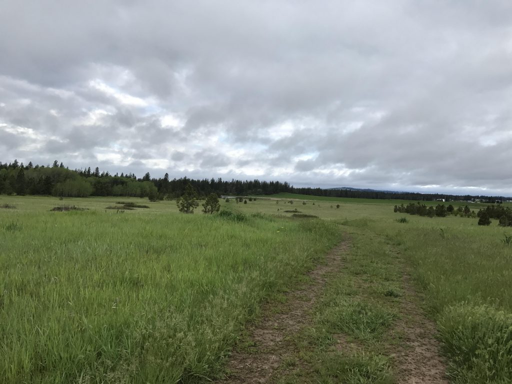
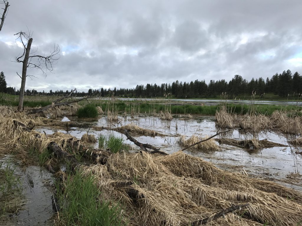
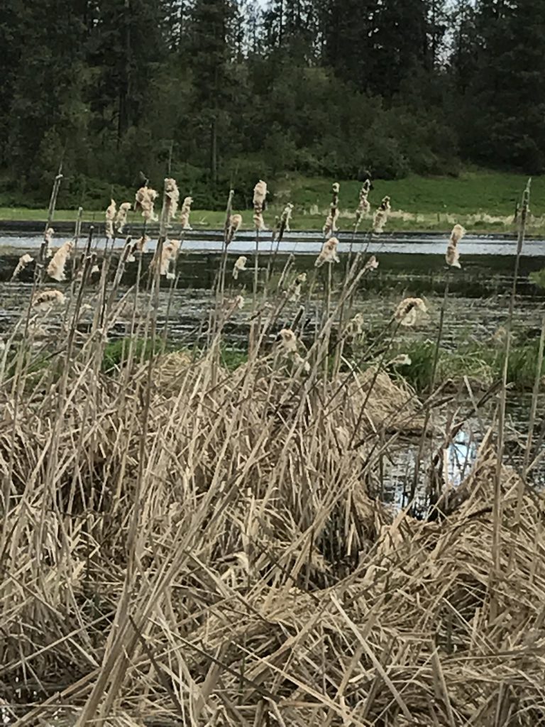
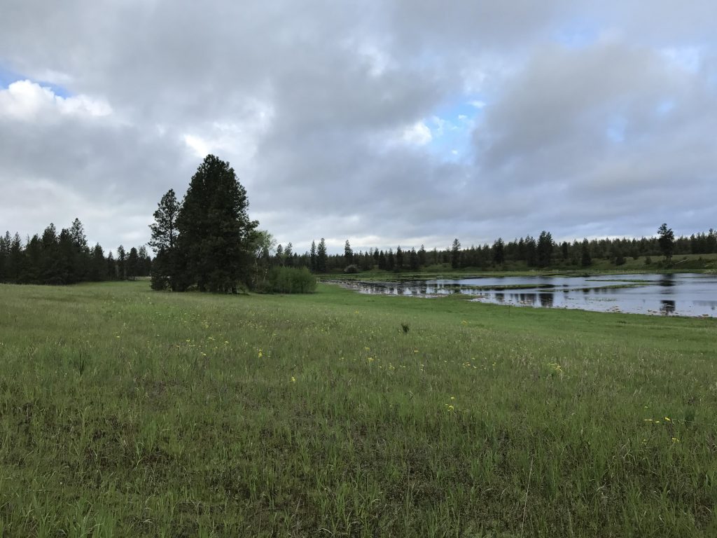
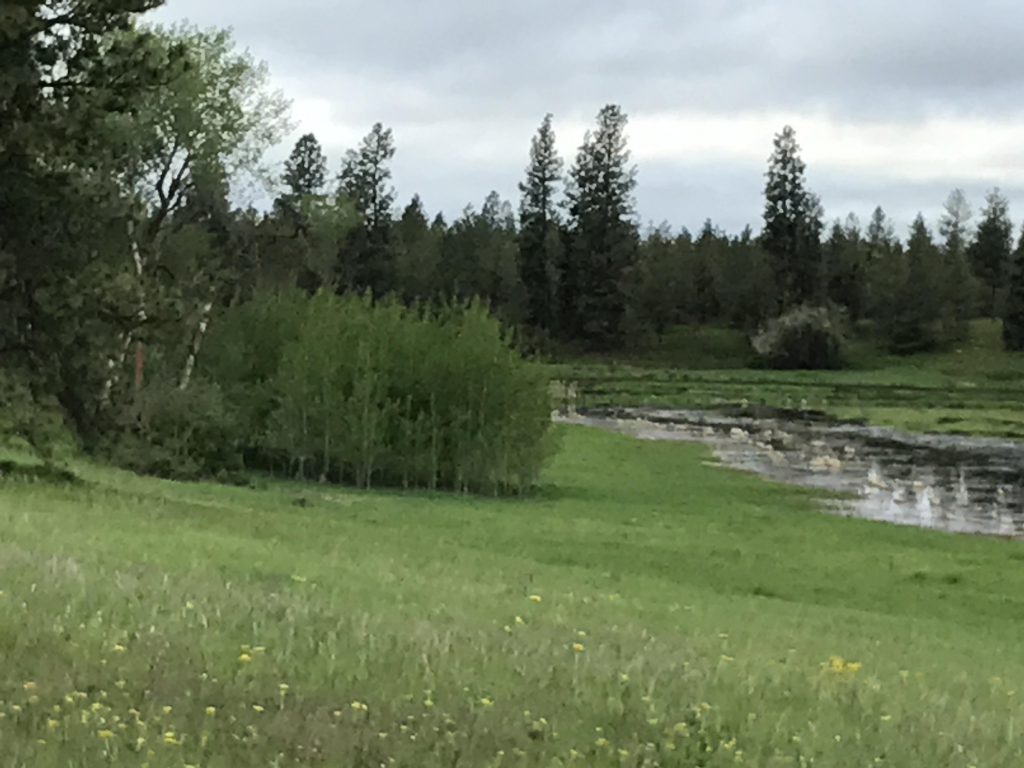
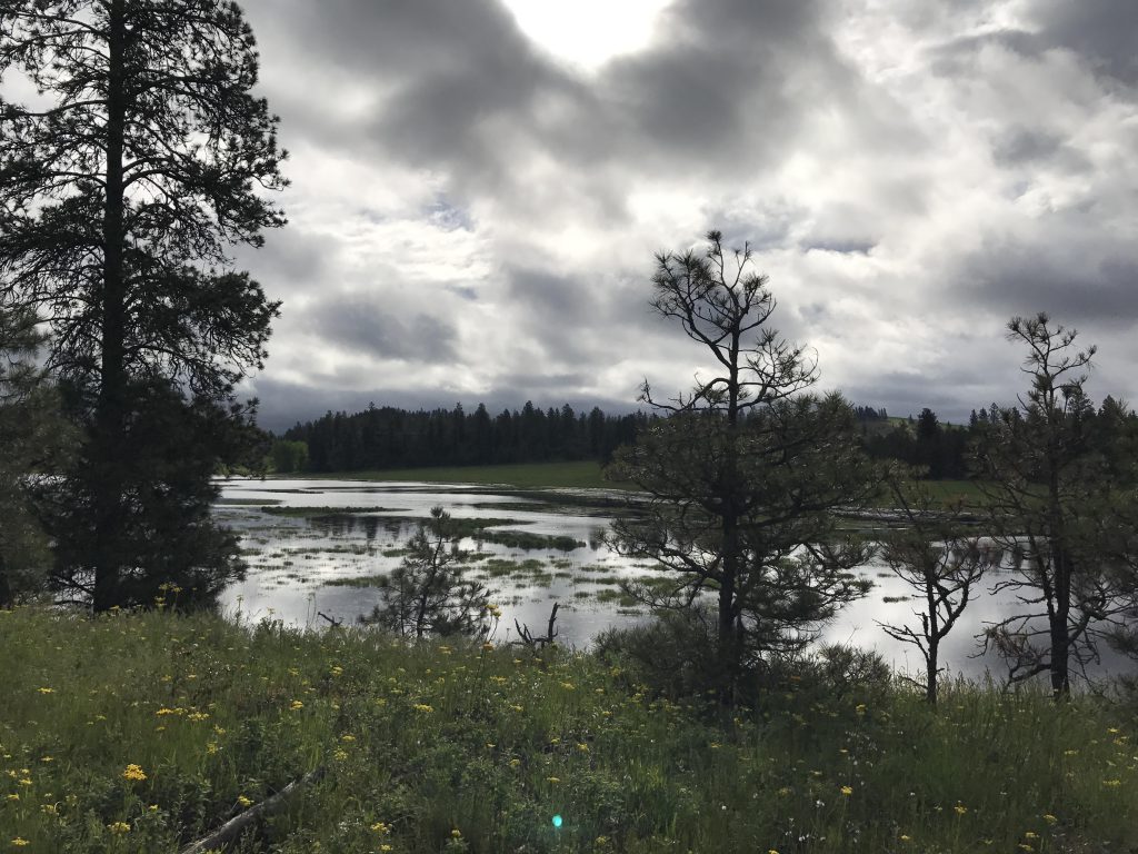
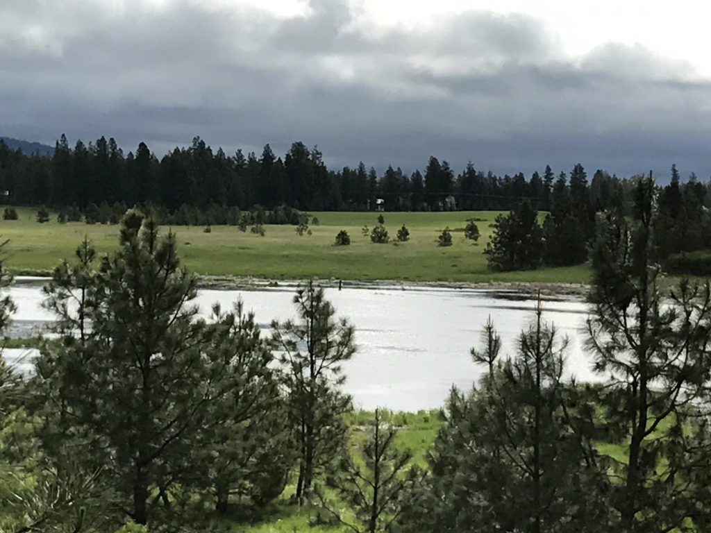
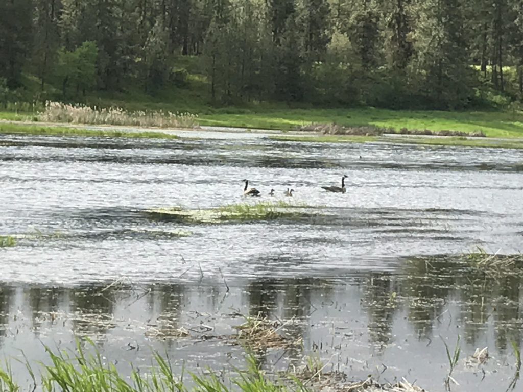
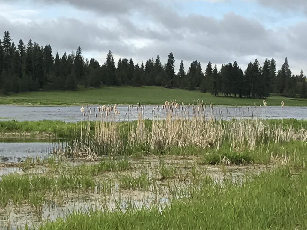
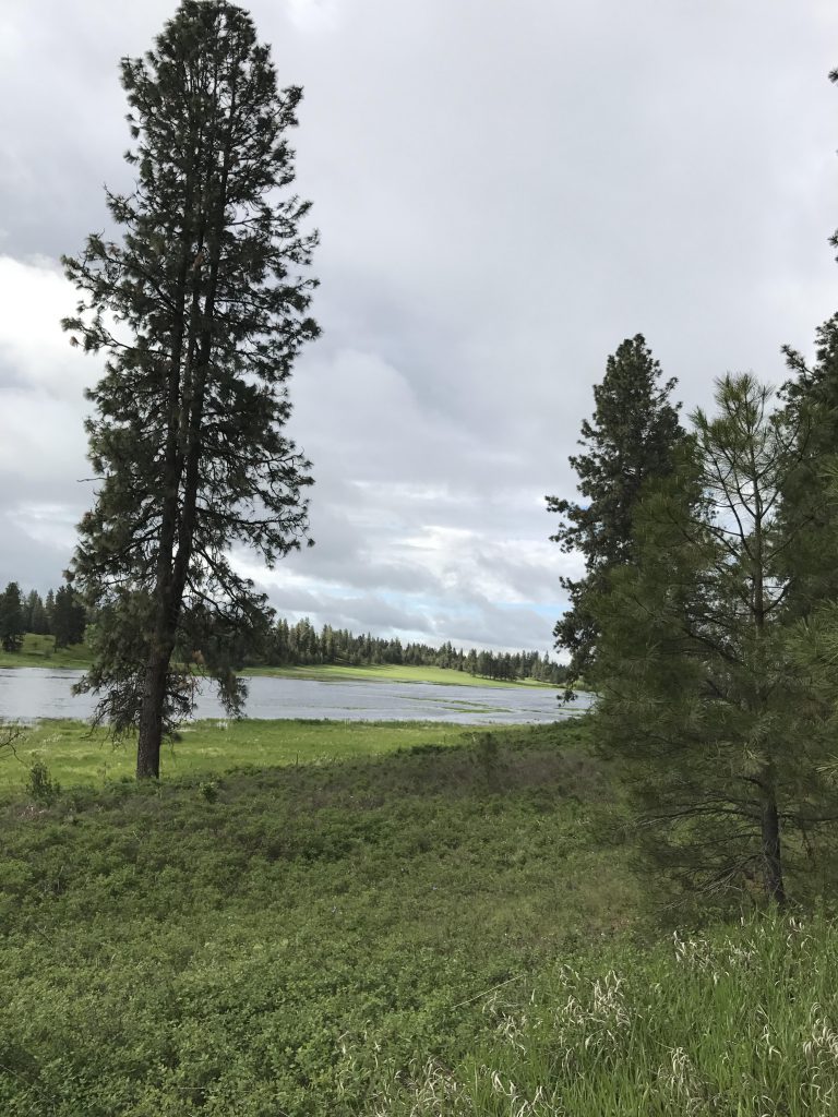
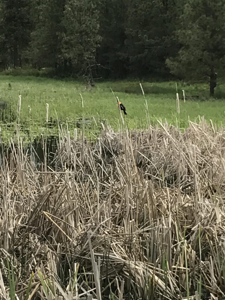
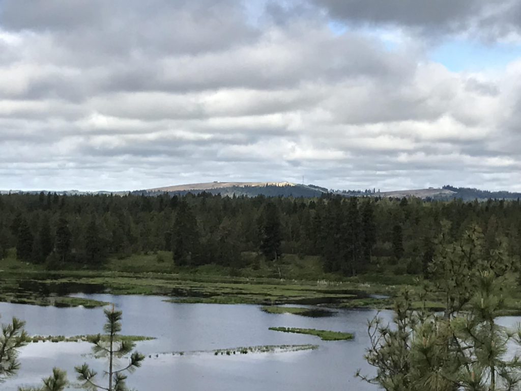
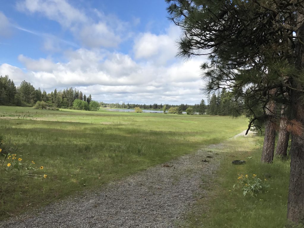
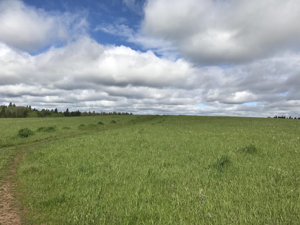
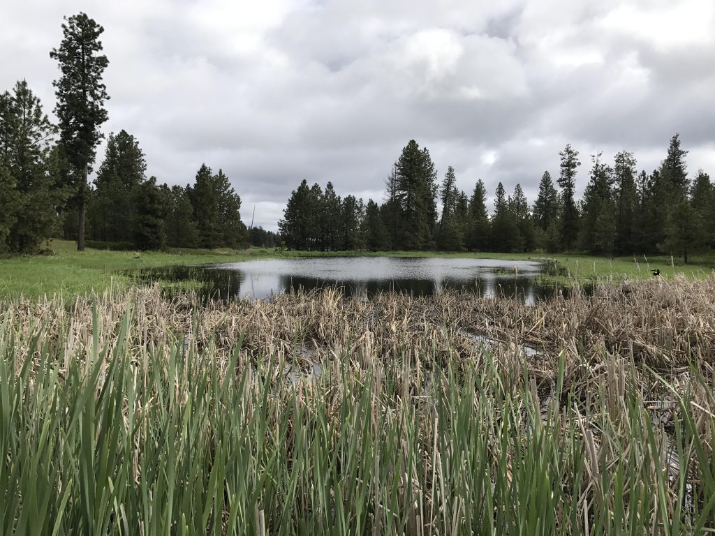
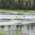
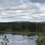
    The trail starts out by crossing a broad level meadow and leads right up to the edge of the pond at the half-mile mark. Near the pond the trail is soggy and flooded in many places and muddy elsewhere, at least in spring. At the pond you get to meet the local bird population, which is rather extensive and exceedingly vocal and likes to cling to last year’s dried-up cattail stalks.

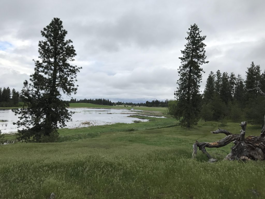
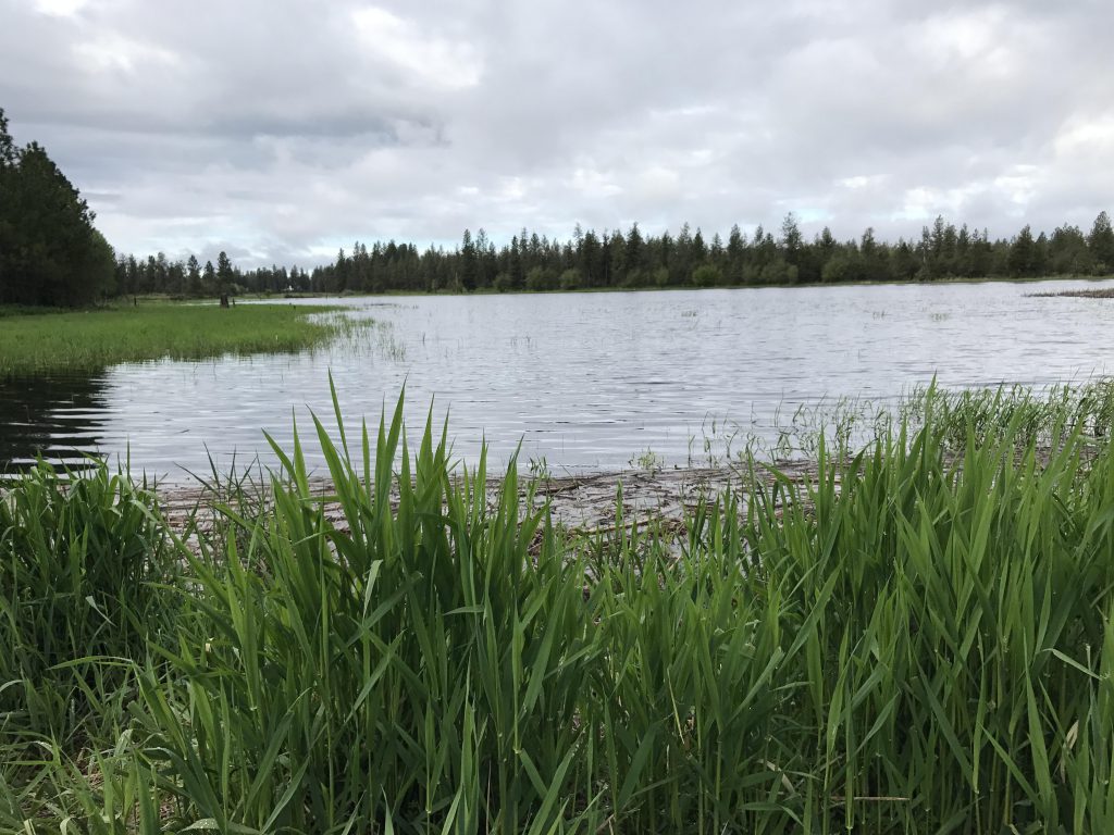
    The trail hugs the lake’s shore going south, and was flooded. Luckily, a secondary trail (single track) moves up into the light forest and parallels the lake at a save (that is, dry) distance.

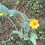
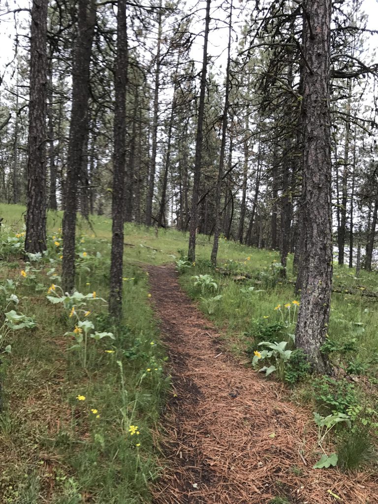
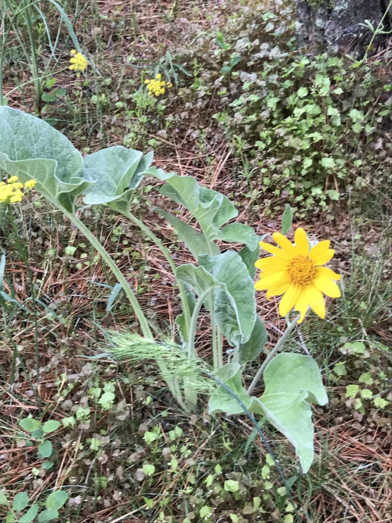
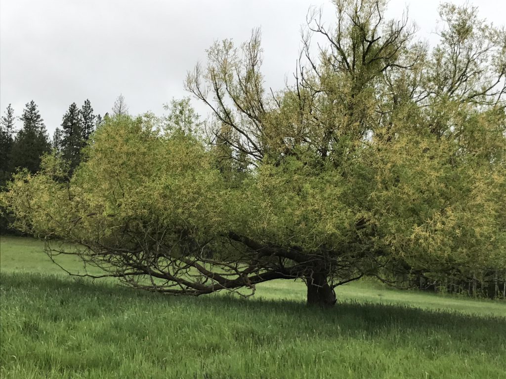
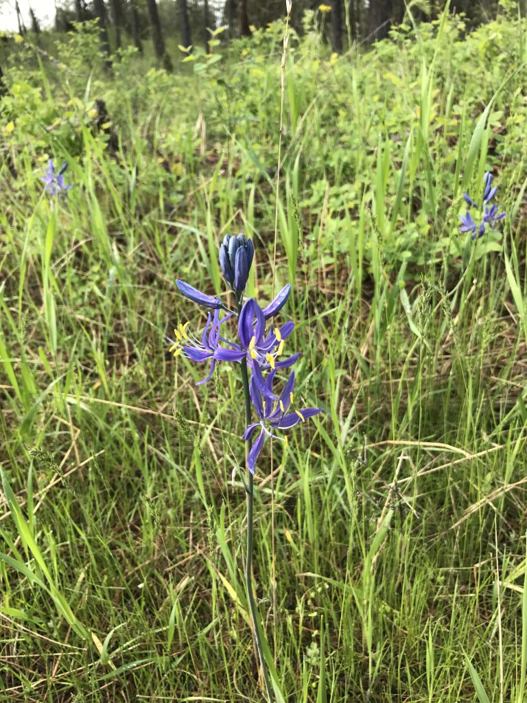
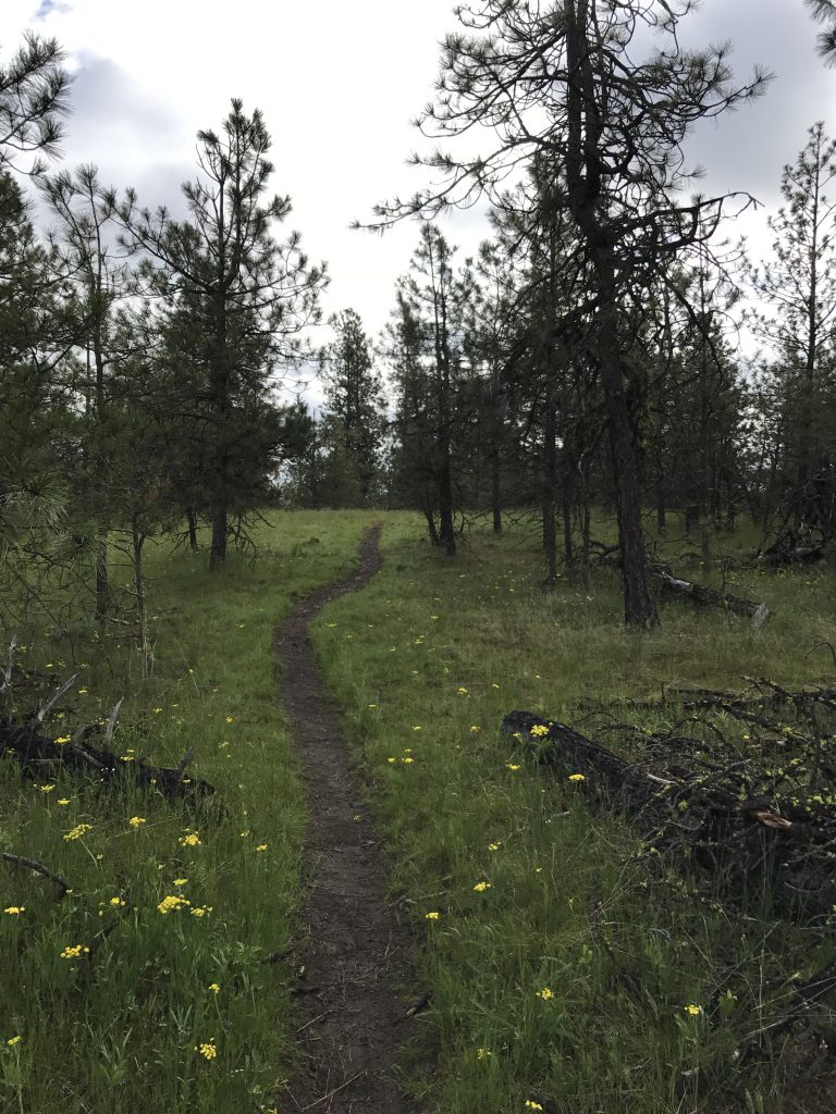
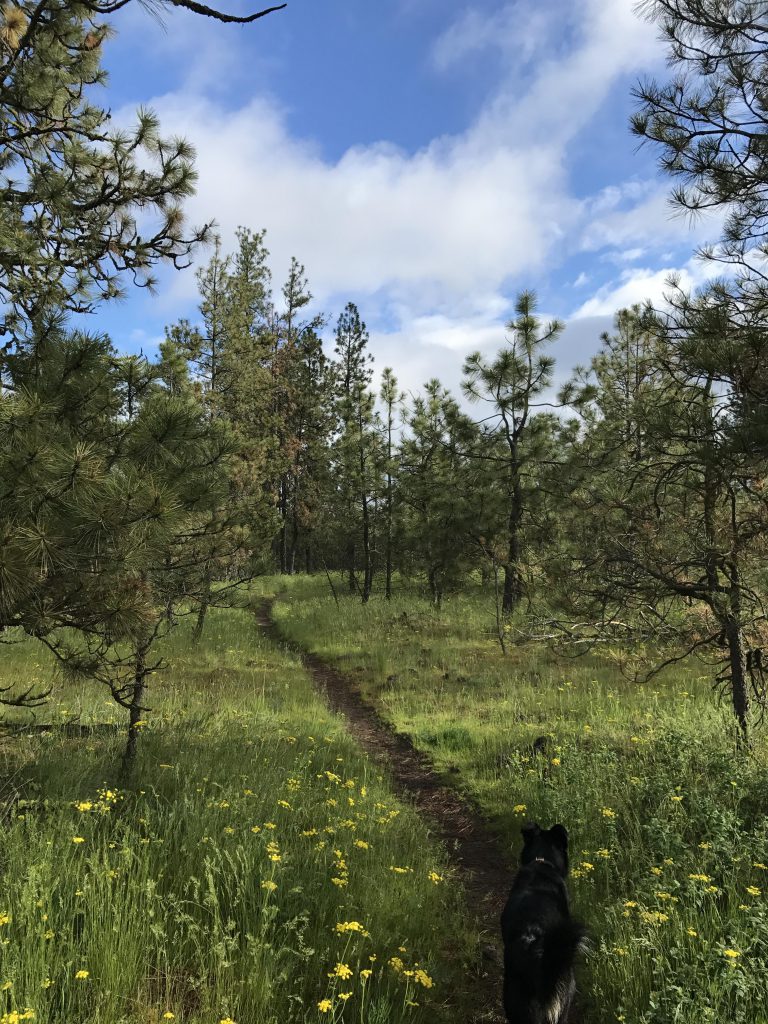
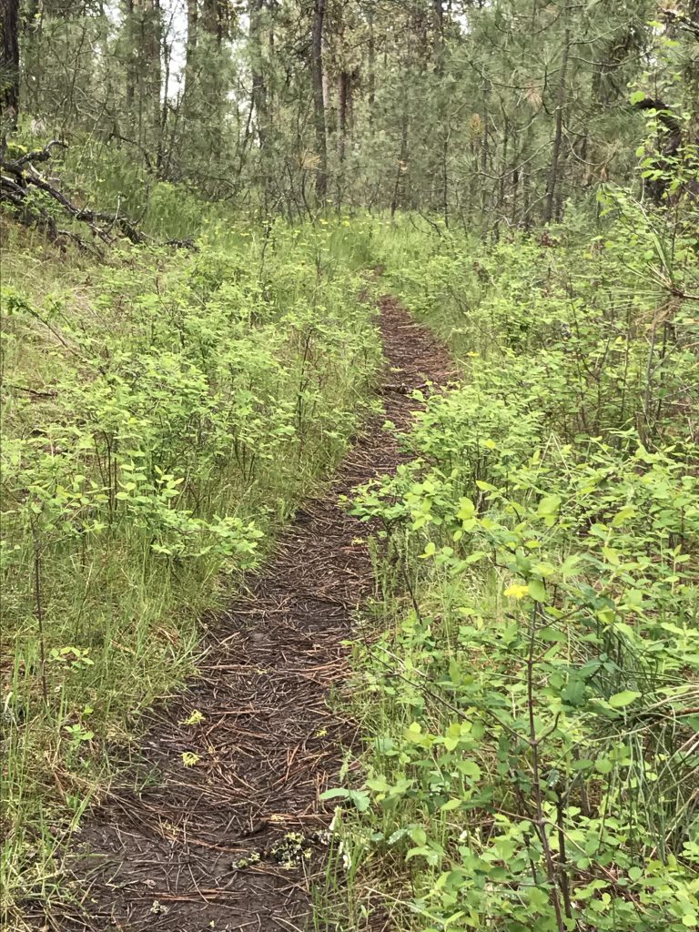
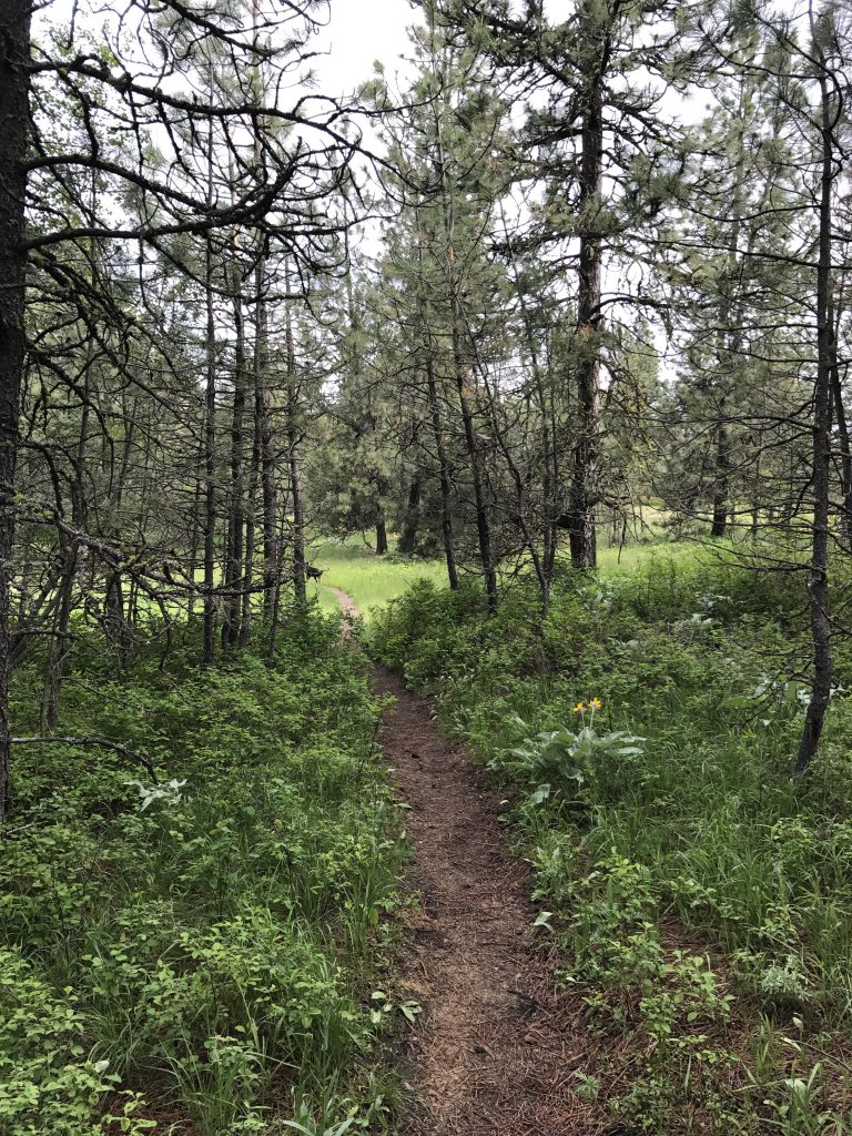
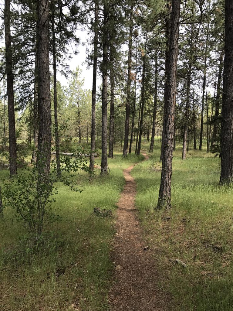
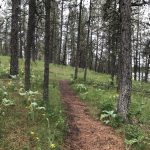
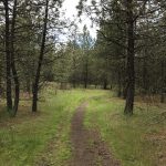
    During this time of spring the forest floor is sprouting all kinds of wild flowers, most prominently arrowleaf balsam root. The trail climbs a small knoll, descends on the other side and crosses a grassy meadow sprinkled with sprawling trees. Occasionally the path meets up with other trails, but you really can’t go wrong; when in doubt simply bear right.

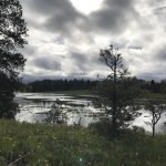
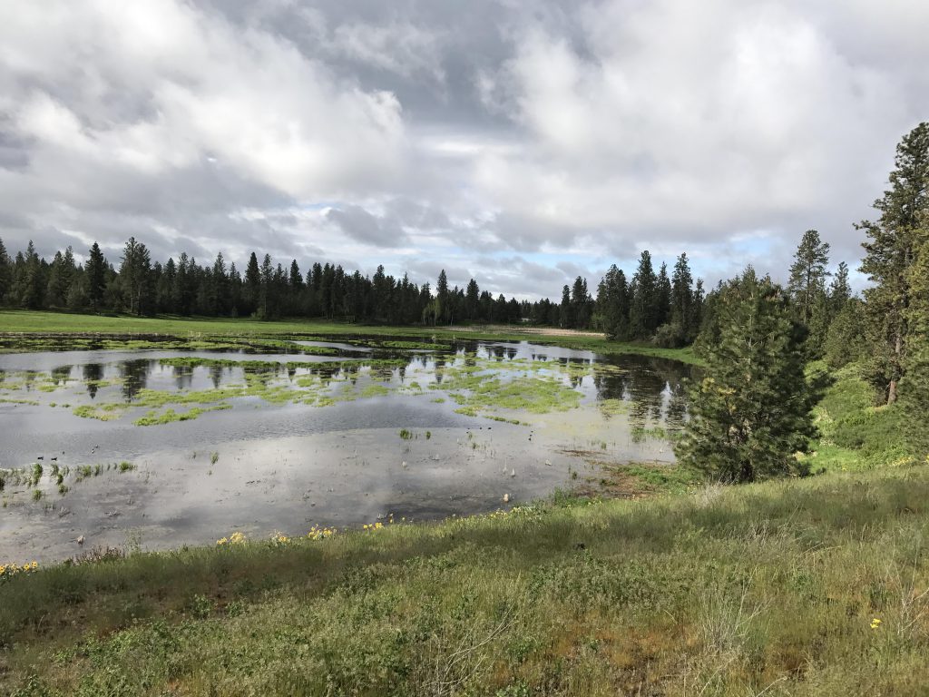
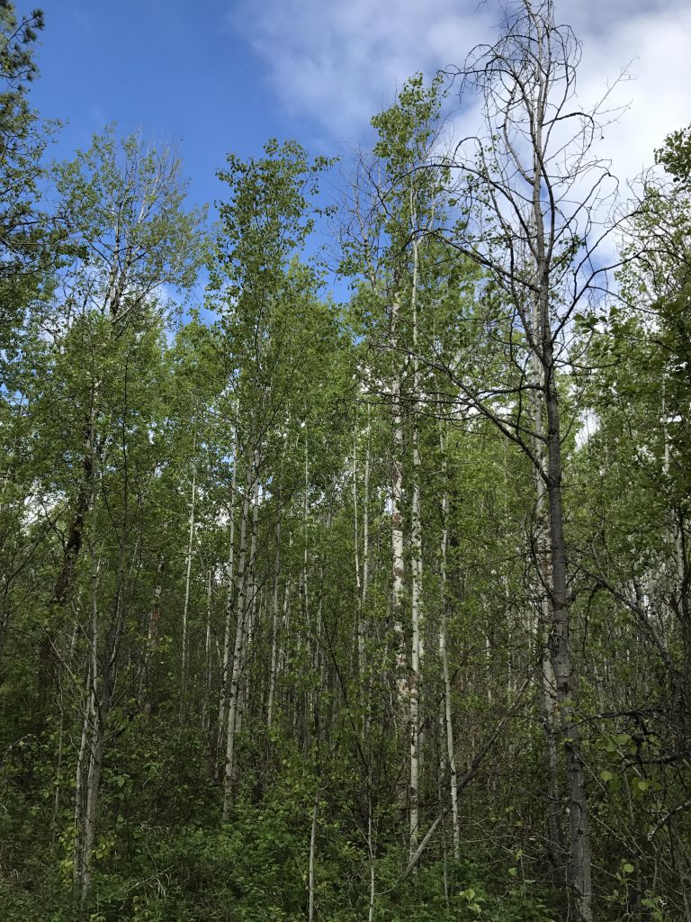
    As you come to a pretty stand of aspen near the lake, the trail starts to veer away from the pond and heads towards the upper, smaller pond, also teeming with birds. After crossing a low earthen dam at the 1.5-mile mark, the trail curls around the southern end of the main pond and heads north, this time a bit higher and thus mostly on dry ground. The trail leads to the far end of the pond, entering in and out of open pine forest, and providing ample views of the pond and the opposite side.

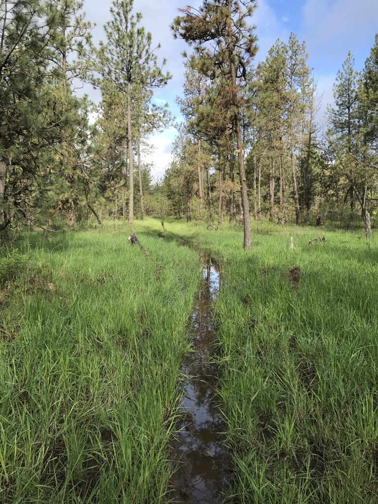
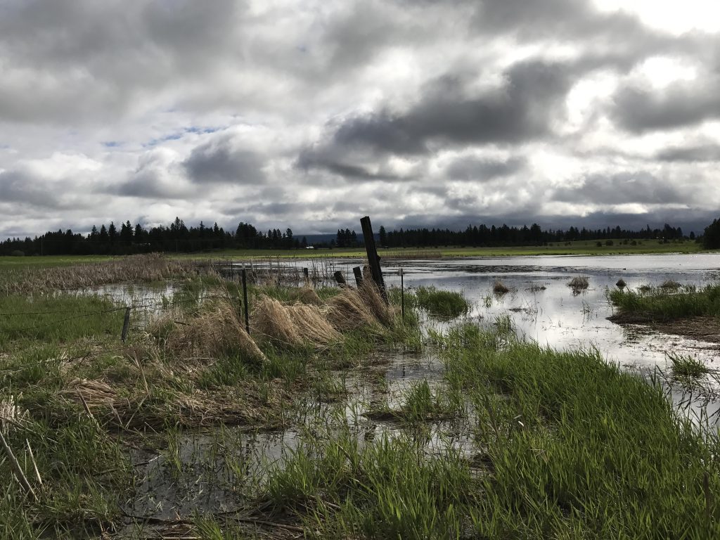
    About 2.8-miles into the hike the trail moves along a fence line which was completely flooded. In fact, a family of geese enjoyed that area very much. During the summer months you can probably follow the fence and hike around the northern end of the lake back to the trailhead, thereby reducing this to a 3-mile loop; however, during the rainy season it’s time to turn back and around the 3-mile mark you’ll come upon a fork. Take a right for a pretty walk in the woods towards the edges of the conservation area.

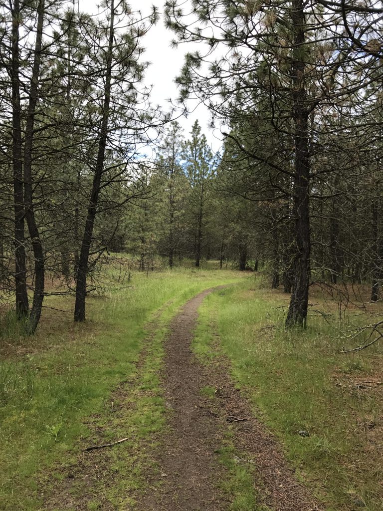
    Just before the 4-mile mark the trail once again meets up with the outbound trail. Then it’s back across the dam and on the eastern shore onto a wider trail that leads slightly uphill through the forest. Shortly it turns northbound and meets up once again with the outbound trail, but almost immediately a single-track branches off to the right and climbs the low bluffs overlooking the pond. Follow this trail, making sure to remain on the single-track as it bisects a wider trail.

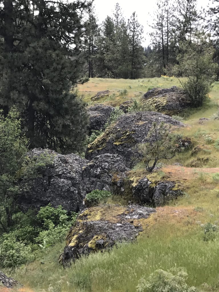
    The single-track contours along the edge of the bluff and offers nice views. It also features a pretty meadow, stocked with ground squirrels, and interesting rock formations. A little past the 5-mile mark the trail descends through light forest, crosses a grassy meadow and a gravel trail, then re-enters the woods. In short order you’ll end up on a wide double-track that pierces a dense aspen thicket and leads to the parking lot.

    Alternate Routes

      Things to Consider

        Not so great

          Meadow near trailhead
          Reeds at pond
          The birds love last year’s dried-up cattail stalks
          Much of the trail is single-track
          Arrowleaf balsam root
          View of the pond from a small hillock
          Larger trees, planted by homesteaders, interspersed in a meadow
          View towards southern end of pond
          Pond and aspen grove
          Close-up of the pond and cattails
          Flooded trail
          Pretty blue flower. Not sure what it is
          On the wester shore the trail runs higher up and is mostly dry
          View of pond from western shore
          Light ponderosa forest
          Looking towards southern tip from western shore
          View across the pond towards trailhead
          Geese and goslings
          Cattails
          The trail moves along this fence and circles around the northern tip of the pond. It is completely flooded.
          Prominent tree on western shore
          Through fir and pine the “alternate” trail heads away from the pond
          Bird sitting on a dried-up cattail stalk near dam
          Trail heading towards the bluffs
          View of pond from bluffs
          Rock formations on bluffs
          Trail dropping down from bluffs towards the meadow
          Down at the meadow. Skip the gravel path in favor of the single-track through the woods
          A pleasant single-track leads through the woods to a wider double-track
          Aspen grove
          Back at the trailhead meadow