Virtually constant access to water, lots of shade, a phenomenal flora, and a comparatively easy climb make this a pretty summer hike, despite its low elevation. The lake is perfect for a quick dip, if you can take the ice-cold chill!
| Location | Cabinet Mountains |
| Rating | 3.2 out of 5 |
| Difficulty | Moderate (some uphill hiking) |
| Distance | 8.7 miles |
| Duration | 3:21 hours moving time (hiking) |
| Elevation Gain | 1,720 feet |
| High Point | 4,781 feet (St. Paul Lake) |
| Low Point | 3,069 feet (trailhead) |
| Trail Type | Out-and-back |
| Trailbed | Packed dirt, loose rocks |
| Trail# | 646 |
| Water | Almost throughout the hike (East Fork Bull River and its tributaries; St. Paul Lake) |
| Status | Wilderness Area |
| Administration | Kaniksu National Forest |
| Conditions | Excellent. We hiked this just after a trail maintenance crew had gone up. Thanks guys!! |
| Permits | None required |
| Camping | At trailhead and at south shore of St. Paul Lake. An additional site sits ahead of the lake just before you get over the lip. There is a pit toilet at the trailhead |
| Maps | USGS Elephant Peak |
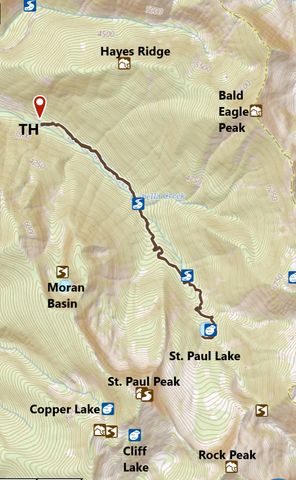
| Trailhead | From MT-200, about 5 miles north of Noxon, take MT-56 north for 8 miles. Turn right onto FS-407 and follow it to the trailhead (6 miles). There are a few forks in the road, all signed (look for signs to trail #646). Google Directions (48.122045, -115.700383) |
| Season | June – October |
| Squirrel Density | Lots, especially at the lake. Horses are allowed to use the trail but can’t be at the lake |
| Features | Lake, Grove |
| Distance From |
|
| Resources | |
| Nearby Hikes | |
| Date | July 15, 2018 |
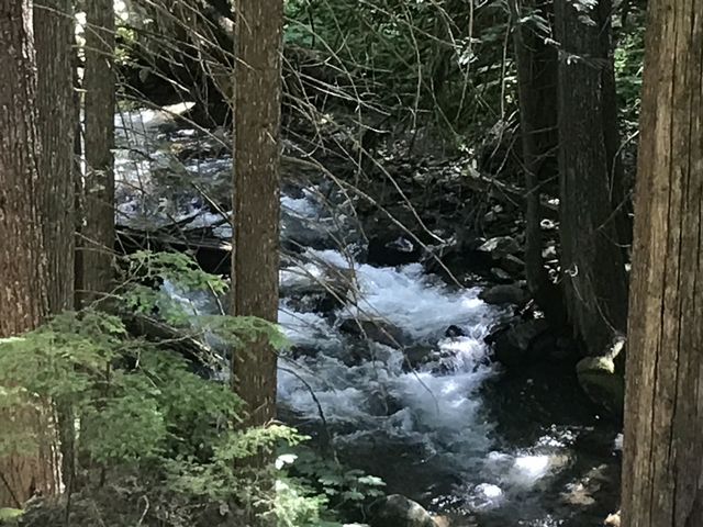
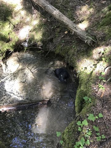
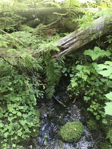
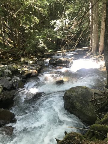
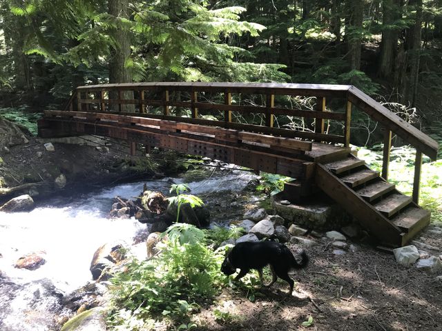
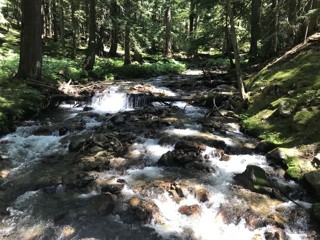
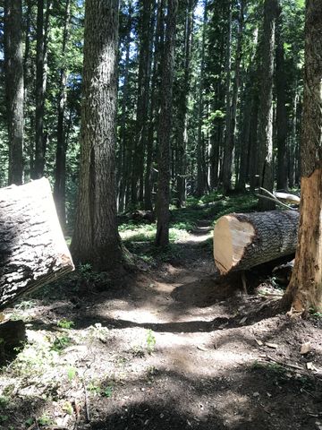
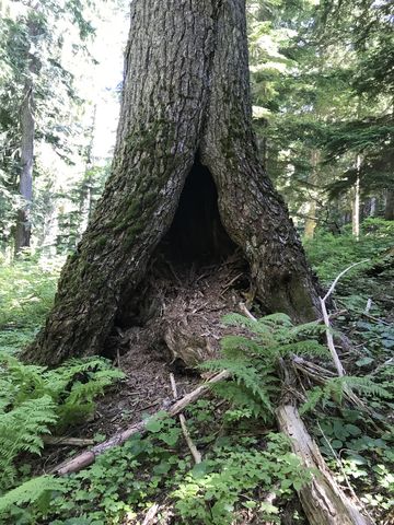
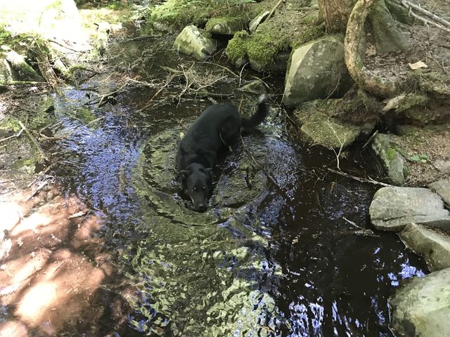
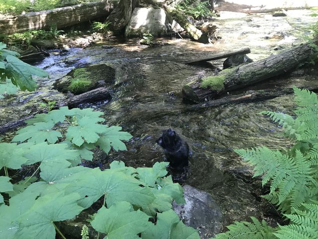
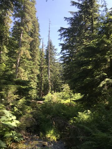
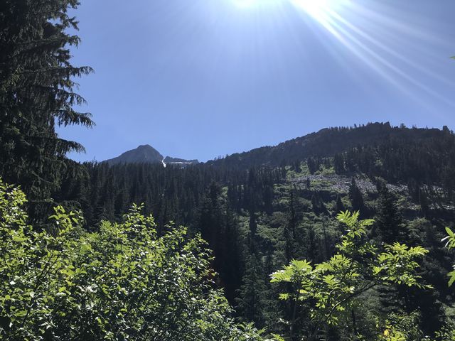
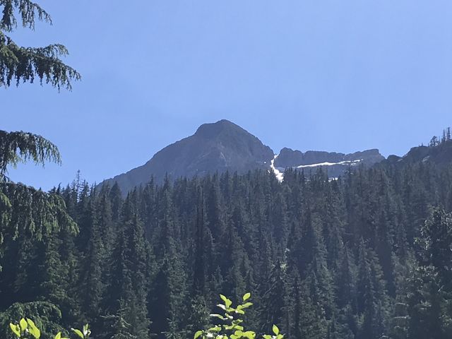
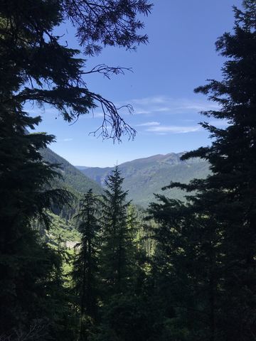
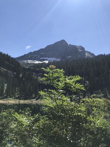
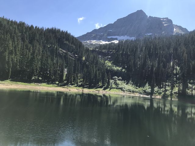
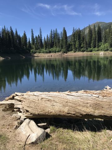
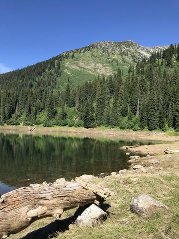
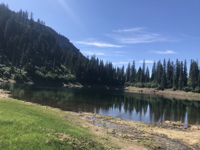
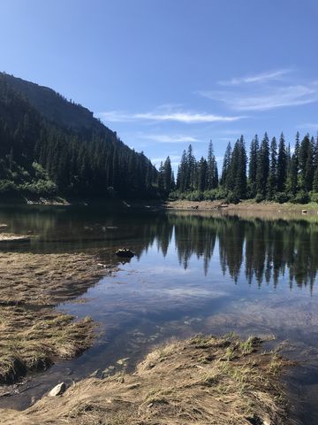
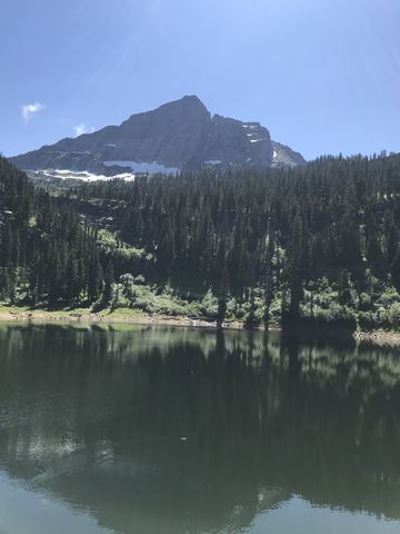 The St. Paul Lake Trail almost immediately enters the Cabinet Wilderness Area, as it winds through dense cedar-and-hemlock forest along the East Fork Bull River. The forest floor is lush and green with mosses and ferns and devil’s club. At a gradual climb, the trail at first moves away from the creek, only to re-approach it at the half-mile mark. Then it moves away once again, crossing a few tributaries (easy rock hops) and passes a small pond with a natural spring and the clearest water. Isabella Creek is crossed on a handy log (though you could probably manage a rock hop as well) and soon after you reach Placer Creek, which would be difficult to cross were it not for the heavy-duty bridge making life easy. Afterwards the incline picks up a bit, but the trail remains nicely forested as it climbs through old-growth cedar groves. There is one more major crossing, accomplished on a lengthy log (you actually have the choice of 2 or 3). About a half mile before ahead of the lake, the trail crosses a basin thick with alder and thimbleberries where you’ll get a first glance of St. Paul Peak, then switchbacks up to the lip of the lake. The lake, incidentially, is very steep-sided, with the best approach from the southeast side, where it’s relatively flat. The best campsite also is on that side of the lake.
Enjoy this hike? Let us know in the comments below!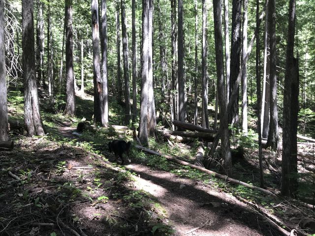
Alternate Routes
- You could climb to St Paul Pass and cross over to Rock Lake. There is no maintained trail, however.
© 2016 – 2018 NaughtyHiker. All rights reserved. No duplication without permission.
I’ve made that trip. It’s a beautiful hike!
Second that! Especially nice when it’s 90 degrees elsewhere and you hike in complete shade