- Seven Devils Mountains
- There are campsites along the Snake every few miles
- Kirwood Ranch has a half dozen sites with picnic tables and flush toilets (the sites were all filled when we were there; no charge)
- Fires are not allowed (except in fire pans during certain months and you have to haul the ashes out. There is preciously little wood to burn)
- Very good. Watch out for poison ivy and snakes.
The Scribe had me salivating for weeks with the promise of an early spring hike in a snow-free paradise. My salivating, I’m told, is not a pretty sight (messy is the word I hear the most), but there it is. Anyway, the grand plan was to do the 4-hour drive to Pittsburg Landing on a Friday after the Scribe was done “working”. Working in quotes, quite frankly, as it does not involve any real activity, he just types and types on his computer all day long. I can do as much in my well-deserved sleep after I transition from my nighttime bed to my daytime bed. But I digress. The grand plan had us starting early on Saturday, hike out to Bernard Creek (~15 miles), then back to about Sheep Creek, stay overnight, and hike out on Sunday. As you can tell by the title to this post, that did not come to fruition because on Thursday night lightning struck (that is, Lady called). Obviously, I was not privy to the conversation, but what I was able to discern was that our trip was about to get nuked. Lady was stuck in Moscow (Idaho), without car, and needed a lift on Friday. Instead of honoring his promise to the most important member of the family, the Scribe offered to pick her up! The gall! Not all was lost, however, with the conversation turning to Lady joining us on our trip as we’d drive through Moscow anyway. After a lot of back and forth, this appeared agreeable, not to me entirely, to be honest, because the mileage would inevitably get slashed.
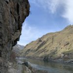
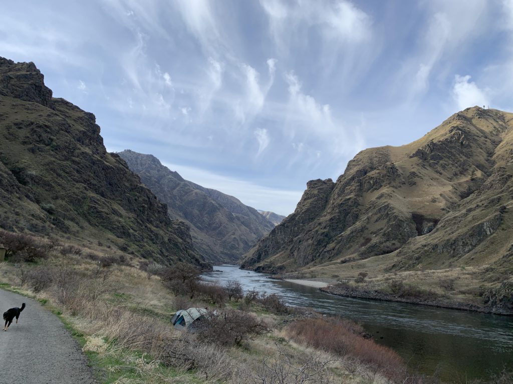
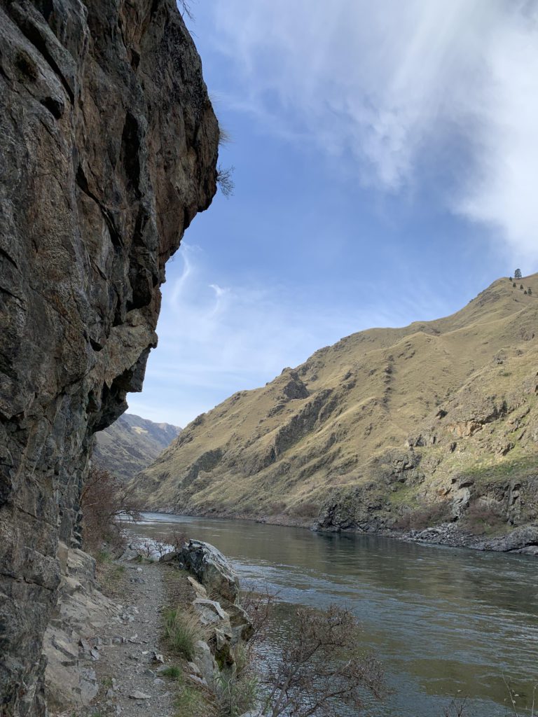
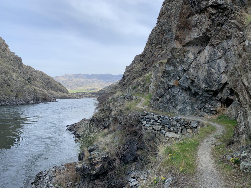
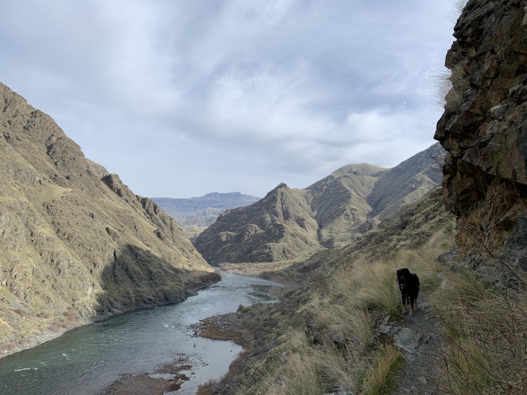
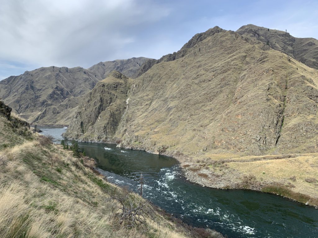
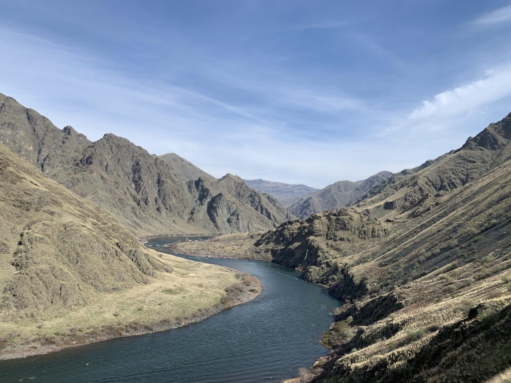
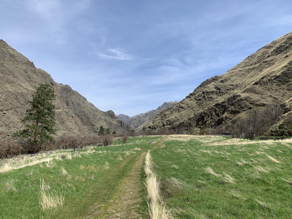
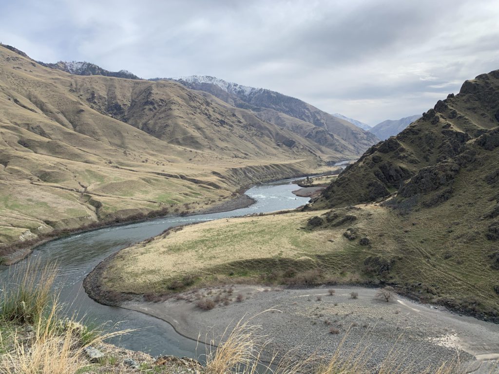
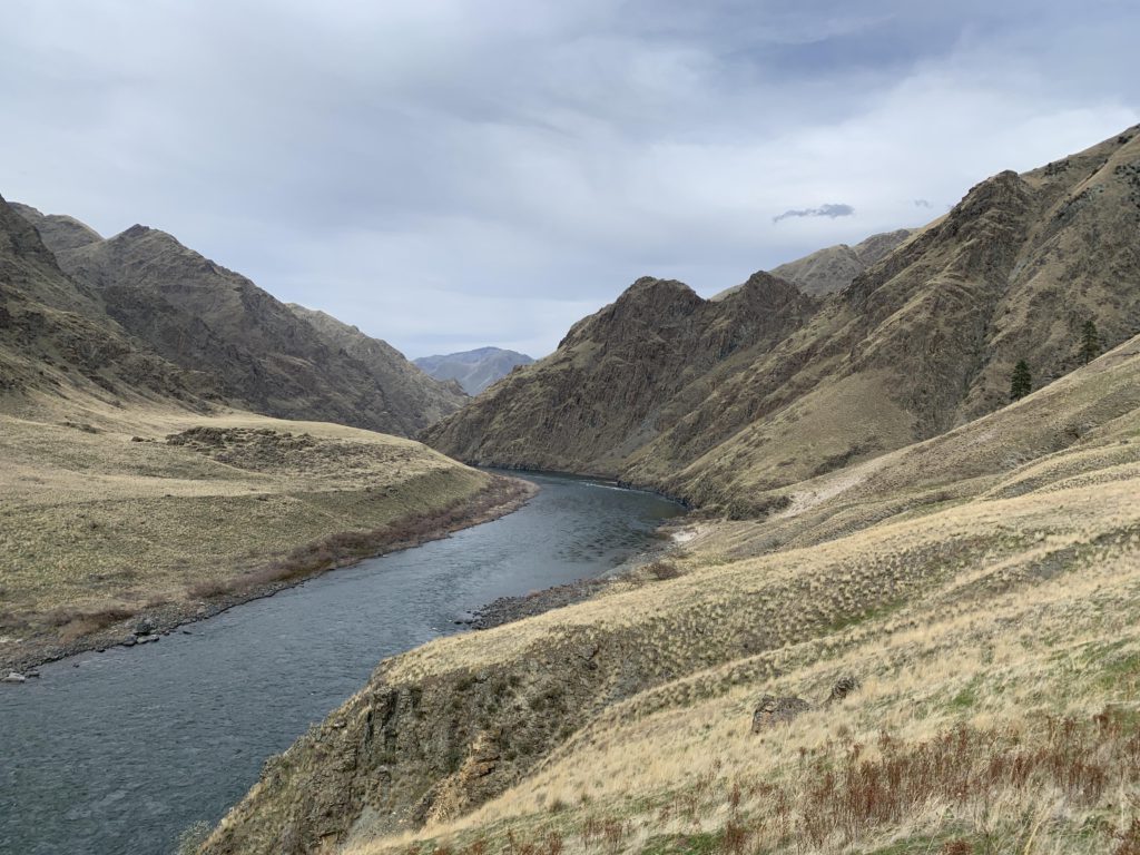
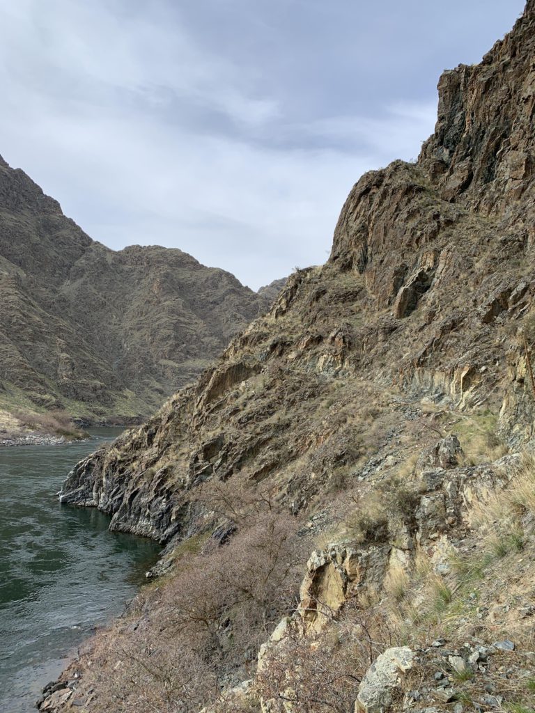
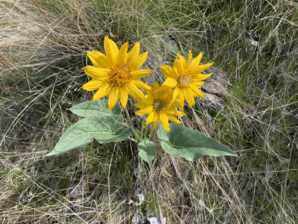
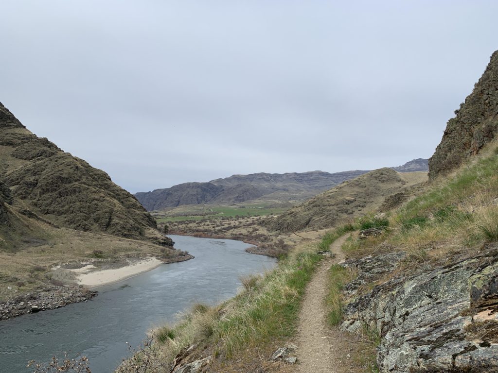
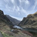
We made good time on our way to the trailhead, but drove across Pittsburg Saddle in complete darkness nonetheless. Campers occupied the last parking lot, so we stayed at the second to last, which we had to ourselves, with our own private pit toilet. Not important to me in the least, but others beg to differ. Anyway, we slept in the back of the truck, the Scribe having outfitted it with a mattress, which was all fine once the misunderstanding was cleared up (the mattress, it turns out, was not intended for me). The next day had us on the trail in no time, but first a bit about Hells Canyon. It gets preciously little snowfall and thus is ideal for early spring hiking. Low elevation and the protection granted by the steep canyon walls create a micro-climate where spring arrives nearly a full month earlier than the rest of North Idaho. Hence, we saw sarvisberries in full bloom, prickly-pear cactus, the splendor of blooming arrowleaf balsamroot, and plenty of greenery all around. Rattlesnakes, too, we learned were out and about, even though it was still early (we didn’t see any). Due to the snake threat, I was ordered to fall in line between Scribe and Lady as we ascended above the lazily moving waters of the Snake, with the Scribe looking hither and thither for petroglyphs on the steep basalt cliffs overhanging the trail (he found none). The trail was in excellent condition, shored up with rock walls and continuously climbing up and down the western flanks of the Seven Devils to avoid the steepest and cliffiest portions along the river. On these excursion the views are far reaching, unimpeded by trees as the hillsides are essentially devoid of forestation, with any wooden members of the flora limited to hackberry stands near the river and the flats along it.
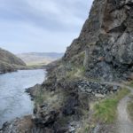
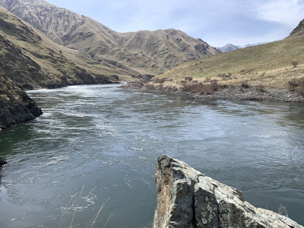
About a mile into the hike, the trail declines towards the river and this is a good spot to view the China Rapids below. These rapids may be named after a group of miners massacred in Hells Canyon in the late 1800s (google Hells Canyon Massacre for details). Beyond China Rapids, the trail starts to climb again, but rather steadily and at times barely noticeable to culminate at an overlook above Kirkwood Ranch at the five-mile mark. In doing so, the trail frequently moves into lush draws sprinkled with poison ivy. Amazingly, as the trail turns away from the river, the noisy rush of the water completely fades and makes way for the voices of the many birds that appear to be the main inhabitants of the canyon (sadly, the squirrel population consisted of but a few chipmunks). From the overlook, the trail switchbacks 300 vertical feet downhill to Kirkwood Ranch.
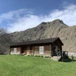
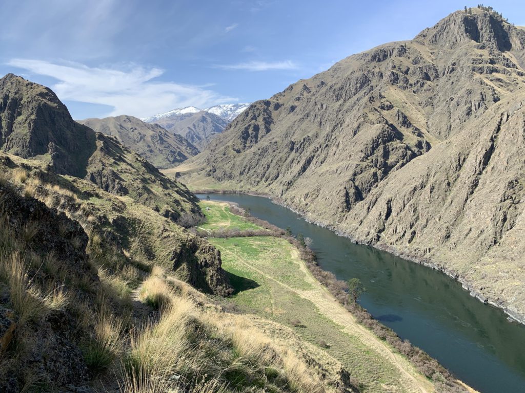
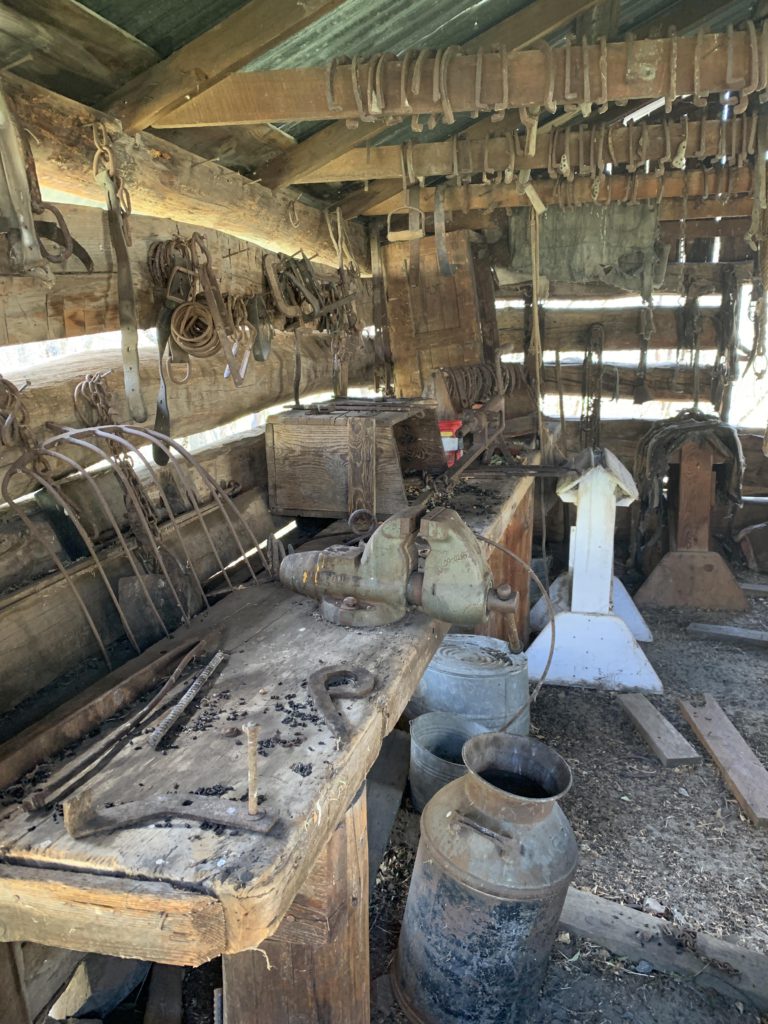
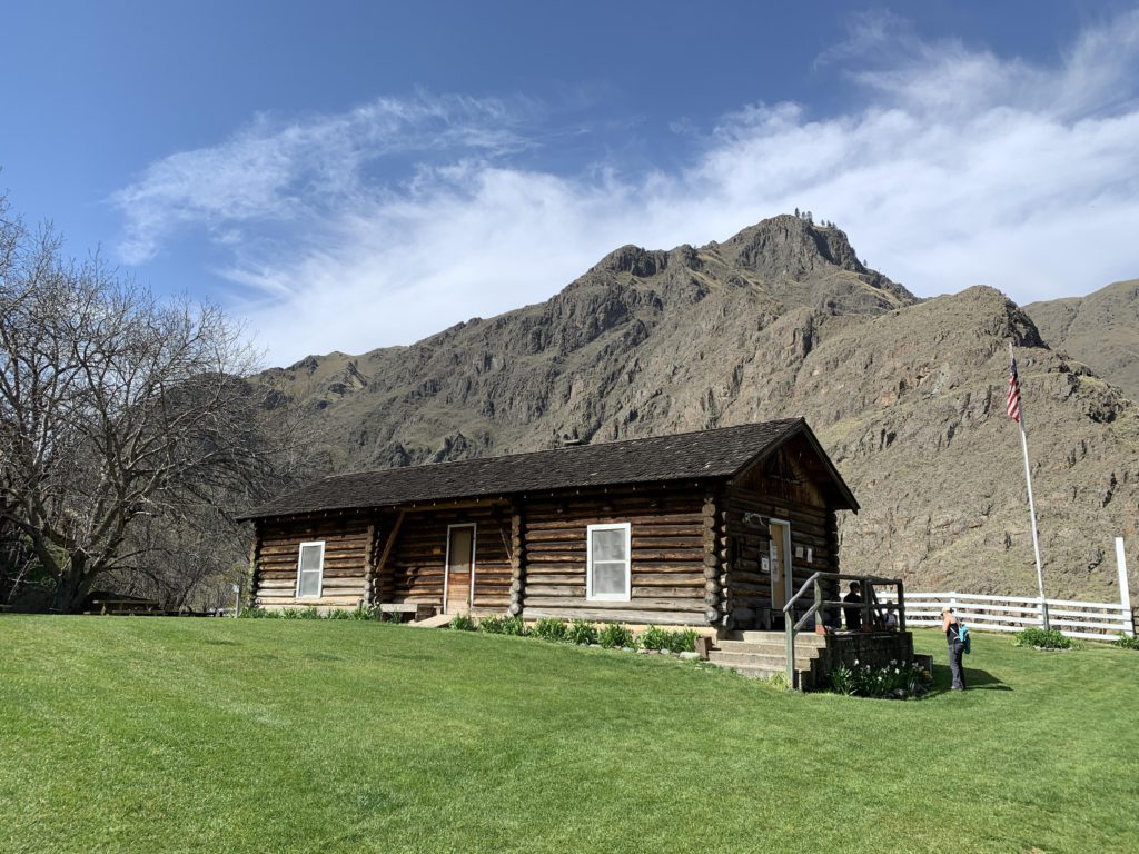
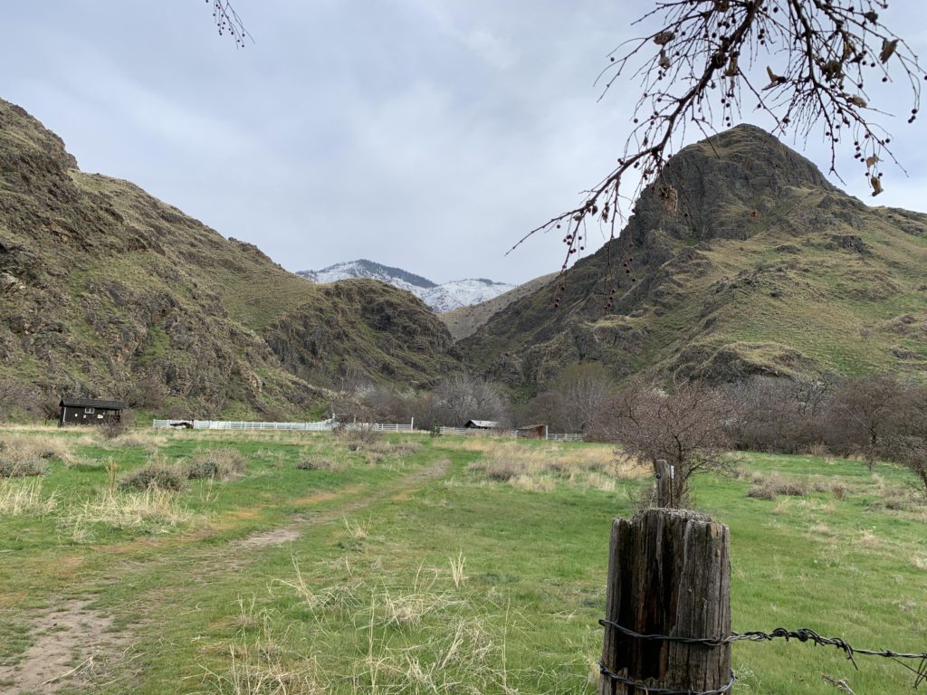
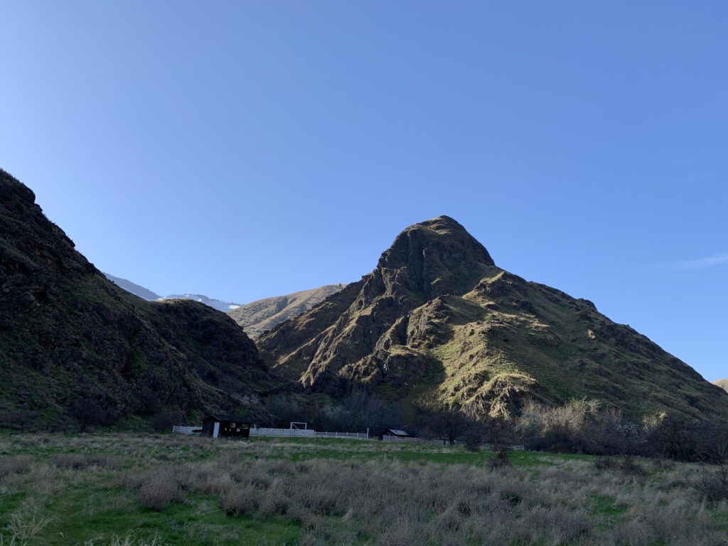
Kirkwood Ranch was a sheep operation formerly owned by Len Jordan, 23rd governor of Idaho, who later become a US senator. We didn’t see the inside of the house, but presumably it contains the first bathtub in Hells Canyon, installed by the governor-to-be. The Forest Service acquired the parcel in 1973 and the house is occupied year-around by caretakers on a 5- or 6-week rotation. Next to the house is Sterling Cabin, built in 1952 from timber harvested in the Lost Valley Creek headwaters east of Kirkwood Ranch. Formerly a bunkhouse, it now serves as a museum featuring photographs (people posing with dead bears) and artifacts of the mining and homesteading attempts in the late 1800s and early 1900s. Next to the cabin is a rather extensive and rusting arsenal of yesteryear’s farm machinery. There is also a blacksmith’s hut on the northern side of Kirkwood Creek, well furbished with horseshoes, decaying implements, and mouse droppings. Take a deep breath of Hanta virus and move on to the defunct flume once irrigating Kirkwood Meadows (now a campground) and a water wheel once powering the ranch house (now an array of solar panels). If you’re in need of more vermin, consider a three-quarter-mile detour to the Carter Mansion, once the finest Hells Canyon had to offer. Its accomplished builder, in his day, also distilled the finest moonshine the canyon had to offer; so much so, in fact, that it became his downfall. Arrested for failure to pay tax on a keg of whiskey, he spent time in a Boise penitentiary; the mansion is now the domain of mice, rats, and bats. Enter at your own risk.
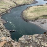
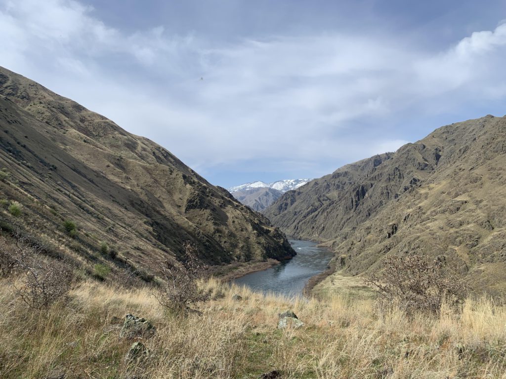
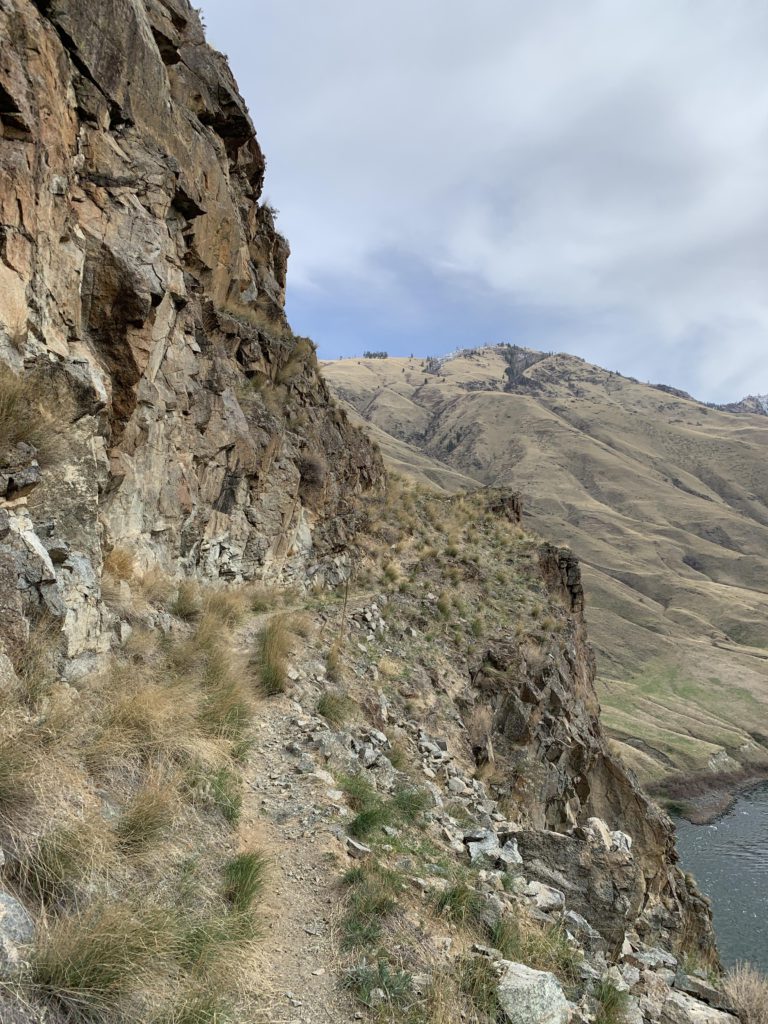
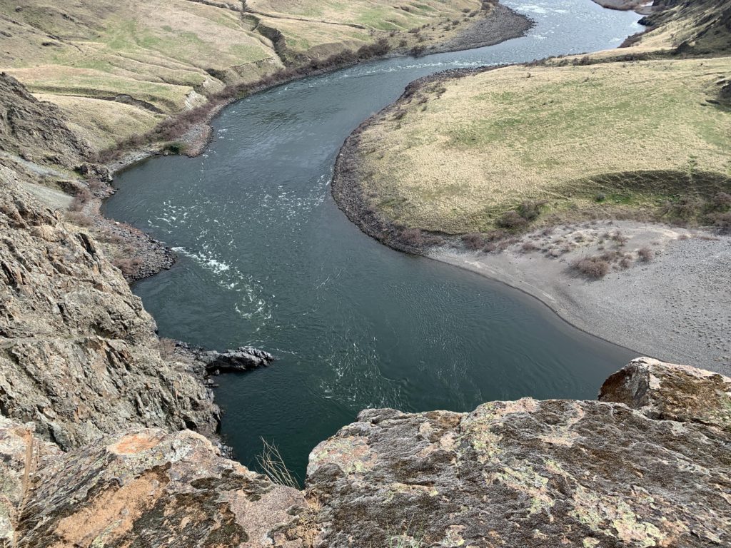
Past Kirkwood Ranch, the trail crosses a meadow featuring the grave of one David Kirk (1852-1916) and sidles up to the river. The tip of Kirkwood Bar is a lovely gravelly beach, inviting for a swim (me) or just plain lounging and watching the jetboats navigating the rapids (Lady). Leaving his backpack with Lady, the Scribe attempted to appease me with a quick run to Suicide Point. Unencumbered with baggage (and life-saving water), we ventured out on a trail hewn into a granite wall above a vertical drop into the river. The trail then climbed the barren hillside and soon turned to sand. Views are great, both up the hillsides and along the Snake as it winds its way around the knob which is the home of Suicide Point. The trail soon turns to packed dirt and talus, but continues to climb and weave in and out of draws. Once the knob is rounded, a few switchbacks ascend quickly to an overlook (with a neat rock seat), where, according to lore, lovers from two different tribes tied their braids together and jumped to their death, having been denied a marriage certificate. That’s what bureaucracy does. Anyway, views are great and if you’d wondered where all the planes are going that buzz around on top of and inside the canyon, scan the flats on the southeastern side of the river for a landing strip near Brockman Ranch.
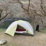
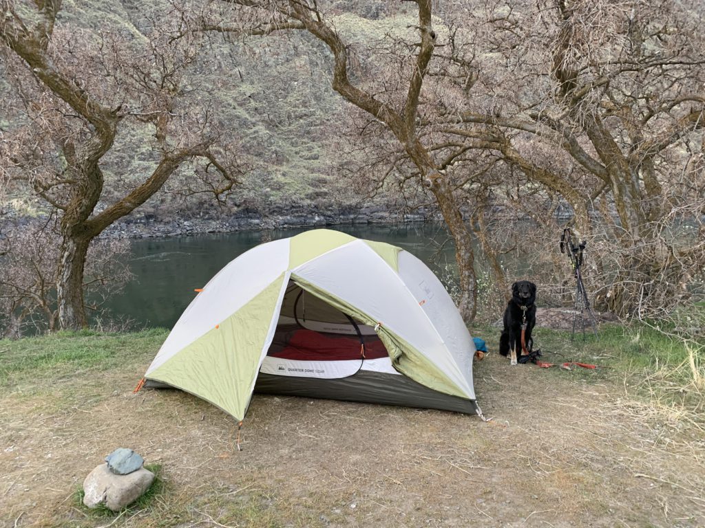
Back it was the same way to Kirkwood Ranch where we hoped to find Lady and not a rattlesnake with a giant bulge. Lady it was, and we continued back to the ranch to snag one of the last campsites with a great view of the river and a pair of otters intimately engaged in perpetuating the species while swimming upstream. Not an easy feat by all means–you had to be there.
Alternate Routes
- The trail continues past Suicide Point for a total of around 30 miles. Expect trail conditions to deteriorate as you go on. Beyond Granite Creek the trail is no longer maintained. You can’t quite make it to the dam; to do so you’d have to cross the river
- You can take a jet boat if you want to turn it into a one-way hike. Google Hells Canyon Jet Boat Tours
- From Kirkwood Ranch, several trails climb into the Seven Devils Mountains
- There is also a lesser-used trail on the Oregon side, but it is more difficult to access
Things to Consider
- It is rattlesnake country, so watch out in the hotter months. We didn’t see any, but other hikers reported spotting a couple (early April)
- Hells Canyon gets very little, if any snow, so the trail can be hiked year around. The access road via Pittsburg Saddle may be the bigger issue (though it is cleared year-around)
Not so great