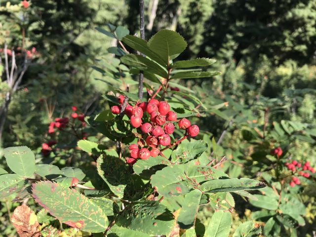
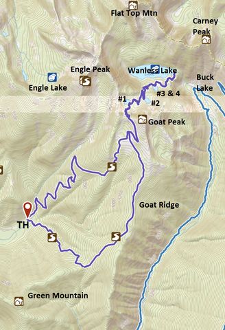
The Wanless Lake loop astonishes with not just one lake, but five in total, each worth the hike in its own right. Wanless Lake is the cream of the crop, measuring a mile long and a quarter mile wide in places, making it the largest lake within the Cabinet Mountains Wilderness.
| Location | Cabinet Mountains |
| Rating | 4.3 out of 5 |
| Difficulty | Moderate (some uphill hiking; trail #921 drops steeply downhill) |
| Distance | 18.9 miles |
| Duration | 7:09 hours moving time (hiking) |
| Elevation Gain | 4,851 feet |
| High Point | 6,447 feet (Goat Pass) |
| Low Point | 2,901 feet (trailhead) |
| Trail Type | Lollipop |
| Trailbed | Packed dirt, loose rocks, talus |
| Trail# | 921, 923, 924 |
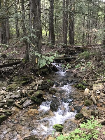
| Water | Any of the lakes and McKay Creek. Goat Ridge and the ascent on #924 are dry. There are a few trickles in the Bearpaw (#923) section. |
| Status | Wilderness Area |
| Administration | Kootenai National Forest |
| Conditions | Very good, especially #924. The trail is sawed out yearly. |
| Permits | None required |
| Camping | Trailhead; upper lakes 1 and 3; Wanless Lake; Intersection of trails 921 and 923, but the latter is dry |
| Maps | USGS Goat Peak, Noxon Rapids Dam, Howard Lake |
| Trailhead | From MT-200, turn east at milepost #18 onto McKay Creek Road (this intersection is where the Noxon Dam road leads off to the west). Follow this pothole-riddled gravel road for 4 miles. When in doubt, choose the better road as a few dirt roads branch off. When the road curves and climbs uphill, however, continue straight and stay on FR-1022. The road ends at a turnaround, a mere dirtroad at that point, but it’s doable in a car.
Google Directions (47.970527, -115.643021) |
| Season | June – October |
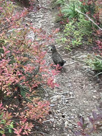
| Squirrel Density | Excellent! Horses not allowed past Upper #4. Closed to mechanized vehicles. |
| Features | Lake, Waterfall, Grove, Meadow |
| Distance From |
|
| Resources | |
| Nearby Hikes | |
| Date | September 15, 2018 |
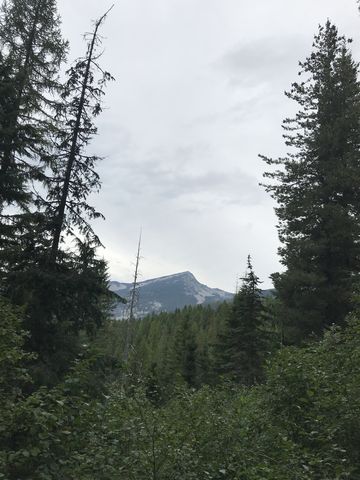
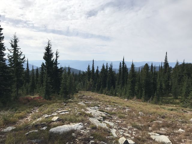
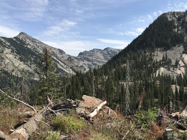
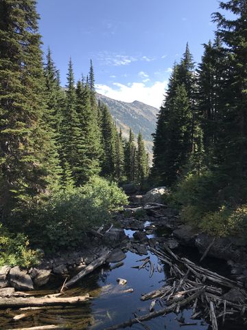
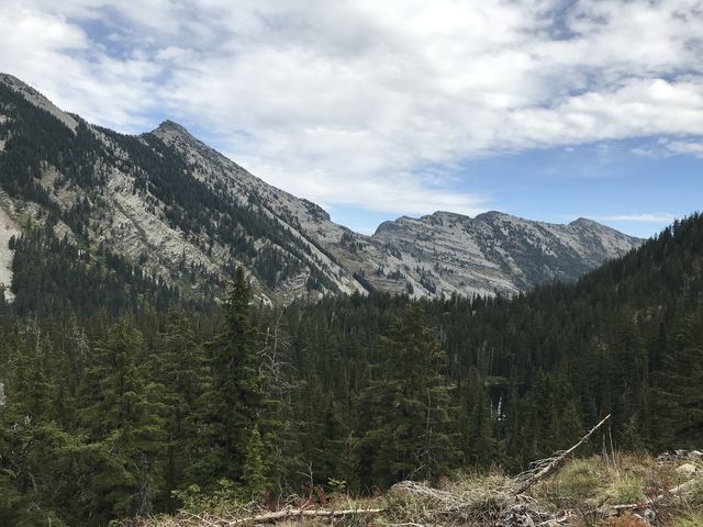
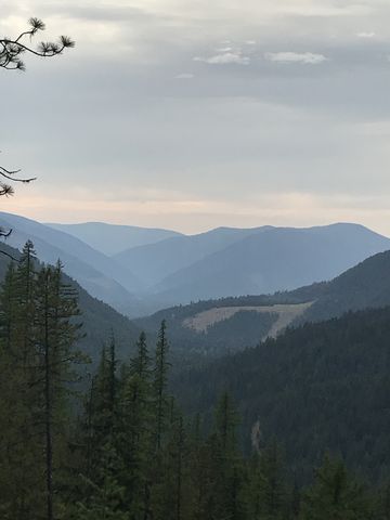
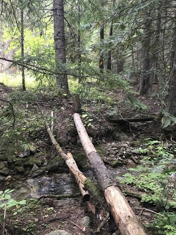
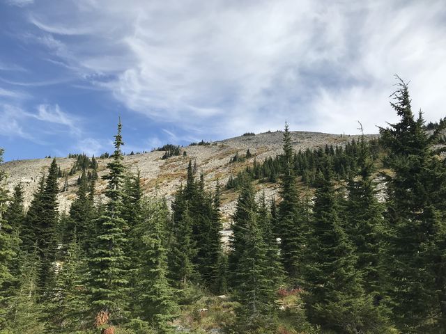 The trail initially parallels McKay Creek through a mixed coniferous forest. About a quarter mile in, the trail crosses the creek on a footbridge and commences the arduous climb up a flank of Goat Peak, switchbacking for about three miles. Then the trees retreat as the trail ascends through an open basin with views of Goat Ridge and beyond to the Clark Fork River and the Coeur d’Alene Mountains.
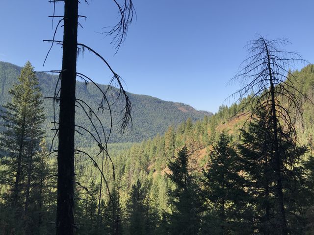
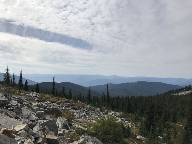
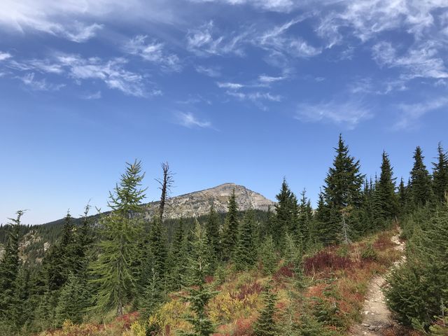
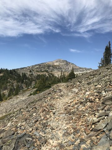
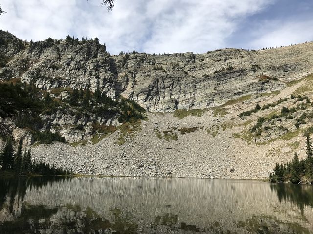
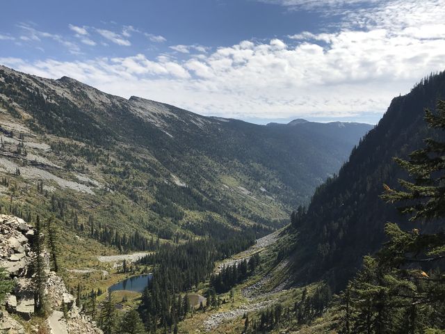
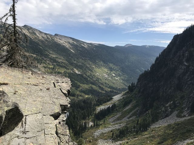
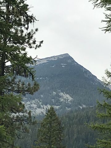
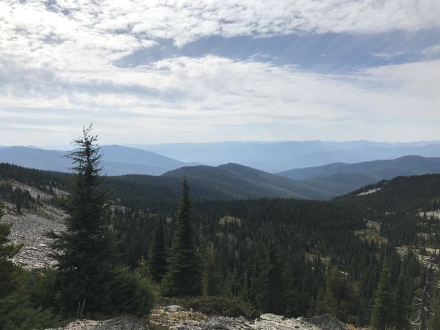 Following the intersection with the Goat Ridge trail, the path moves across a talus slope with more views to the west as well as Engle Peak to the north. The trail switchbacks one more time, traverses the barren west face of talus-covered Goat Peak and reaches Goat Pass–the high point of this hike–just before the 6 mile mark. Goat Pass dishes out excellent views to the east and west. It also marks the boundary to the Cabinet Wilderness. And there is a cell signal (Verizon).
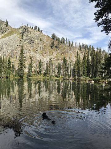
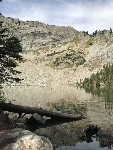
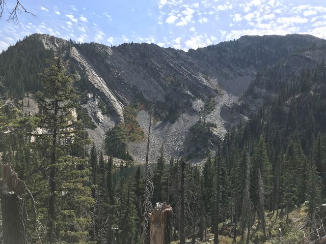
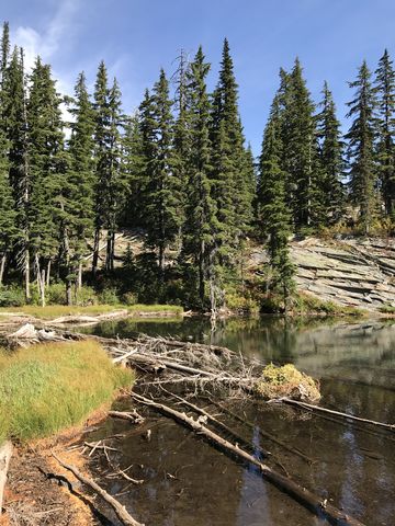
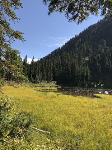
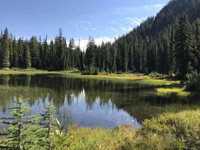
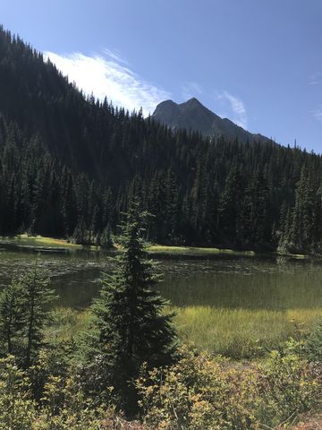
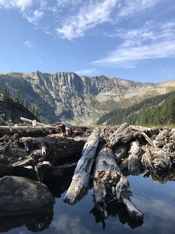
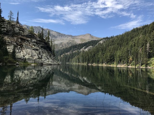
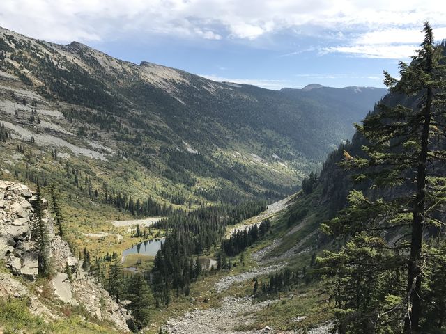
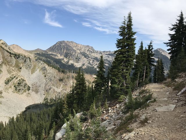 A dozen tight switchbacks make short work of the steep talus slope on the east side, and then the trail flattens out a bit on approach to Upper Wanless Lake #1. This jewel of a lake is the first consistent source of water, about 6.5 miles in, and offers a number of excellent campsites. Following #1, the trail moves through an old burn area to lake #2 in about a mile, with good vantage points of Wanless Lake along the way. There is no camping at #2, huddled below the eastern face of Goat Peak. For less than a mile the trail then continues on and off through old burns to lake #3, which does include a campsite, but the lake has a bit of a swampy look–beware of mosquitoes. Though invisible from #3, lake #4 is almost immediately adjacent. There is no camping at #4.
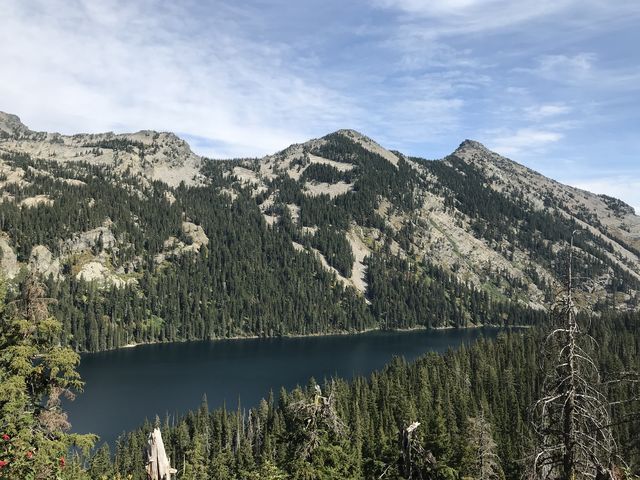
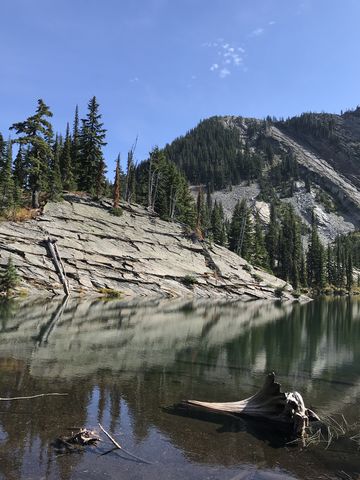
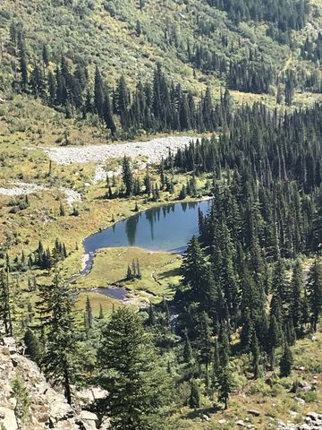
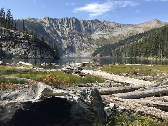
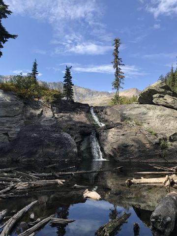 Stock has to remain at lake #4, while the singletrack continues downhill to a fantastic overlook just ahead of Wanless Lake. The sheer rock cliff appears to just drop off below, enabling magnificent views of Buck Lake and the Swamp Creek valley, as well as the divide on the opposite side, including Lost Buck Pass. Continuing, the trail quickly drops down to the lake, the lack of equestrian users making the trail a bit more overgrown. The trail meets the lake near its exit, which sports a massive granite wall keeping the lake in place and a waterfall spilling over it–a mere trickle this late in summer. Views to the west end of the lake are fabulous, with the snub-nosed headwall of Engle Peak sneering angrily across the lake and the remaining snow patches (likely permanent snow). The lakes are stocked with cutthroats, which are native in Wanless Lake.
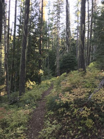
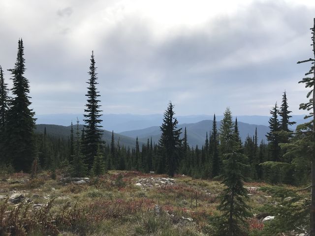
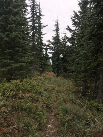
 For the return trip, climb back up to Goat Pass, then downhill to the fork with the Goat Ridge trail. Goat Ridge is a pretty, if uneventful, trail, less traveled than #924, but still well-maintained. There are selective views during the high traverse to Goat Ridge, but once on the ridge the trail is hemmed in thickly by alpine fir on both sides. The trail also drops lower and lower, and with not much of a view one’s attention is easily diverted to the thick and delicious huckleberry carpet. At the 17-mile mark you reach the fork with trail #923 (Bearpaw), which plunges steeply downhill to McKay Creek. Clearcuts in this section provide extensive views to the mouth of McKay Creek and Engle Peak. At the bottom, the trail leads through a cedar forest and crosses McKay Creek via a narrow log back to the trailhead.
Enjoy this hike? Let us know in the comments below!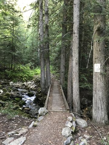
Alternate Routes
- From Wanless Lake you could scramble steeply down a talus slope to Buck Lake. This opens up the Swamp Creek trail, Cabinet Divide, and Geiger Lakes area (see Buck Lake trail description)
- Trail #921 extends further out to the top of Green Mountain
© 2016 – 2018 NaughtyHiker. All rights reserved. No duplication without permission.
- Hikers
Sure enjoyed this post and your photos! I’ve not made that hike, but have seen and photographed Wanless Lake from the Cabinet Divide trail at Lost Buck Pass. Always wondered what that hike was like! Thanks!
I bet it’s even more spectacular now with the larches turning color. Goat Ridge is mostly larches