Chimney Rock

Easily identifiable on clear days from as far away as Myrtle Peak or Priest Lake, the distinct shape of Chimney Rock makes this one of the most popular hikes in the southern Selkirk Crest. The views are superb and if you’re into rock climbing you won’t want to miss the technical climb to the pinnacle.
Location
  • Selkirk Mountains
Rating
3.8 out of 5
Difficulty
More Difficult (uphill; precarious trail around the chimney)
Distance
10.8 miles
Duration
4:11 hours moving time (Hiking)
Elevation Gain
2,798 feet
High Point
6,931 feet (Saddle below Chimney Rock)
Low Point
4,021 feet (trailhead)
Features
  • Mountain
  • Grove
  • Meadow
  • Outing Type
  • Daytrip
  • Trail Type
  • Out-and-back
  • Trailbed
    Old logging roads, packed dirt, granite slab
    Trail#
    256
    Water
  • There are a few creeks, most of them seasonal, along the old logging roads. Chimney Creek is probably the last reliable source of water. We found a small pool off-trail in the basin below Chimney Rock (see trailmap).
  • Camping
    • At trailhead and a few dry spots in the basin below Chimney Rock
    Conditions
    • Good. Cleared of downfall, but somewhat overgrown with shrubbery. The trail is difficult to discern across the granite slabs and in the boulder fields you are on your own.
    Administration
  • Kaniksu National Forest
  • Status
  • Unprotected
  • Maps
    USGS
  • Mount Roothaan
  • Fees & Permits
  • None required
  • ()
    Open To
  • Hikers
  • Dogs
  • Horses
  • Mountain Bikers
  • ()
    Directions
  • From US-95, head west on Upper Pack River Road (this is about 11 miles north of Sandpoint, in a place called Samuels. There is a gas station on the left, shortly after you cross the Pack River). Stay on Upper Pack River (aka FR #231) for 17 miles (the first 7 are blacktopped, the rest is a well-graded gravel road). Turn left onto FR #2653 and head downhill for a quarter mile to the trailhead.
  • Season
    July – October
    Resources
      Date
      August 5, 2017

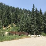
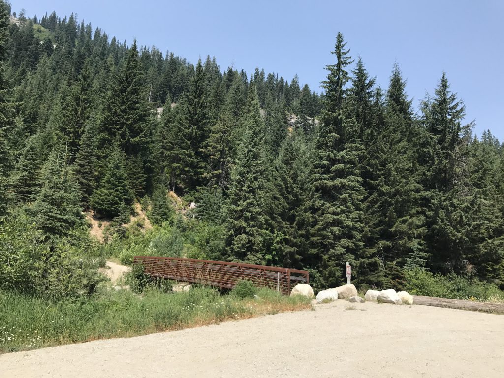
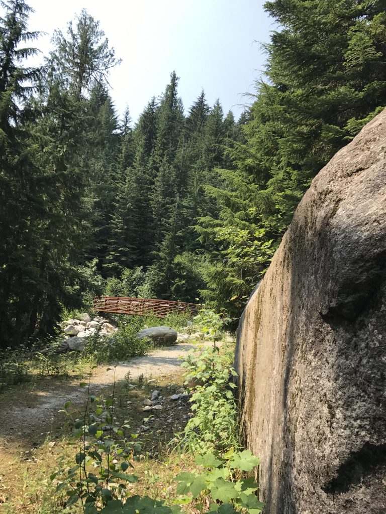
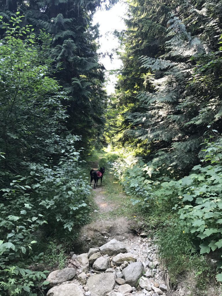
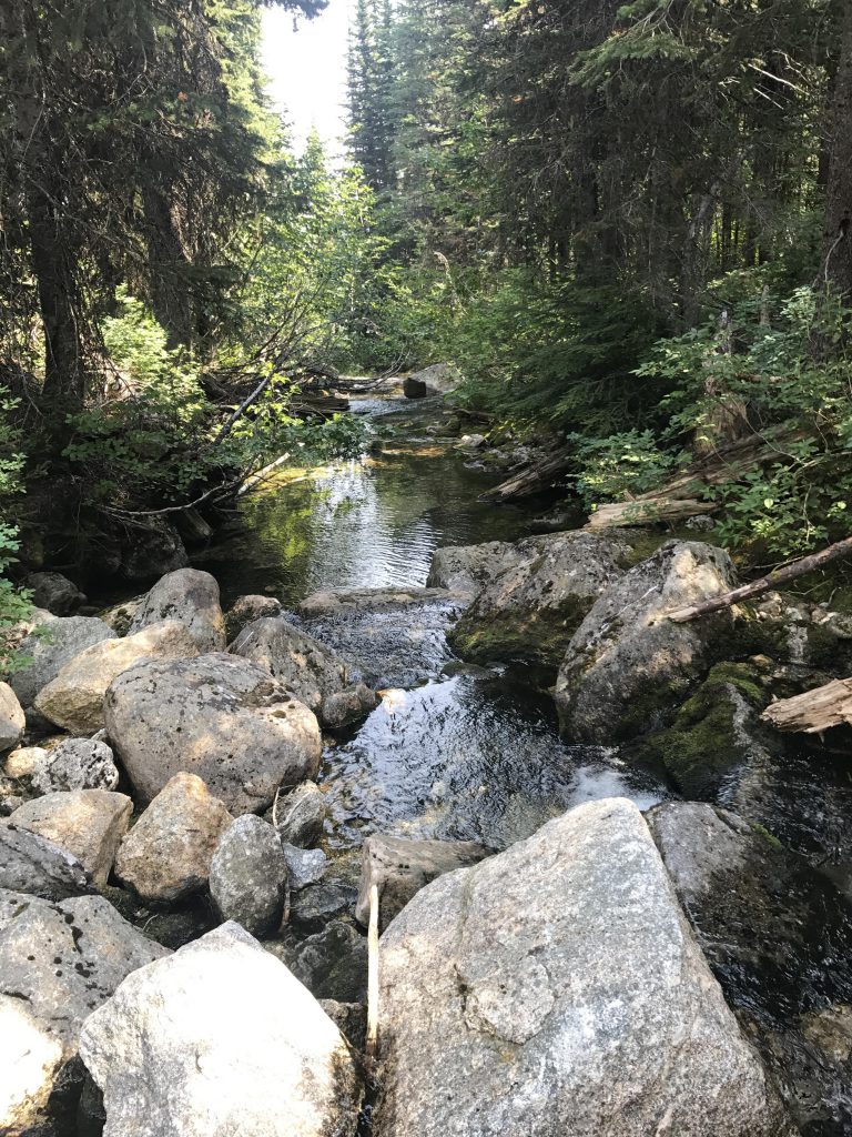
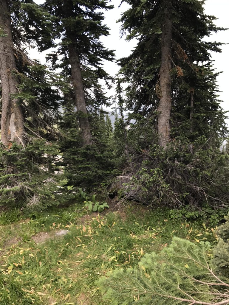
      The trail starts out by crossing the Pack River on a newer bridge, then following old FR #2653, which is now closed to motorized traffic. The road consists of a dense bed of noxious weeds bordered on both sides by thick stands of alder and shoulder-high bracken ferns. It meanders alongside the lower flank of Silver Dollar Peak in a southwesterly direction for a couple of miles, crossing Thor Creek on a sturdy bridge, entering a cooling grove of western red cedars, then exchanging the shade and cool for heat and views of the Pack River valley and the west face of Roman Nose on the other side of the Pack River. 

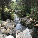
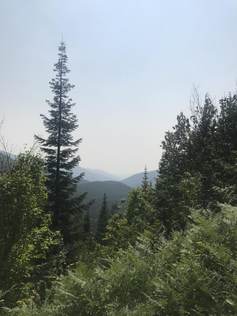
      Eventually you come to a fork in the road. In the hiking world, as in real life, the road less traveled involves more bushwhacking, thus choose the road more traveled, which, alas, leads westwards and uphill. It remains an old logging road all the way to Chimney Creek at the 3-mile mark. As the road ascends towards Chimney Creek the tree canopy opens somewhat and serves up views of the McCormick Ridge and Gunsight Peak. 

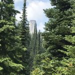
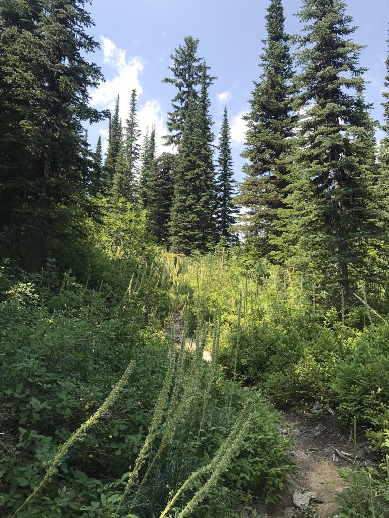
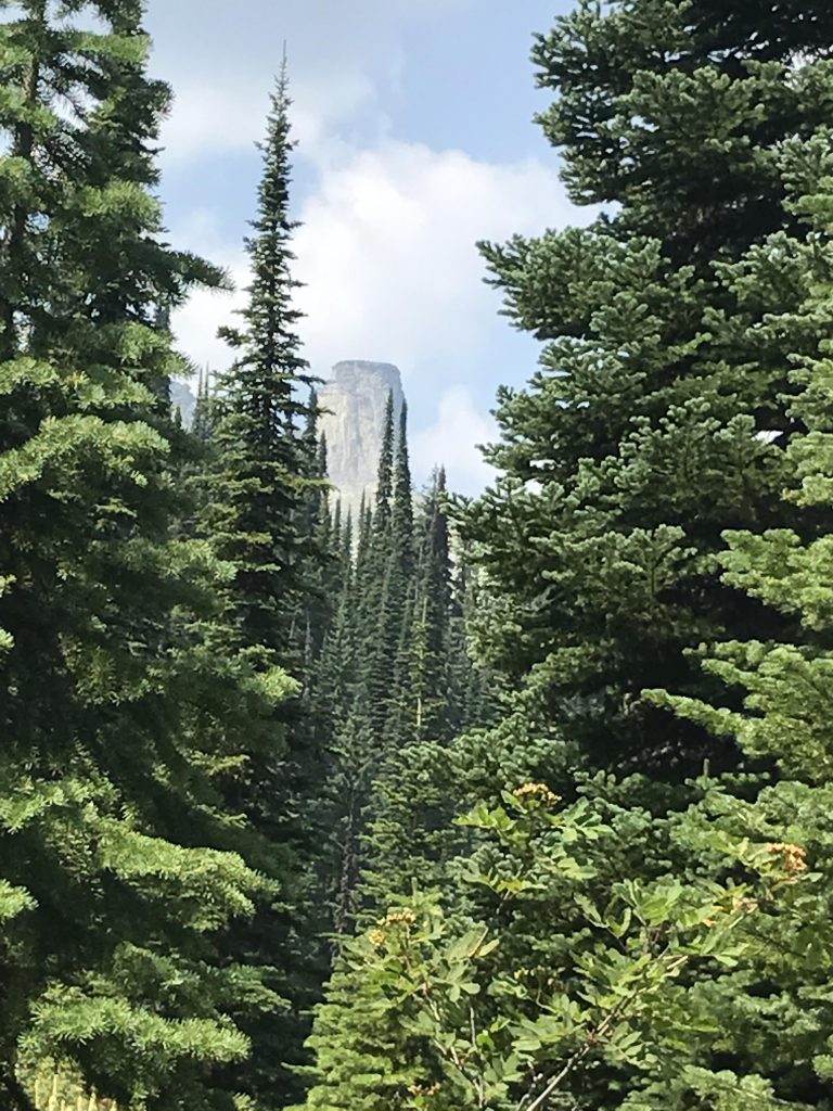
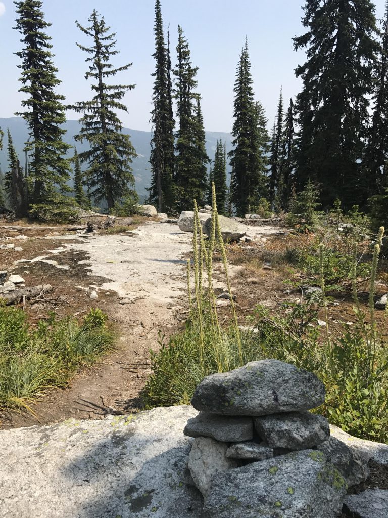
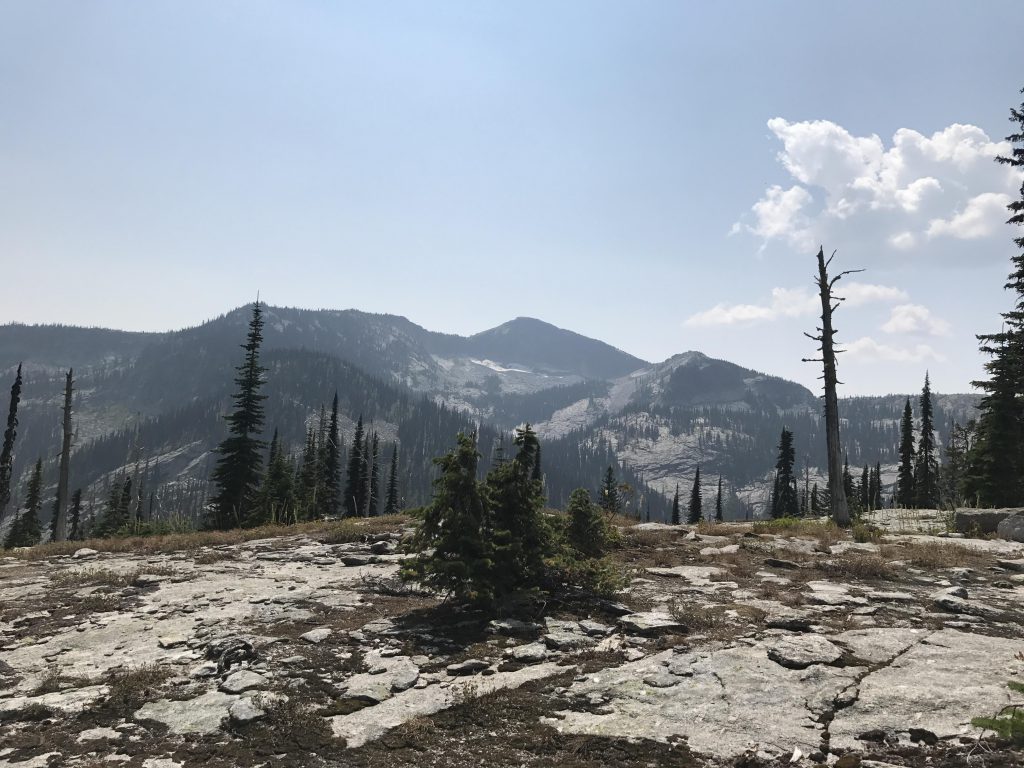
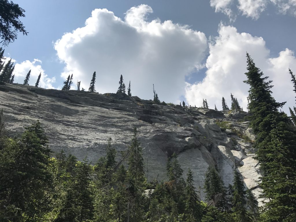
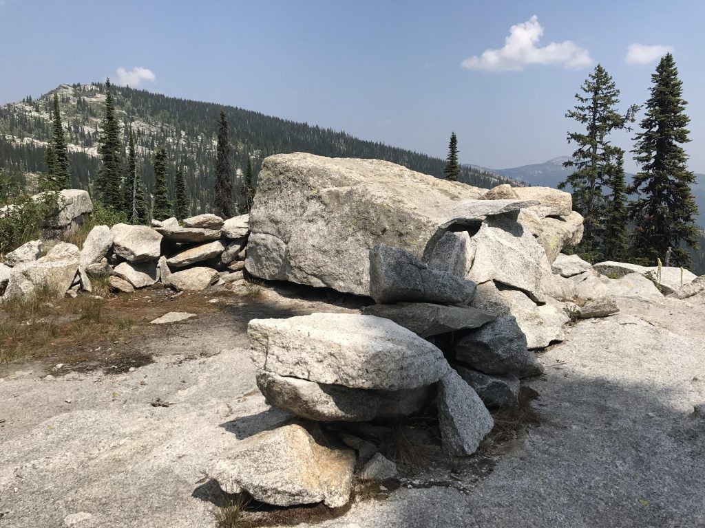
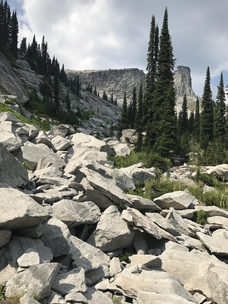
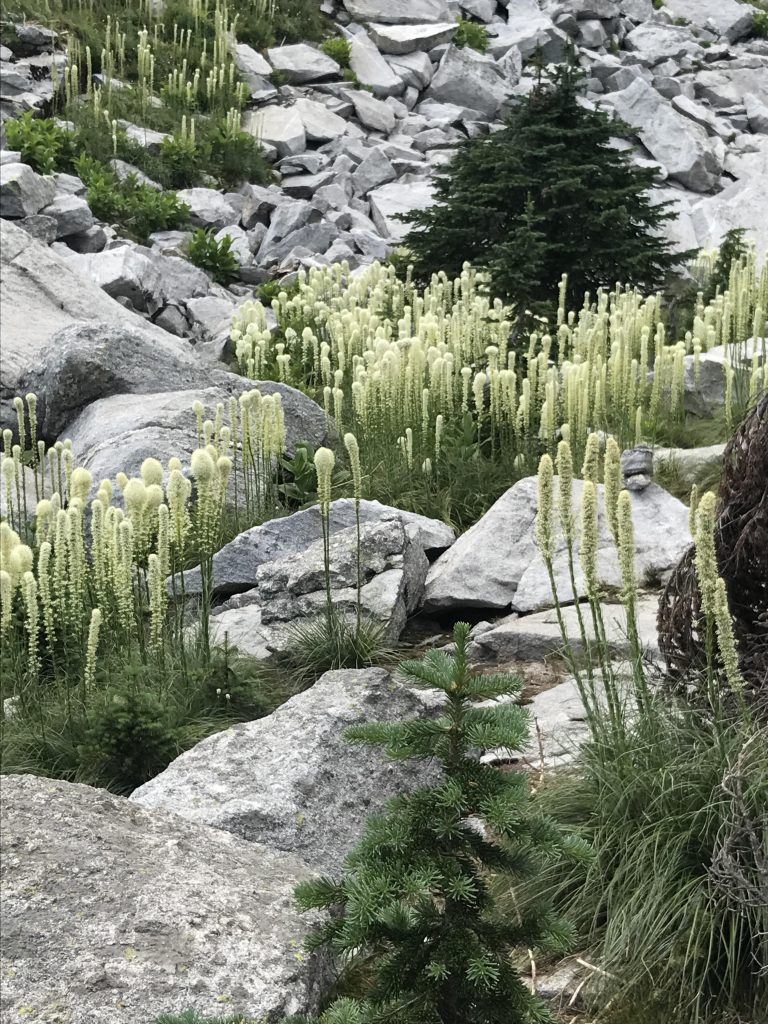
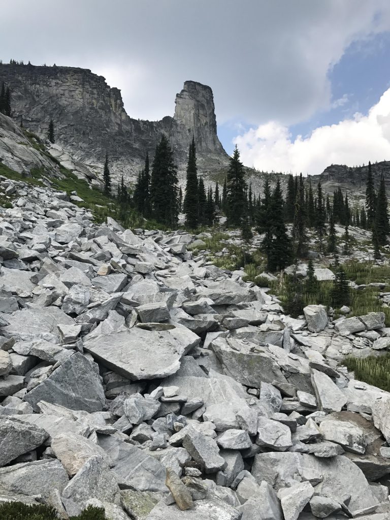
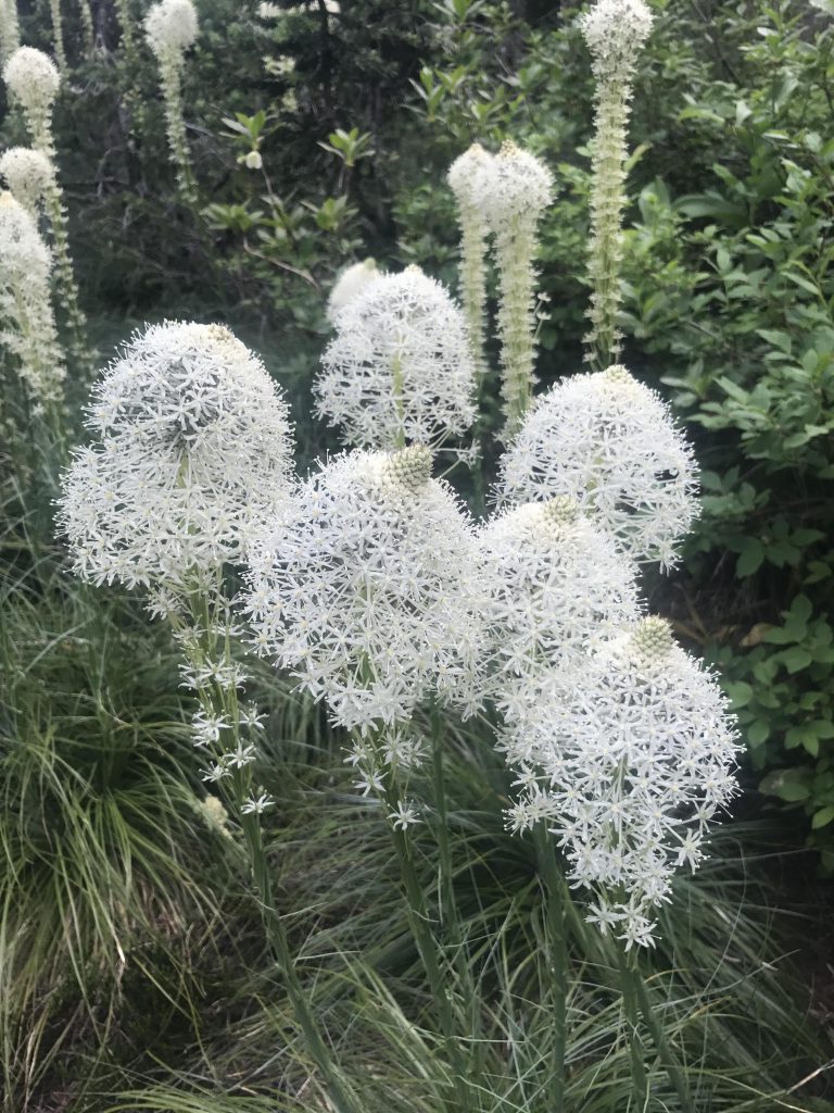
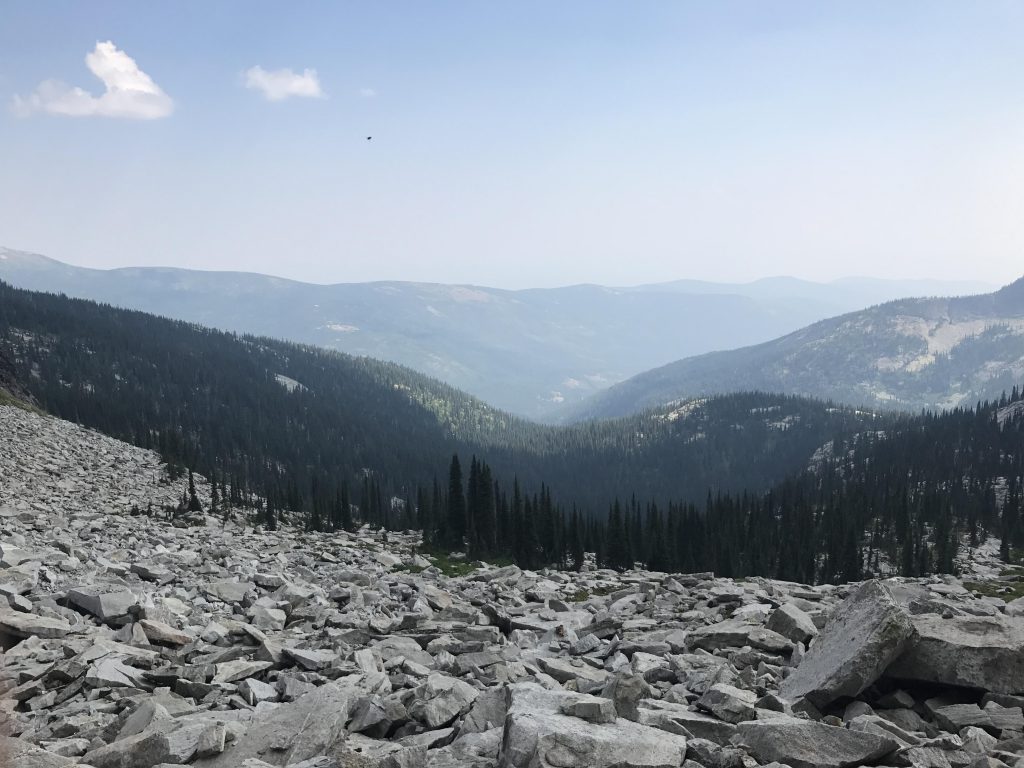
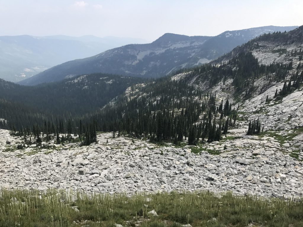
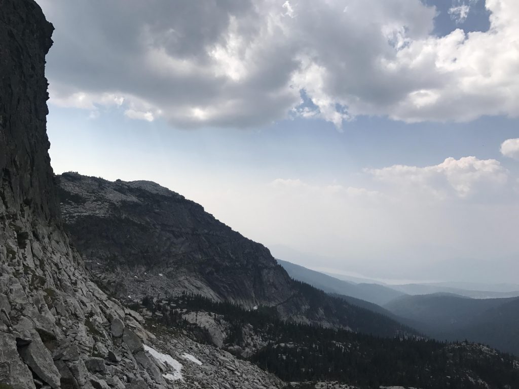
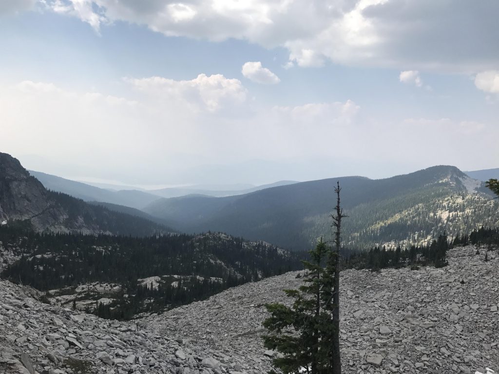
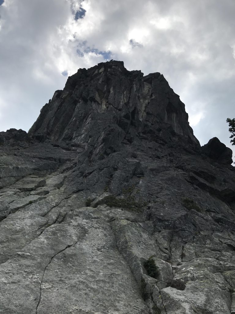
      Shortly past Chimney Creek, the trail loses all semblance of a road, being reduced to a single-track winding its way uphill through a lush carpet of still-tart (in early August) huckleberries. Be on the lookout for Chimney Rock, with first glimpses possible near the 3.25-mile mark through the trees. Shortly afterward you’ll emerge onto a granite bench, enabling a better look at the chimney. The terrain flattens out and you’ll have to keep a sharp eye on the rock cairns signaling the route across the expansive granite slabs.

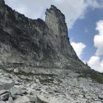
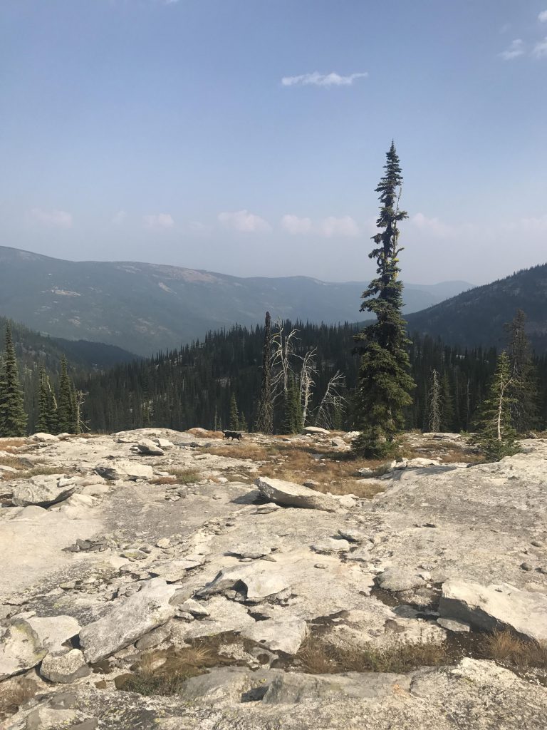
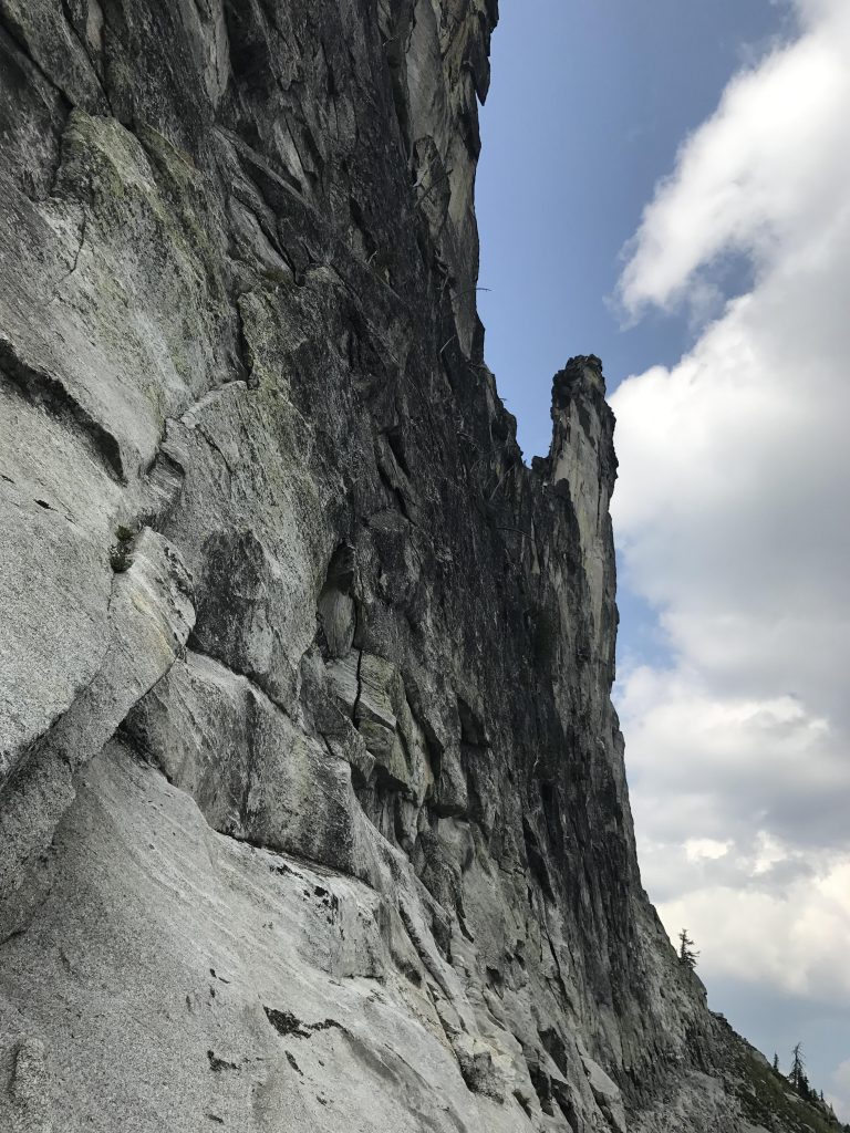
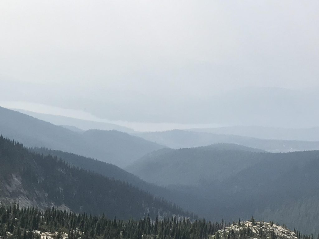
      Near the 4-mile mark the route turns northwestwards toward Chimney Peak, but staying below a steep cliff of a Mount Roothaan flank. The trail here is quite overgrown and easy to lose, especially when you get into the rockier areas. We lost is more than once, but as long as you keep a sharp eye on the rock cairns you’ll find your way back to the proper route. Once the trees retreat, and Chimney Rock rises up in it full glory in front of you, the trail all but vanishes. The objective is simple, though. Cross the boulder field towards the base of Chimney Rock, then hike along its base towards the saddle to the right (eastern side). After taking in the view to the north (Eddy Peak, Silver Dollar Peak) follow the narrow and precarious footpath around Chimney Rock’s north face to the west side. The west side offers a fairly straightforward scramble up to the razor-edge saddle just below Chimney Rock. This spot provides grandiose views in every direction, including Priest Lake. The ledge is only a few feet wide though, and the drop-off on the eastern side is vertical. Be careful! 

      Alternate Routes

      • You can also access Chimney Rock from the Priest Lake side along Horton Ridge

      Things to Consider

        Not so great

          Campsite at trailhead
          Bridge across Pack River at trailhead
          Trail #2653 and bridge across Thor Creek
          Cedar grove
          Views down Pack River valley
          An unnamed tributary to West Branch
          Lots of bees and flowers
          Huge boulders ahead of the Chimney Creek crossing
          Chimney Creek features an inviting pool
          Huckleberries and beargrass line the singletrack after the Chimney Creek crossing
          First view of Chimney Rock around 3.5 miles into the hike
          The climb up leads across this forested knoll below the granite slab
          Follow the cairns across the rock slab!
          From the basin below Mt. Roothaan you get a good view of Chimney Rock
          McCormick Ridge and Gunsight Peak
          Steep cliff of Mt. Roothaan
          A rough shelter and dry campsite
          From the basin below Mt. Roothaan you get a good view of Chimney Rock
          The trail leads along the right side of this boulder field
          A patch of beargrass high up still in bloom
          Chimney Rock from the end of the basin Rock
          Beargrass in full bloom
          Geocache spoiler foto
          Chimney Rock from the boulder field. The trail follows along the base to the saddle on the right, then curls around and ends up on the razor-edge saddle to the left of the chimney
          Naughty found a pool in the basin below Chimney Rock
          Chimney Rock from right beneath it
          View into Pack River valley
          The Pack River trail drops down to the right along the boulder field into the trees.
          Lots of sharp crags
          Mt. Roothaan, with Priest Lake in the background
          View of west side towards Priest Lake
          A couple of climbers up on Chimney Rock
          Priest Lake. Haze due to forest fires
          It’s a climber’s paradise…

          2 Comments

          1. montucky says:

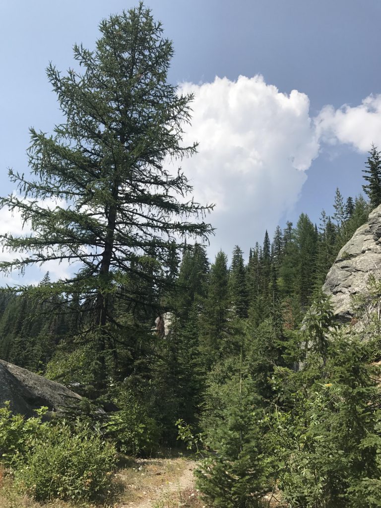
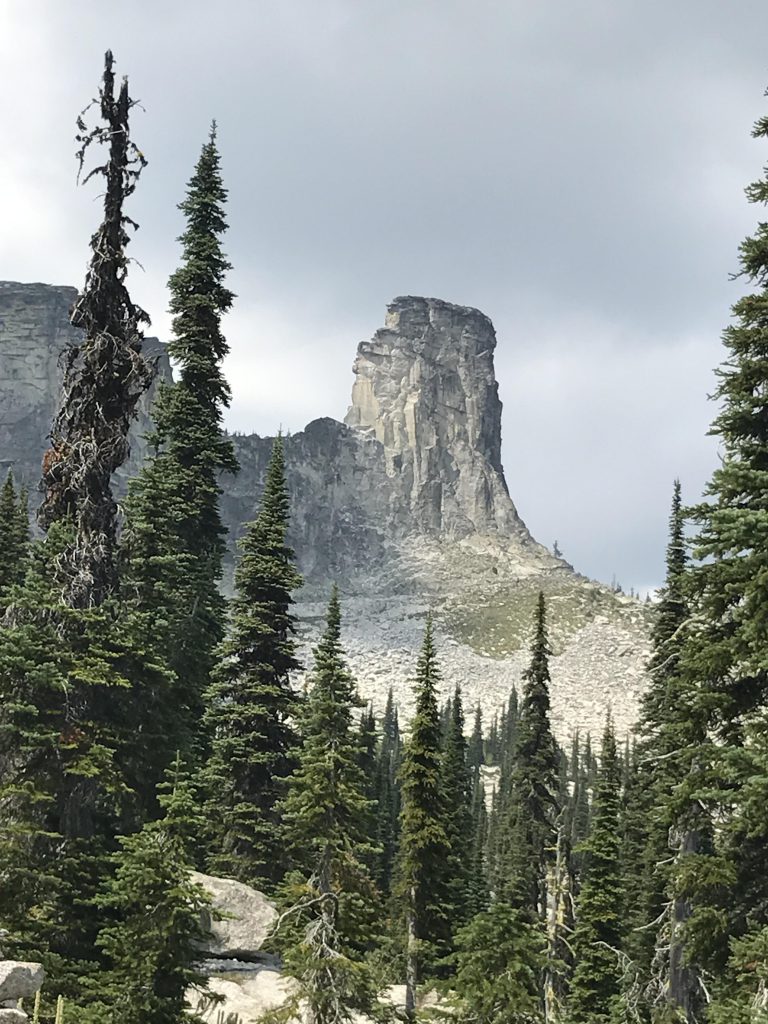
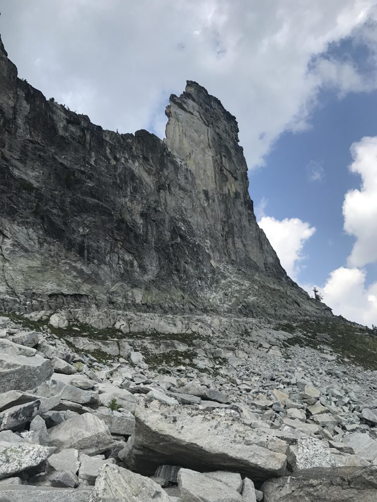
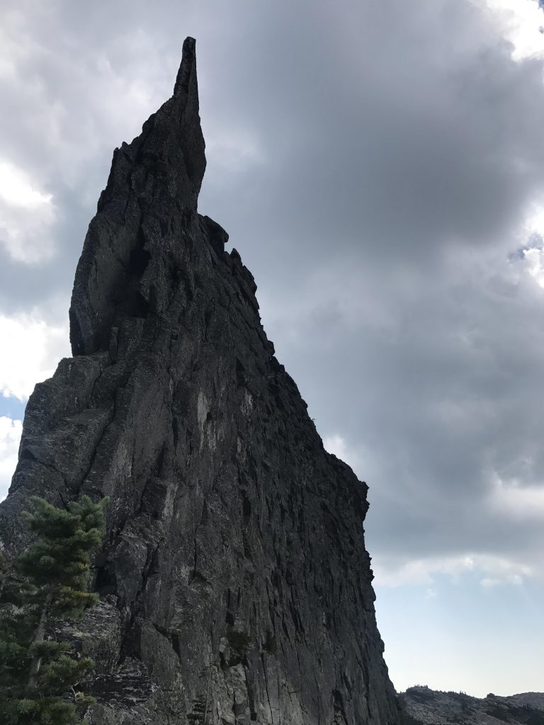
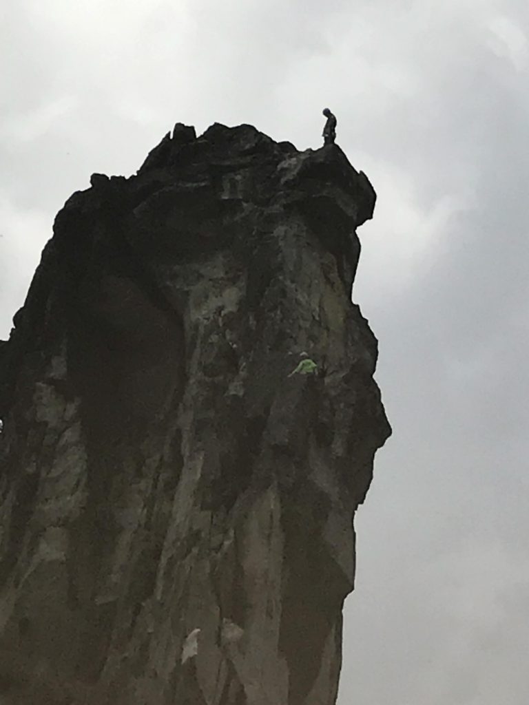
            The views of that spire would make the hike to get there a pleasure. What a beautiful sight!

            1. naughtyhiker says:

              As far as rock formations it’s hard to beat. A large hunk fell off in 2012

          Comments are closed.