Evans Landing

Trail #64 is a short hike mostly downhill through a mixed coniferous forest to a gravel-and-sand beach on Lake Pend Oreille. The trail is well-shaded yet still provides ample unobstructed views across the lake towards the Monarch ridge and north towards Maiden Rock and the distant Cabinets. The beach is the perfect spot for a quick swim, with Lake Pend Oreille cold even on a hot day, or an overnight camp stay.  
Location
  • Selkirk Mountains
Rating
3.4 out of 5
Difficulty
Moderate (return is mostly uphill)
Distance
4.0 miles
Duration
1:42 hours moving time (Hiking)
Elevation Gain
1,045 feet
High Point
3,134 feet (just above trailhead)
Low Point
2,046 feet (Lake Pend Oreille)
Features
  • Lake
  • Grove
  • Outing Type
  • Daytrip
  • Trail Type
  • Out-and-back
  • Trailbed
    Packed dirt, rocks
    Trail#
    64
    Water
  • None, except for the lake (recommend against using lake water due to agricultural and industrial runoff)
  • Camping
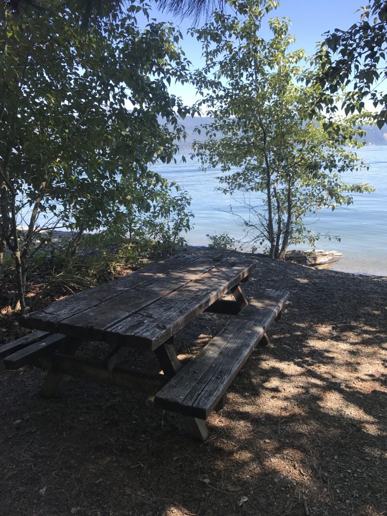
    • There are a number of spots at Evans Landing, which featerures a picnic table. The vault toilet is gone, though.
    Conditions
    • Excellent
    Administration
  • Kaniksu National Forest
  • Status
  • Unprotected
  • Maps
    USGS
  • Cocolalla
  • Fees & Permits
  • None required
  • ()
    Open To
  • Hikers
  • Dogs
  • Horses
  • Mountain Bikers
  • ()
    Directions
  • From US-95 head east on Blacktail Road (this is near Careywood) for 2.6 miles, then swing a right onto Little Blacktail Mountain Road. This is a well-graded gravel road. After another 2.5 miles take a right onto East Ridge Road, also gravel, but not as well graded and narrower. After about half a mile turn left at the fork. There is a sign that says something like “Private Land. Stay on road to trailhead”. The trailhead is marked at another fork, about a quarter-mile up. There is parking for a few cars.
  • Season
    Year-around
    Resources
      Date
      June 24, 2017

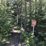
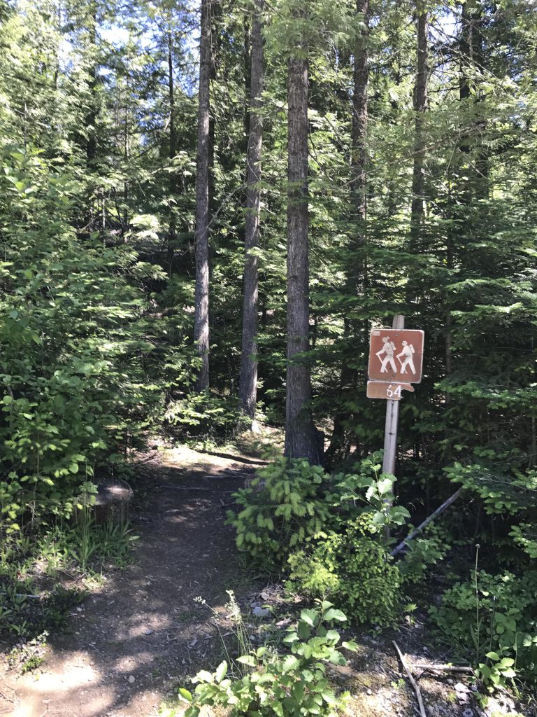
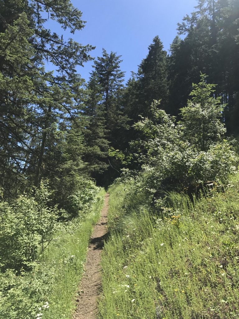
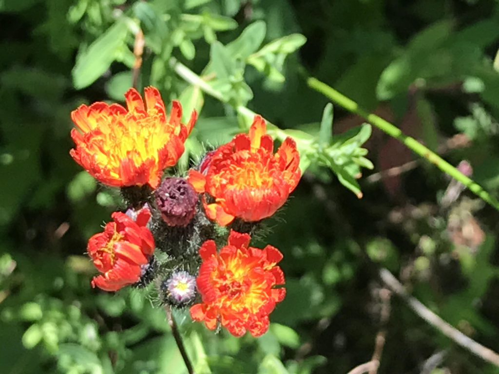
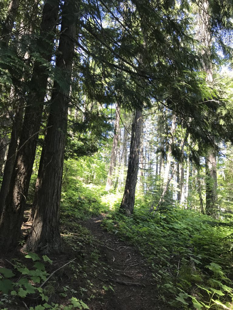
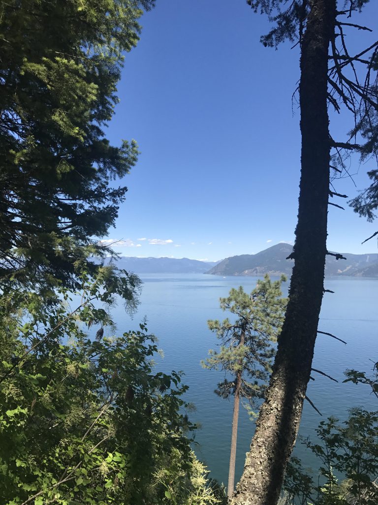
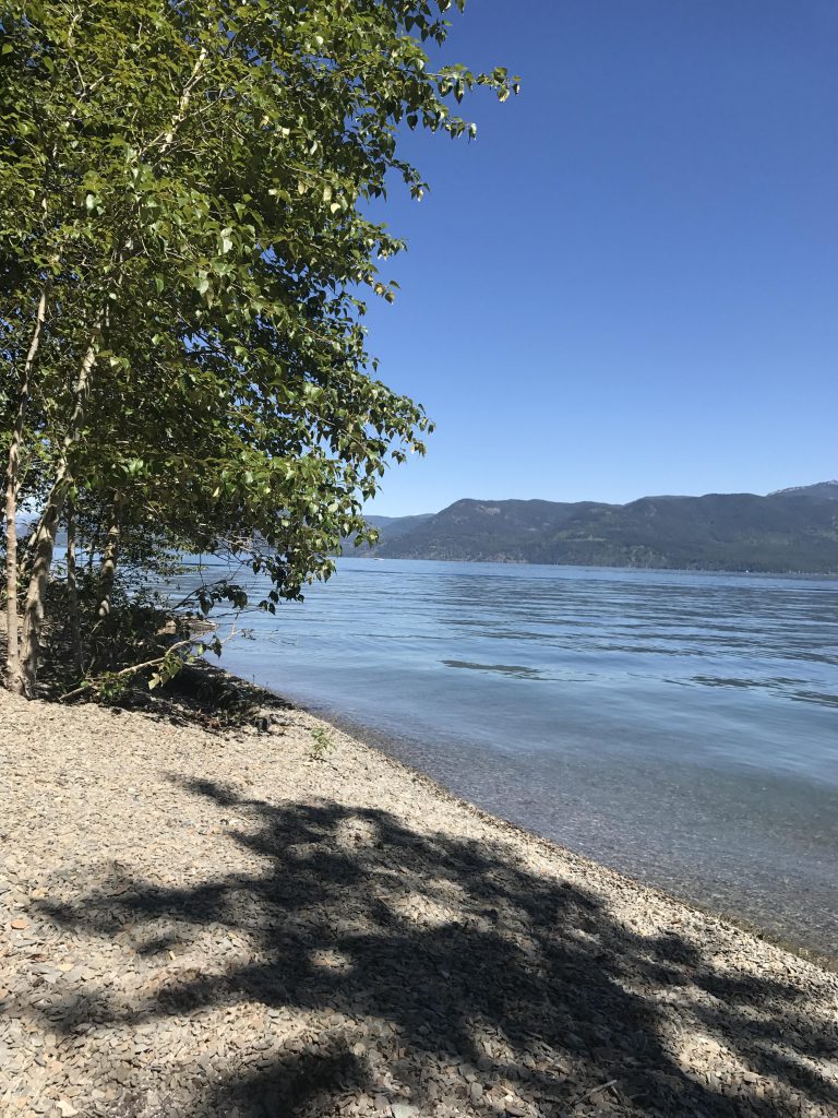
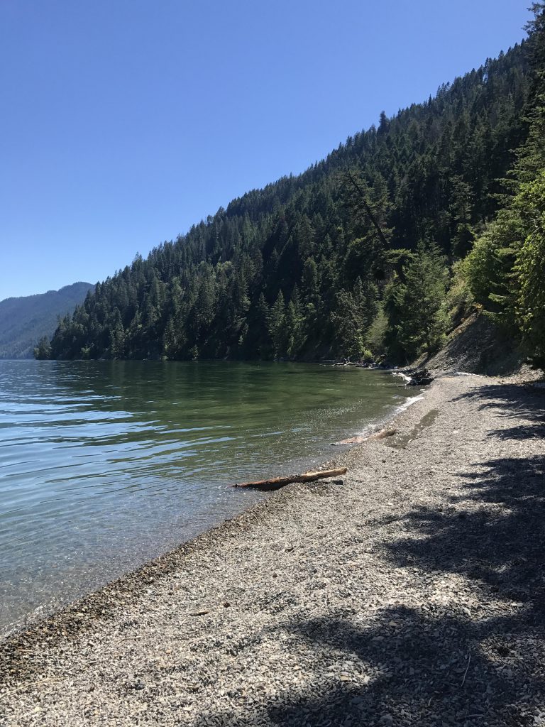
      From the trailhead, trail #64 meanders uphill for just a very short section, perhaps a couple hundred yards, then heads downhill the rest of the way. Most of the trail is very well shaded, in some parts so much so that it gets rather dark and there is almost no undergrowth. Mostly, though, you get filtered views of Lake Pend Oreille and the Monarchs, while hiking through a mix of fir, pine, larch, and in the cooler spots western red cedar. This time of year, wildflowers are abundant.

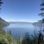
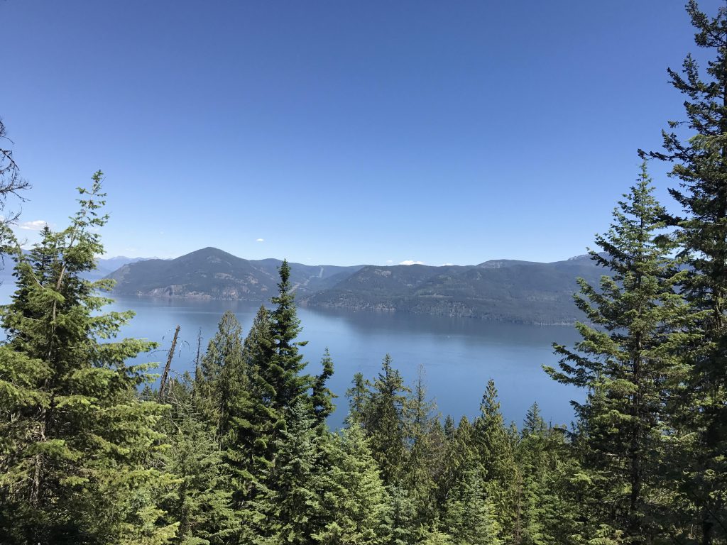
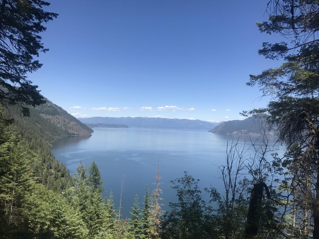
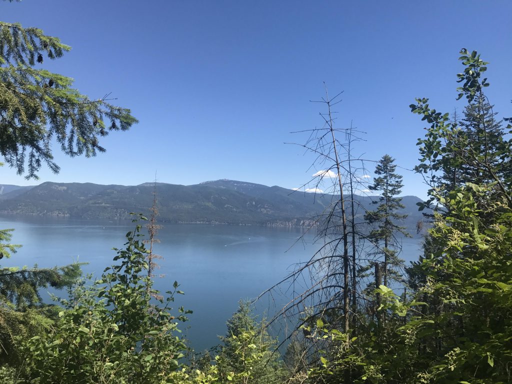
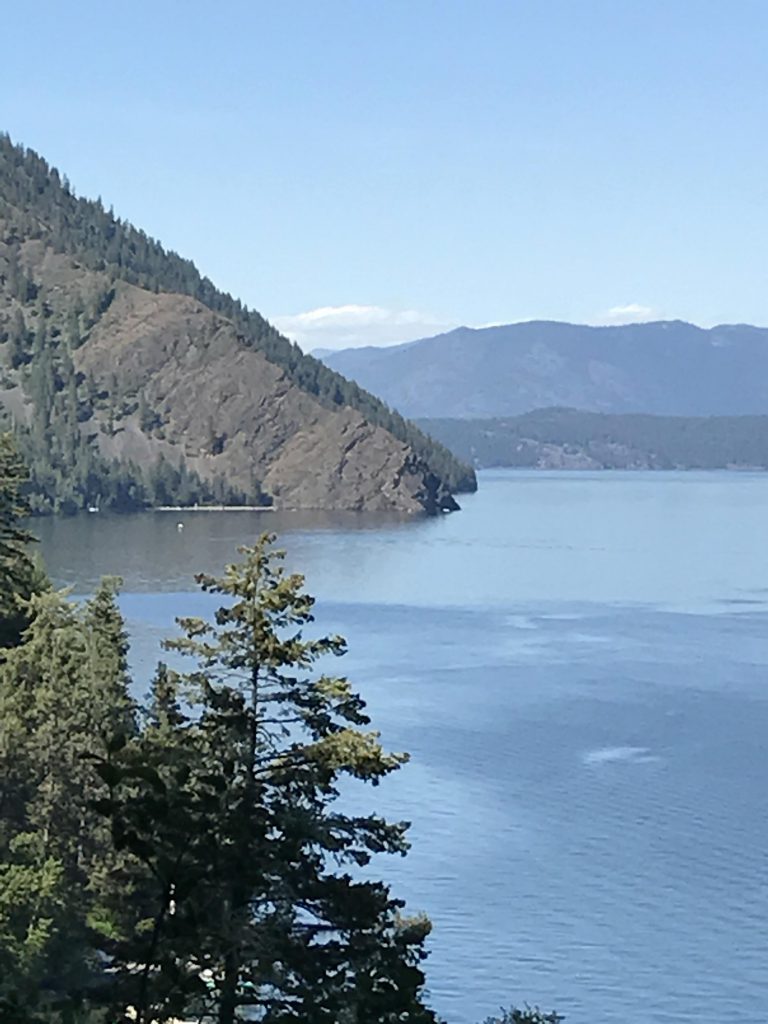
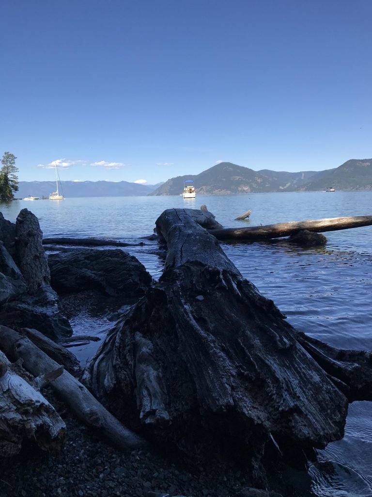
      The trail incline is modest as a handful of sweeping switchbacks make short work of the 600-foot descent. Make sure to pause in a few areas that offer broad views across the lake towards the Monarchs and Packsaddle Mountain. Towards the north you will see Maiden Rock (another boat-camping area slightly to the north), the Cabinets in the distance, and Schafer Peak to the right.

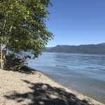
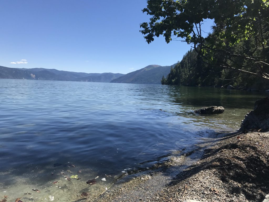
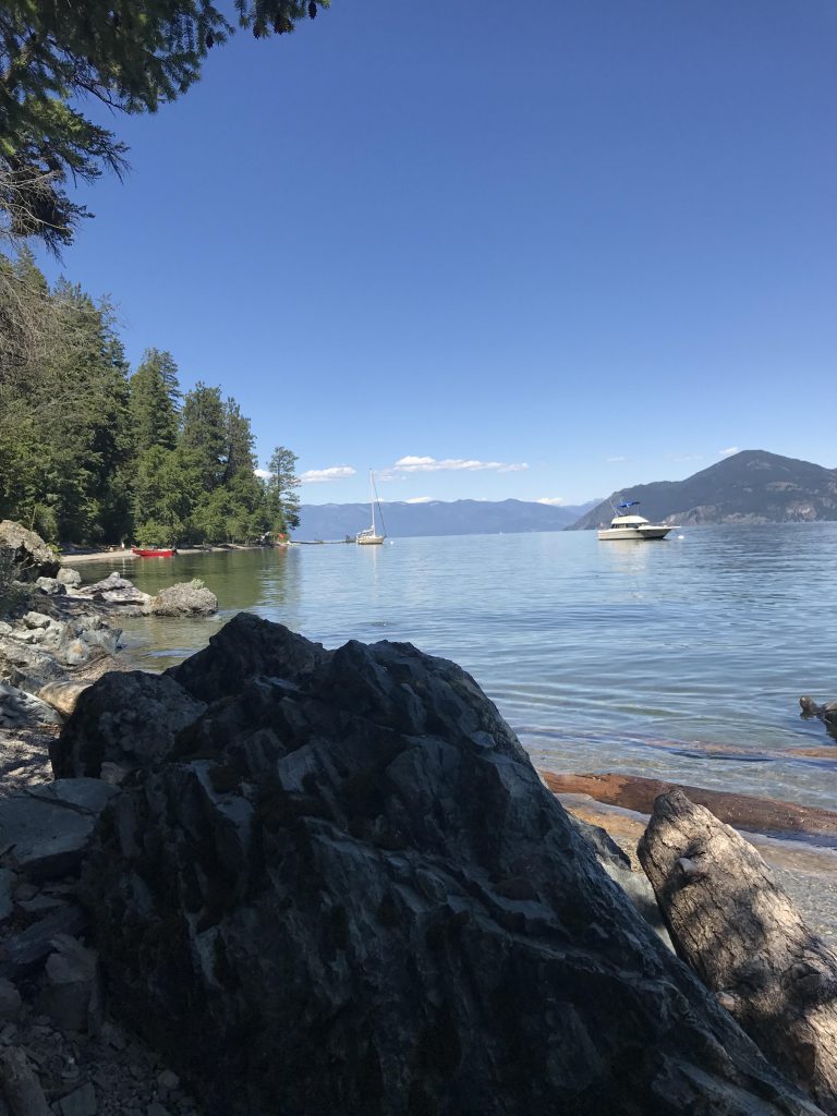
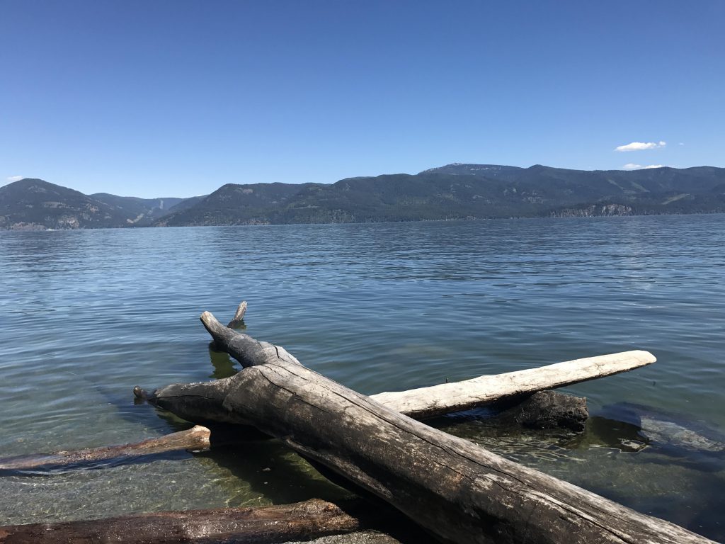
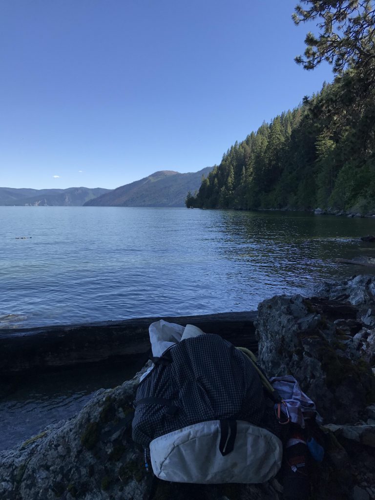
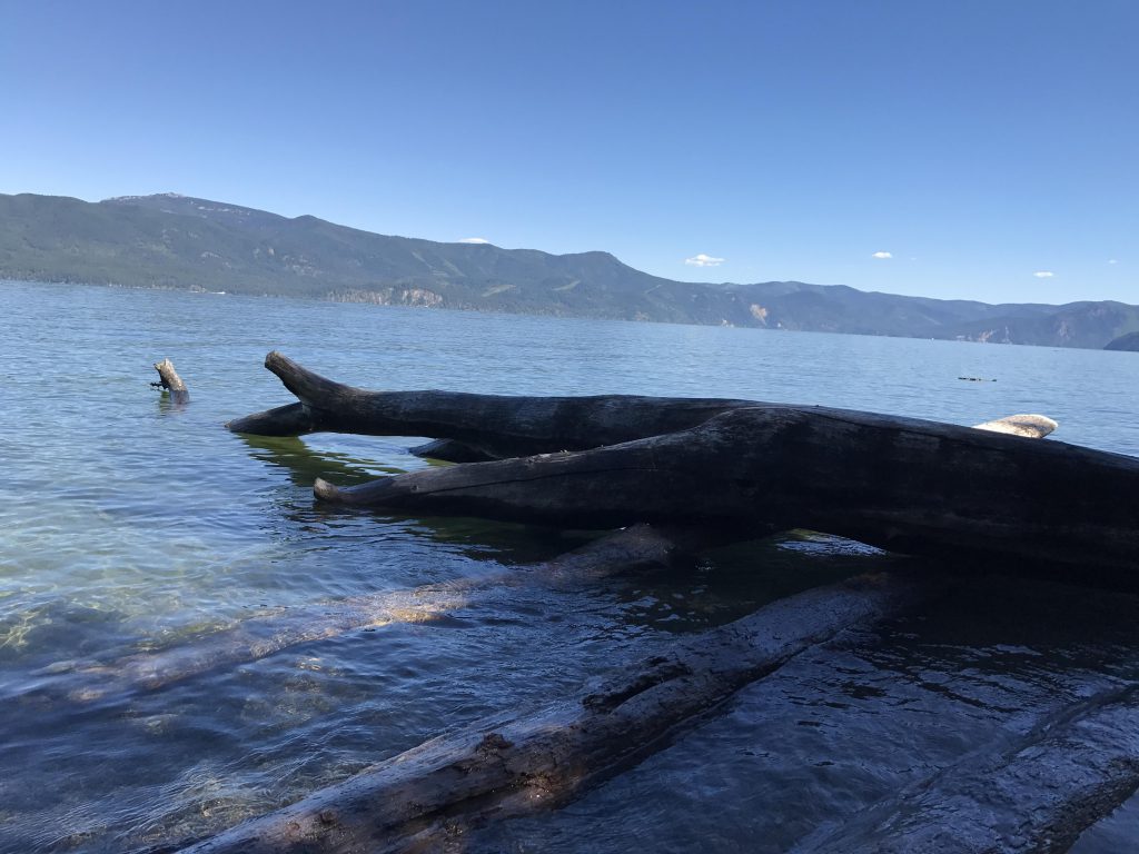
      At the lake you will find a nice gravel beach beckoning for a swim. This is a very popular hangout with boaters and this Saturday was no exception with at least four parties camped there. There used to be a vault toilet at the beach, and a tire swing, but both are gone. There was at least one picnic table though (we did not hike all the way across the beach as it was heavily utilized by campers–the beach is only about 10 yards wide this early in the season).

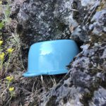
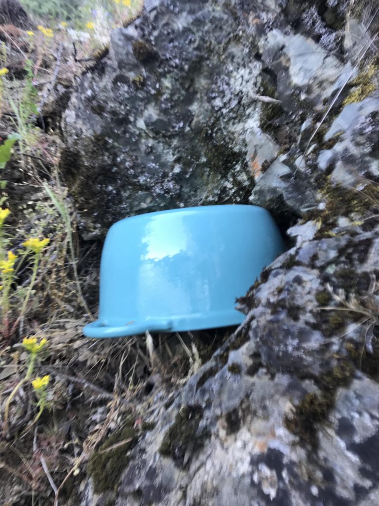
      There is a geocache at the spot where the hiking trail meets the beach. It appears to have been moved from its original position, perhaps due to the high water level. It had obviously taken on some water and the lid does not stay shut. We found an abandoned cookpot and used it to “seal” the cache. It is still in the rock crevice where we found it.

      The return trip is all uphill, but the switchbacks really make this an easy ascent. Just watch out in the first 30 yards or so, which are a bit steep and washed out. 

      Alternate Routes

        Things to Consider

          Not so great

            Trailhead
            First views across Lake Pend Oreille of the Monarch Ridge
            The trail is a nice single-track all of the way
            Pretty flower. Not sure what it is
            Much of the trail is nicely shaded
            Lake Pend Oreille, looking north
            Lake Pend Oreille, looking east. The tall mountain is Packsaddle
            Tall leaning tree
            View across Lake Pend Oreille with Schafer Peak in the distance
            Maiden Rock
            View from Evans Landing looking south
            View from Evans Landing looking north
            Evans Landing
            Evans Landing beach
            Picnic table at Evans Landing
            Evans Landing beach
            Our favorite backpack: Hyperlite Mountain Gear
            Driftwood at Evans Landing
            Geocache
            Naughty hunting for fossilized fish…
            …fossilized fish aka stick
            The obligatory carcass