Cutoff Peak

Although only 3 miles one way, the Cutoff Peak trail nonetheless dishes out all the makings of a great alpine hike. The hike up is pleasant among beargrass, huckleberries and alpine fir, with frequent filtered views of the Parker and Smith ranges. At the top awaits an old log cabin, phenomenal views of the entire Parker range, line-of-sight of neighboring lookout tower sites, including Shorty Peak and Red Top, and the distant silhouette of the southern Selkirk Crest. A true gem! 
Location
  • Selkirk Mountains
Rating
3.7 out of 5
Difficulty
Moderate (uphill hiking)
Distance
6.0 miles
Duration
2:10 hours moving time (Hiking)
Elevation Gain
1,345 feet
High Point
6,854 feet (Cutoff Peak)
Low Point
5,495 feet (Trailhead)
Features
  • Mountain
  • Structure
  • Outing Type
  • Daytrip
  • Trail Type
  • Out-and-back
  • Trailbed
    Old logging road, packed dirt, loose rocks
    Trail#
    17, 18
    Water
  • None
  • Camping
    • Cutoff Peak, but it is dry
    Conditions
    • Excellent
    Administration
  • Kaniksu National Forest
  • Status
  • Unprotected
  • Maps
    USGS
  • Shorty Peak
  • Fees & Permits
  • None required
  • ()
    Open To
  • Hikers
  • Dogs
  • Horses
  • Mountain Bikers
  • ()
    Directions
  • From Bonners Ferry head north on US-95 for about 15 miles, then take Highway 1 north for another 2 miles. Turn left onto Copeland Hill Road and head west across the Kootenai valley, about 2 miles. Bear right when the road merges with Westside Road #417 and continue northwest for 9 miles. The road will eventually turn into FR #281. Make sure to stay left at the switchback on the blacktopped road, which remains blacktopped most of the way, but expect a few potholes and some buckling. Turn left onto FR #2443 and head uphill for 6.5 miles. This is a dirt road and a high-clearance vehicle is recommended due to rutting, rocks and water bars. There are a few forks along the way; just stay on the road that is in better condition. About 1.3 miles from the trailhead the roads are about the same–take a right. The road ends at a gate and there is parking for a few cars and a small turnaround area.
  • Season
    June to October
    Resources
      Date
      July 22, 2017

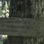
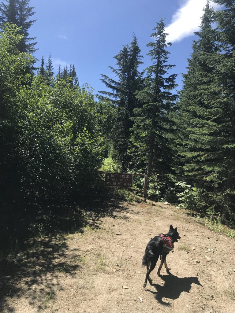
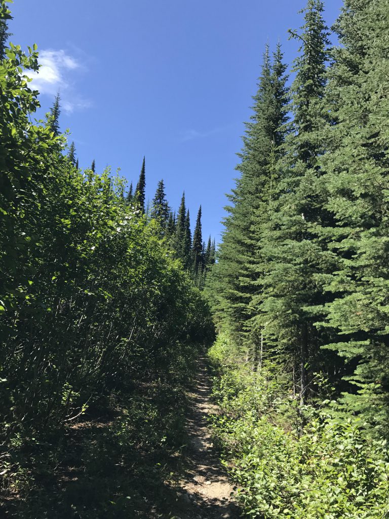
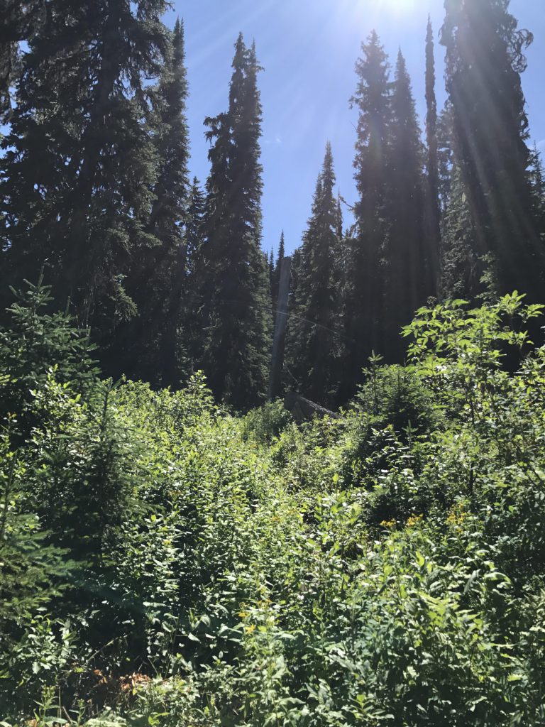
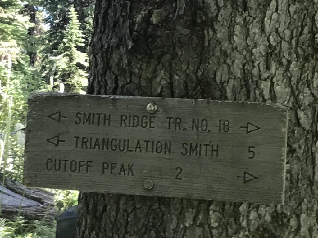
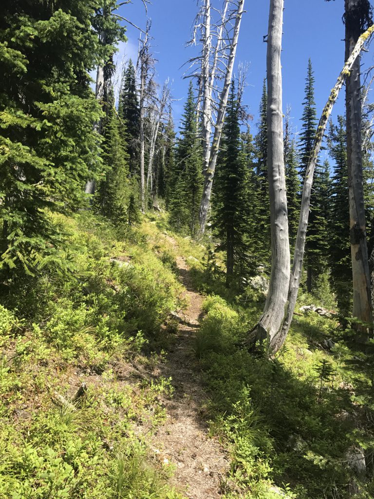
      Starting at the gate, trail #17 continues along an old logging road for about half a mile, then heads uphill in the form of a singletrack, across a clearcut and back into the forest, and gains the ridge (Smith Ridge) in just shy of a mile. At the ridge is the intersection with trail #18, which moves northeast to southwest. The northeastern portion heads out to Triangulation Smith, another former fire lookout site, so turn right (southwest). The trail contours along the flank of Smith Ridge for about a mile, mostly shaded by alpine fir, and beautified by beargrass. Views are limited here, so enjoy the flowers, and, as the incline starts to pick up, watch out for Cutoff Peak looming massively ahead of you.

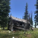
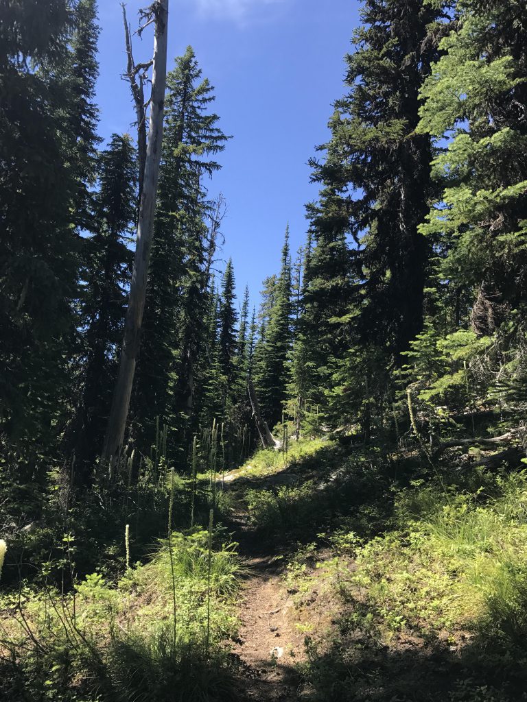
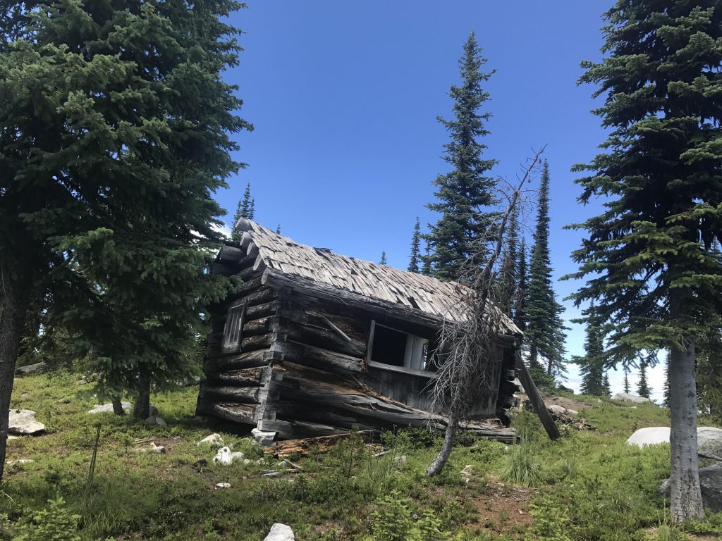
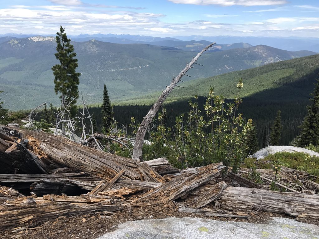
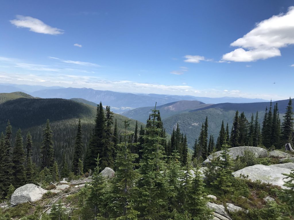
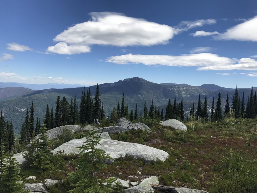
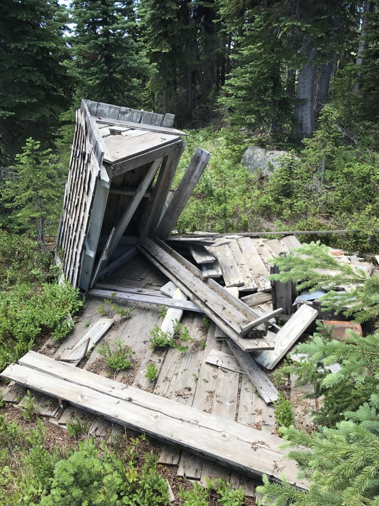
      Luckily, though, the trail continues southeast around the flank of the mountain, climbing steadily with constant views of the Parker Range to the east, and eventually switchbacking up Cutoff’s southern face. You end up emerging out onto the top from the south and the trail meanders between rocky outcroppings northwards for about a quarter mile to the dilapidated cabin serving the fire lookout crews a long, long time ago. Only the footings of the lookout tower remain, but the views couldn’t be better!

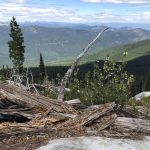
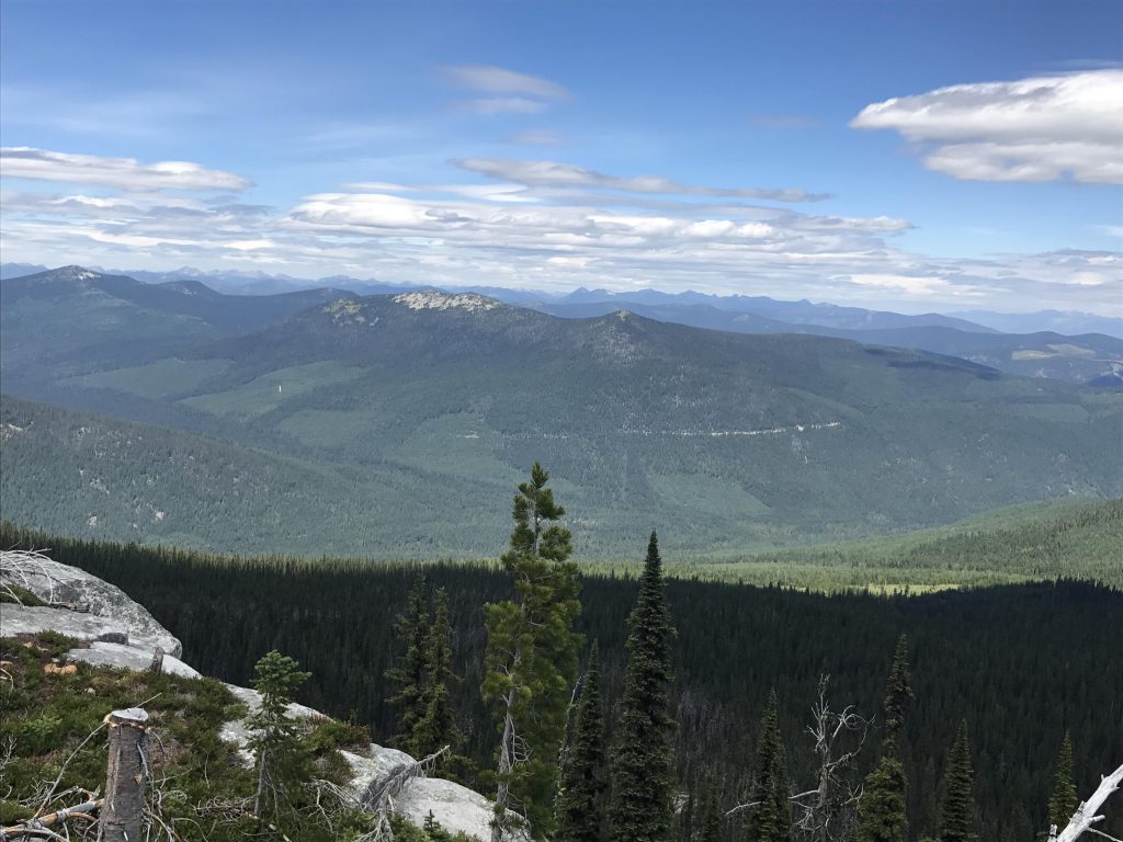
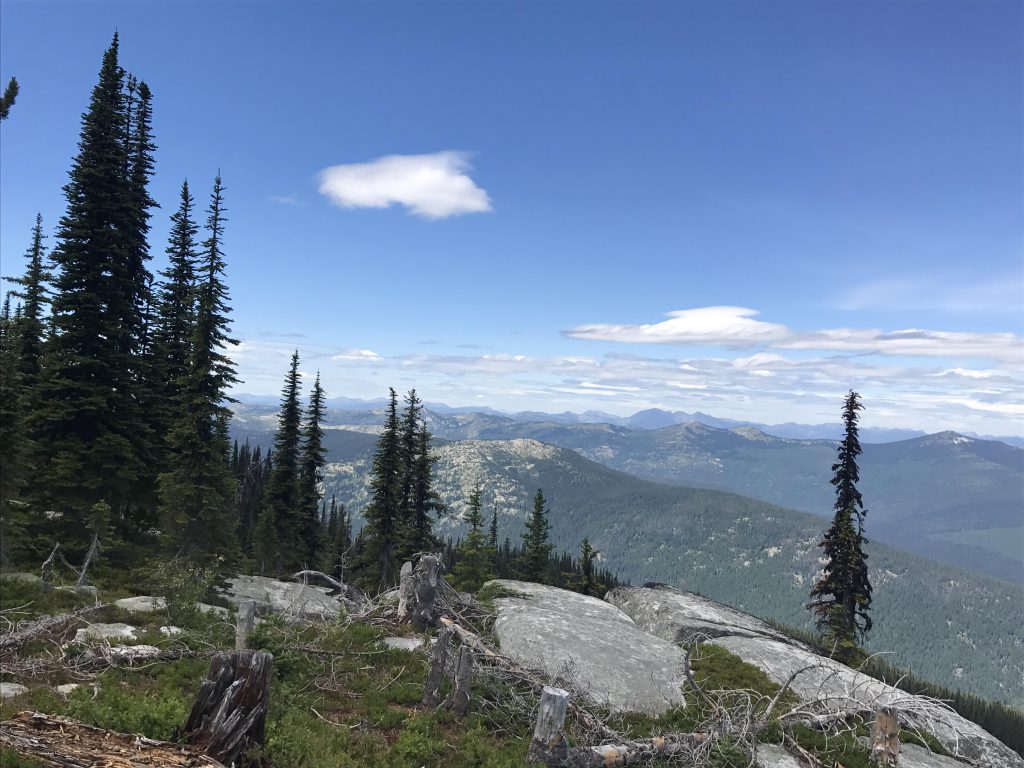
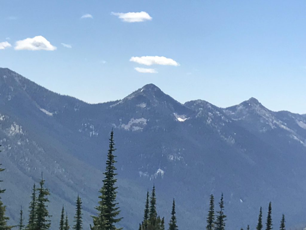
      Looking north across Smith Canyon you can see peaked Shorty Peak, whose lookout tower is still intact today, to the west is the bare rocky hump of Red Top, which also once featured a lookout tower, and to the northeast, extending from Cutoff Peak, is the remainder of the Smith ridge, stretching out to Triangulation Smith, the last peak of the ridge and also once a lookout tower site. To the east the Parker ridge rises mightily from the Kootenai River Valley and extends south, with the distinct humps and peaks clearly identifiable as Parker Peak, Long Mountain, and Pyramid Peak.

      Alternate Routes

      • A trail to Triangulation Smith, also a former fire lookout, starts at the same trailhead

      Things to Consider

        Not so great

          Trailhead and gate
          The first half mile is on an overgrown logging road…
          …then it’s uphill through a clearcut area in full sun
          Intersection of trails 17 and 18
          The trail contours along the eastern flank of Cutoff for the most part
          Towards the end the trail switchbacks uphill to the peak with nice views of the Parker ridge
          Dilapidated guard shack. The lookout tower is gone.
          Looking north towards Shorty Peak. The bare crest to its left is Lone Tree Peak
          Looking west towards Red Top. The West Fork ridge is in the background behind Red Top
          View towards Shorty Peak
          The Smith ridge in the foreground on the left, the tail end of the Parker ridge is on the right (including the section that burned a couple of years ago), and the Purcell range is in the background
          Panorama shot west to east: Red Top and Shorty, then the Smith ridge in the middle, and to the right the Parker ridge
          Parker Ridge
          The Smith ridge to the left, Long Canyon and Parker ridge to the right, the Kootenai River Valley and the Purcells in the background
          Pyramid Peak, an extension of the Parker ridge
          The privy is no more. Anyone vote for obligatory privy shots?
          The obligatory grouse

          2 Comments

          1. montucky says:

            Good looking trail and beautiful views!
            I really like the format of your posts and the effort you put into them!

          Comments are closed.